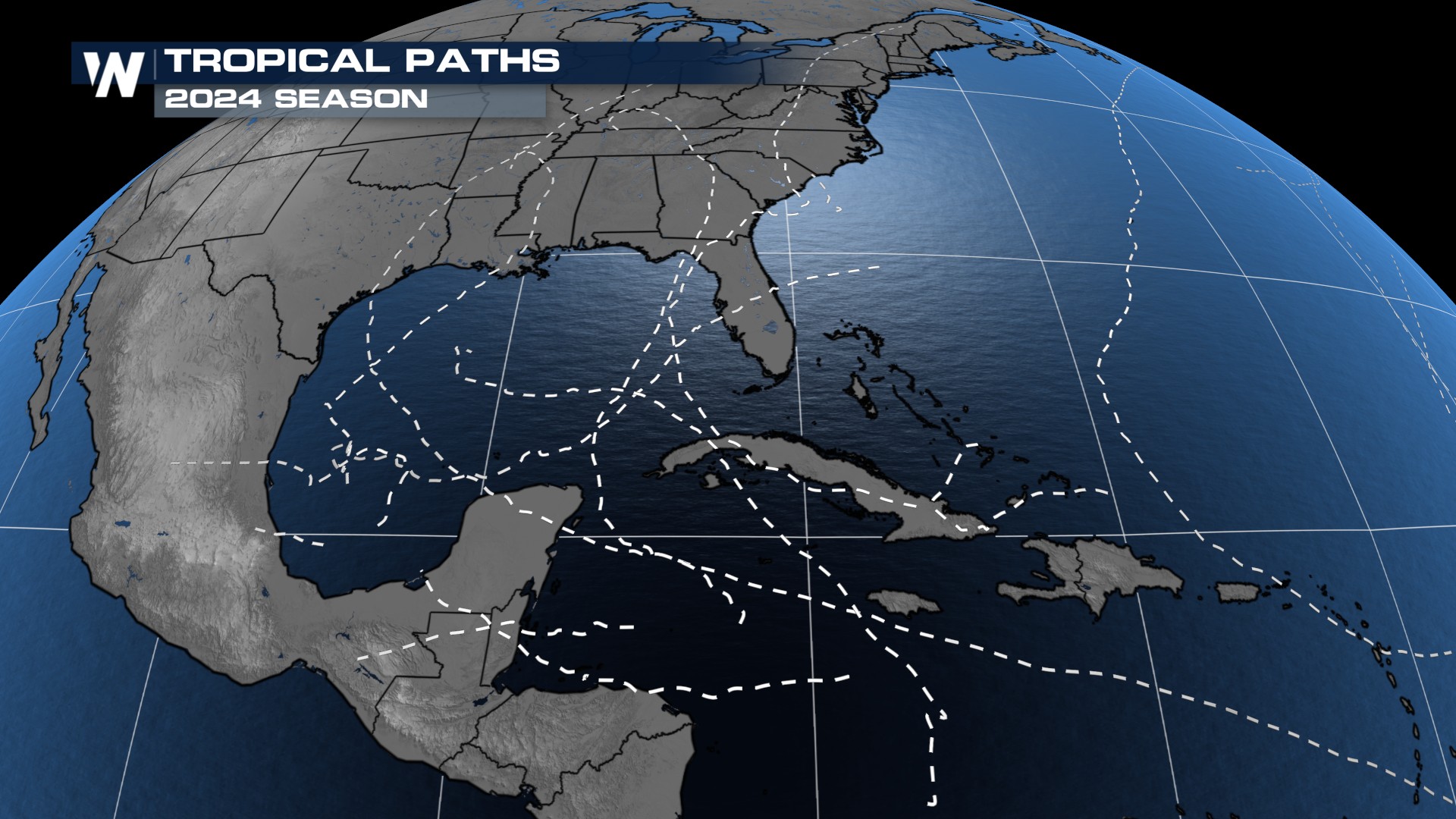
Record-Breaking Year for the National Hurricane Center

Coming off of a season that featured 18 named storms and 5 Gulf Coast landfalls, it helps to know that the forecasts are improving. The National Hurricane Center takes a look back at how their forecasts fared each year. They always want to improve their ability to warn those in the path of a tropical system and how strong it ultimately will be. Let's see how they did.
For a full recap, head over to our article on last year's full Atlantic season:
Looking back at the 2024 Atlantic Season
Where do we start when look at whether a forecast was right or wrong? In tropical terms, there's a whole host of ways to dissect one, but the two that will be the same with every storm are path and intensity.
PATH
When the NHC is talking about a "path" verifying, they're not looking at every step along its lifetime, but where it makes landfall relative to the forecasted spot. This past year was the best in history since they started tracking the measure in 1990!
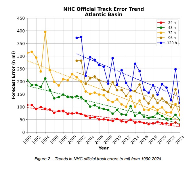
The track error has continued to decrease in the past decade. Of course, when looking at the 3 vs 5 day forecasts, the farther out in time you get, the more error there will be. Since the turn of the century, the NHC track error 5 days out has been cut in half! In 2024, they were only off a little over an average of 100 nautical miles. Some forecasts ended up within a matter of a few miles 5 days after being issued. They actually have an issue explaining what all goes into the process:
Path forecasting has become a specialty of the National Hurricane Center. What can be a little tougher? The intensity...
INTENSITY
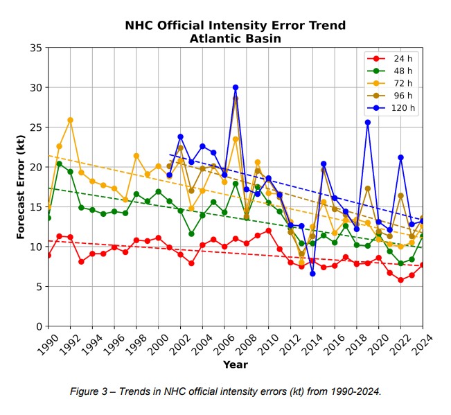
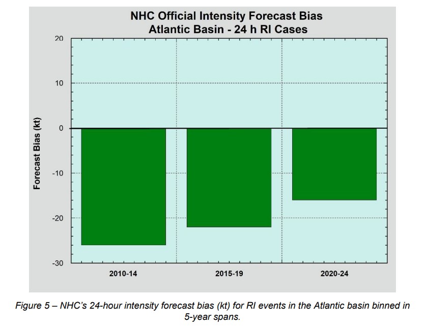
The trend has continued to decrease since the turn of the century. The error in intensity has been improving. However, when a system rapidly intensifies, that's where the forecast can bust. But as we've seen far too many times in recent memory, storms that gain 35+ mph in a 24-hour period are hard to predict with a lot of certainty. 2024 alone had 34 instances of rapid intensification (!), which they say led to a slightly above average intensity error compared to last year.
Forecast models that using data from the Hurricane Hunters can help. Many times those that are using more complicated physics can help identify systems that could rapidly intensify. But they come with their biases as well. The trust has increased to the level that before Helene formed, the initial forecast called for a majhor hurricane within a 72-hour period.
Now is the time to get your supplies ready and fortify plans for the upcoming hurricane season. The season is quickly approaching, but as it does, we have some of the best and brightest on the guard for any tropical trouble.


