Stretch of Historic Heat Continues

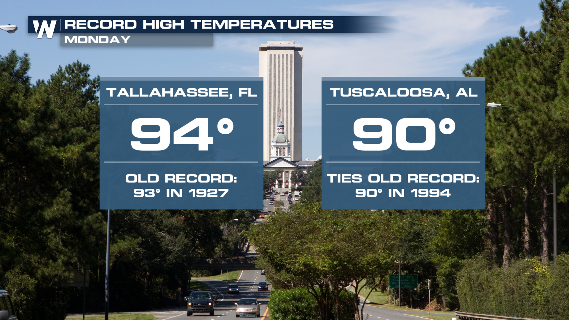
We saw another day of record warmth across the south on Monday. Tallahassee, FL, saw a high of 94°, breaking a record from 1927, and Tuscaloosa, AL, reached a high of 90°, which tied a previous record from 1994. An area of high pressure will continue to dominate, and we will see the potential for more record highs this week.
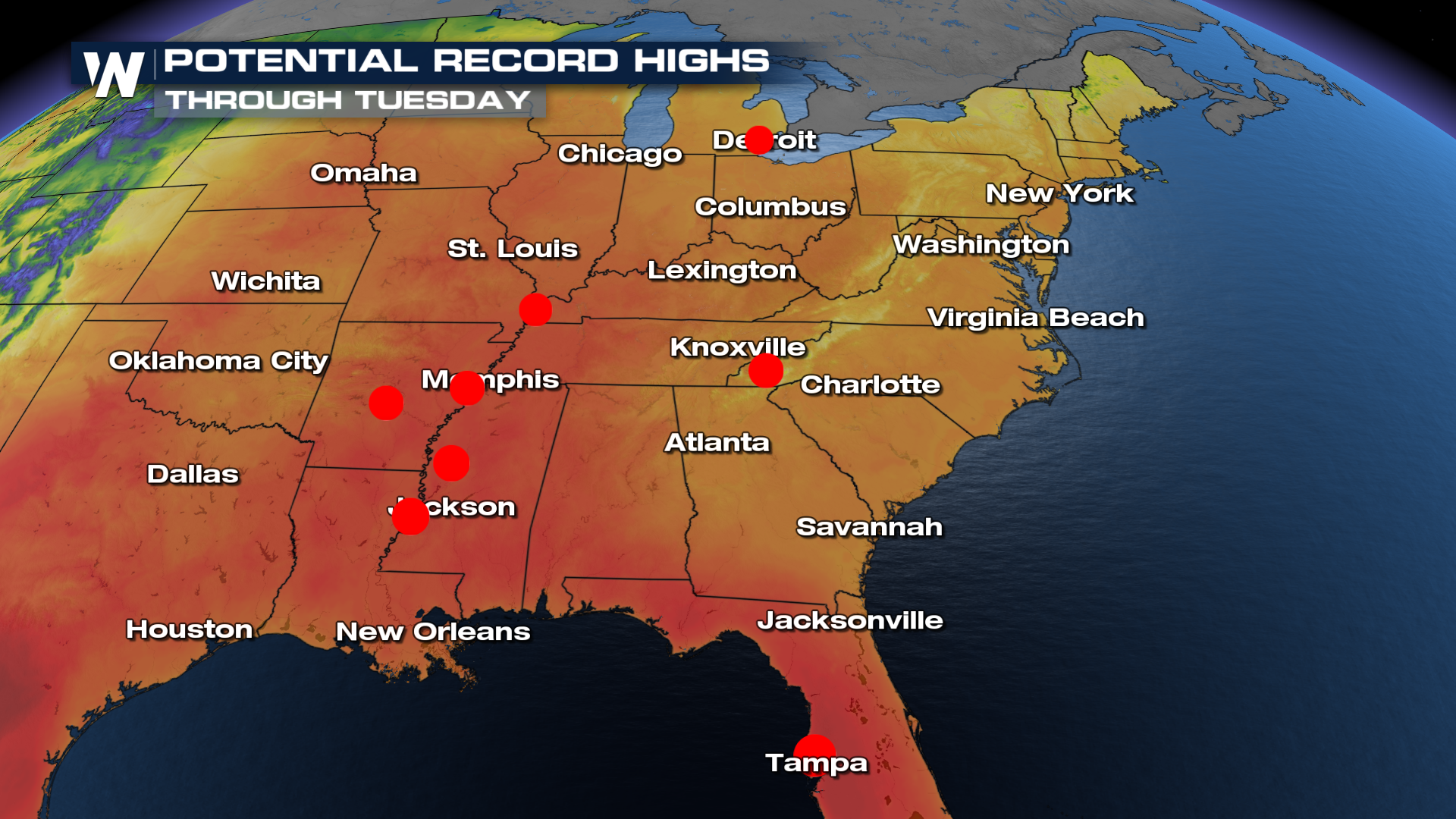
While the recent heatwave is beginning to settle down, we could see a few more records fall during the day Tuesday.
Looking over the next few days, many cities across the south will continue to run above average. Tampa, Florida, has an average in the mid-80s for this time of year, and temperatures will reach the lower 90s, bringing the heat! The Little Rock, AR average this time of year is in the mid-70s, but will see highs in the 80s.
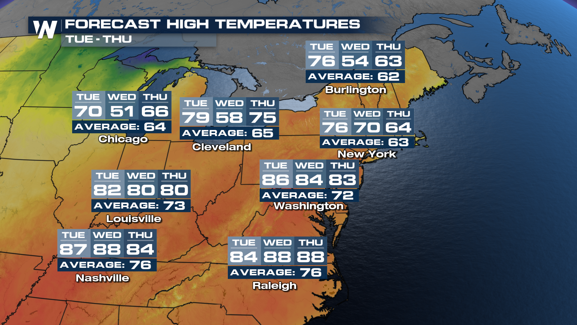
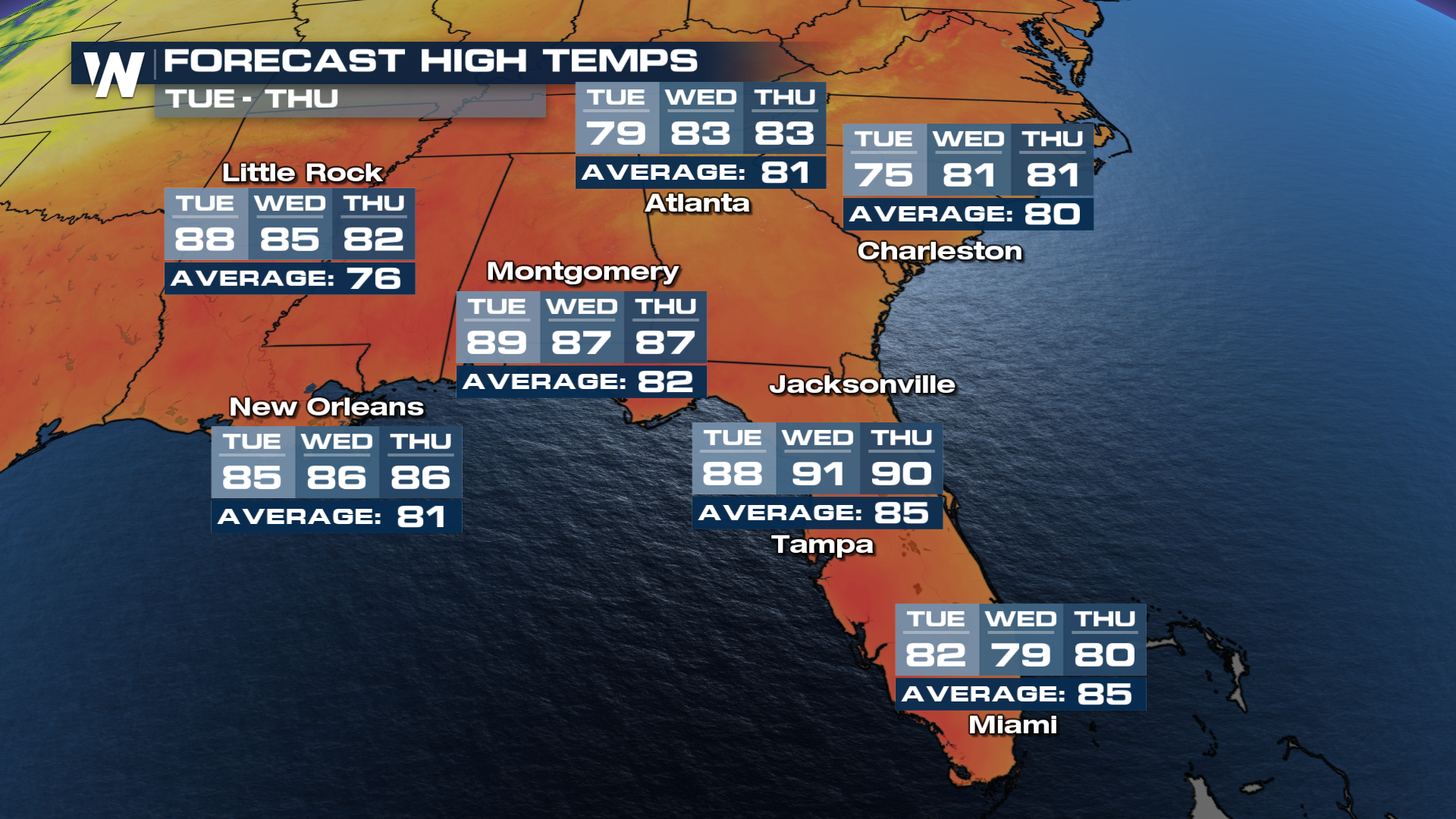 Even the northeastern U.S. is feeling the beautiful spring temperatures. On average, many northeast cities will be about 10 degrees warmer than normal on Tuesday before our next front moves in on Wednesday and Thursday.
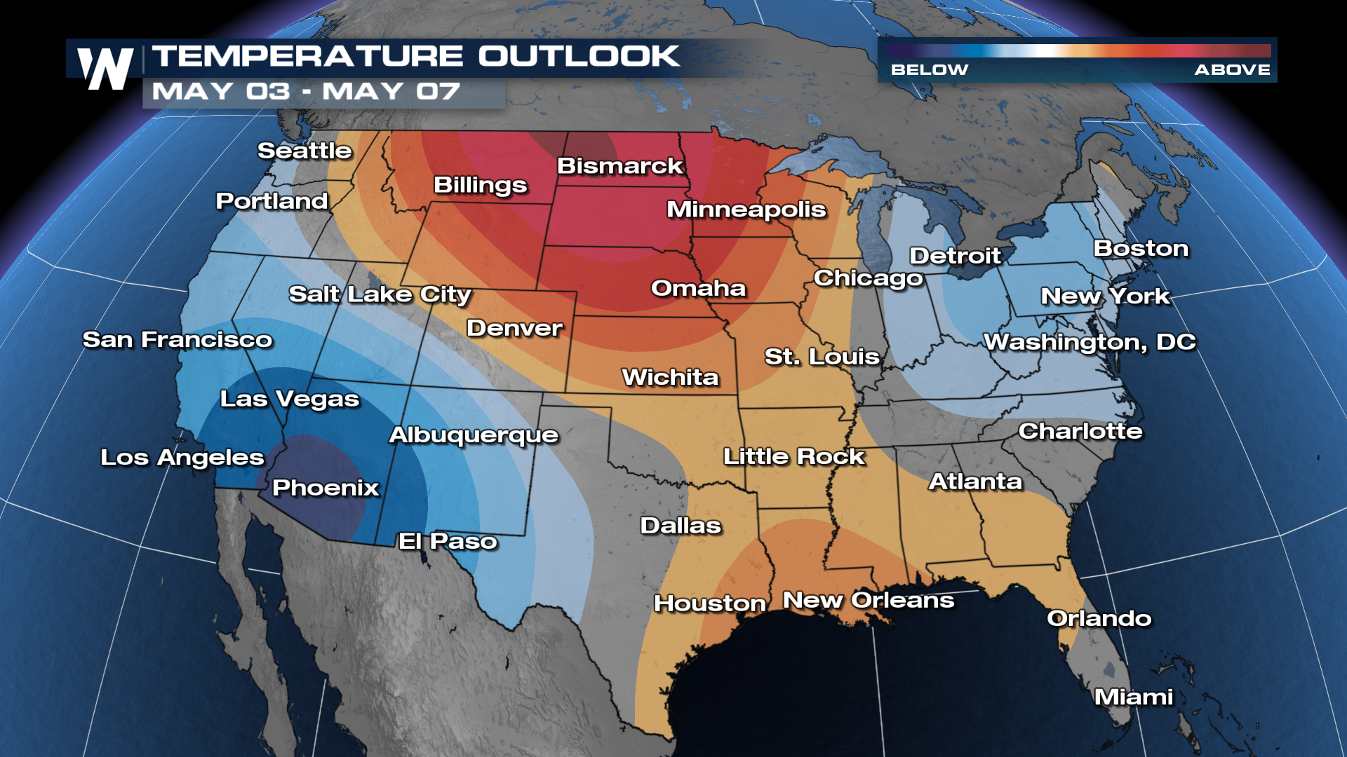
 As we move into the longer-term trends, the Climate Prediction Center offers some reprieve from the hot temperatures in the northeast, settling us back down to likely average temperatures into the first week of May. Meanwhile, the next region to watch for likely above-average temperatures turns to the northwest and the High Plains.