Snow Chances For The Mid-South and Southeast This Week

WHAT TO EXPECT
A trough of low pressure is expected to combine with a cold Arctic air mass, bringing the potential for snow, gusty winds, and wind chills in the teens across the mid-south and southeast. Wednesday night, a frontal boundary will drop down from the north, bringing snow chances across this portion of the country through Friday.
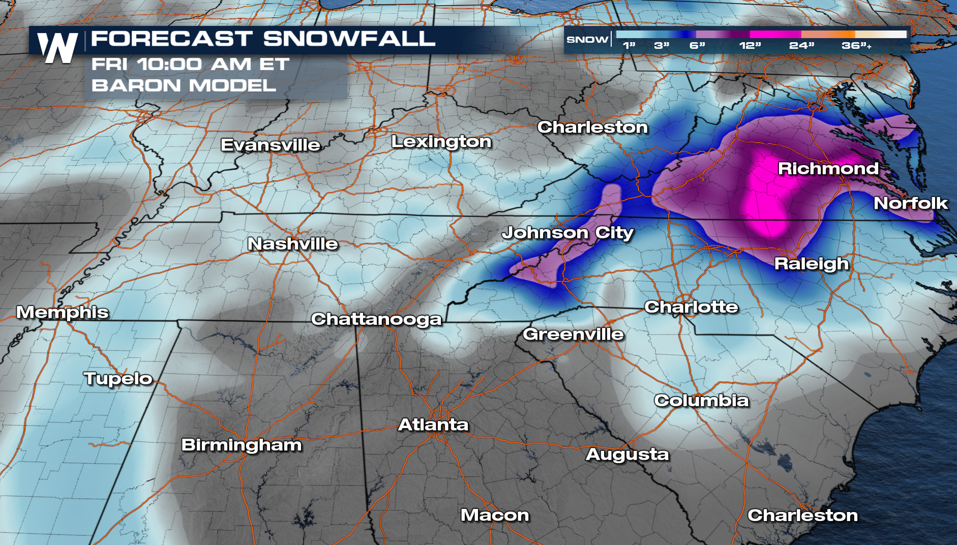
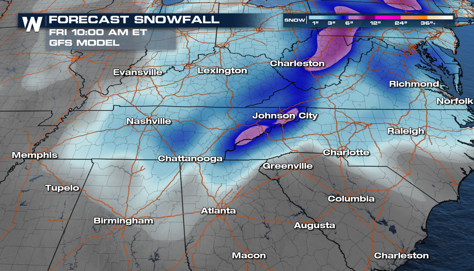
FORECAST SNOWFALL
We are still a ways out, and the models are showing disagreement as far as snowfall totals. Our in-house model, Baron, shows up to a foot of snow across Northern North Carolina and Virginia, with portions of the Upstate in South Carolina seeing a few inches of snow.
 The GFS model predicts some of the higher snowfall totals, around 6 inches, vs the foot that the GFS model predicts. Make sure to stay with us for the latest updates, as snowfall totals will change as we get closer to the event.
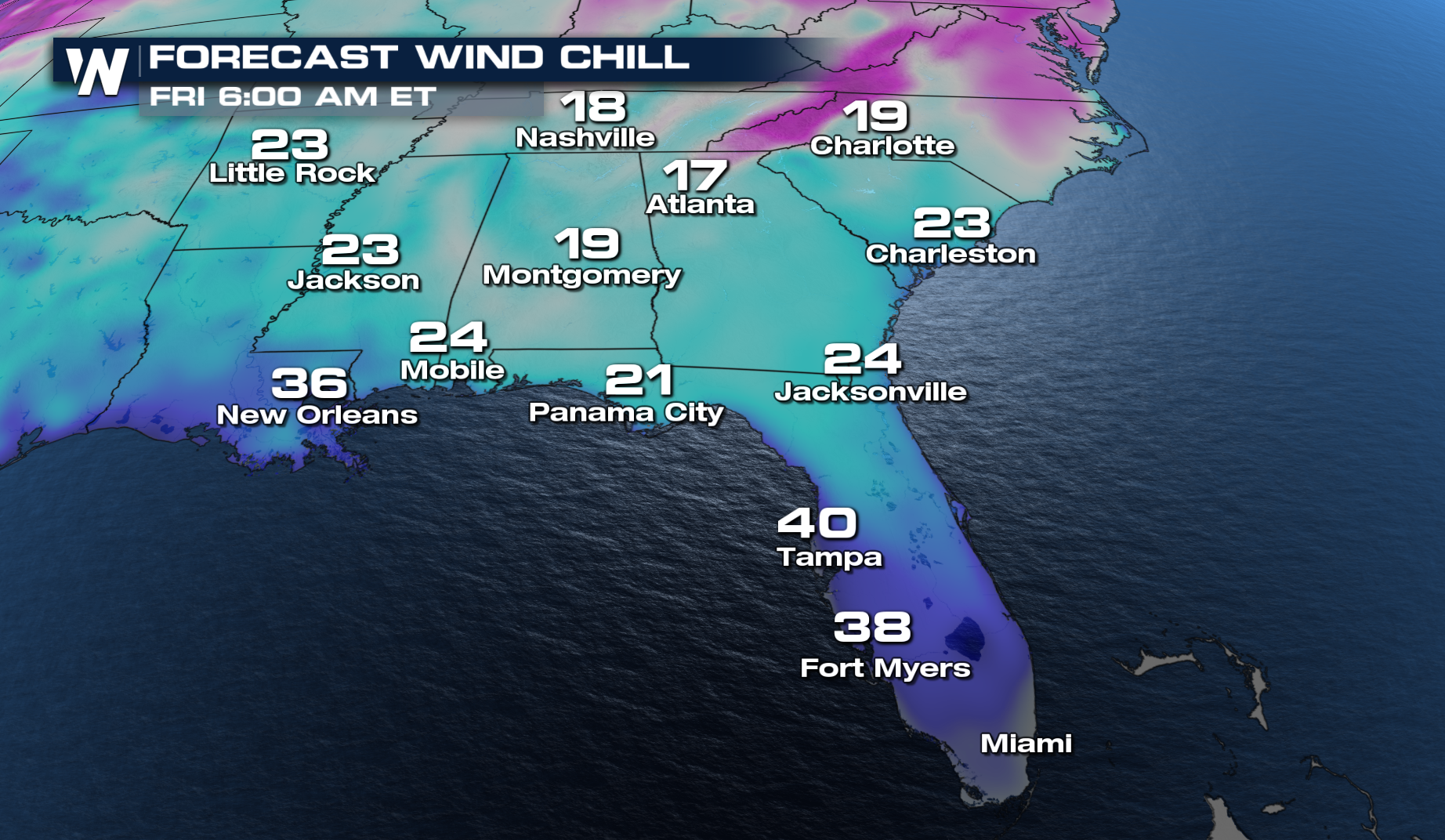
 Gusty winds can create some cold wind chills on Friday morning, with the feel-like temperatures in the teens.
 For the latest updates on this forecast, you can tune into WeatherNation :10 past the hour for your eastern regional forecast.


