Record Heat Shifts East This Weekend
A ridge of high pressure has brought unseasonable warmth to the Western and Central U.S. this week with temperatures running about 10-20° above average Monday through Wednesday. On Thursday, December 7 the temperature climbed into the 50's and 60's, melting any snow in sight. Those wishing for a white Christmas will have to keep on wishing and being patient during this warm weather spell.
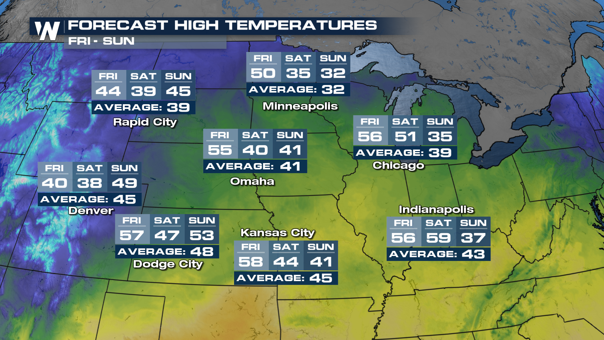
 Temperatures start to fall on Friday after peaking on Thursday in the North Central Plains. Temperatures fall into the 40s and eventually into the 30s for the High Plains. Temperatures will take a bit longer to fall in the Great Lakes region, eventually cooling off back towards average by Sunday.
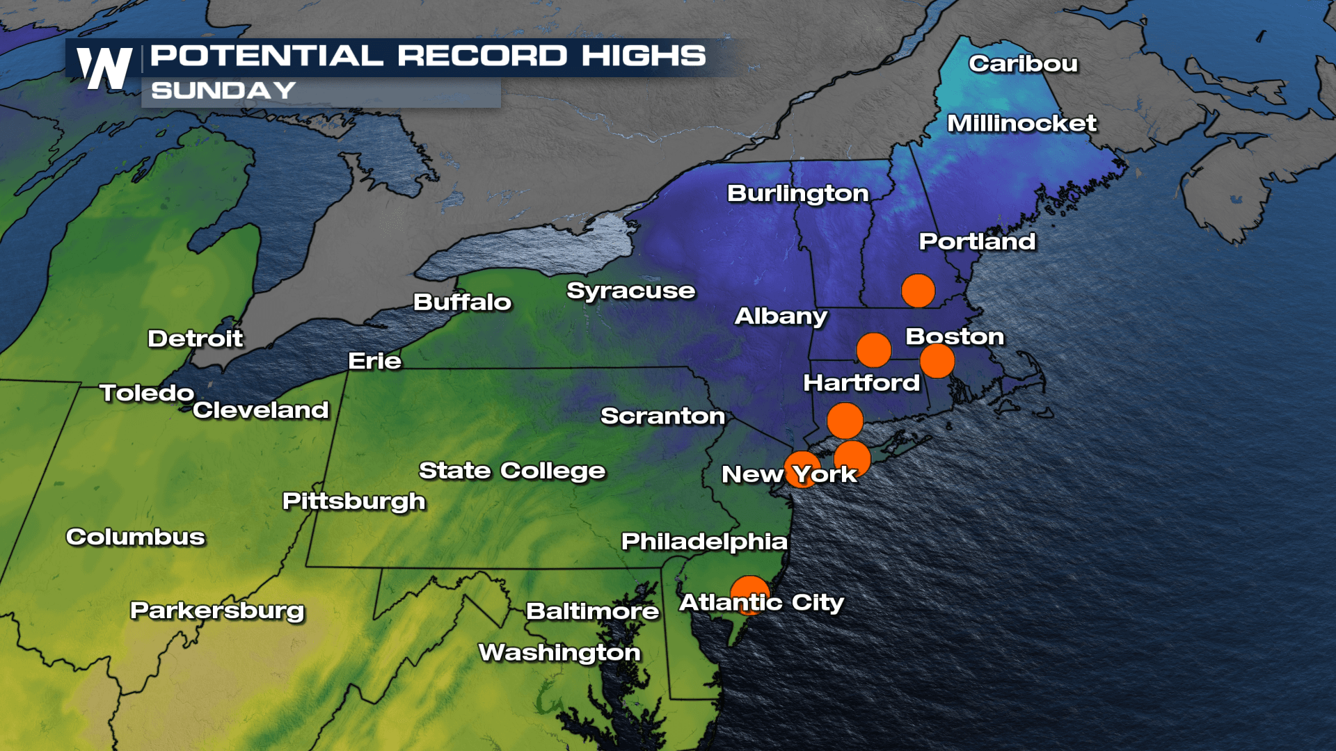
 Meanwhile, the ridge of high pressure shifts east, and along with it the opportunity for record temperatures. Temperatures region-wide will jump into the 50s and even the 60s, with records possible from Michigan to Maine, and down to our Nation's Capital this weekend!


