Risk for Severe Thunderstorms in the Upper Midwest
Special Stories
26 May 2020 9:00 AM
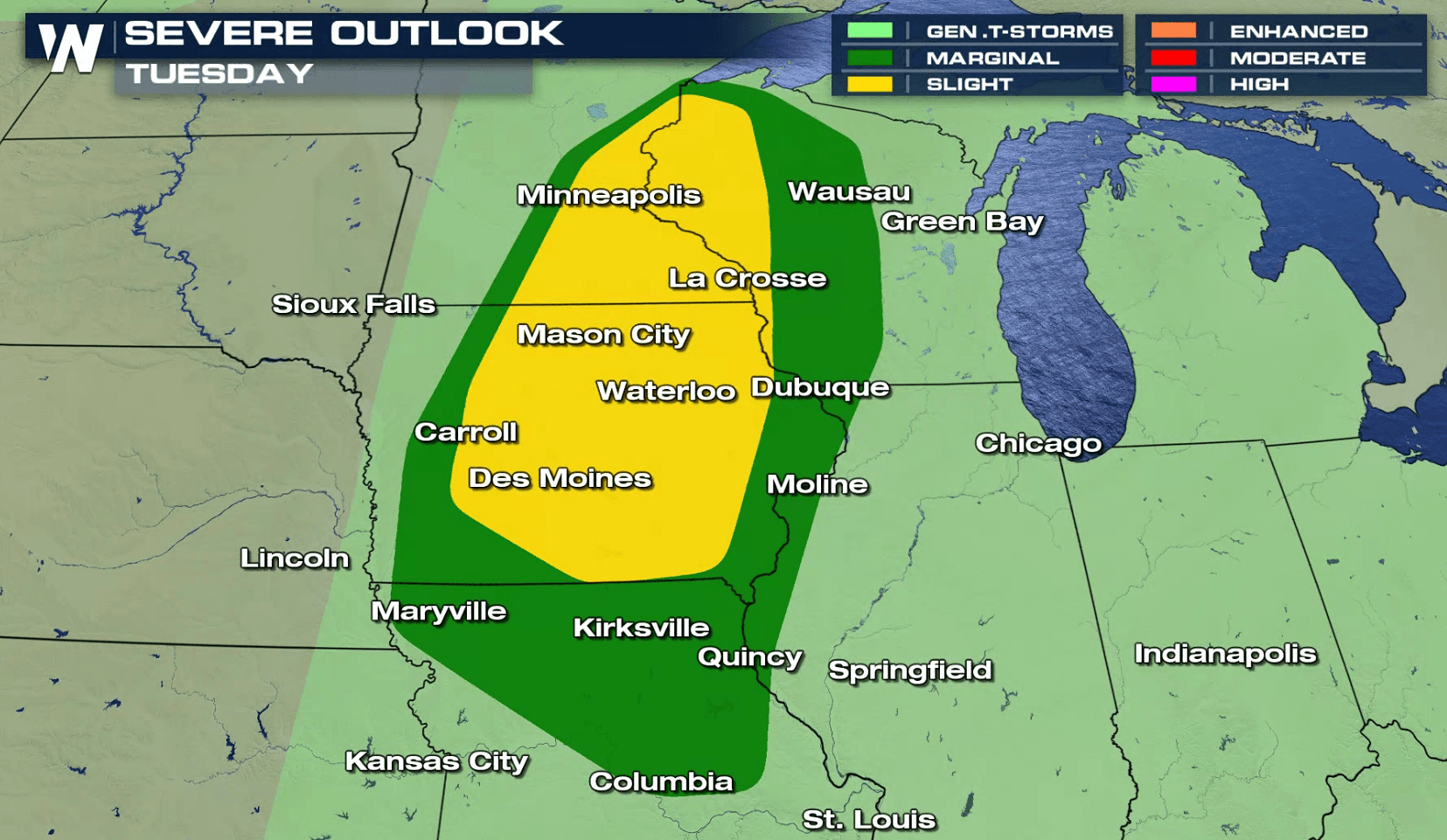
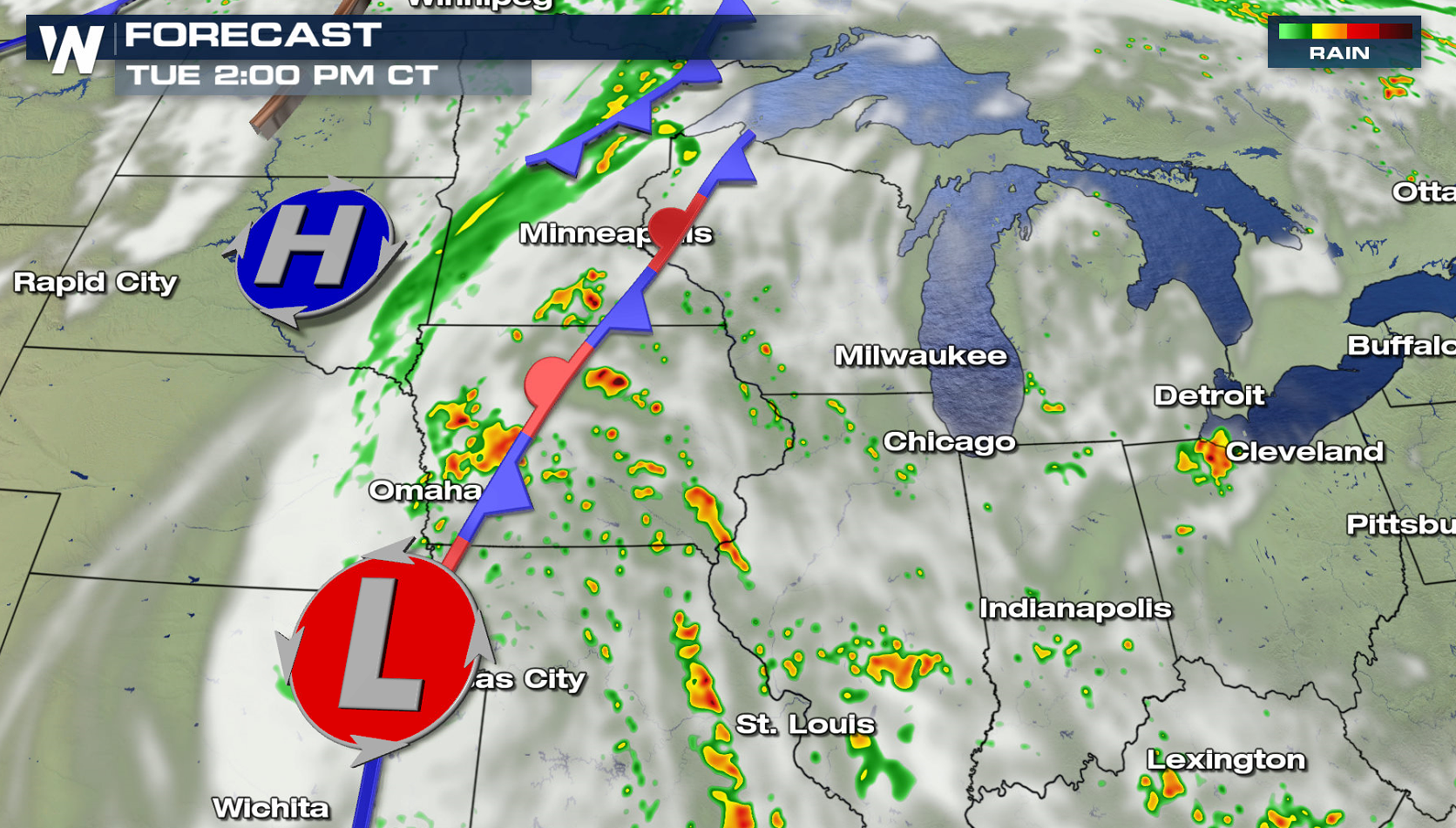
A slow moving storm system will bring the threat for severe thunderstorms into the Upper Midwest today (Tuesday). A slight risk for severe storms extends from near Duluth, Minnesota to the Iowa / Missouri border. A marginal risk extends into northern areas of Missouri, southward to Columbia.
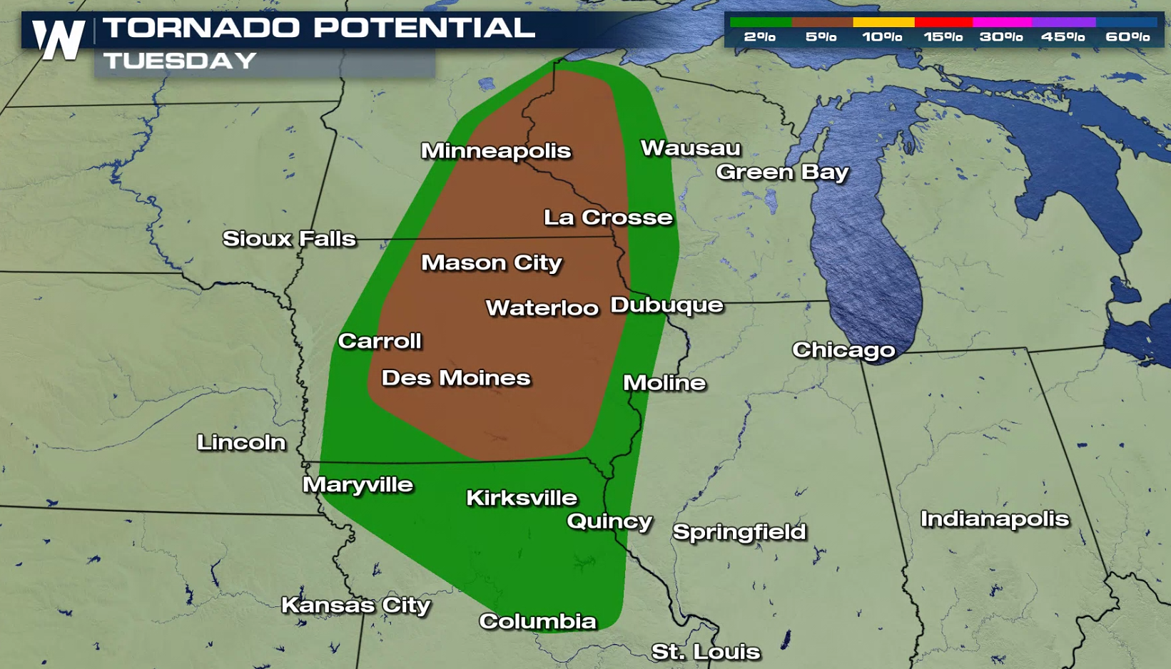
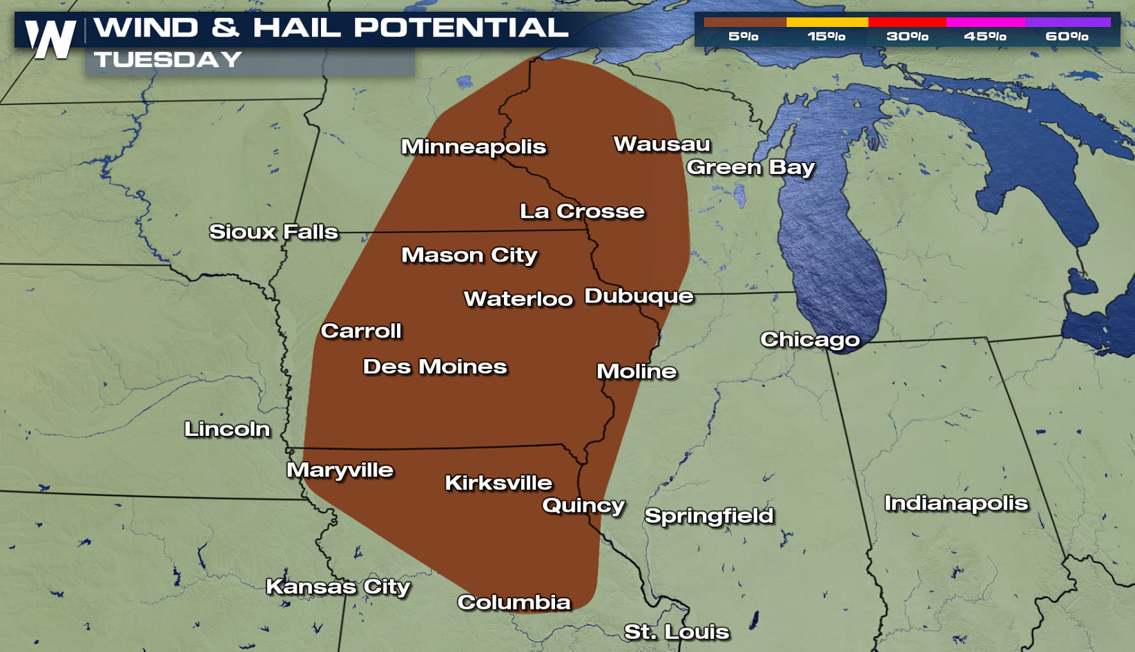 If you focus on the wind direction in the atmosphere, notable low level wind shear is present. The direction the wind is flowing from changes with height as you move from the surface to a few thousand feet high. This will support the development of a few supercells in late afternoon and evening. Tornadoes, large hail, and strong wind gusts are all possible with ample instability and energy over the region.
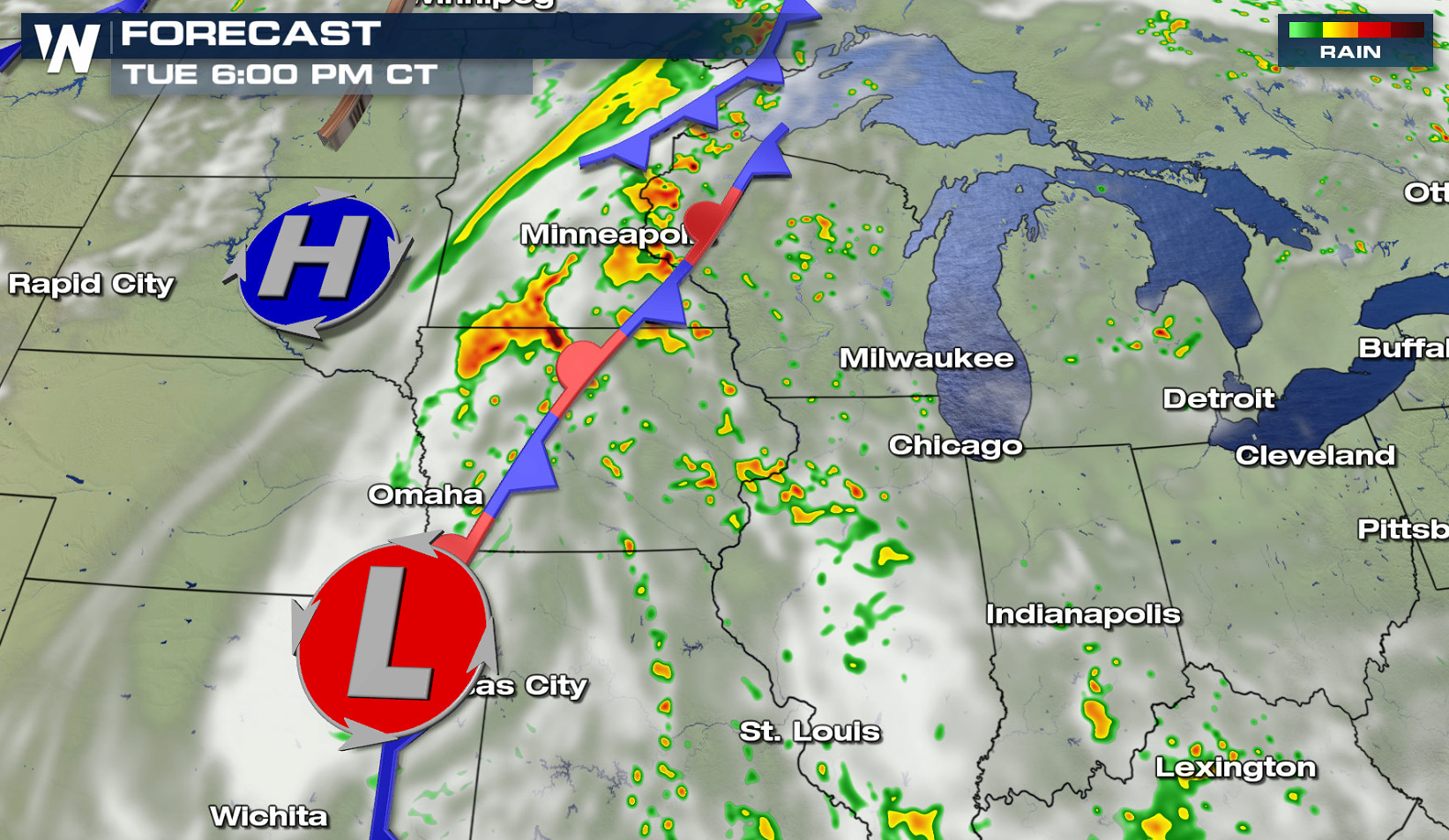
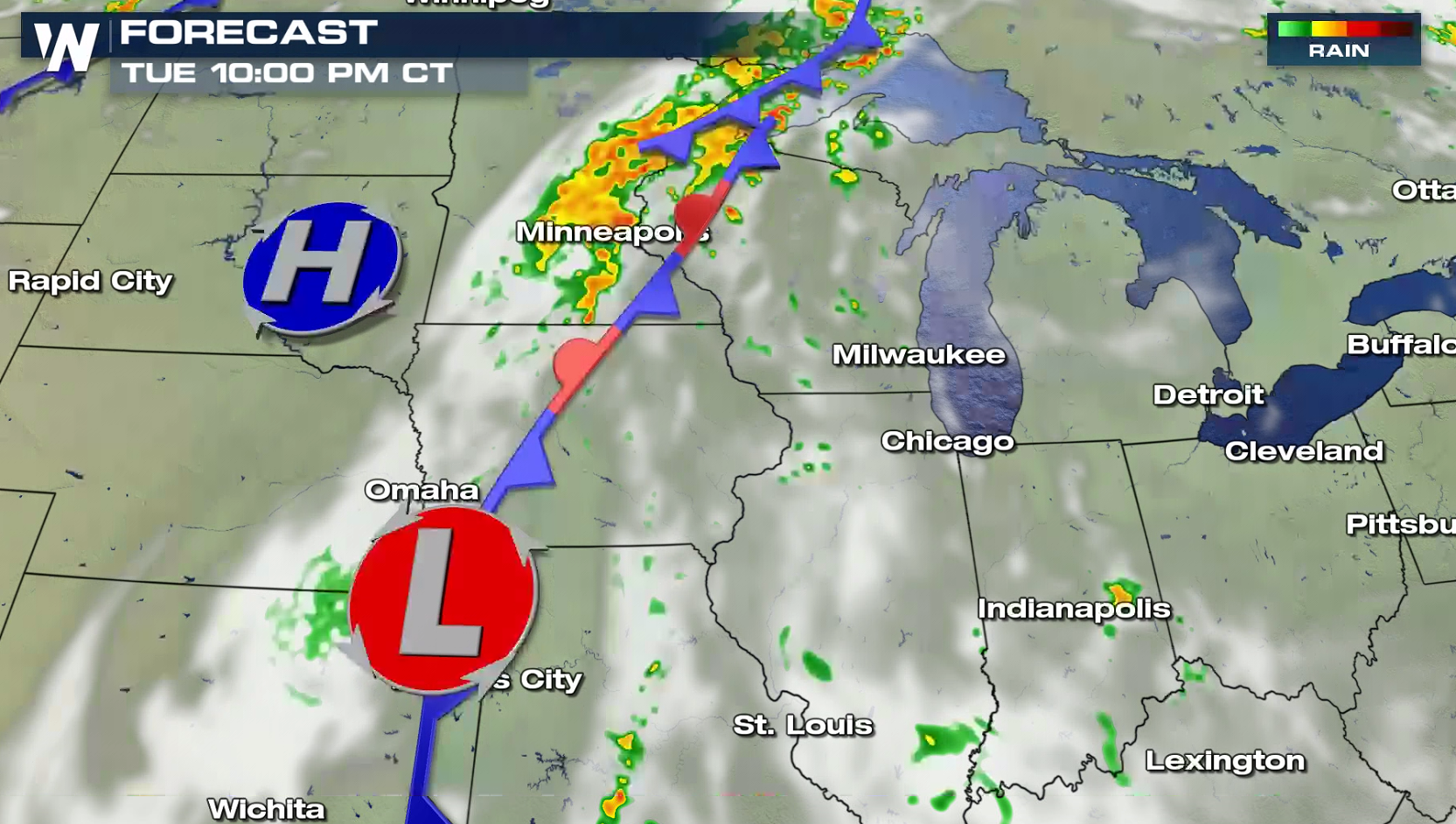 If you are in the risk areas, check back with WeatherNation throughout the day for forecast updates and alerts on-air and online.
If you focus on the wind direction in the atmosphere, notable low level wind shear is present. The direction the wind is flowing from changes with height as you move from the surface to a few thousand feet high. This will support the development of a few supercells in late afternoon and evening. Tornadoes, large hail, and strong wind gusts are all possible with ample instability and energy over the region.
If you are in the risk areas, check back with WeatherNation throughout the day for forecast updates and alerts on-air and online.All Weather News
More

Wildfire Outbreak in the Pacific Northwest
Conditions have been incredibly dry out west.
2 Aug 2026 12:20 PM

After Reaching Category 5, Genevieve Weakens in the Pacific
PacificGenevieve formed on last Friday south
2 Aug 2026 1:30 AM

Flooding, Severe Storms Target the Midwest Again
After an active week of storms across the nor
1 Aug 2026 1:40 AM

Flooding Risk Increases as Heavy Rain Targets the Tri-State Area
Tuesday, heavy rainfall moved across the Nort
30 Jul 2026 12:25 AM

Severe Weather: Energy From the Midwest Now in the Southeast
UPPER MIDWEST - Through Monday, dangerous tor
29 Jul 2026 10:30 PM

Southeast Flood Risk Lingers Near Stalled Front
A stalled boundary over the Southeast will ke
25 Jul 2026 10:55 AM