Satellite Damage Map of Camp Fire from NASA
Special Stories
20 Nov 2018 1:29 PM
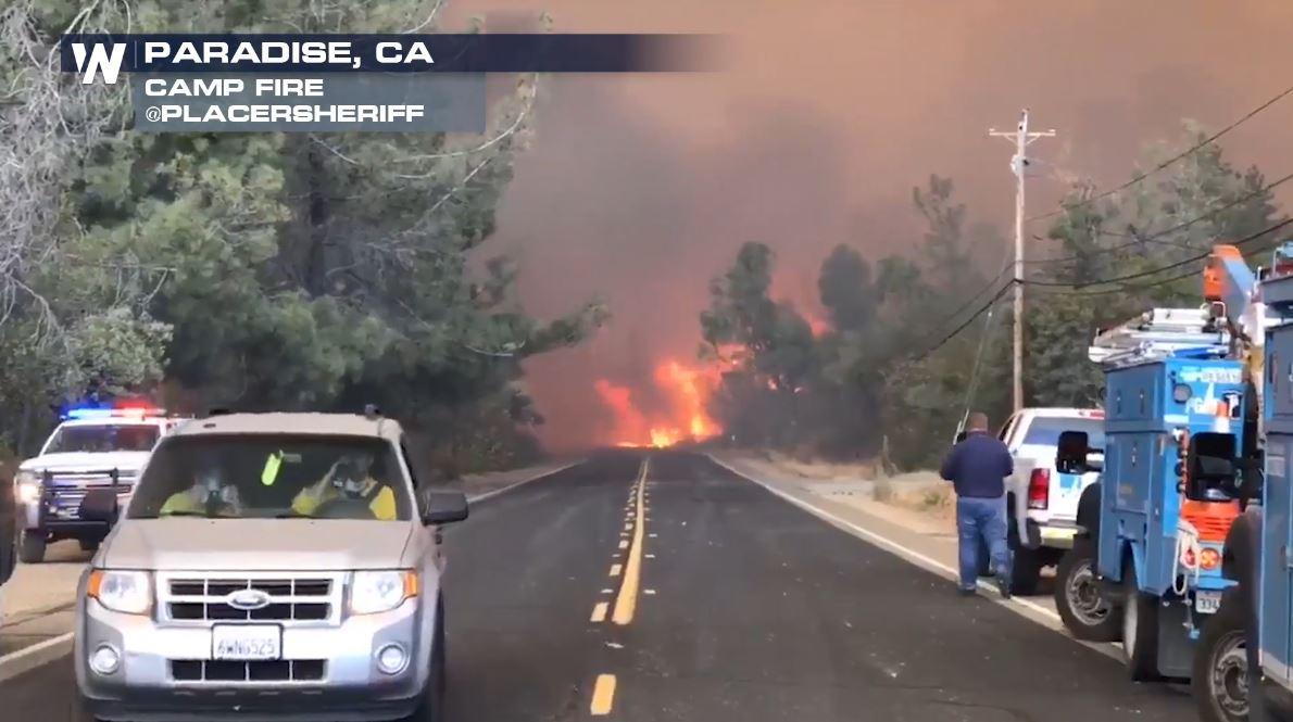
[Image from the Camp Fire in northern California from November 9th. Courtesy: Placer Sheriff]
[NOAA] As firefighters continue to battle the destructive Camp Fire in Northern California, the Advanced Rapid Imaging and Analysis (ARIA) team at NASA's Jet Propulsion Laboratory in Pasadena, California, has produced a new map showing damage as of Nov. 16.
The map was developed using synthetic aperture radar images from the Copernicus Sentinel-1 satellites operated by the European Space Agency. The map covers an area of 48 miles by 48 miles (78 by 77 kilometers), outlined in red on left. A closeup view of damage to the town of Paradise is inset on right, outlined in white. The color variation from yellow to red indicates increasingly more significant changes in the ground surface.
The ARIA team creates its maps by comparing before-and-after satellite images of the fire region to see the extent of change between the two images. For this map, they compared the data for the image to a Cal Fire map for preliminary validation.
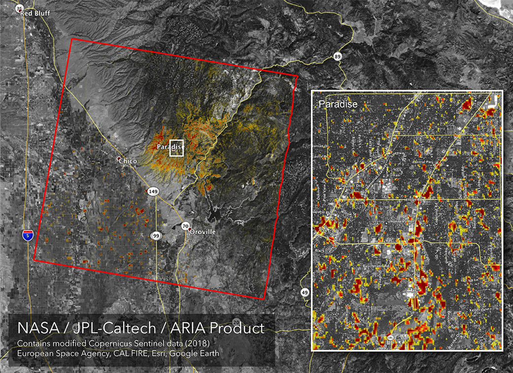 [NASA's ARIA team produced this map of damage to Paradise, California, from the Camp Fire, the deadliest wildfire in the state's history. Credits: NASA/JPL-Caltech]
Although the maps may be less reliable over vegetated terrain, like forests, they can help officials and first responders identify heavily damaged areas and allocate resources as needed.
Sentinel-1 data were accessed through the Copernicus Open Access Hub. The image contains modified Copernicus Sentinel data (2018), processed by ESA and analyzed by the NASA-JPL/Caltech ARIA team.
Edited for WeatherNation by Meteorologist Mace Michaels
[NASA's ARIA team produced this map of damage to Paradise, California, from the Camp Fire, the deadliest wildfire in the state's history. Credits: NASA/JPL-Caltech]
Although the maps may be less reliable over vegetated terrain, like forests, they can help officials and first responders identify heavily damaged areas and allocate resources as needed.
Sentinel-1 data were accessed through the Copernicus Open Access Hub. The image contains modified Copernicus Sentinel data (2018), processed by ESA and analyzed by the NASA-JPL/Caltech ARIA team.
Edited for WeatherNation by Meteorologist Mace MichaelsAll Weather News
More
Fronts Continue To Spark Severe Weather Across the Plains
A cold front that brought record lows to the
18 Jul 2025 10:40 PM

Extreme Heat Impacts for the East Coast & South
Extreme heat continues to impact several area
18 Jul 2025 10:05 PM

Flooding Threat Remains Elevated in the East
A cold front pushing through the Eastern Seab
18 Jul 2025 9:10 PM

EF-2 Firenado from the Deer Creek Fire in Utah
A fire tornado was spotted near La Sal, Utah
18 Jul 2025 7:30 AM

Tropical System Brings Flood Risk to the Central Gulf
Time has run out for notable tropical develop
18 Jul 2025 3:05 AM

Heavy Rain, Flooding Threat Returns to Florida
Keep the rain boots handy in Florida - heavy
13 Jul 2025 12:50 PM

Severe Storm Risk Pushes into the Great Lakes, Ohio Valley
Friday was another busy day with severe weath
12 Jul 2025 8:00 PM