Satellite Imagery Shows Three Different Fires
Special Stories
12 Jun 2018 11:01 AM
The new GOES-East satellite captured smoke plumes from a number of fires Monday across the Rockies.
https://www.facebook.com/WeatherNation/videos/10156573366519874/
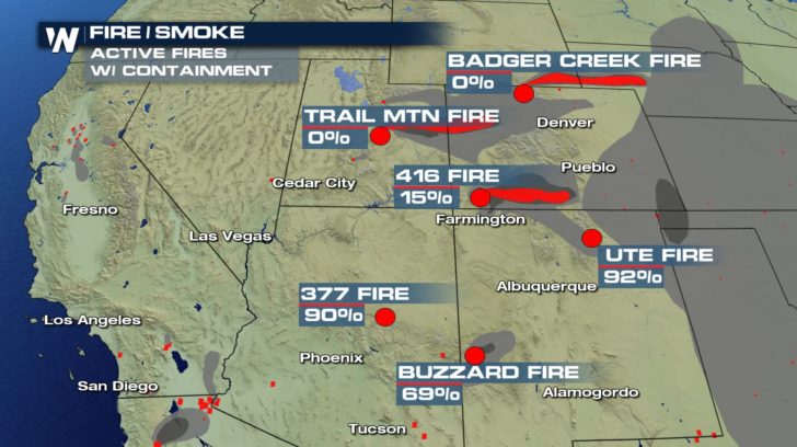
Seen in the video is the smoke plumes from the Badger Creek Fire, the Trail Mountain Fire and the 416 Fire.
 The Badger Creek Fire is located just north of the Colorado-Wyoming state line. As of Monday, it was estimated to have burned more than 2,300 acres.
The Trail Mountain Fire is located in the Manti-La Sal National Forest and State and private lands 15 miles northwest of Orangeville, Utah. As of Monday, the fire has burned more than 2,600 acres and was only 10% contained. The fire started on started on Wednesday, June 6.
The 416 Fire is located approximately 10 miles north of Durango, Colorado. As of Tuesday morning, the fire had burned more than 23,000 acres and was only at 15% containment. Officials say that the weather conditions remain critical and fuels are ideal for significant fire growth. The fire has been very active and continues to burn in rough and inaccessible terrain. Many homes have been evacuated and structure protection is in place.
All Weather News
More