Heavy Rain to Saturate the South
Special Stories
21 Jan 2021 7:00 AM
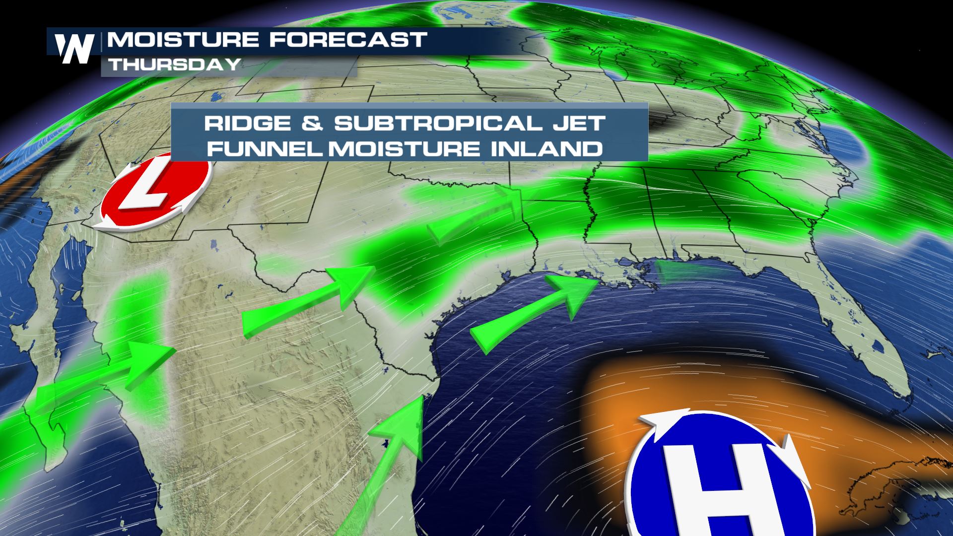
States like Texas, Louisiana, Arkansas and surrounding states are expected to see a lot more moisture through the rest of this week. A ridge of high pressure across the Gulf of Mexico will bring in Gulf moisture the next several days as well as a subtropical jet stream which will pump in Pacific moisture to the upper levels of the atmosphere.
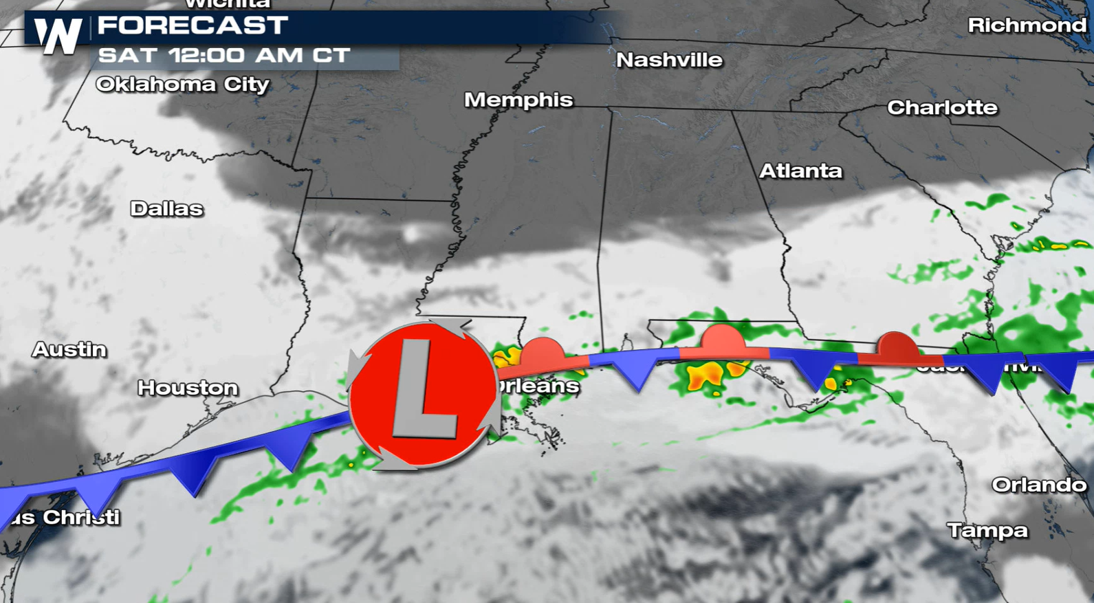
 During the afternoon and evening, the frontal boundary will push slowly south and eastward. Areas of North and East Texas, the Arklatex and into the rest of our Gulf Coast states sees a lot of rain, moderate to heavy at times.
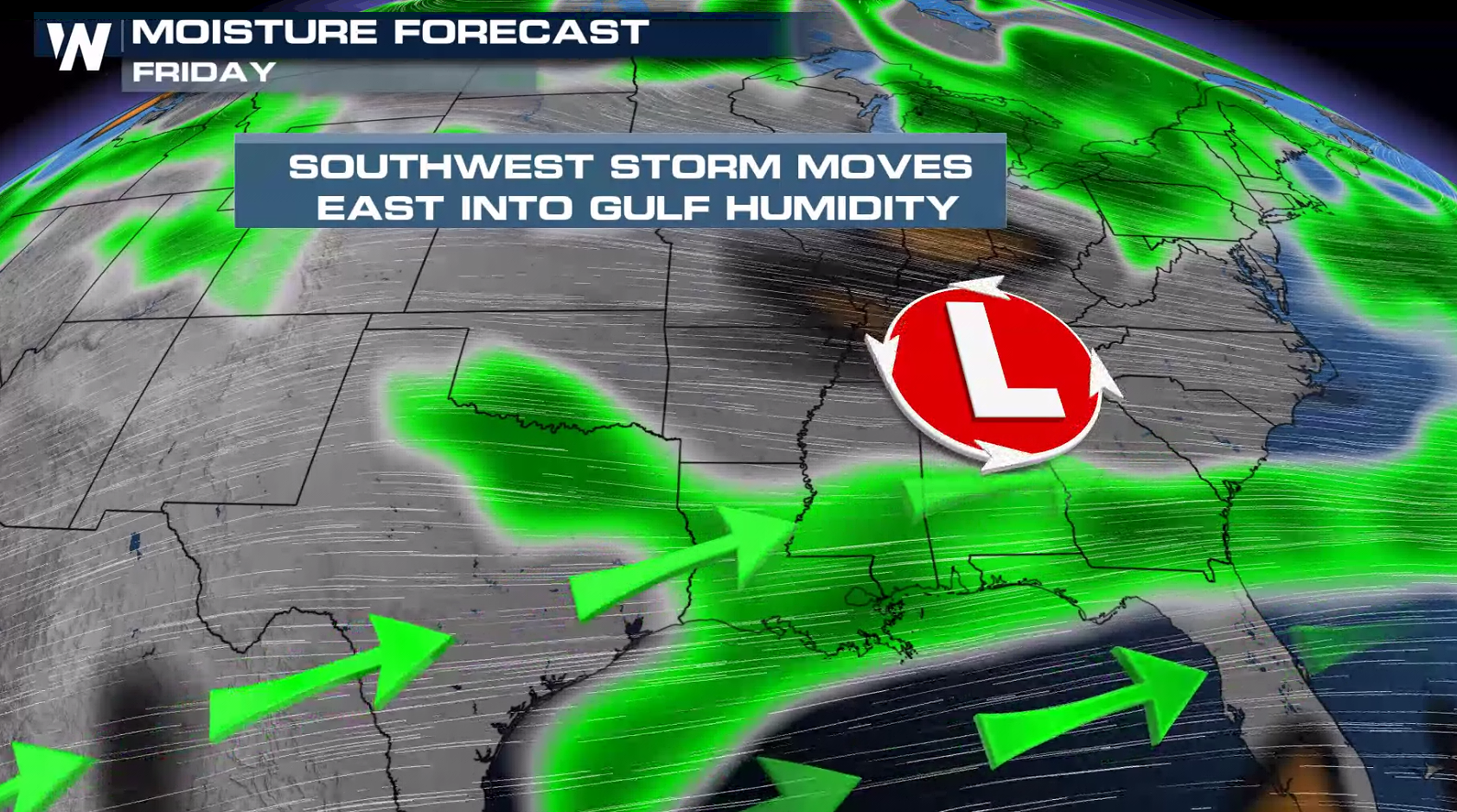
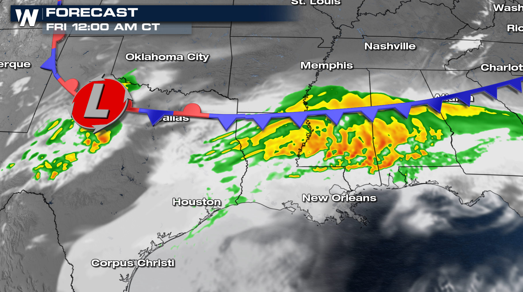 The frontal boundary stalls tonight. This means heavy rain will train over a lot of the same areas bringing a risk for high rainfall totals across the Gulf Coast states.
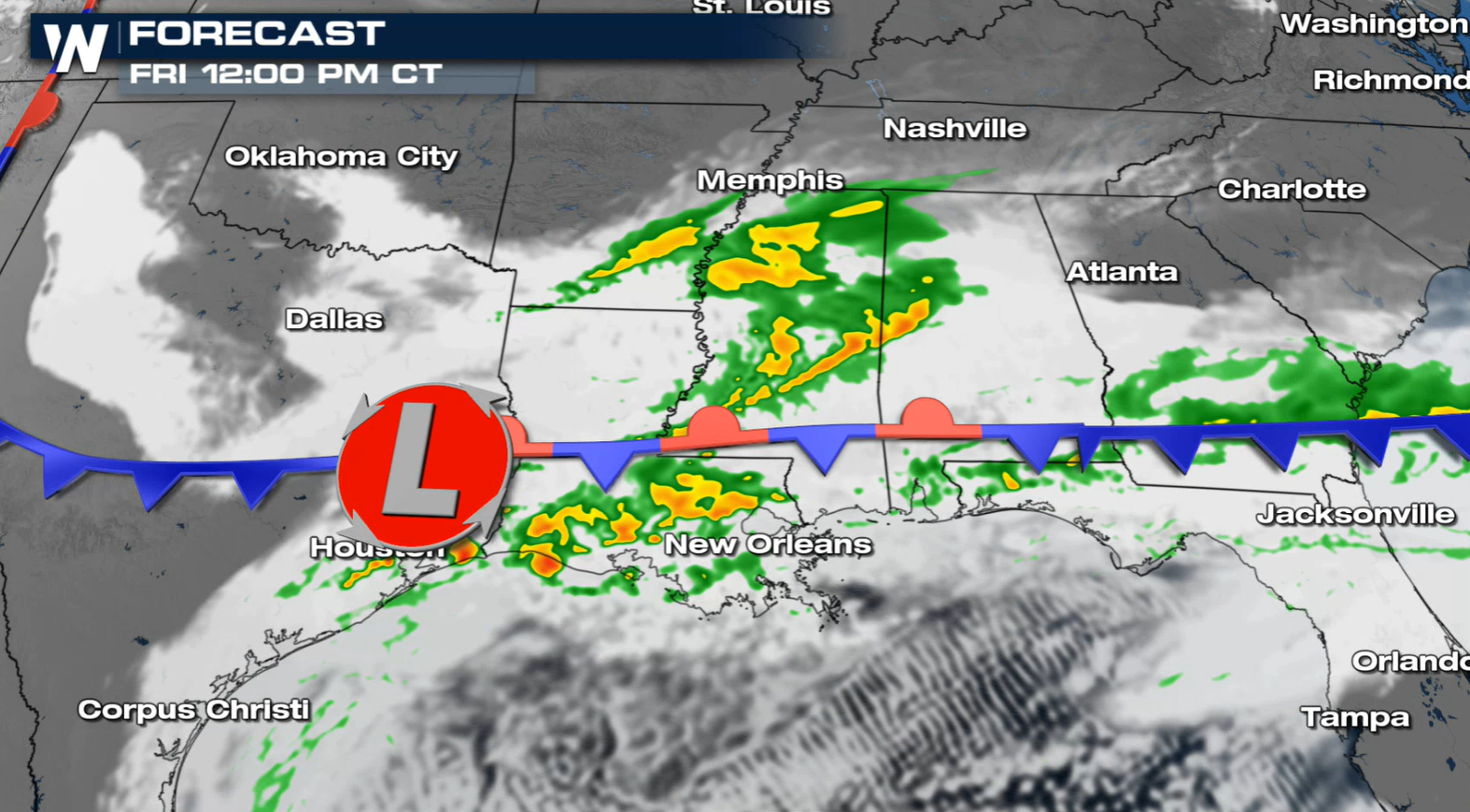
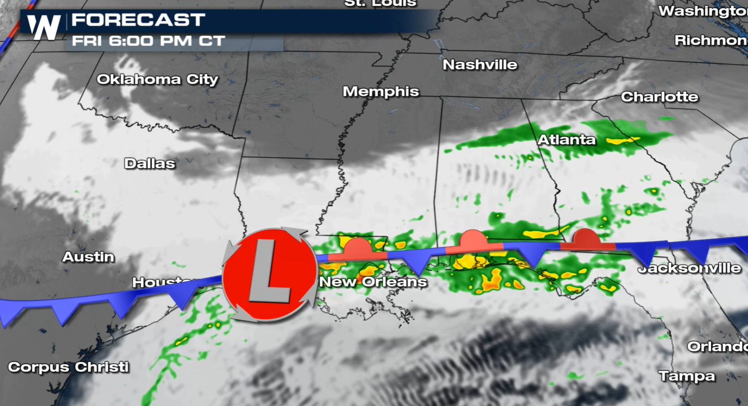 By Friday, most of Texas will see a break from the downpours, but additional rain is expected through Louisiana Mississippi, Alabama, and Georgia. Rain will start to stretch to the Atlantic by Friday evening.
 Stay with WeatherNation for updates on this system along with all of the other top weather headlines!
Forecast
Thursday
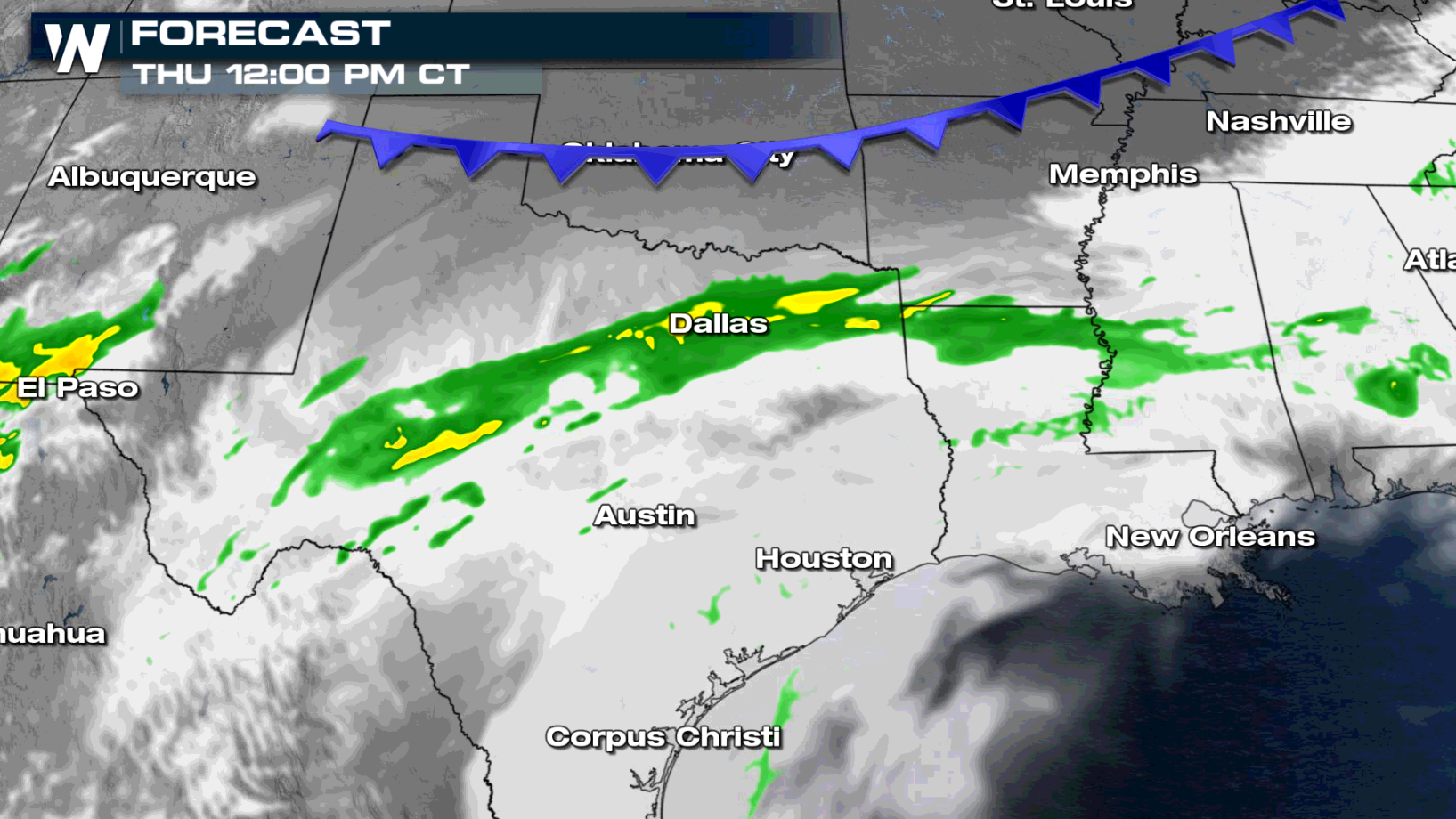
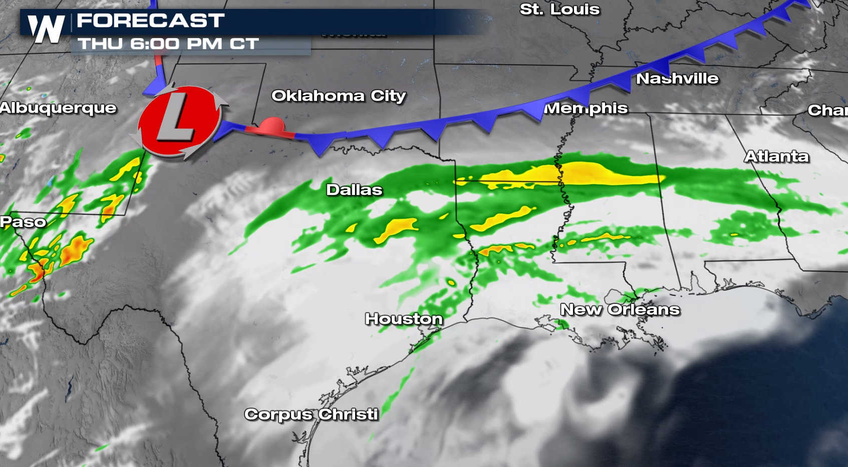
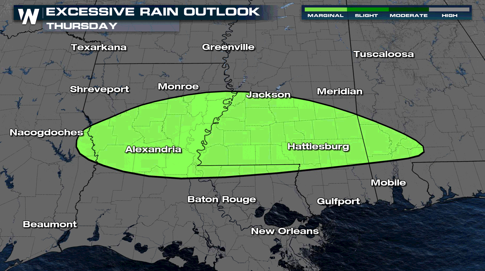
Our next frontal boundary starts to sweep into Oklahoma throughout the morning. Moisture fills into Texas from San Angelo through Lubbock and even into Louisiana and Mississippi. The lift from the front will help enhance areas of very heavy rain across the I-20 corridor from San Angelo to Dallas, Shreveport, Louisiana and into Mississippi.
During the afternoon and evening, the frontal boundary will push slowly south and eastward. Areas of North and East Texas, the Arklatex and into the rest of our Gulf Coast states sees a lot of rain, moderate to heavy at times.
The frontal boundary stalls tonight. This means heavy rain will train over a lot of the same areas bringing a risk for high rainfall totals across the Gulf Coast states.
Friday
By Friday, most of Texas will see a break from the downpours, but additional rain is expected through Louisiana Mississippi, Alabama, and Georgia. Rain will start to stretch to the Atlantic by Friday evening.
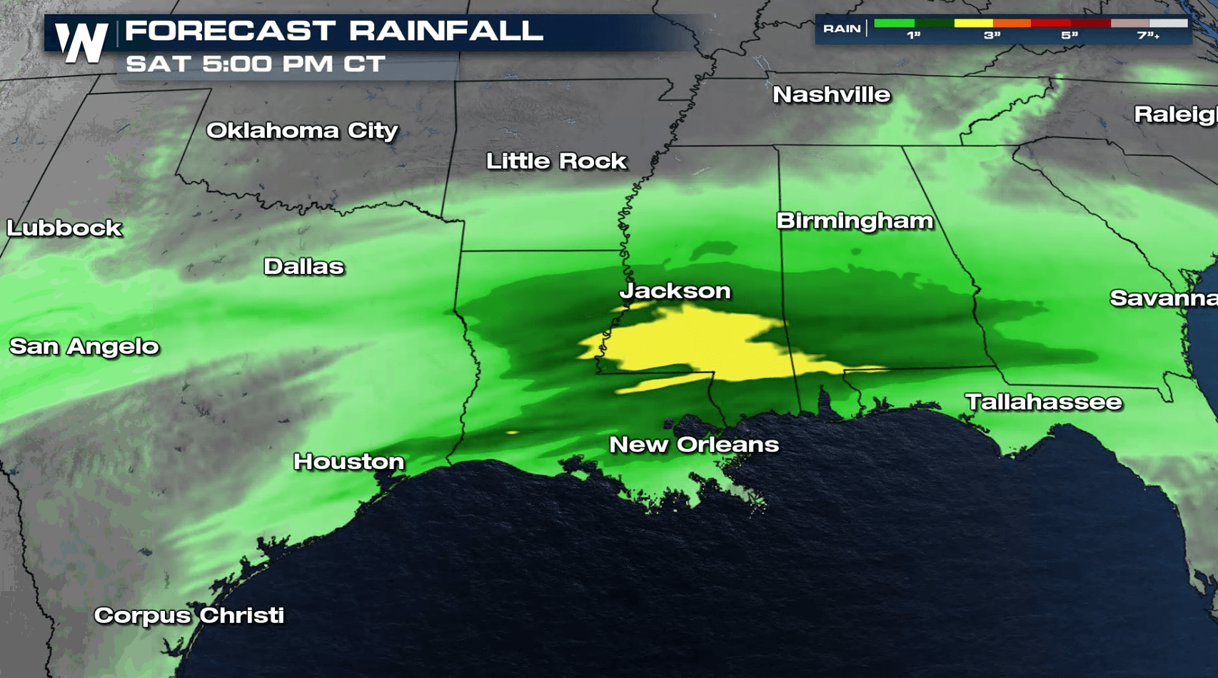
Forecast Accumulation
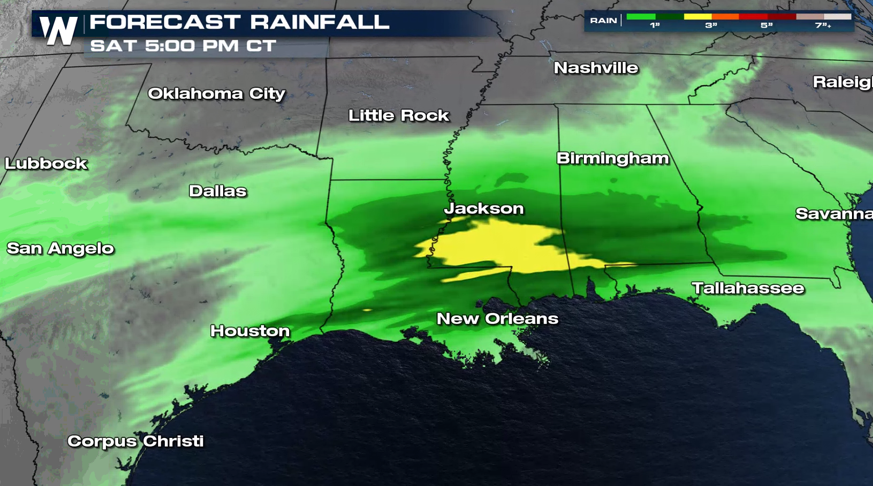
With rain expected over the next several days, some totals may get up to 2-4" across north and central Texas, Louisiana, and into central Mississippi. Isolated areas may get up to 5" of rain as a corridor of heavy rain sets up in the Lower Mississippi Valley. A wide swath of central Louisiana and central and southern Mississippi could see isolated flooding, especially in prone areas with the excessive the amount of heavy rain expected.
Stay with WeatherNation for updates on this system along with all of the other top weather headlines!All Weather News
More
Pacific Northwest Fires Bringing Down the Air Quality
Conditions have been real dry out west. We've
21 Jul 2026 11:05 AM

Flash Flooding and Severe Weather for the Carolinas This Week
Another stalled front in the Carolinas is for
21 Jul 2026 10:40 AM

Another Round of Storms Targets the Northeast
Another cold front is dropping east and will
21 Jul 2026 10:25 AM

Tropics: Tropical Storm Bertha Forms In the Atlantic, Eastern Pacific Active
In the Atlantic basin, we are keeping a very
21 Jul 2026 10:00 AM

Another Round of Severe Weather for the Upper Midwest and Great Lakes
The upper-level low train continues to keep t
21 Jul 2026 1:45 AM

Air Quality Improvements in the Forecast
Wildfires burning in Northwestern Ontario, Ca
20 Jul 2026 7:20 PM

Monsoon Moisture Brings Weekend Flood Threat
The monsoon has returned to the southwestern
19 Jul 2026 1:30 AM