Saturday Severe Risk from Kansas to the Mississippi Valley

Special Stories
28 Dec 2019 5:11 AM
An upper-level system moving through the Plains will bring increasing showers and storms to the forecast from Kansas to the Mississippi Valley Saturday. Damaging winds and isolated tornadoes on top of heavy rain will be possible. Here is the very latest severe forecast.
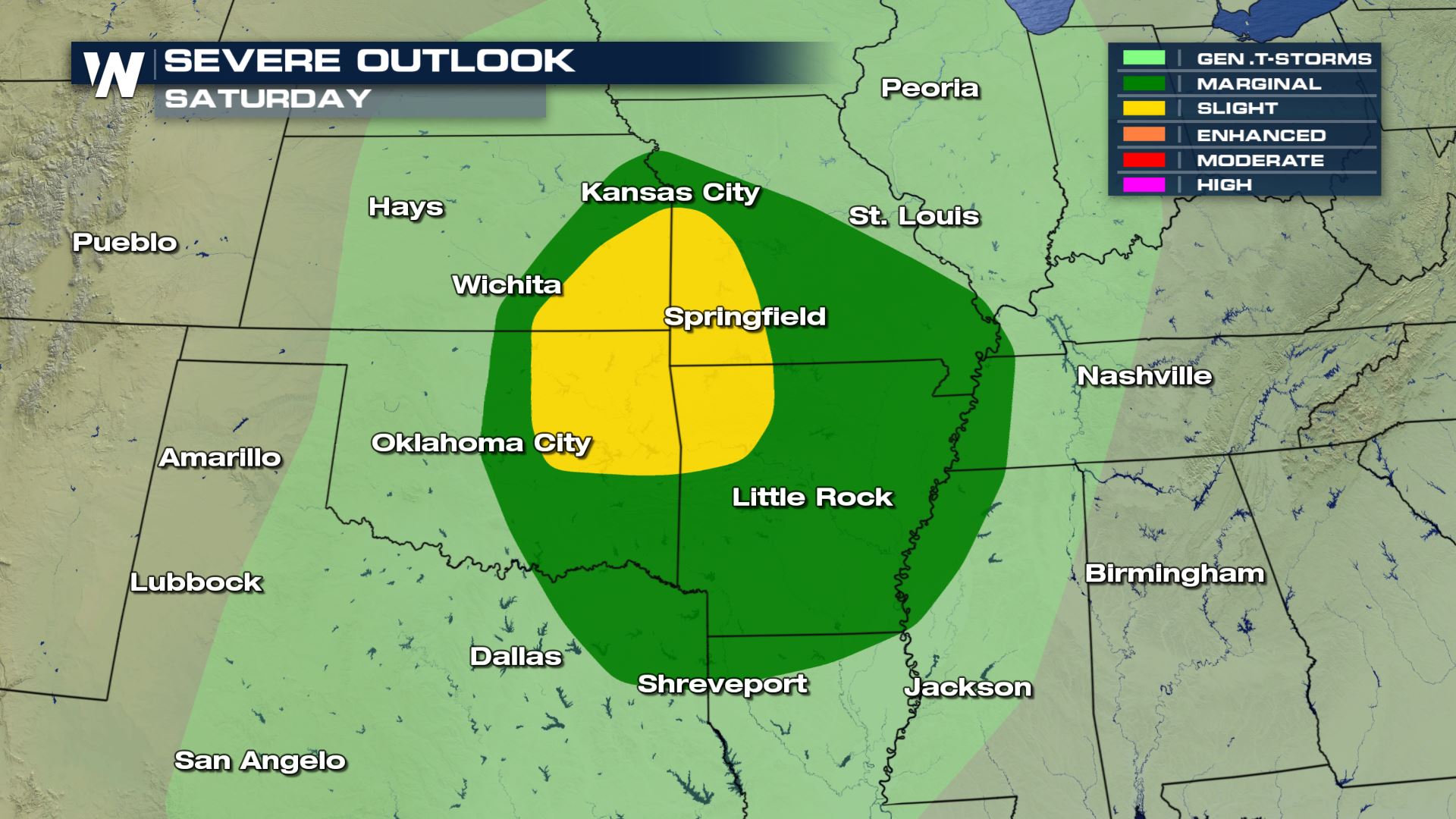 Scattered severe storms will be possible over Oklahoma, Kansas, Missouri and Arkansas through the afternoon and evening on Saturday.
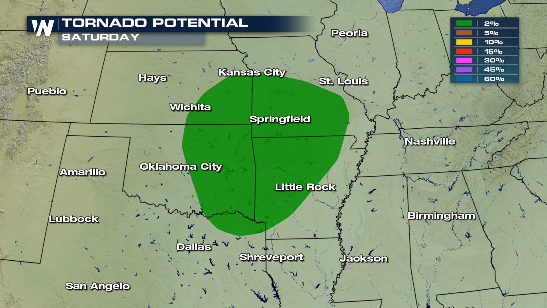
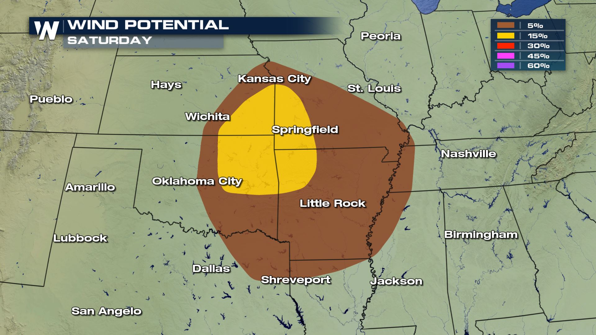 The biggest severe threats will be for damaging winds and a tornado or two. The hail risk will be low with only pea to nickel sized hail as a possibility.
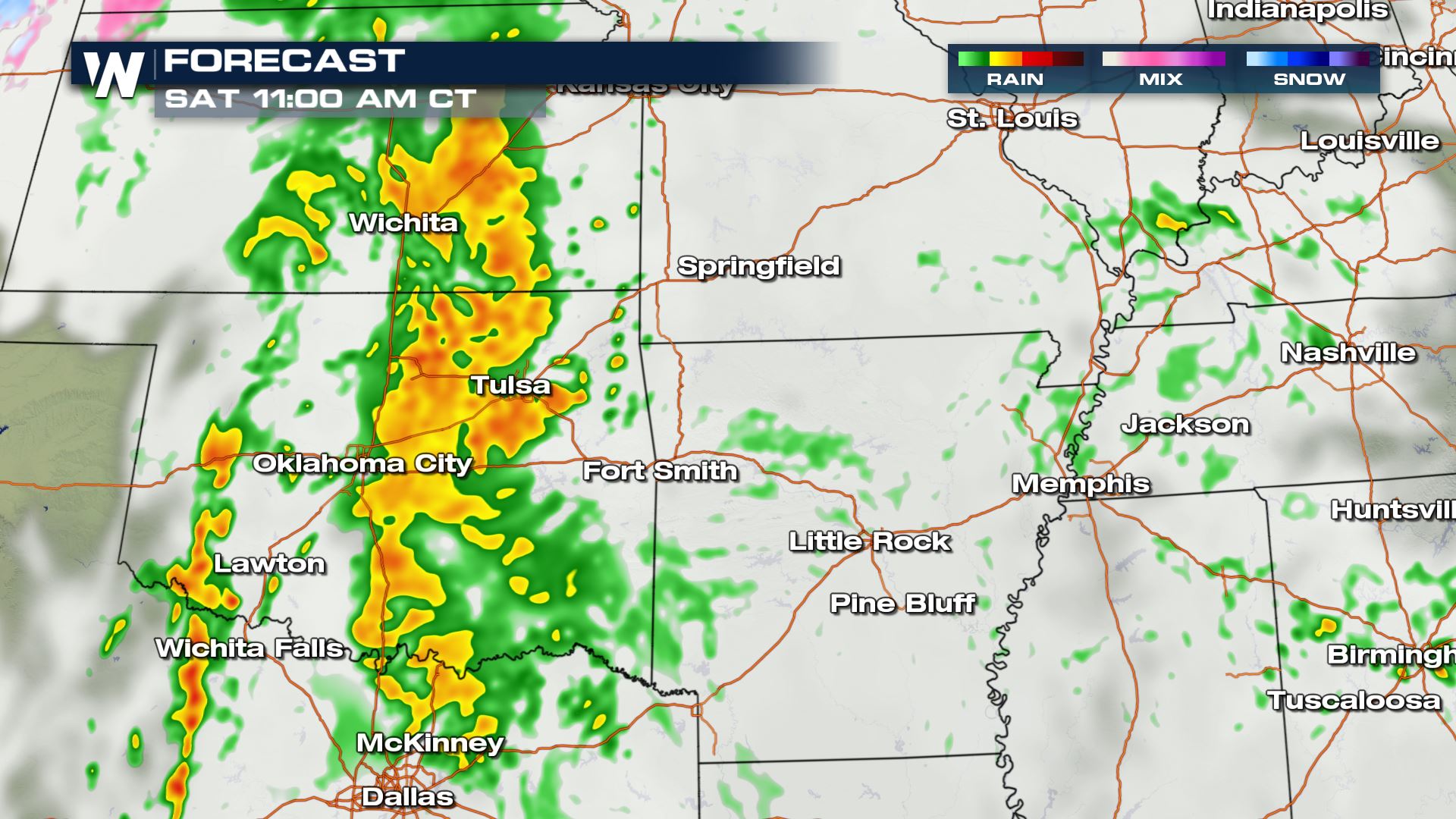
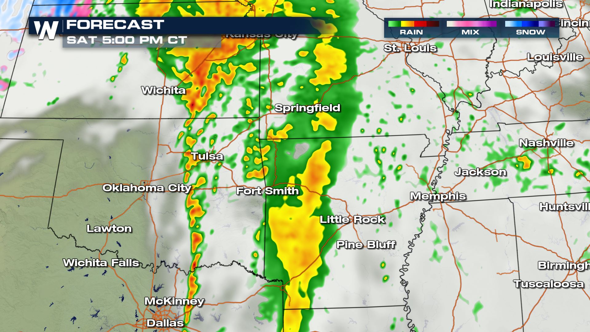
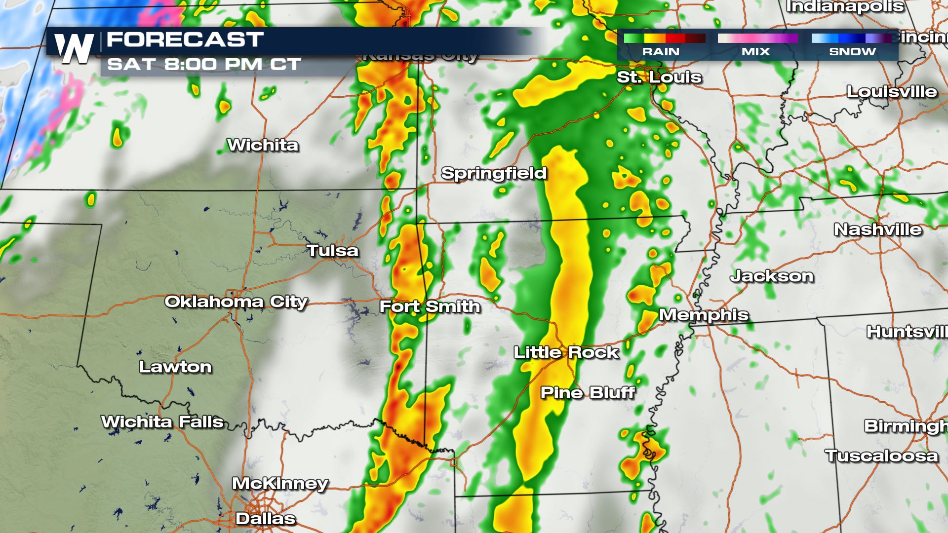
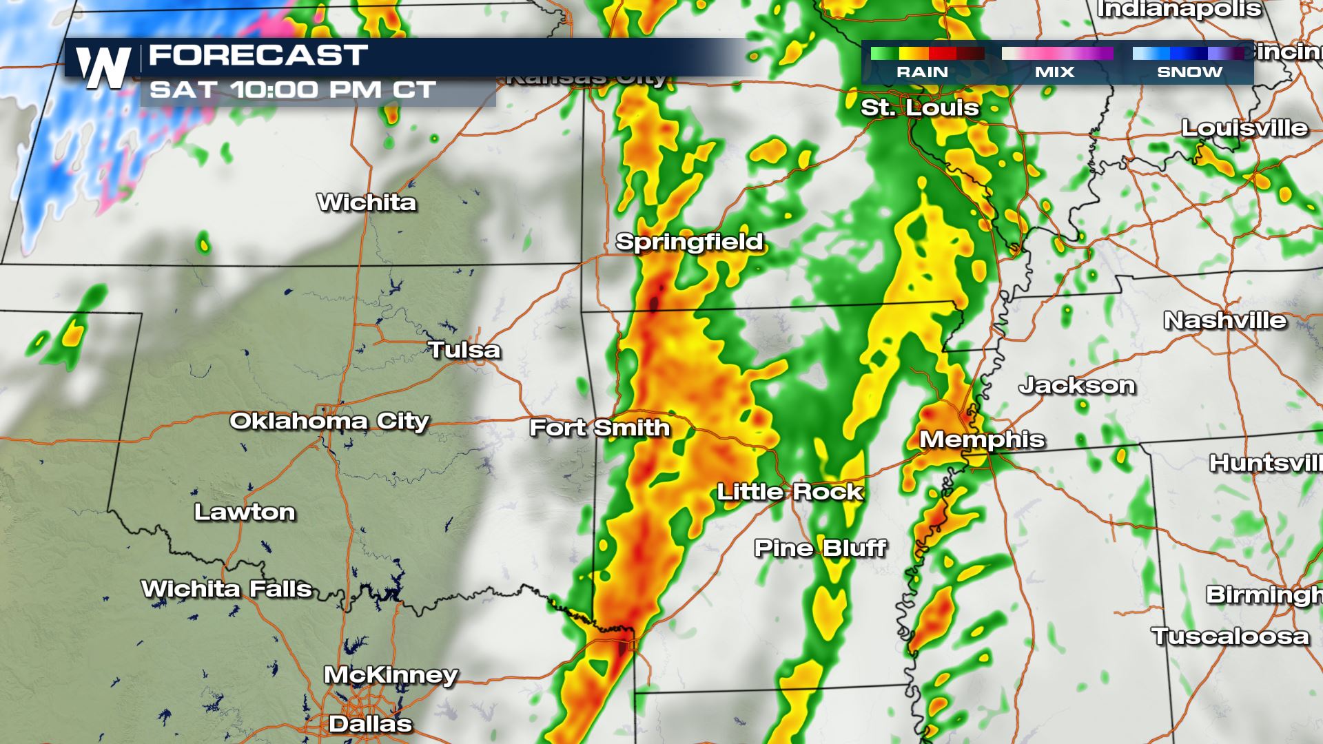 Today's stormy weather will last throughout Saturday with the risk of severe storms more likely for the early evening time frame. Keep it tuned to WeatherNation as we will be covering today's severe storm chances all day and night.
Severe Outlook
Scattered severe storms will be possible over Oklahoma, Kansas, Missouri and Arkansas through the afternoon and evening on Saturday.
Severe Threats
The biggest severe threats will be for damaging winds and a tornado or two. The hail risk will be low with only pea to nickel sized hail as a possibility.
Forecast
Today's stormy weather will last throughout Saturday with the risk of severe storms more likely for the early evening time frame. Keep it tuned to WeatherNation as we will be covering today's severe storm chances all day and night.All Weather News
More
Severe Storms Target the Midwest to the Northeast
UPPER MIDWEST - Dangerous tornadoes have alre
28 Jul 2026 1:45 AM

Tropics: Fausto Heads towards Hawaii; Genevieve Cat 4 Hurricane
PacificHurricane Fausto continues to track we
28 Jul 2026 1:45 AM


Southeast Flood Risk Lingers Near Stalled Front
A stalled boundary over the Southeast will ke
25 Jul 2026 10:55 AM

Another Round of Storms Targets the Northeast
Tuesday brought severe weather again across p
23 Jul 2026 1:15 AM

Another Round of Severe Weather for the Upper Midwest and Great Lakes
The upper-level low train continues to keep t
21 Jul 2026 1:45 AM