Saturday Severe Weather Threat
Special Stories
28 Mar 2020 12:09 PM
SEVERE WEATHER OUTLOOK
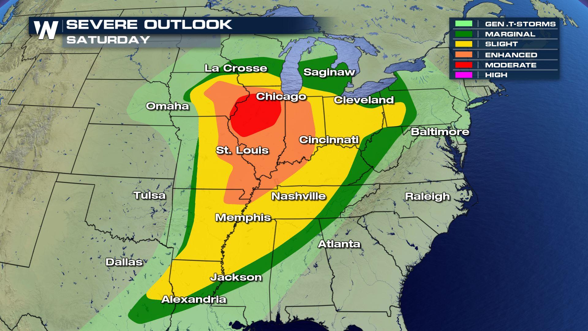
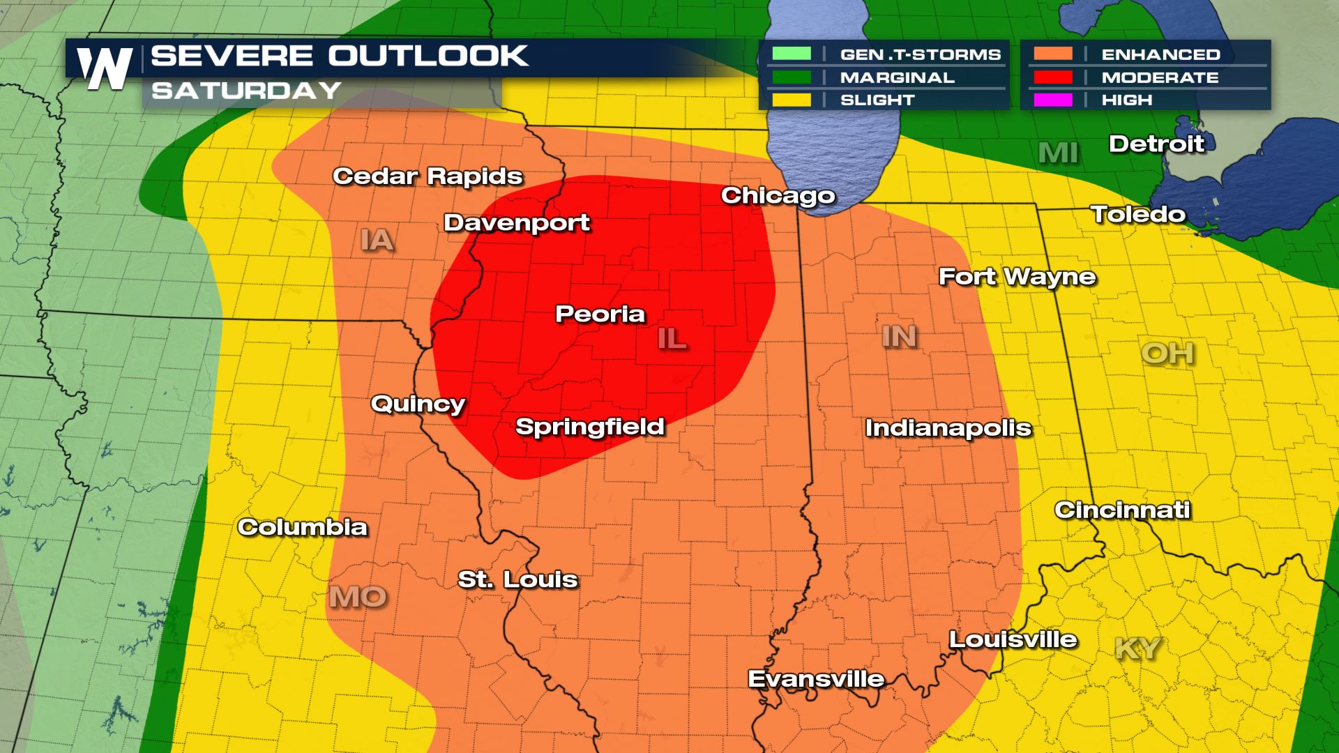 There is a moderate risk for severe storms across North Central Illinois and far Southeastern Iowa, which includes Peoria, Illinois and Davenport, Iowa. Areas in the moderate risk are expected to see rotating thunderstorms that could spawn several strong tornadoes. Large hail and damaging downdraft winds are possible for the entire region in the marginal risk.
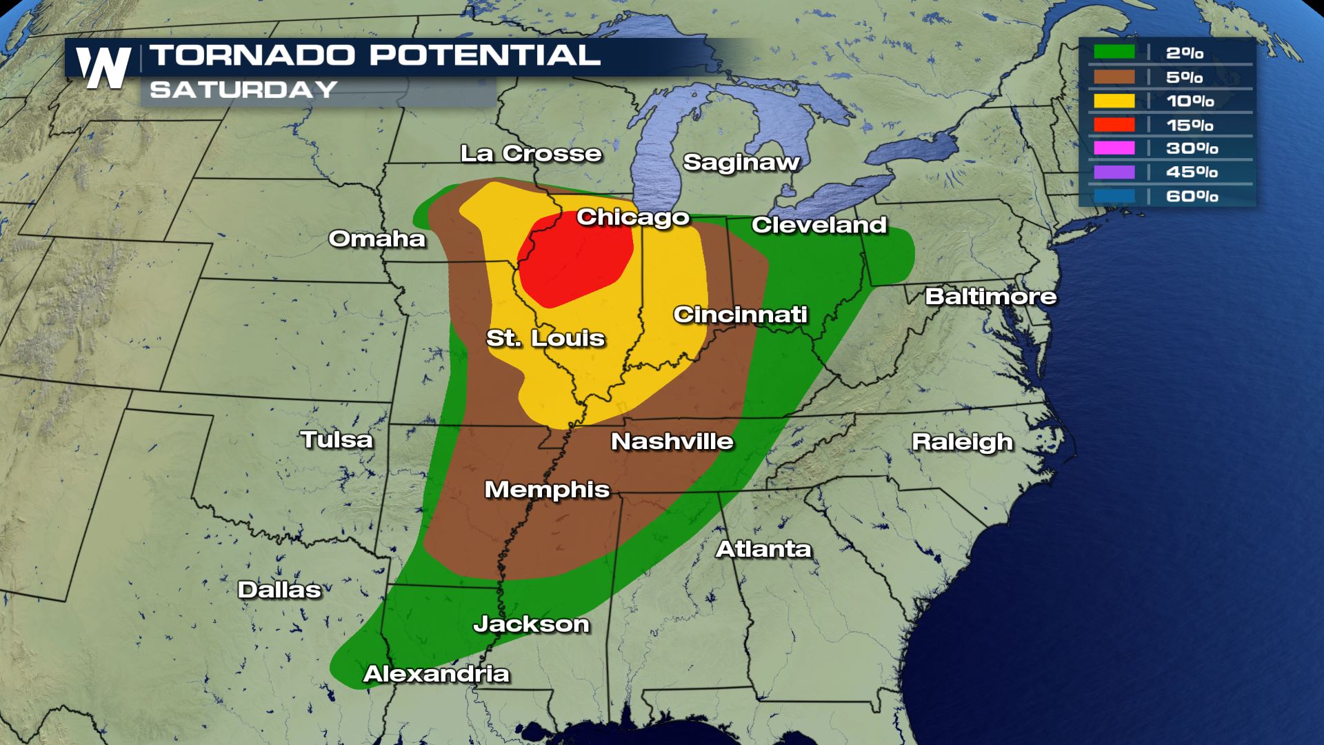
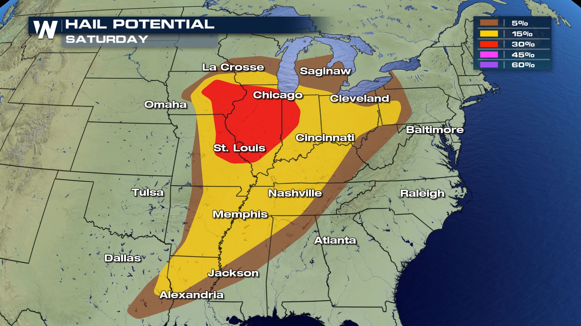
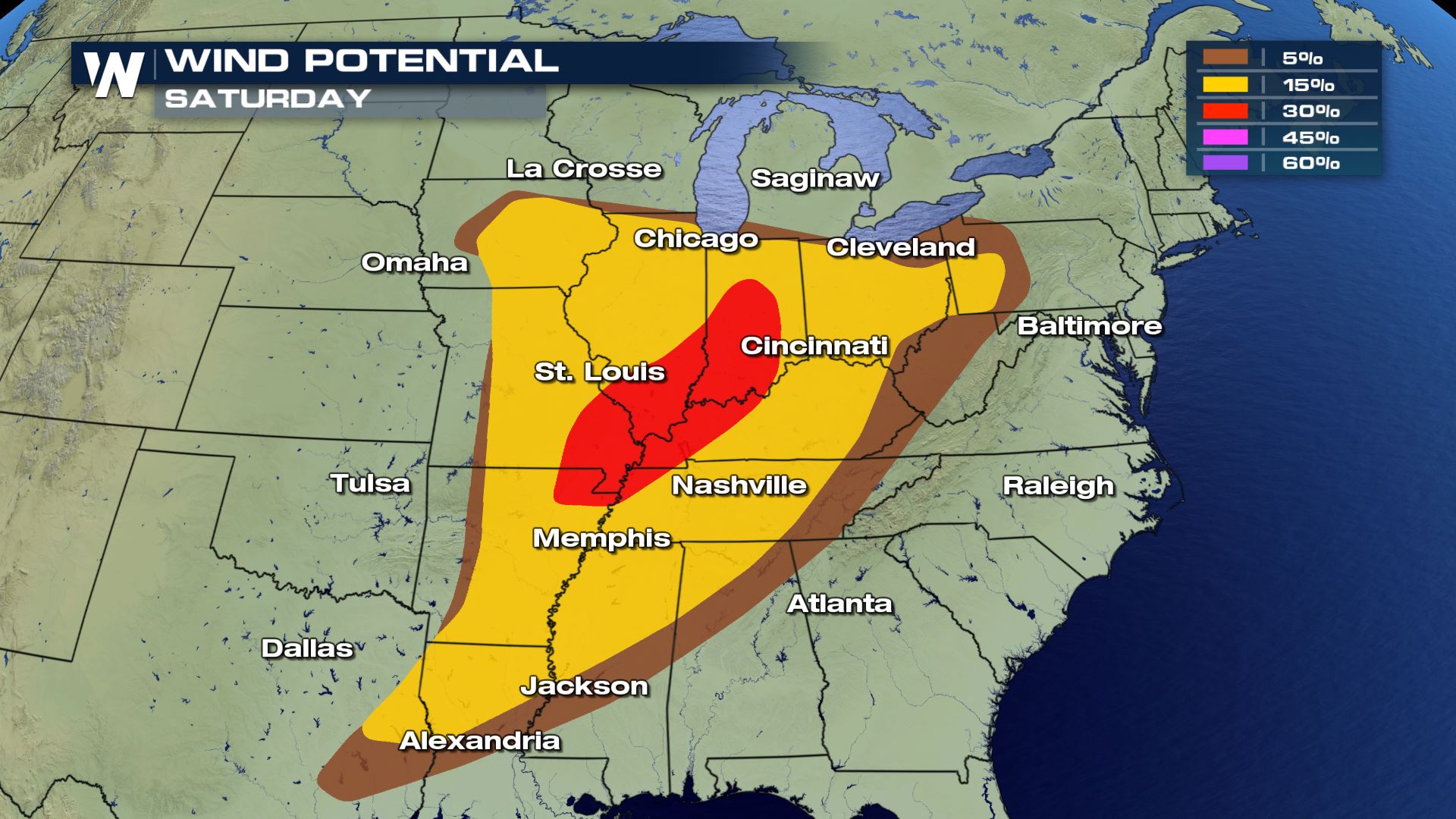 A pool of warm and humid air will help to tap into the potential for severe storms. Another component that could add to the storms severity could come from a pocket of air within the Jet Stream that’s comprised of even faster moving air. This ‘jet streak’ could enhance the rising air that form the thunderstorms (the updraft) which in turn means faster vertical motion that equates to possibly larger hail stones.
SET UP
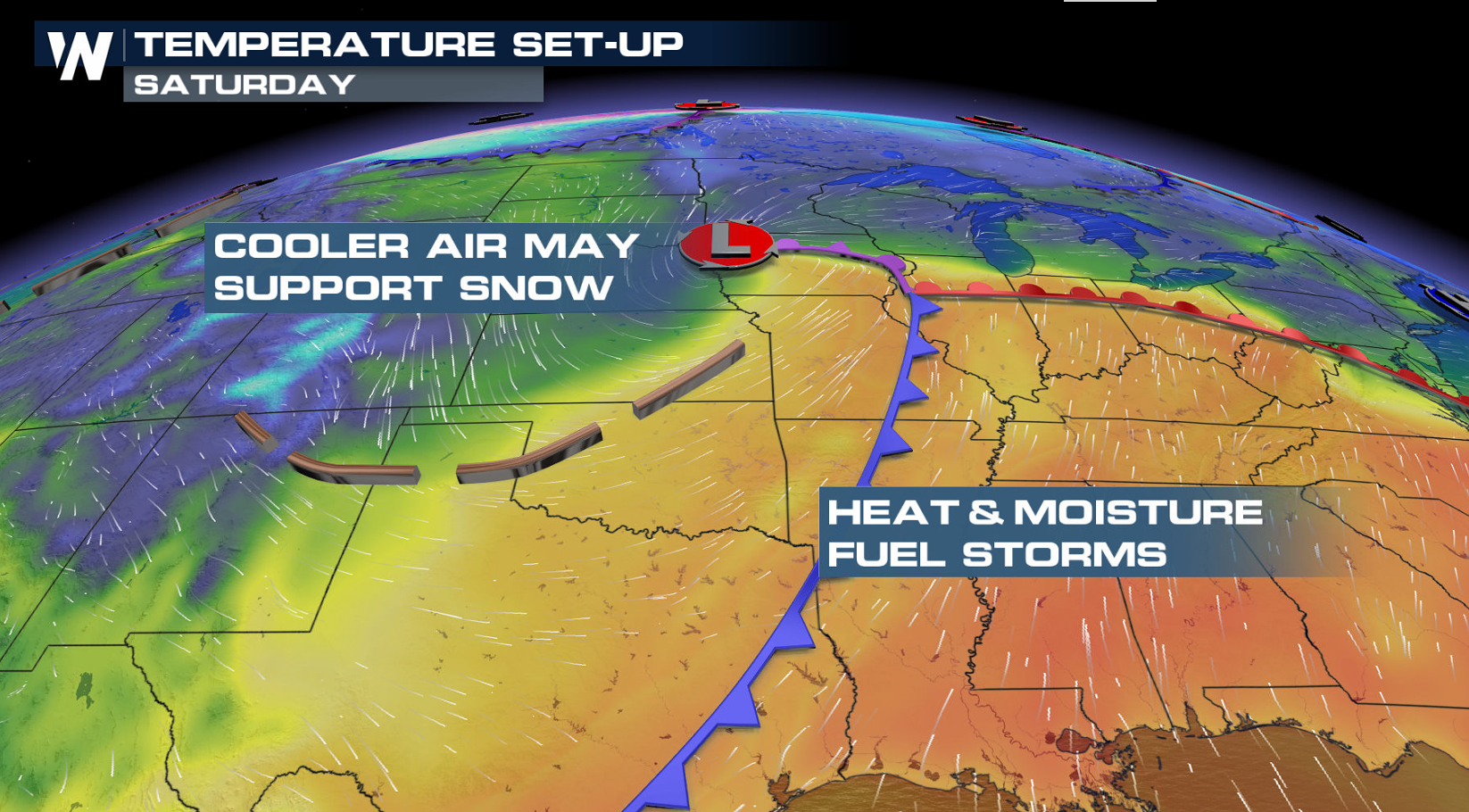
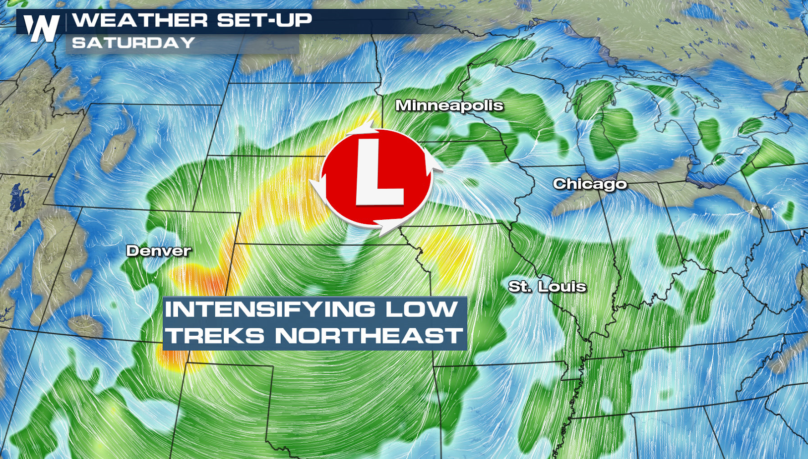 Storms are expected to move very quickly today, possibly at 50-70 mph. That could reduce the lead time for warnings before a storm hits so, be sure to have a method to get severe weather alerts for your area.
FORECAST
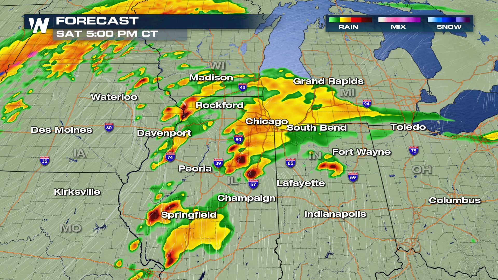
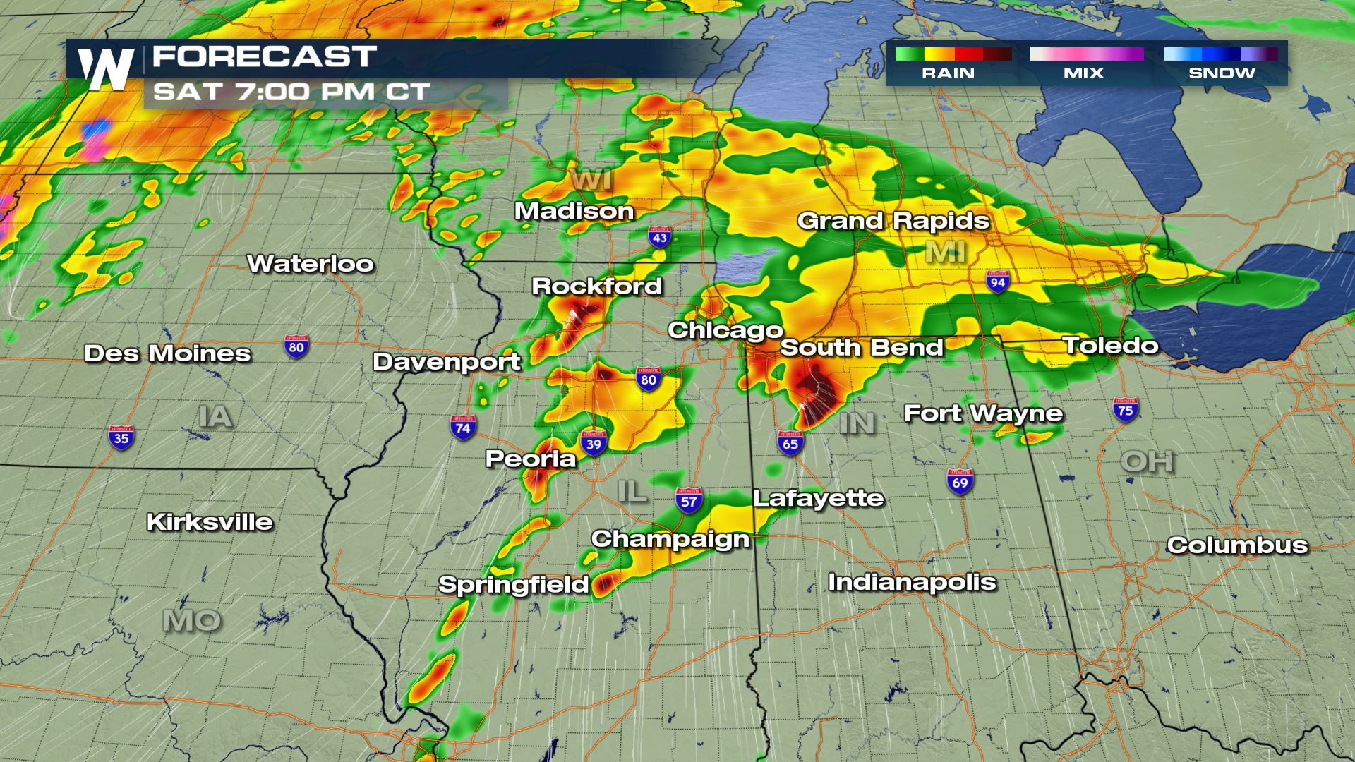
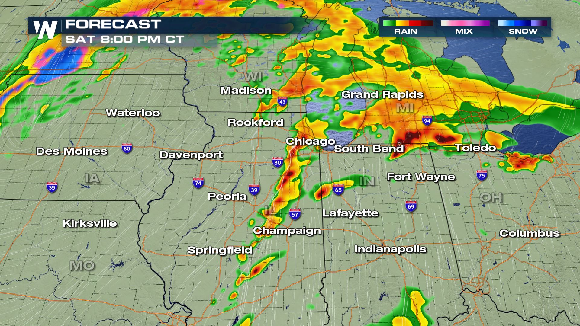 Numerous severe storms are expected to pop up for the remainder of the day. A few strong storms could persist overnight into Michigan, Indiana, and Ohio. Make sure to have a plan in place just in case your area is hit with a strong storm.
Stay with www.weathernationtv.com for the last updates on the severe weather chances. And remember to catch us streaming 24/7 through our different platforms: https://media.weathernationtv.com/apps/
Weather. It’s what we do.
Numerous severe storms are expected to pop up for the remainder of the day. A few strong storms could persist overnight into Michigan, Indiana, and Ohio. Make sure to have a plan in place just in case your area is hit with a strong storm.
Stay with www.weathernationtv.com for the last updates on the severe weather chances. And remember to catch us streaming 24/7 through our different platforms: https://media.weathernationtv.com/apps/
Weather. It’s what we do.All Weather News
More
Severe Storms Target the Northeast Saturday
While smoke and heat have made headlines in t
18 Jul 2026 6:00 PM

Monsoon Moisture Brings Weekend Flood Threat
The monsoon has returned to the southwestern
18 Jul 2026 5:40 PM

Watching the Gulf for Tropical Development
In the Atlantic basin, we are keeping a very
18 Jul 2026 5:00 PM

Thick Wildfire Smoke Continues to Pour Across the Great Lakes, East Coast
Wildfires burning in Northwestern Ontario, Ca
18 Jul 2026 1:45 AM

After Historic Flooding, Flood Risk Moves West Saturday
TEXAS HILL COUNTRY - Life-threatening floodin
18 Jul 2026 1:00 AM

Heat Alerts Across the Nation End Thursday
ALL-TIME RECORD HIGHS were broken across the
16 Jul 2026 1:00 AM

Rare Enhanced Severe Threat For New England
WHAT TO EXPECT The SPC has issued a severe ou
15 Jul 2026 1:35 AM