Saturday Severe Weather Update
Special Stories
12 May 2018 5:48 AM
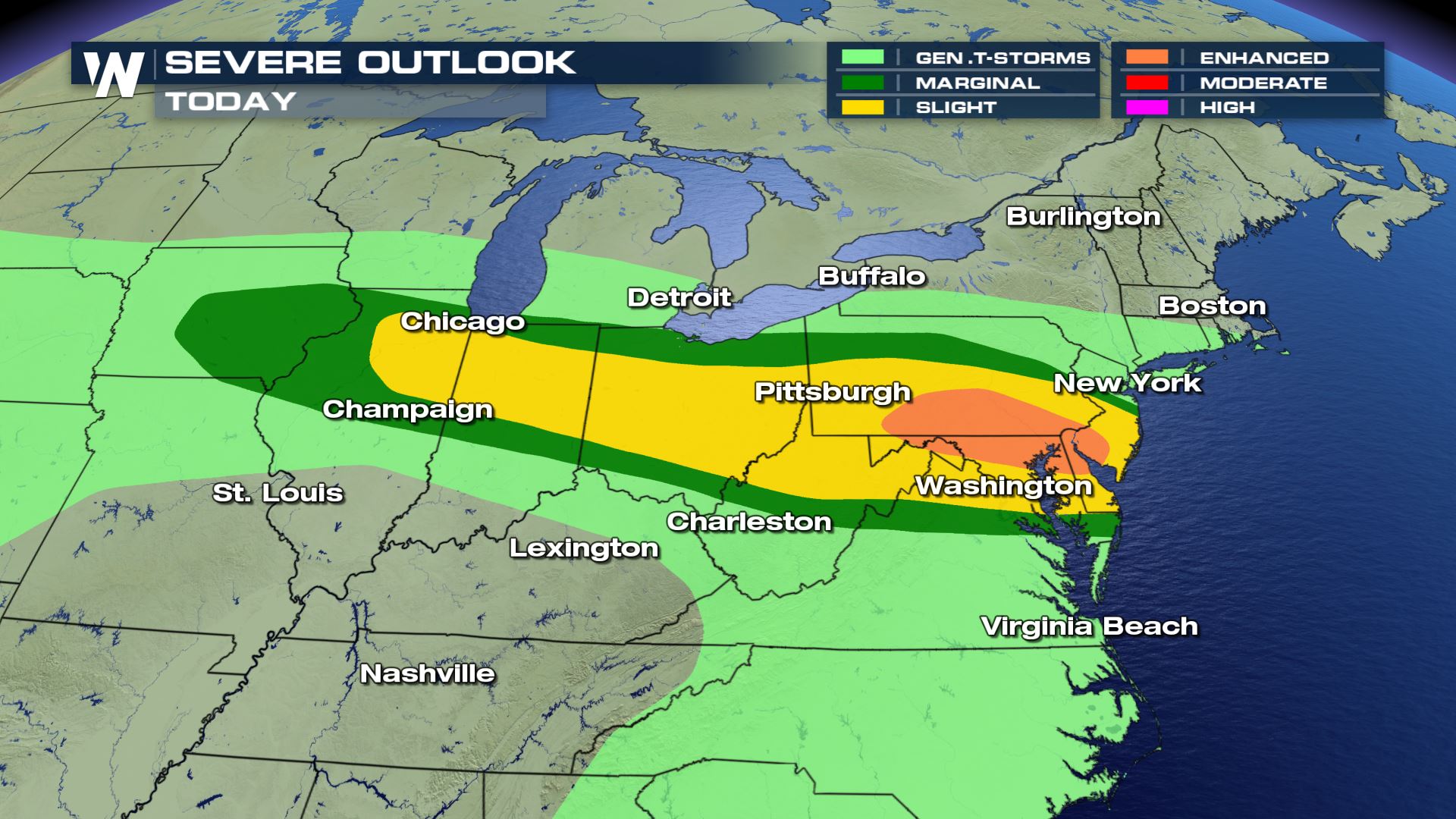
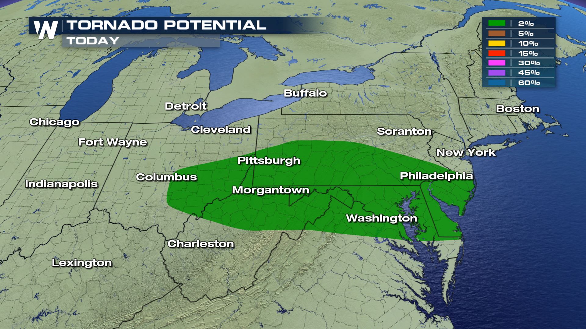
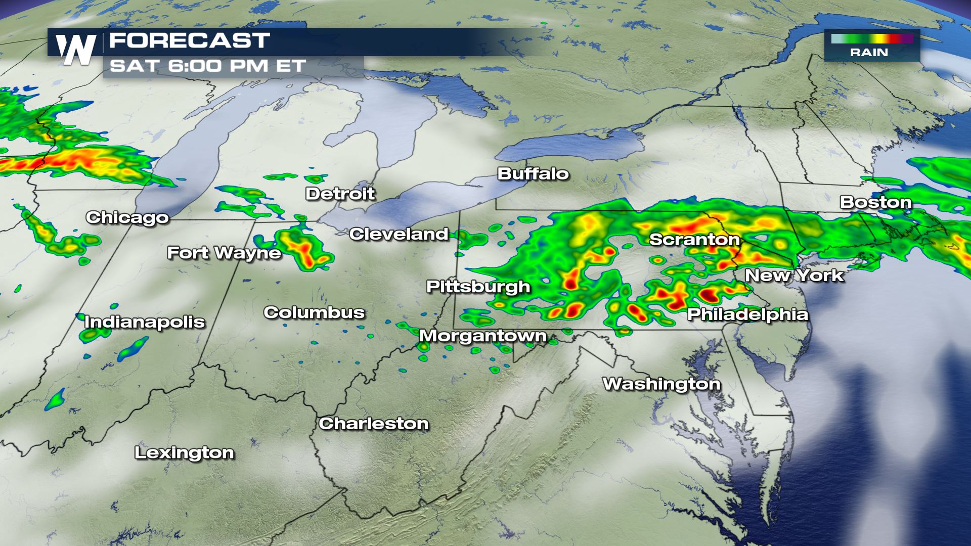
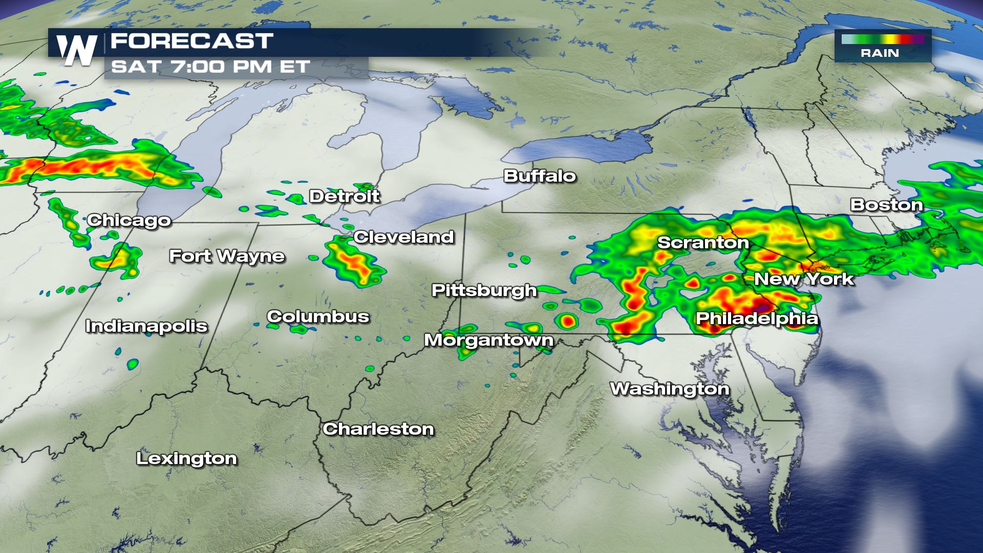
Severe weather chances are looking much higher and stronger today for portion of Midwest/Ohio Valley eastward to the Mid-Atlantic Coast. Right now it looks like this will be a damaging wind event, but we can't rule out some large hail and isolated tornadoes.
 Stay tuned to WeatherNation for more severe updates all day on-air and online.
Meteorologist Patrick Crawford
Stay tuned to WeatherNation for more severe updates all day on-air and online.
Meteorologist Patrick Crawford
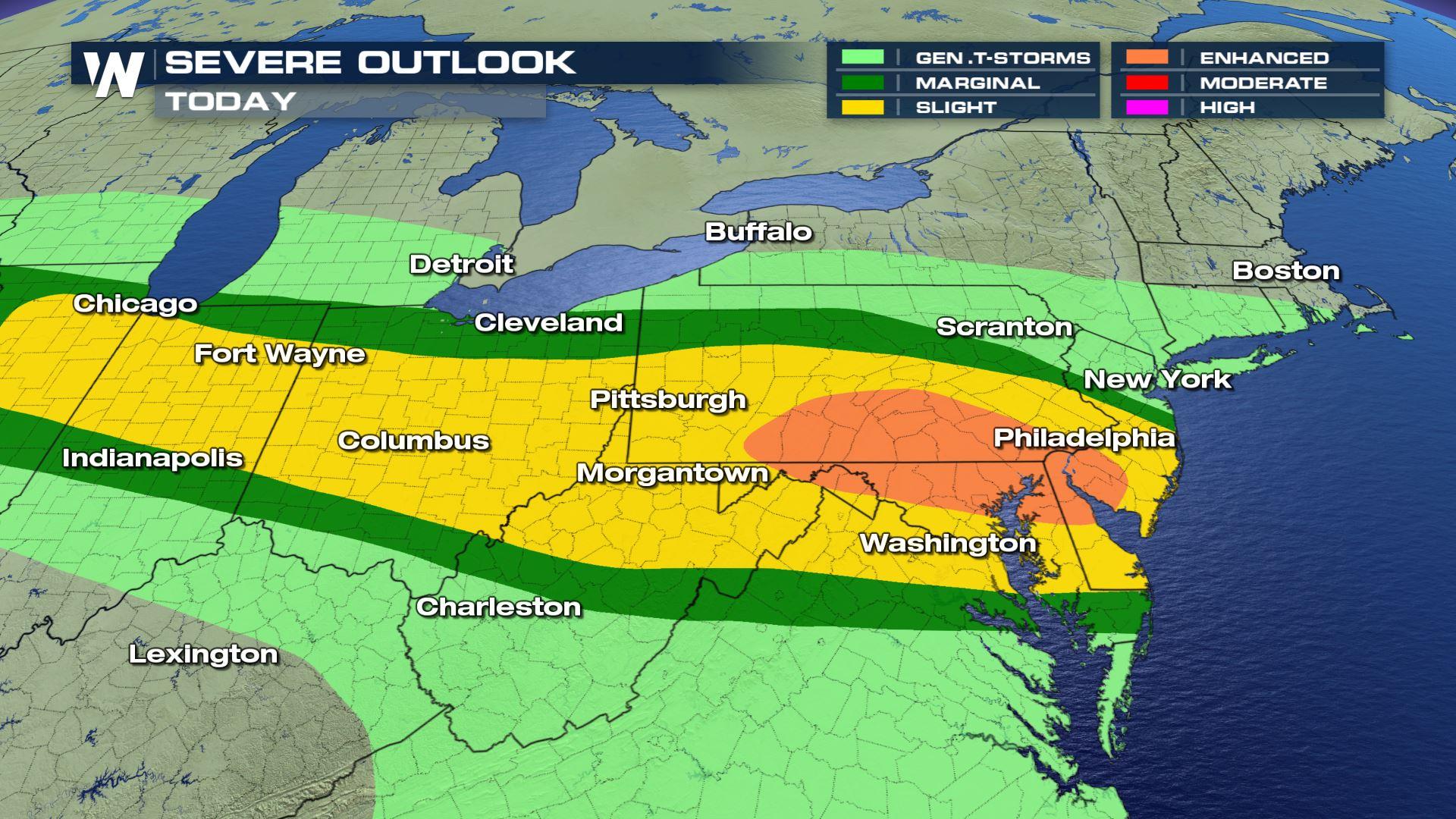
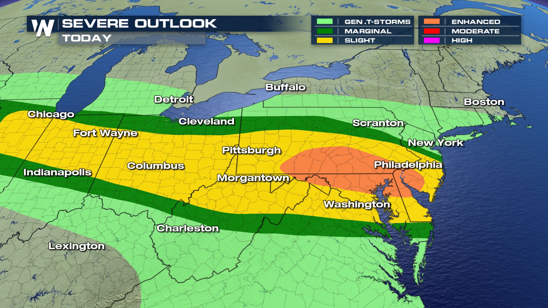
Severe Outlook
You can see a slight risk from Illinois to New Jersey...this lines up with the location of a stationary front that will help produce today's storms.
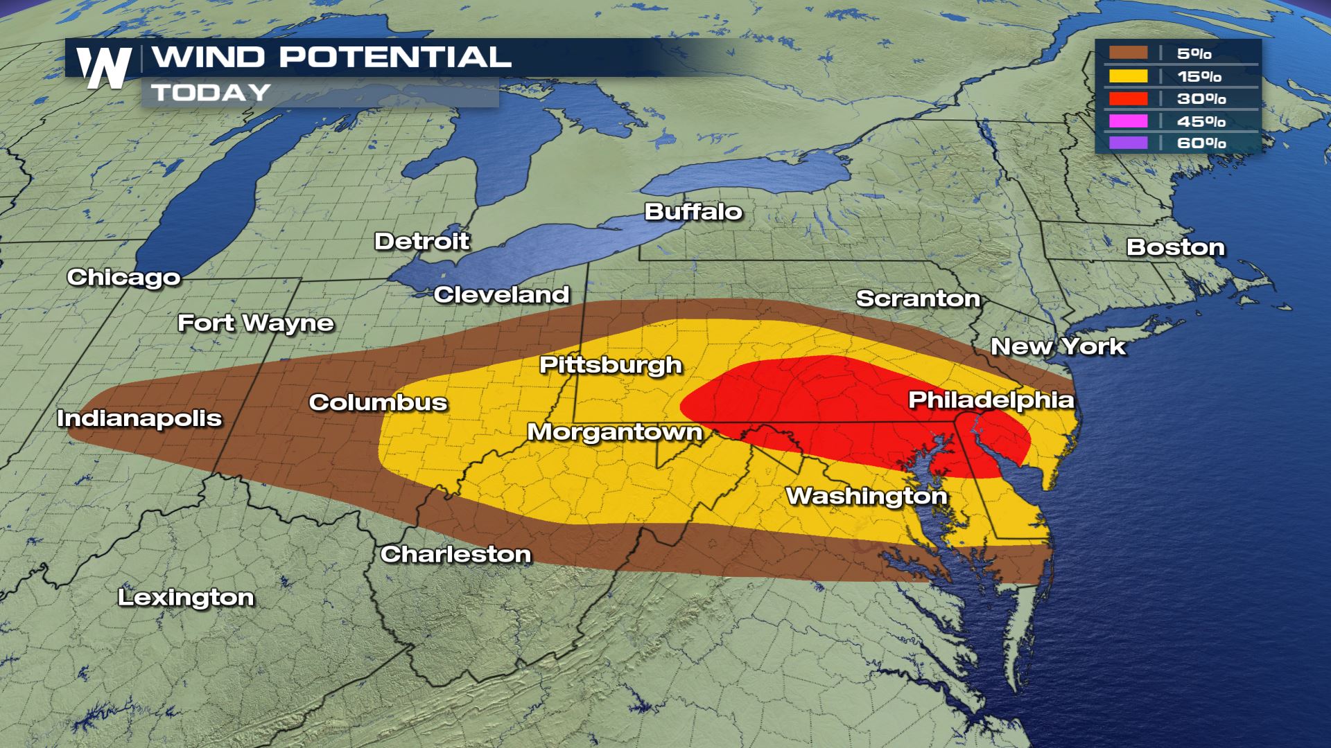
Severe Risks
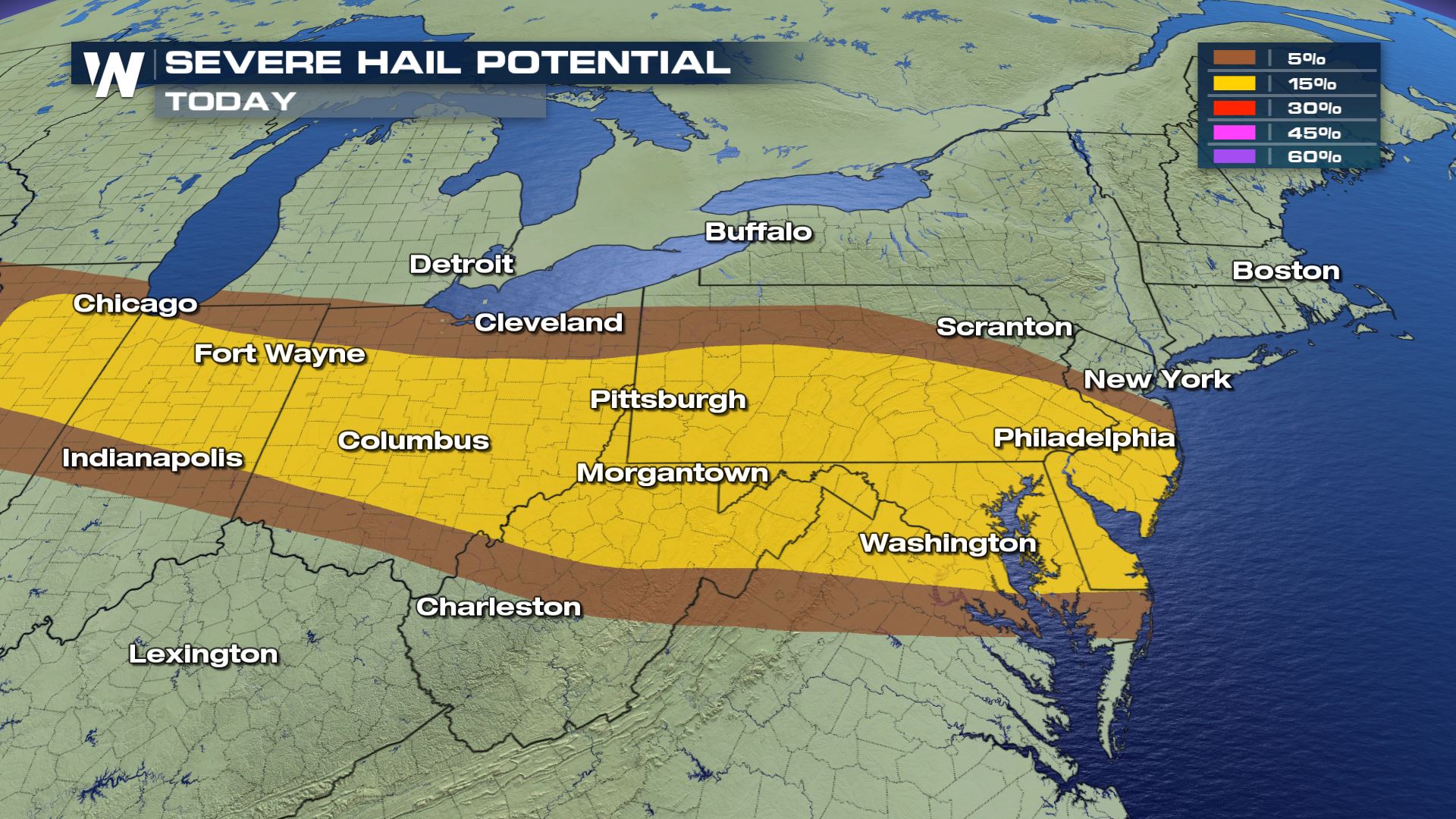
Unfortunately all the severe weather risks will be in today's forecast with damaging winds being the strongest risk for this afternoon.
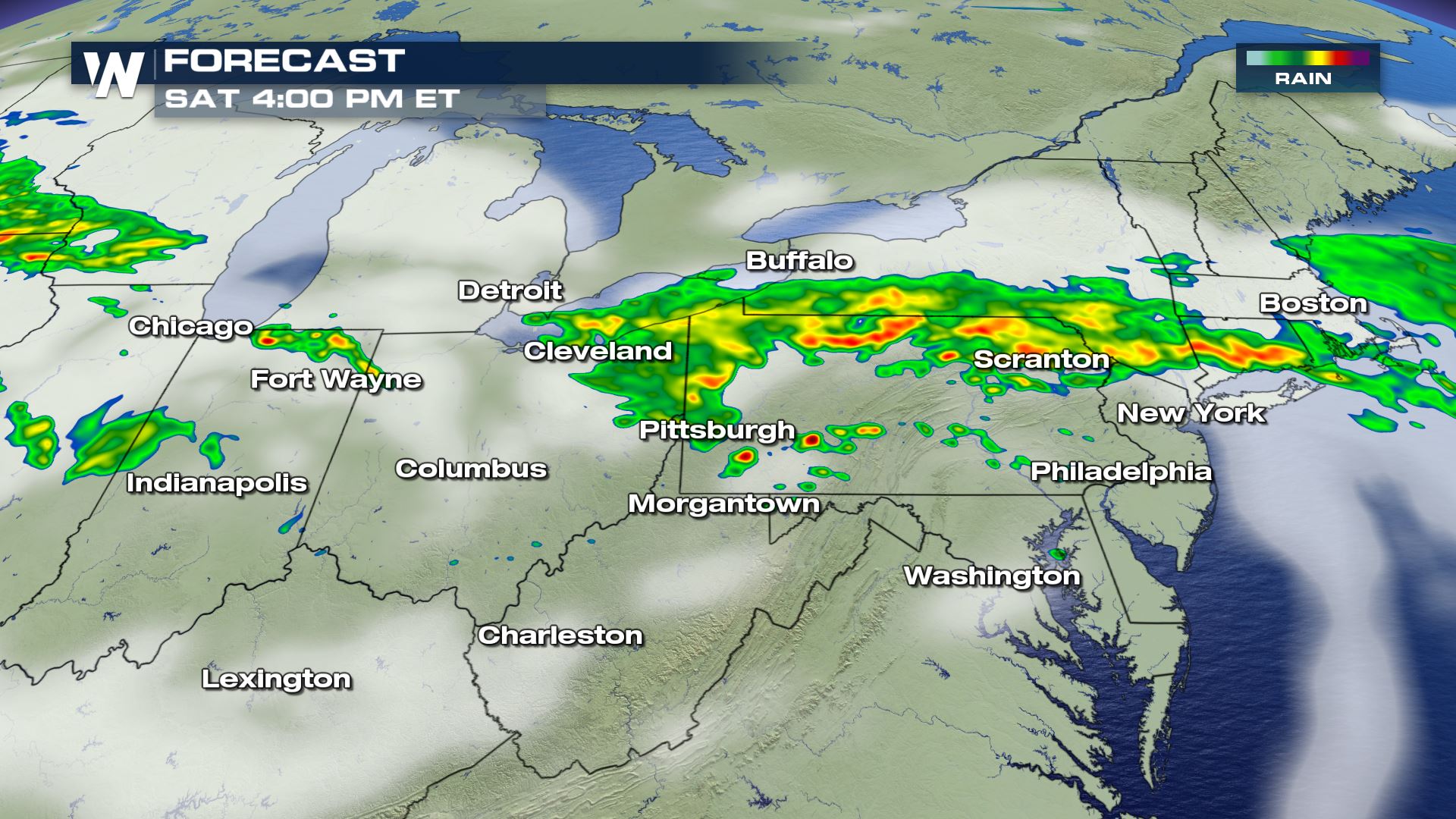
Latest Forecast
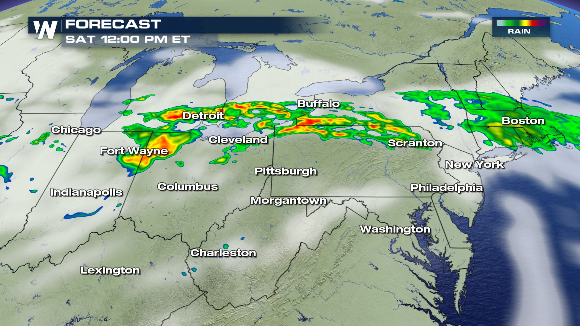
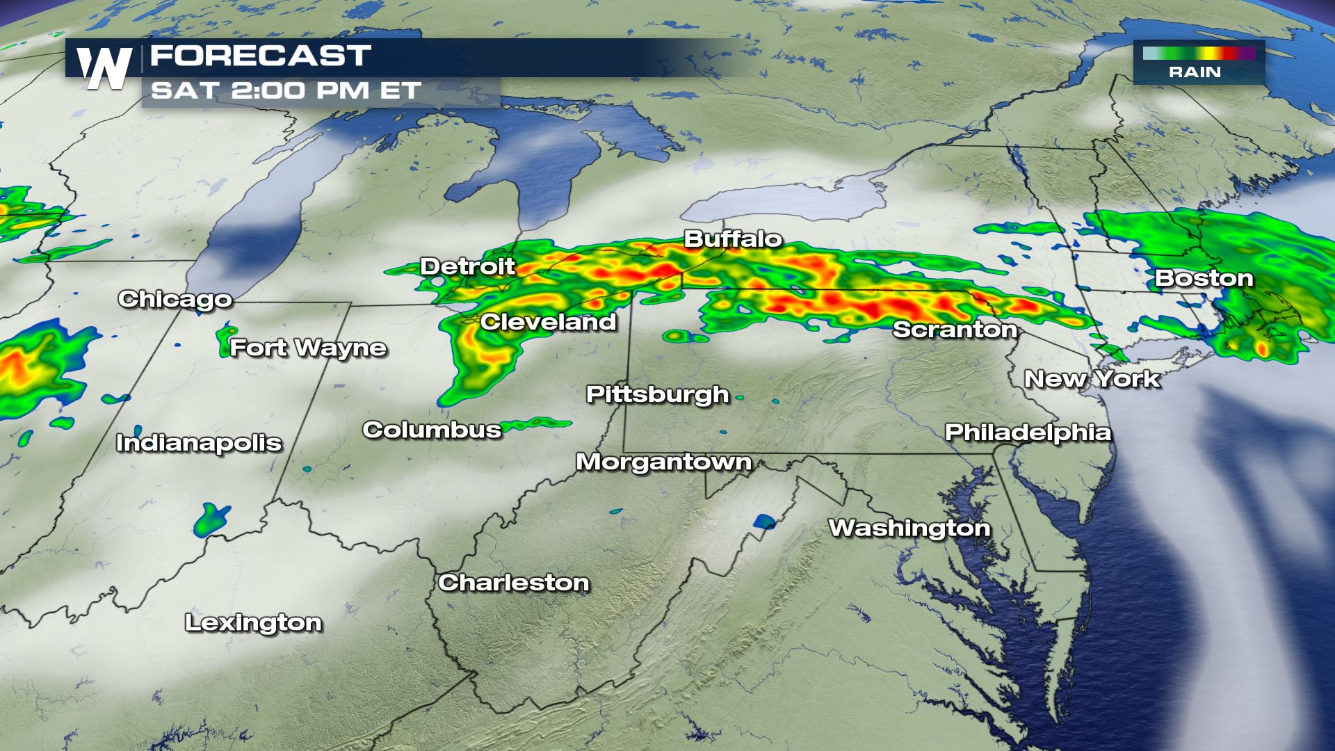
They strongest storms will be moving through the Mid-Atlantic later this afternoon and through the early evening. These are the storms that will likely produce damaging winds and large hail.
Stay tuned to WeatherNation for more severe updates all day on-air and online.
Meteorologist Patrick Crawford
All Weather News
More

Flooding, Severe Storms Target the Midwest Again
After an active week of storms across the nor
1 Aug 2026 1:40 AM


After Reaching Category 5, Genevieve Weakens in the Pacific
PacificFausto is now a post-tropical cyclone.
31 Jul 2026 1:30 AM

Flooding Risk Increases as Heavy Rain Targets the Tri-State Area
Tuesday, heavy rainfall moved across the Nort
30 Jul 2026 12:25 AM

Severe Weather: Energy From the Midwest Now in the Southeast
UPPER MIDWEST - Through Monday, dangerous tor
29 Jul 2026 10:30 PM