September Recap: Multiple Hurricanes, Destructive Fires, and Record Heat
Climate by the numbers
September 2020
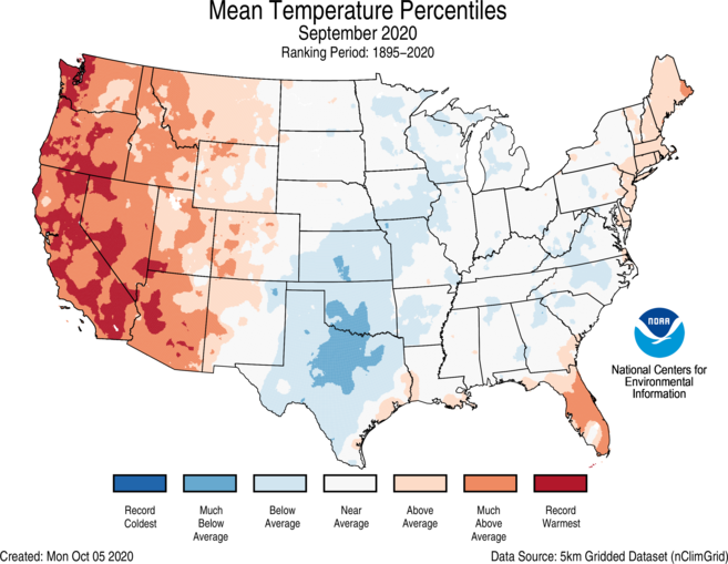
The average September temperature across the contiguous U.S. was 66.0 degrees F — 1.1 degrees above average — which fell into the warmest third in the 126-year record. While parts of the country saw cooler-than-average temperatures, including the Plains and Deep South, much of the West was steamy.
California and Oregon saw their hottest September on record; Arizona and Nevada had their second hottest.
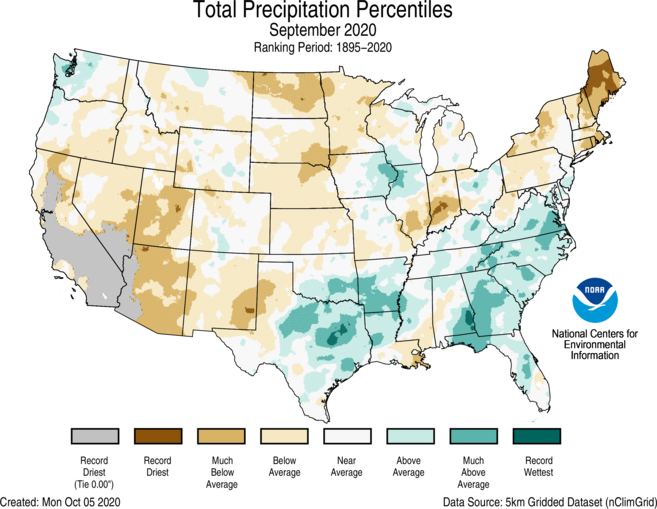
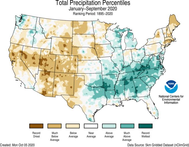
The average precipitation last month was 2.38 inches (0.11 of an inch below average), which ranked in the middle third of the record. Some locations did see a wetter-than-normal September, including the Deep South and Southeast, due mainly to Tropical Storm Beta and Hurricane Sally. In fact, Georgia has its ninth-wettest September on record.
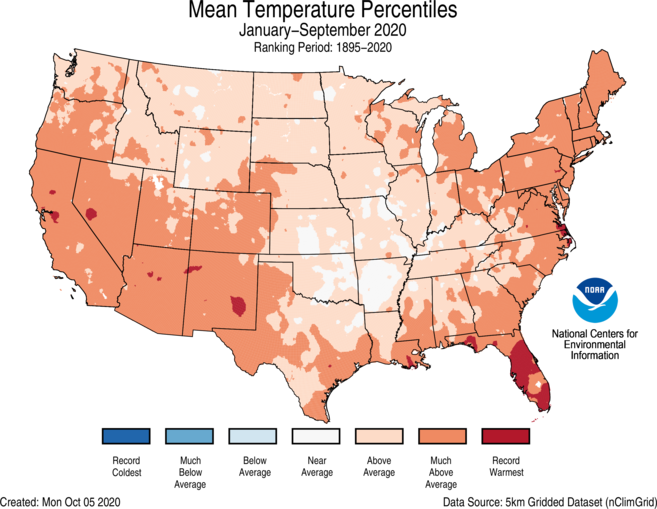
Year to date (YTD) | January through September 2020
The year-to-date average temperature for the contiguous U.S. was 57.3 degrees F — 2.3 degrees above the 20th-century average and the sixth-warmest YTD on record. Florida experienced its hottest YTD, while Arizona, Massachusetts, New Jersey and Rhode Island saw their third hottest.
In terms of precipitation, the YTD total was 24.08 inches (0.88 of an inch above average) and ranked in the middle third of the record.
Mississippi, North Carolina, Tennessee and Virginia saw their third-wettest YTD on record, while Utah and Colorado recorded their driest and second-driest YTD, respectively.
More notable climate events
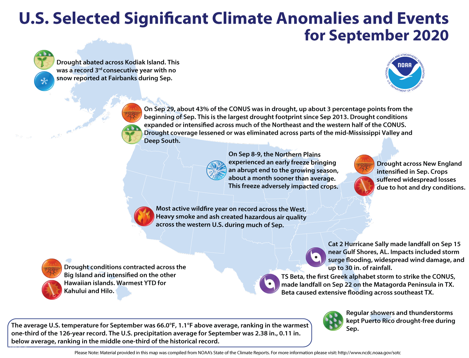
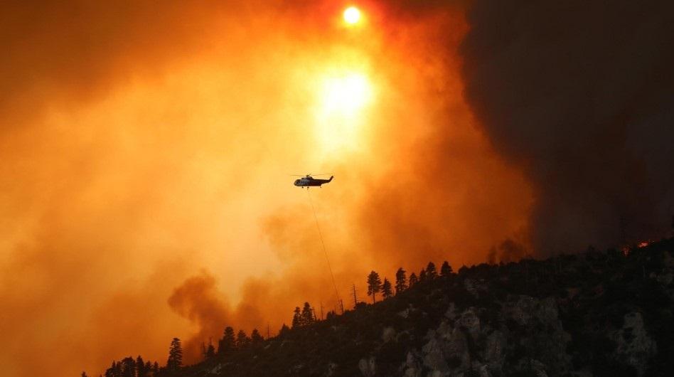
- Wildfires wreaked havoc across California: Since mid-August, more than 4 million acres have burned across California, breaking the statewide burn record set in 2018 by more than 2 million acres. Five of the top six largest wildfires on record in California (dating to 1932) burned between August and the end of September.
-
The tropics were very active: The Atlantic hurricane season continued at a record pace last month. In September alone, 10 named storms formed — Nana, Omar, Paulette, Rene, Sally, Teddy, Vicky, Wilfred, Alpha and Beta. For the first time since 1971, five named storms churned in the Atlantic Basin at the same time.
-
Drought got worse: According to the U.S. Drought Monitor report, 42.6% of the contiguous U.S. was in drought, up about 3 percentage points from the beginning of September. Drought conditions expanded or intensified across much of the Northeast and the western half of the contiguous U.S.


