Severe Chances For The Next Few Days
Top Stories
13 May 2018 9:13 AM
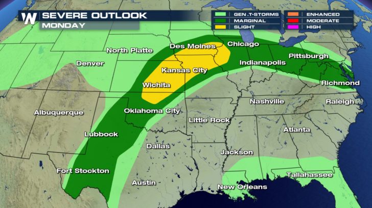
We are continuing to talk about more severe weather chances as we wrap up this weekend and head into next week. Today, the threat stretches from the Southern Plains to the Mid-Atlantic. Especially with the risk for scattered severe storms in areas shaded in yellow.
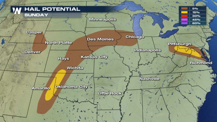
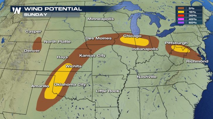
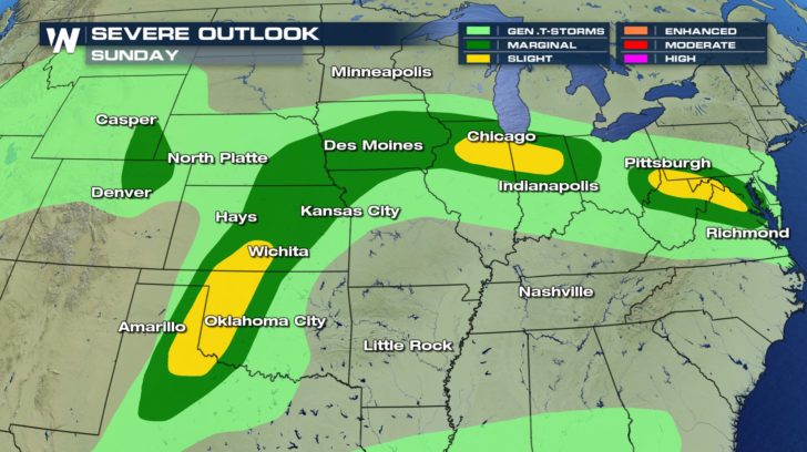 Any strong or severe storm brings with the threat for damaging winds with gusts in excess of 60 mph and large hail.
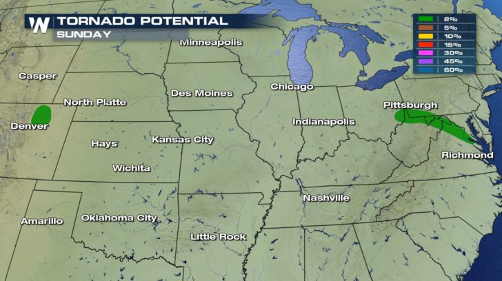
 The potential for tornadoes remains small but still a potential across north, central Colorado and southeastern Wyoming as well as across the northern panhandle of West Virginia to the Chesapeake Bay.
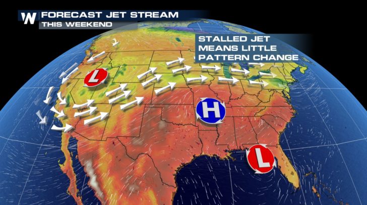
 As we head into the start of next week, we really don't see too much change in the weather patter. A low the to west and high across the southeast keep the jet stream relatively stationary. This means that storms chances will remain along similar locations.
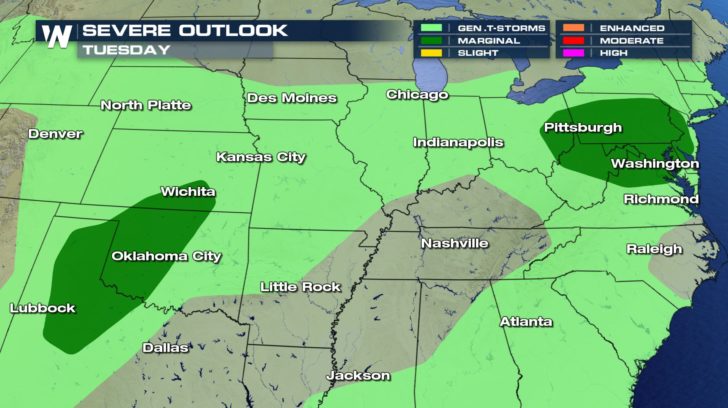 Flooding may also become a concern with repetitive showers and storms over the same region. Watch for ponding on the roadways and start weather weather for the next few days.
For WeatherNation, Meteorologist Kate Mantych
 Any strong or severe storm brings with the threat for damaging winds with gusts in excess of 60 mph and large hail.

 The potential for tornadoes remains small but still a potential across north, central Colorado and southeastern Wyoming as well as across the northern panhandle of West Virginia to the Chesapeake Bay.
 As we head into the start of next week, we really don't see too much change in the weather patter. A low the to west and high across the southeast keep the jet stream relatively stationary. This means that storms chances will remain along similar locations.


 Flooding may also become a concern with repetitive showers and storms over the same region. Watch for ponding on the roadways and start weather weather for the next few days.
For WeatherNation, Meteorologist Kate Mantych
Flooding may also become a concern with repetitive showers and storms over the same region. Watch for ponding on the roadways and start weather weather for the next few days.
For WeatherNation, Meteorologist Kate MantychAll Weather News
More