Severe Potential in the Plains and Ohio Valley
Special Stories
1 May 2019 8:00 AM
SEVERE OUTLOOK
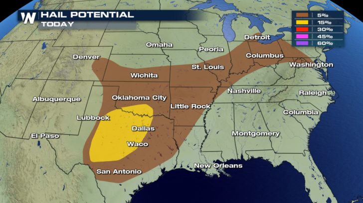
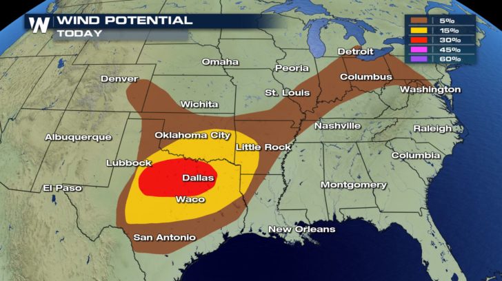
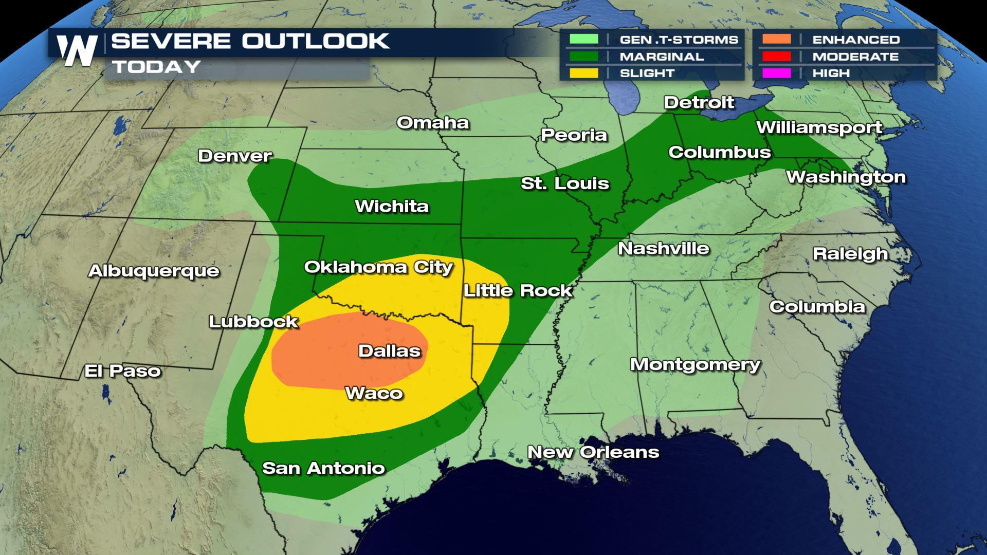
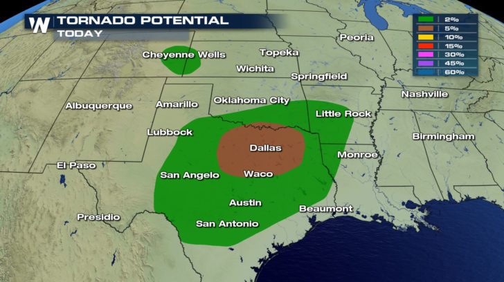 There is a enhanced risk for severe weather in the Plains and western Ohio Valley for today (Wednesday). All modes of severe weather could pose a threat.
Hail from 1 to 2 inches in diameter, damaging winds from 58 to 8o mph, and several tornadoes could be possible within these storms throughout the day.
FORECAST
There is a enhanced risk for severe weather in the Plains and western Ohio Valley for today (Wednesday). All modes of severe weather could pose a threat.
Hail from 1 to 2 inches in diameter, damaging winds from 58 to 8o mph, and several tornadoes could be possible within these storms throughout the day.
FORECAST
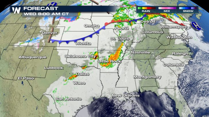
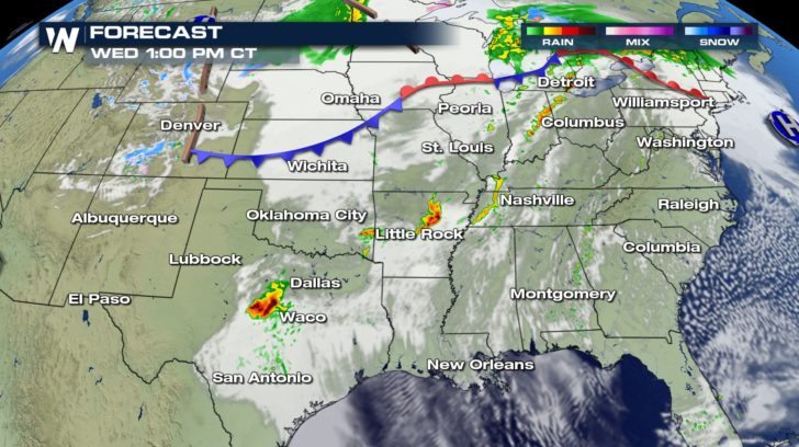
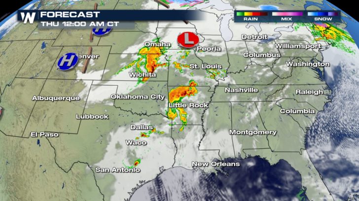 A low pressure center will move slowly along a stalled front. Storms will be firing off all day starting in the later part of the morning.
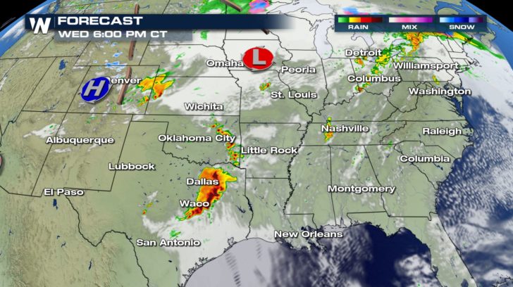
Around 5 to 6 PM tonight, Texas will see a strong band of storms roll through. This is when the high risk of all three threats comes into play.
Stay weather aware throughout the whole day, and stay tuned to WeatherNation for updates on-air and online for the latest severe weather information.
A low pressure center will move slowly along a stalled front. Storms will be firing off all day starting in the later part of the morning.
Around 5 to 6 PM tonight, Texas will see a strong band of storms roll through. This is when the high risk of all three threats comes into play.
Stay weather aware throughout the whole day, and stay tuned to WeatherNation for updates on-air and online for the latest severe weather information.
There is a enhanced risk for severe weather in the Plains and western Ohio Valley for today (Wednesday). All modes of severe weather could pose a threat.
Hail from 1 to 2 inches in diameter, damaging winds from 58 to 8o mph, and several tornadoes could be possible within these storms throughout the day.
FORECAST
A low pressure center will move slowly along a stalled front. Storms will be firing off all day starting in the later part of the morning.
Around 5 to 6 PM tonight, Texas will see a strong band of storms roll through. This is when the high risk of all three threats comes into play.
Stay weather aware throughout the whole day, and stay tuned to WeatherNation for updates on-air and online for the latest severe weather information.All Weather News
More

Flooding, Severe Storms Target the Midwest Again
After an active week of storms across the nor
1 Aug 2026 1:40 AM


After Reaching Category 5, Genevieve Weakens in the Pacific
PacificFausto is now a post-tropical cyclone.
31 Jul 2026 1:30 AM

Flooding Risk Increases as Heavy Rain Targets the Tri-State Area
Tuesday, heavy rainfall moved across the Nort
30 Jul 2026 12:25 AM

Severe Weather: Energy From the Midwest Now in the Southeast
UPPER MIDWEST - Through Monday, dangerous tor
29 Jul 2026 10:30 PM