Southeast Dries Out After Record Rainfall
Top Stories
3 Jan 2020 9:30 AM
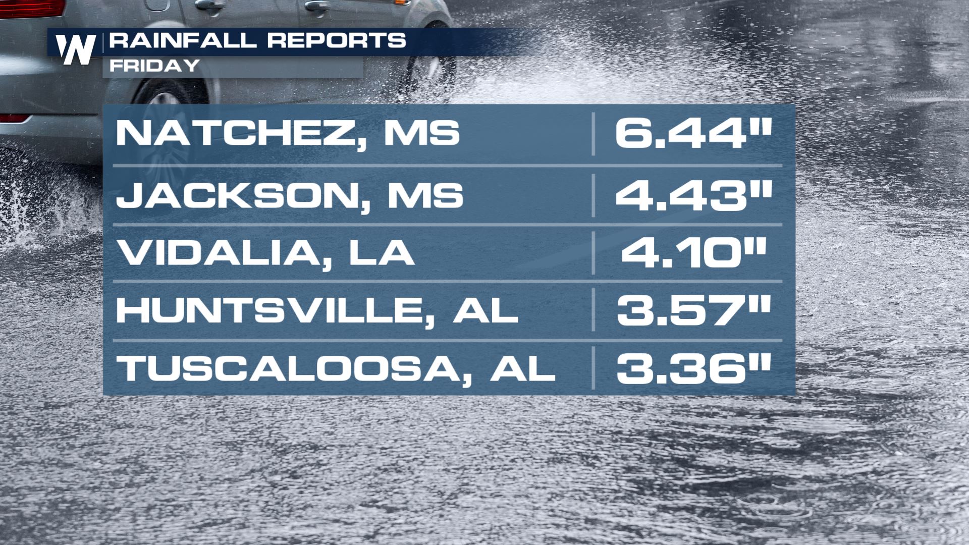
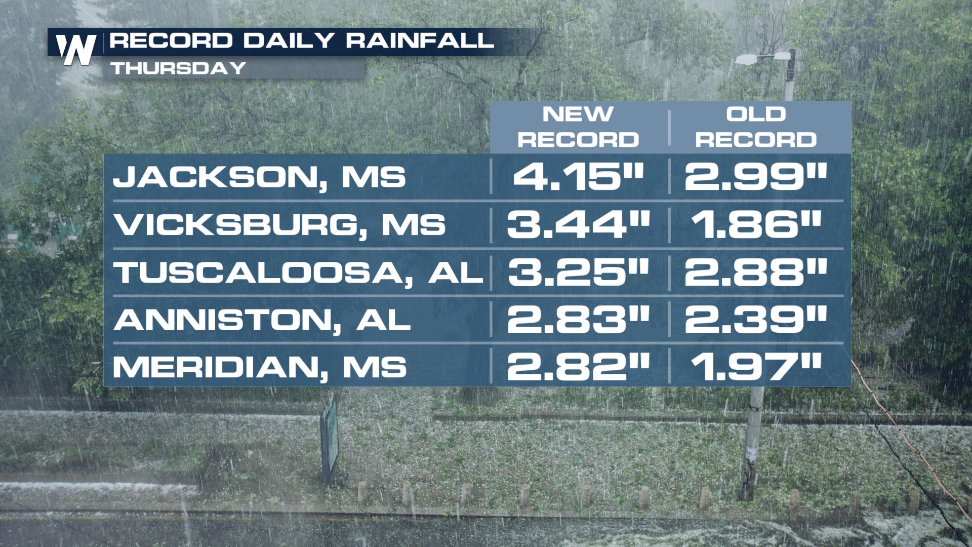
After record rain this week for parts of the Gulf Coast states, we dry things out heading into Saturday.
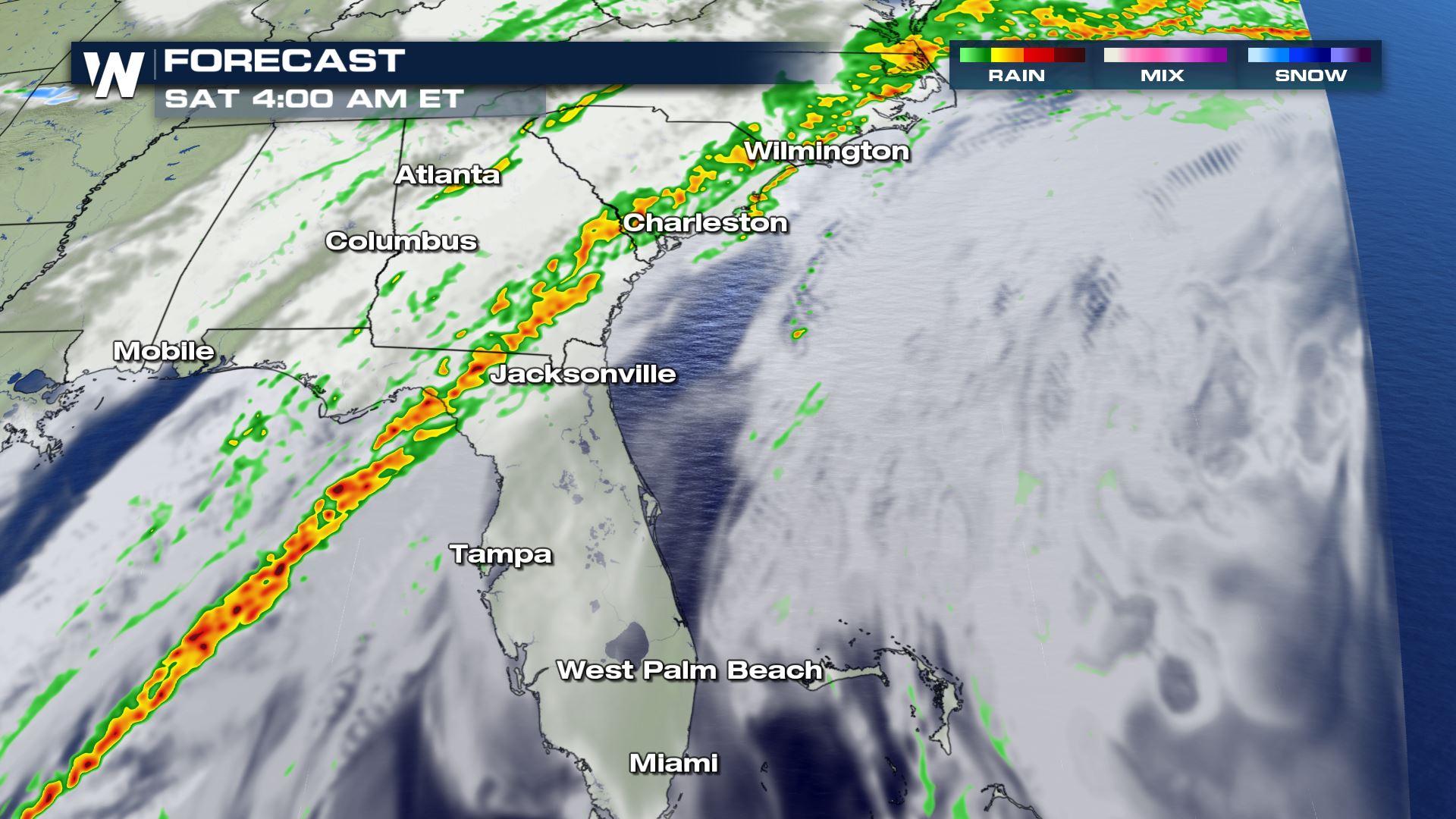
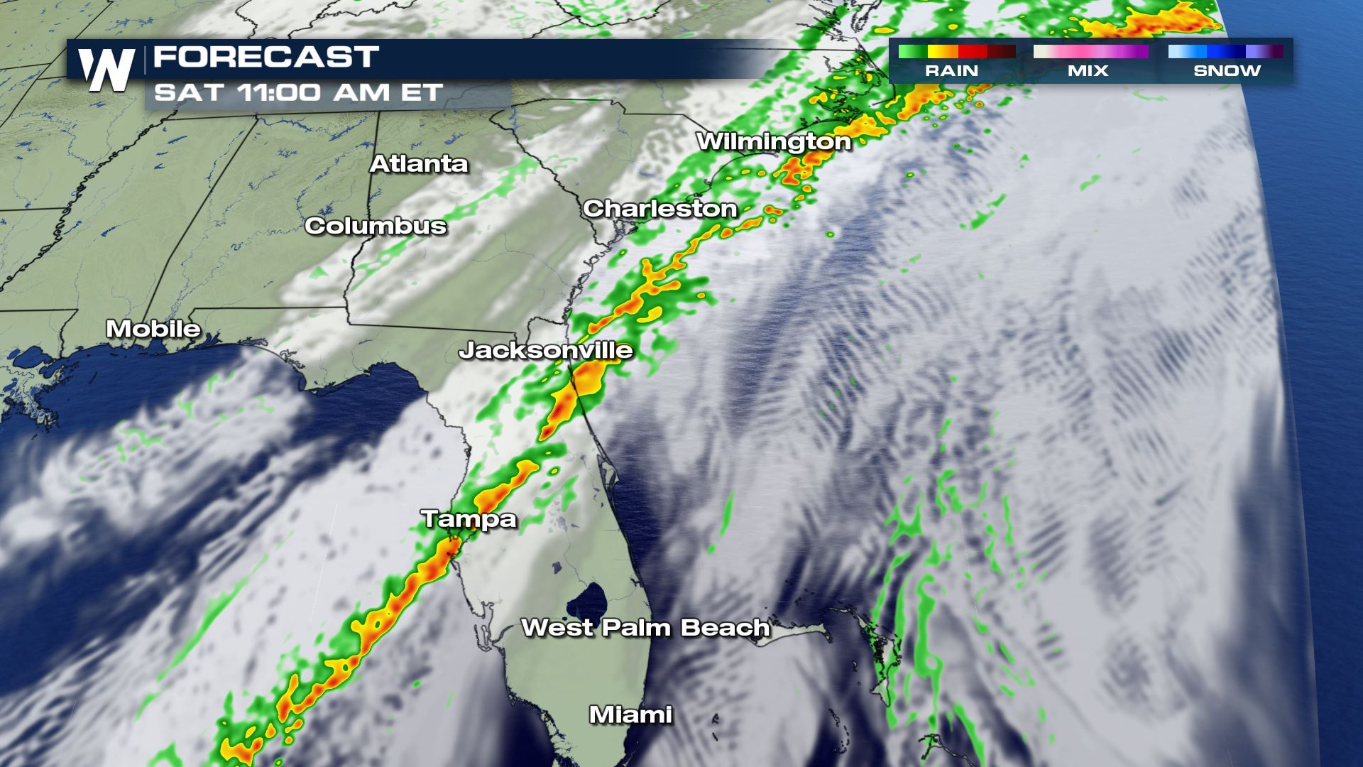
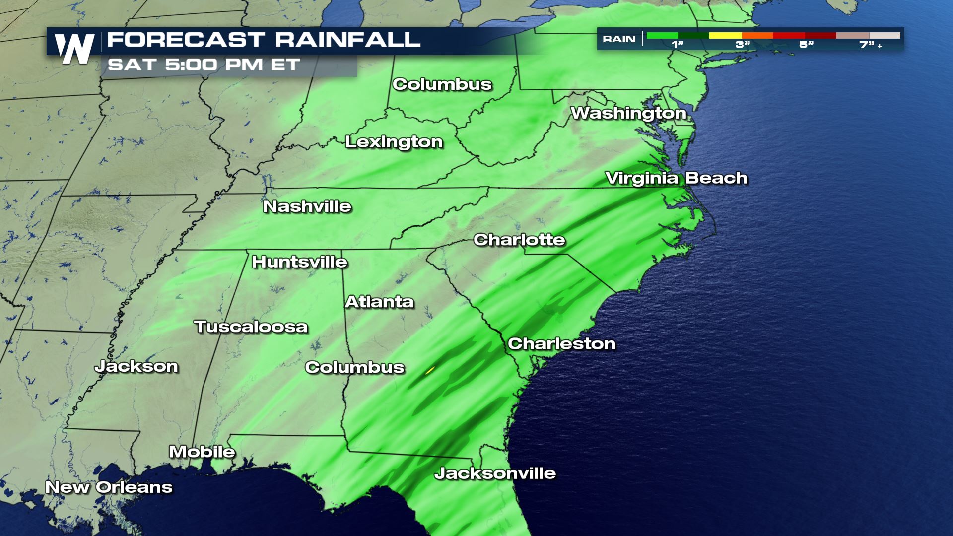
 We're almost there, with a few lingering showers and thunderstorms still to get through. The extent of the thunderstorms will stay in Florida, Georgia, South Carolina and North Carolina where a few may be on the stronger side. There were tornado warnings issued earlier Friday. Additional rainfall will be up to 1-2 more inches in the immediate Southeast between Friday evening and Saturday midday.
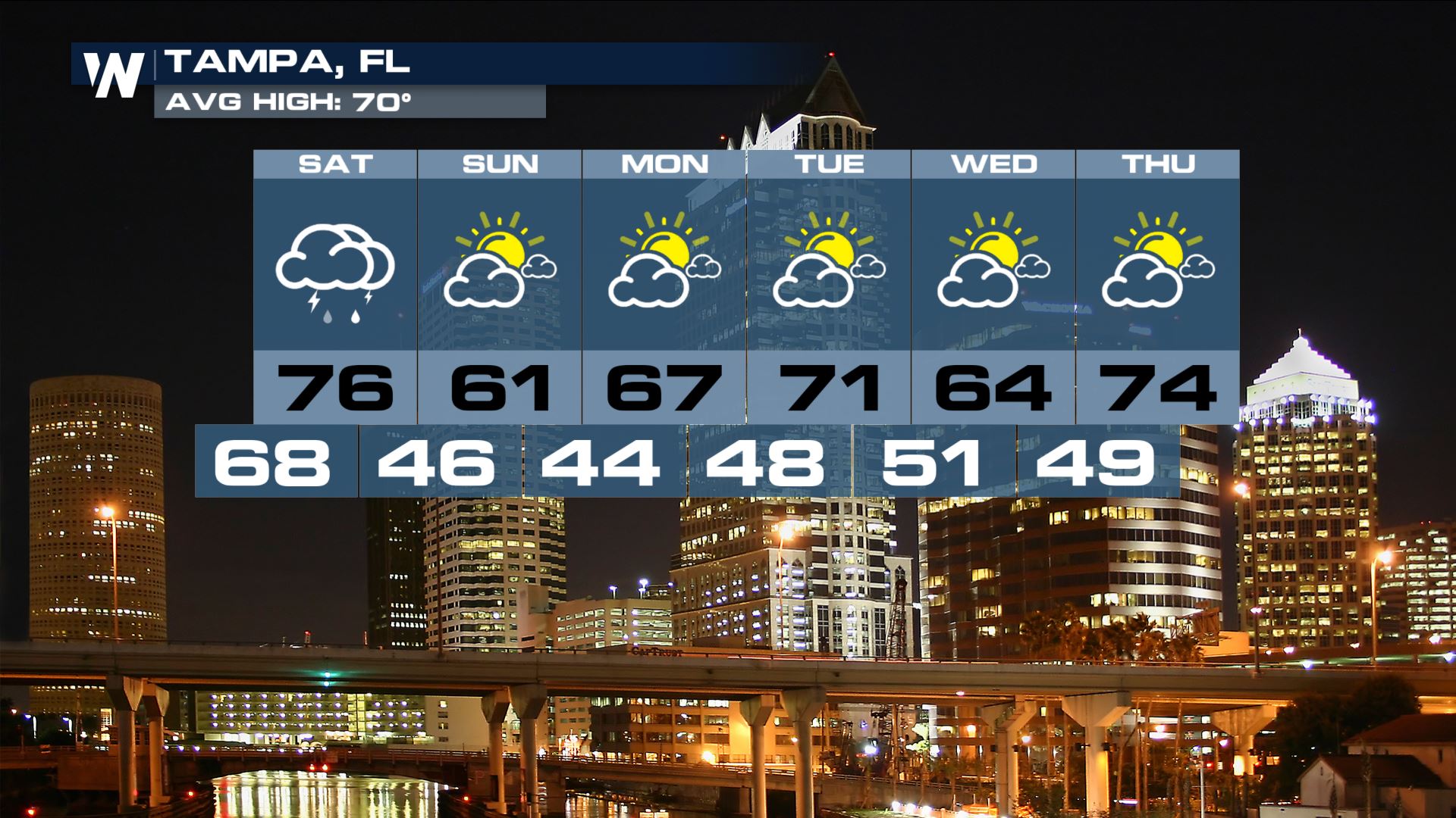
 It will still be quite warm in Florida on Saturday. Friday featured many a record for daily high temperature. For instance, Jacksonville reached to 85 degrees and that mark in northeast Florida matched the hottest temperature recorded in January for Jacksonville. The cold front bringing rain to Tampa-Orlando-Melbourne on Saturday will also bring a temperature drop of 10-20 degrees.
 Remember, you can get your local weather forecast any time at the top left side of our homepage weathernationtv.com. Keep checking with WeatherNation for more updates.

 We're almost there, with a few lingering showers and thunderstorms still to get through. The extent of the thunderstorms will stay in Florida, Georgia, South Carolina and North Carolina where a few may be on the stronger side. There were tornado warnings issued earlier Friday. Additional rainfall will be up to 1-2 more inches in the immediate Southeast between Friday evening and Saturday midday.


 It will still be quite warm in Florida on Saturday. Friday featured many a record for daily high temperature. For instance, Jacksonville reached to 85 degrees and that mark in northeast Florida matched the hottest temperature recorded in January for Jacksonville. The cold front bringing rain to Tampa-Orlando-Melbourne on Saturday will also bring a temperature drop of 10-20 degrees.
 Remember, you can get your local weather forecast any time at the top left side of our homepage weathernationtv.com. Keep checking with WeatherNation for more updates.
All Weather News
More