Severe Risk from the Mississippi Valley to the Ohio Valley Tuesday
Top Stories
8 Jun 2021 2:15 AM
A risk of severe storms is in the forecast for areas in the Lower Mississippi and Ohio Valleys this afternoon. Here is a look at what areas could see some damaging winds

 Keep checking with WeatherNation for more updates on today's severe weather risk.
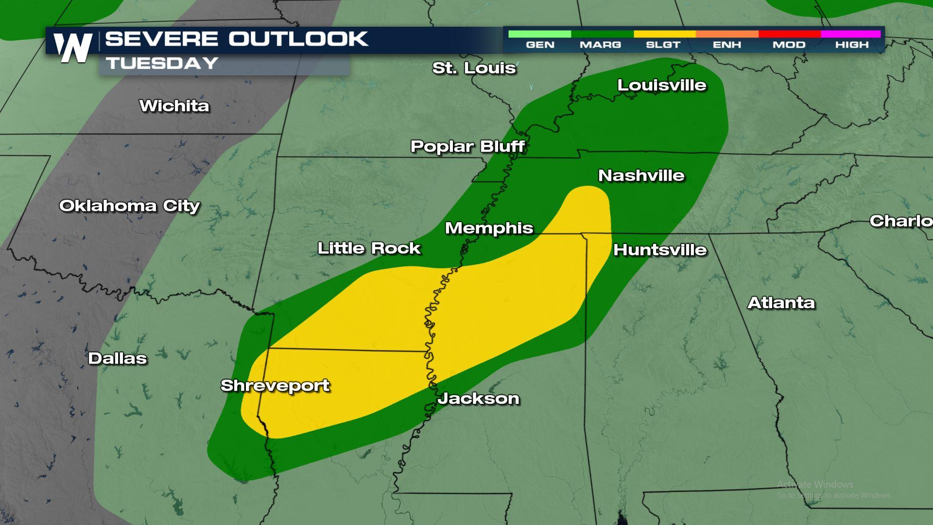
Severe Outlook
The severe risk has shifted more East today and includes cities like Memphis and Evansville. Here is a look at the areas included in the isolated severe risk for today.
Severe Risks
The main weather threat today will be damaging winds over 58 mph. The hail and tornado threat are very low with today's particular set-up.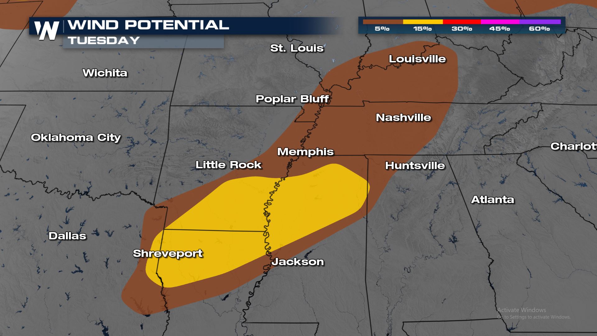
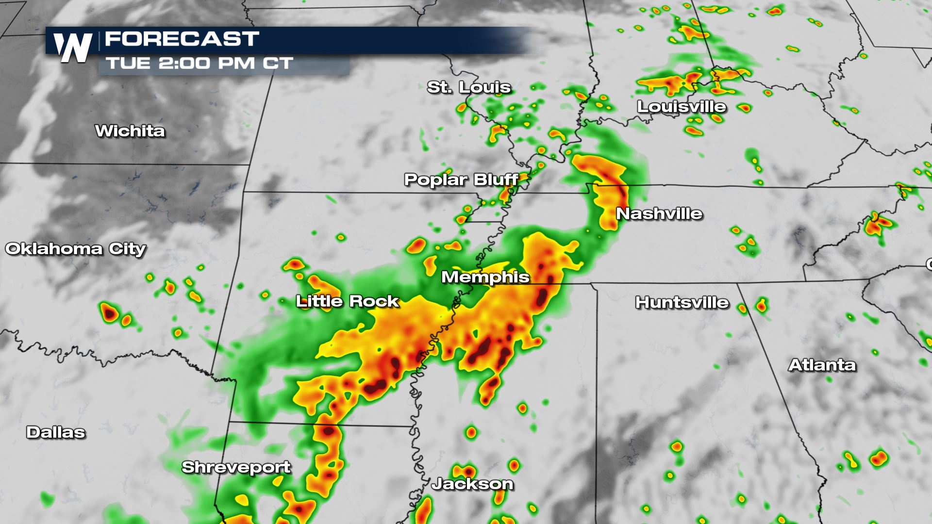
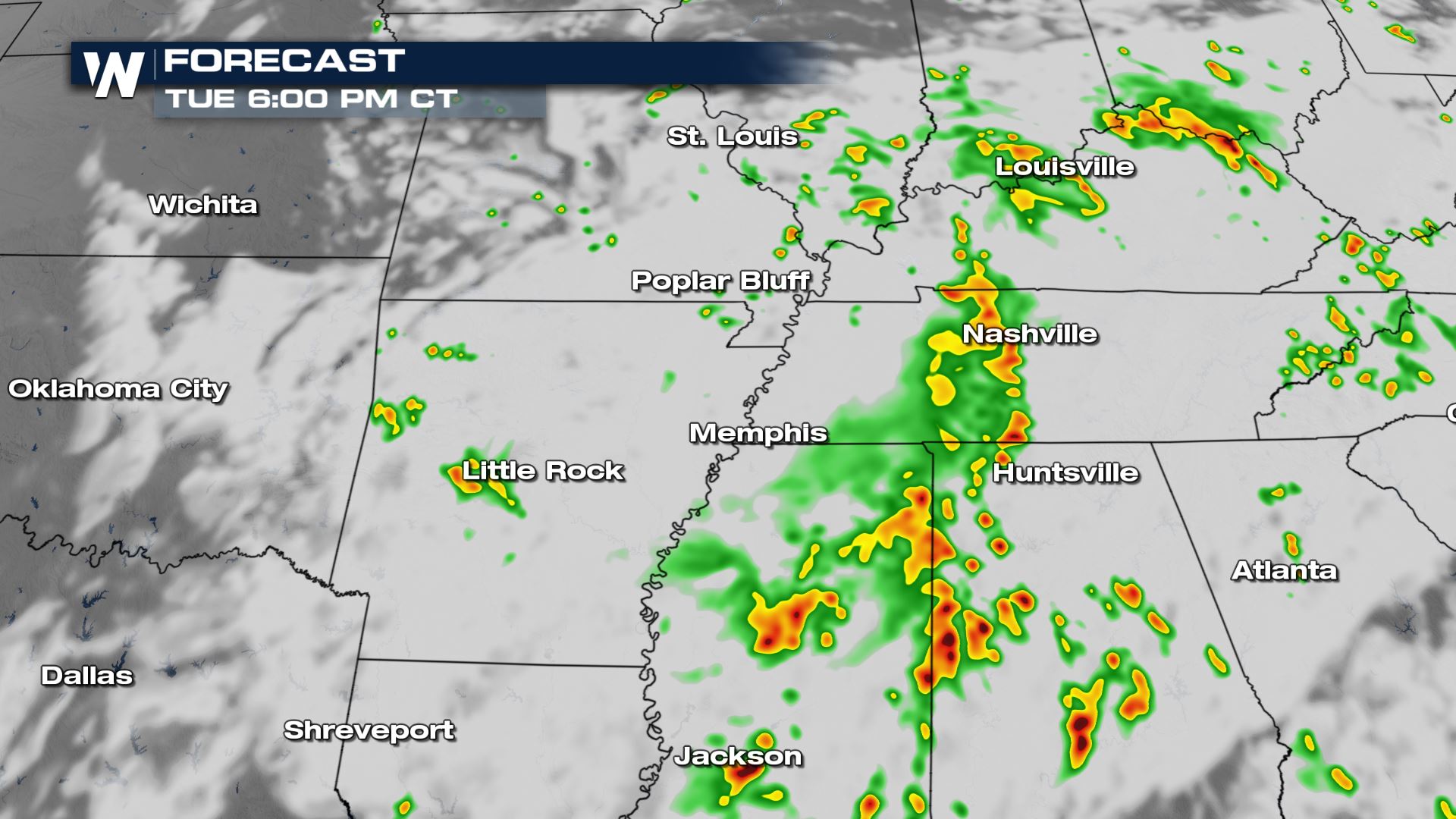
Forecast
Storms will be pushing through these areas all morning and into the afternoon. Once the sun goes down the severe risk will begin to diminish. Heavy rain could lead to some isolated areas of flash flooding too. Definitely need to be weather aware for this region.
Keep checking with WeatherNation for more updates on today's severe weather risk.All Weather News
More
Very Hot Temperatures For the Western and Central United States
Are you over the summer heat yet? Well, more
24 Jul 2026 10:10 PM

Severe Chances Return for the Midwest
The upcoming stretch of hot temperatures will
24 Jul 2026 8:10 PM

Southeast Flood Risk Lingers Near Stalled Front
A stalled boundary over the Carolinas will ke
24 Jul 2026 8:00 PM

Tropics: Fausto Heads to Hawaii, Bertha Breaks Apart
BerthaBertha has dissipated after moving inla
24 Jul 2026 11:50 AM

Hot & Smoky w/ a Chance of Lightning
Conditions have been really dry out west. We'
24 Jul 2026 11:15 AM

Another Round of Storms Targets the Northeast
Tuesday brought severe weather again across p
23 Jul 2026 1:15 AM

Another Round of Severe Weather for the Upper Midwest and Great Lakes
The upper-level low train continues to keep t
21 Jul 2026 1:45 AM