Severe Risk Moves into the High Plains

Special Stories
6 May 2018 4:20 PM
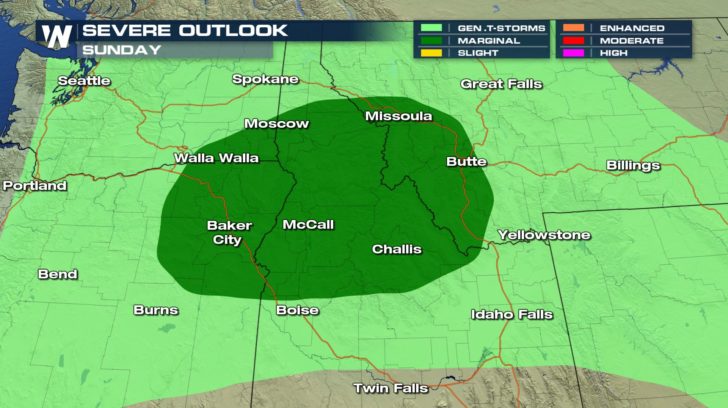
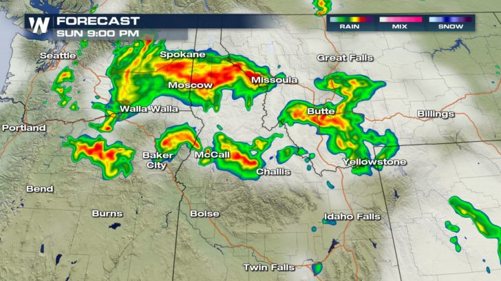
Isolated severe thunderstorms will continue to rumble through the interior Northwest and northern Rocky Mountains region into Sunday night. Sizable hail and wind gusts over 60 mph will be the main concern for areas of Oregon, Washington, and Idaho.
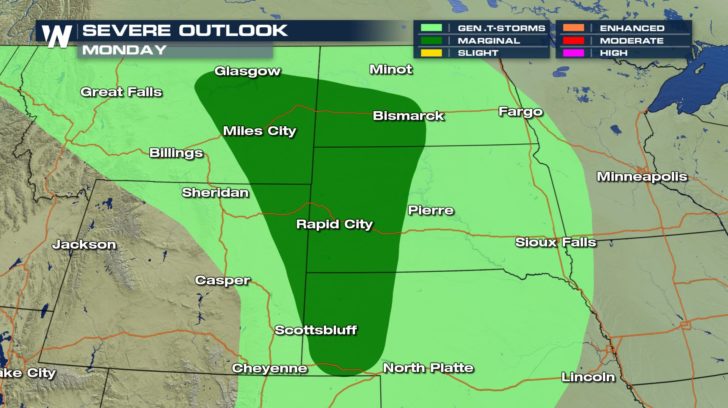
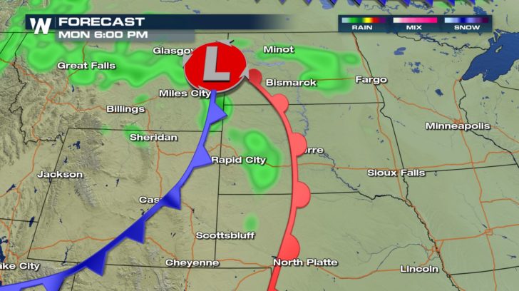
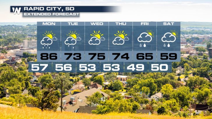
 By Monday, however, residents of the High Plains can expect a few strong thunderstorms. As this system moves east, the risk for hail and gusty wind pushes east as well. Areas of Montana, Wyoming, the Dakotas, and Nebraska run the risk for isolated severe thunderstorms.
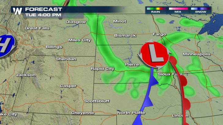 Once this system moves out, the forecast should be fairly pleasant through the middle of the week. By the end of the week, cooler temperatures return to the region.
 - Meteorologist Joe Astolfi
By Monday, however, residents of the High Plains can expect a few strong thunderstorms. As this system moves east, the risk for hail and gusty wind pushes east as well. Areas of Montana, Wyoming, the Dakotas, and Nebraska run the risk for isolated severe thunderstorms.
Once this system moves out, the forecast should be fairly pleasant through the middle of the week. By the end of the week, cooler temperatures return to the region.
- Meteorologist Joe AstolfiAll Weather News
More
More Storms for the East Through Monday
The threat for flooding rain continues across
3 Aug 2026 6:00 PM


After Reaching Category 5, Genevieve Weakens in the Pacific
PacificGenevieve formed last Friday south of
3 Aug 2026 12:30 AM

Flooding, Severe Storms Target the Midwest Again
After an active week of storms across the nor
1 Aug 2026 1:40 AM

Flooding Risk Increases as Heavy Rain Targets the Tri-State Area
Tuesday, heavy rainfall moved across the Nort
30 Jul 2026 12:25 AM