Severe Risk Moves into the High Plains

Special Stories
6 May 2018 4:20 PM
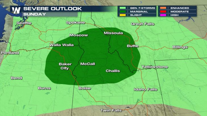
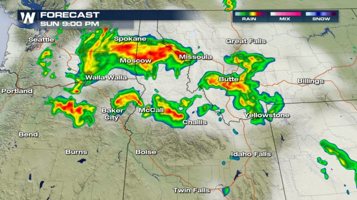
Isolated severe thunderstorms will continue to rumble through the interior Northwest and northern Rocky Mountains region into Sunday night. Sizable hail and wind gusts over 60 mph will be the main concern for areas of Oregon, Washington, and Idaho.
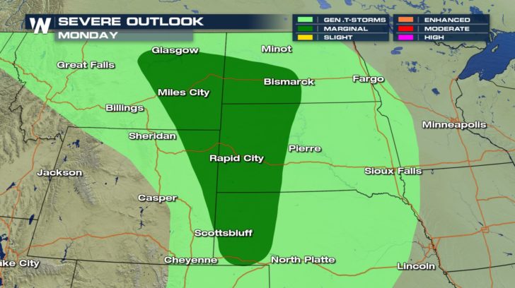
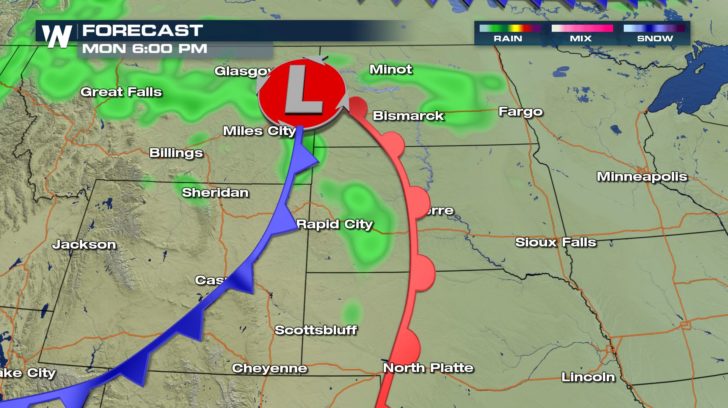
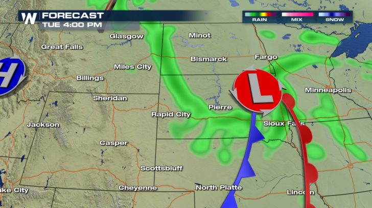
 By Monday, however, residents of the High Plains can expect a few strong thunderstorms. As this system moves east, the risk for hail and gusty wind pushes east as well. Areas of Montana, Wyoming, the Dakotas, and Nebraska run the risk for isolated severe thunderstorms.
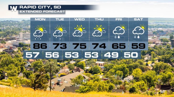
 Once this system moves out, the forecast should be fairly pleasant through the middle of the week. By the end of the week, cooler temperatures return to the region.
 - Meteorologist Joe Astolfi
By Monday, however, residents of the High Plains can expect a few strong thunderstorms. As this system moves east, the risk for hail and gusty wind pushes east as well. Areas of Montana, Wyoming, the Dakotas, and Nebraska run the risk for isolated severe thunderstorms.
Once this system moves out, the forecast should be fairly pleasant through the middle of the week. By the end of the week, cooler temperatures return to the region.
- Meteorologist Joe AstolfiAll Weather News
More
Fronts Continue To Spark Severe Weather Across the Plains
A cold front that brought record lows to the
18 Jul 2025 10:40 PM

Extreme Heat Impacts for the East Coast & South
Extreme heat continues to impact several area
18 Jul 2025 10:05 PM

Flooding Threat Remains Elevated in the East
A cold front pushing through the Eastern Seab
18 Jul 2025 9:10 PM

EF-2 Firenado from the Deer Creek Fire in Utah
A fire tornado was spotted near La Sal, Utah
18 Jul 2025 7:30 AM

Tropical System Brings Flood Risk to the Central Gulf
Time has run out for notable tropical develop
18 Jul 2025 3:05 AM

Heavy Rain, Flooding Threat Returns to Florida
Keep the rain boots handy in Florida - heavy
13 Jul 2025 12:50 PM

Severe Storm Risk Pushes into the Great Lakes, Ohio Valley
Friday was another busy day with severe weath
12 Jul 2025 8:00 PM