Severe Risk Tuesday for the Central Plains and Upper Mississippi Valley
Top Stories
24 Sep 2019 8:00 AM
An upper-level trough and surface cold front sweeping eastward across the northern U.S. will the focus for numerous severe storms this afternoon and evening. Here is the very latest.
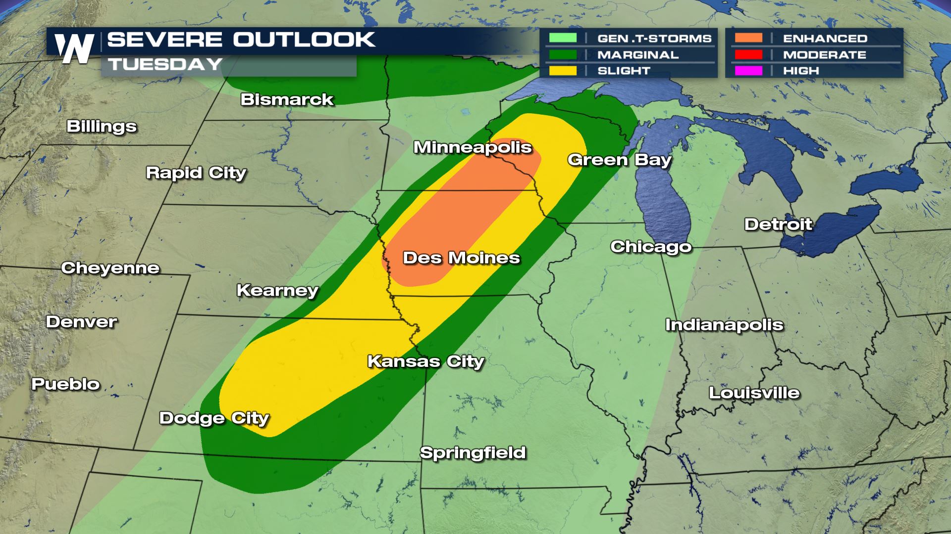 Scattered to numerous severe storms will be possible in the highlighted areas. If you have any things you have to get done outdoors or any errands you need to run, you will want to do that during the morning. By the afternoon the weather will likely deteriorate very rapidly.
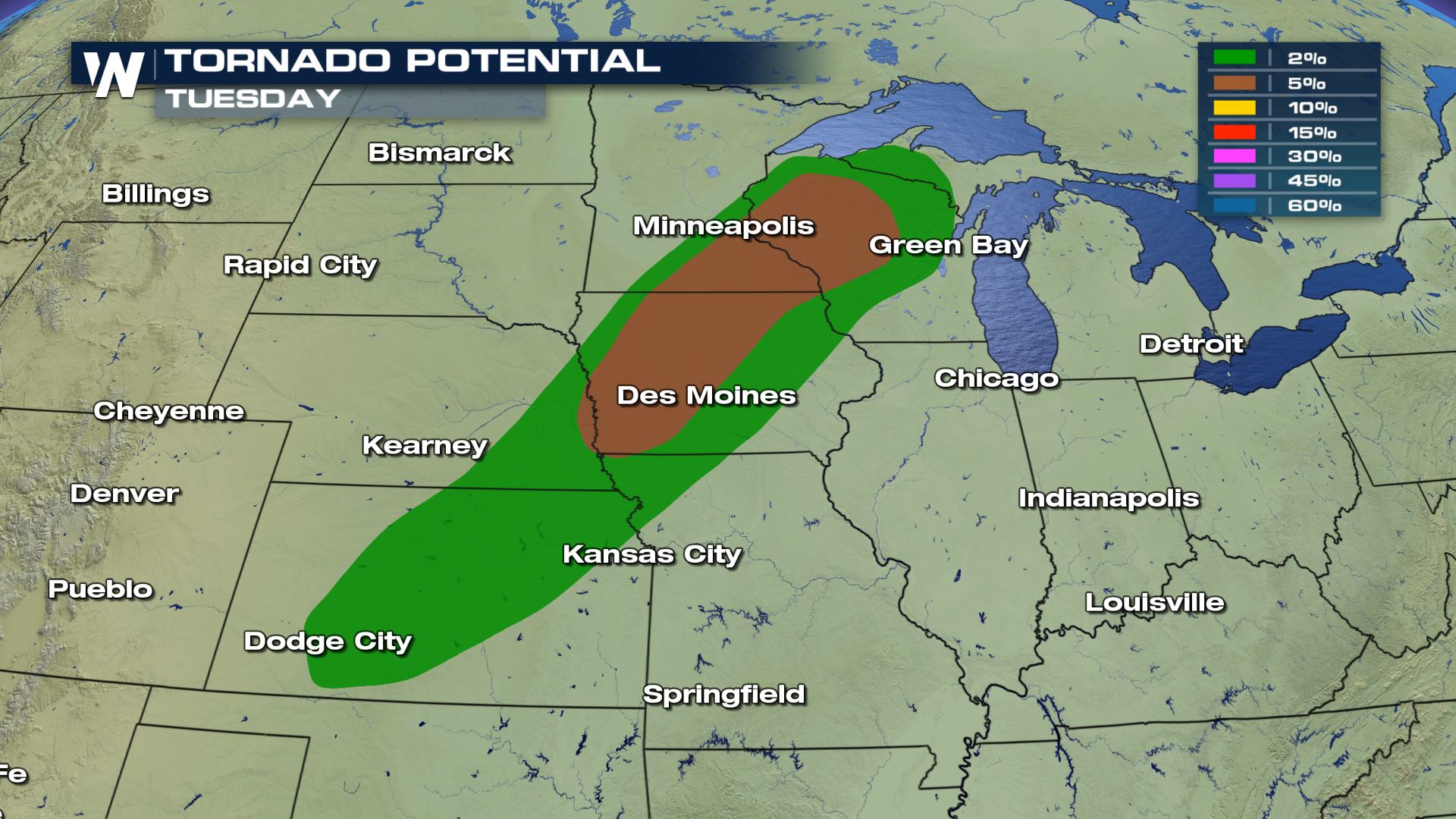
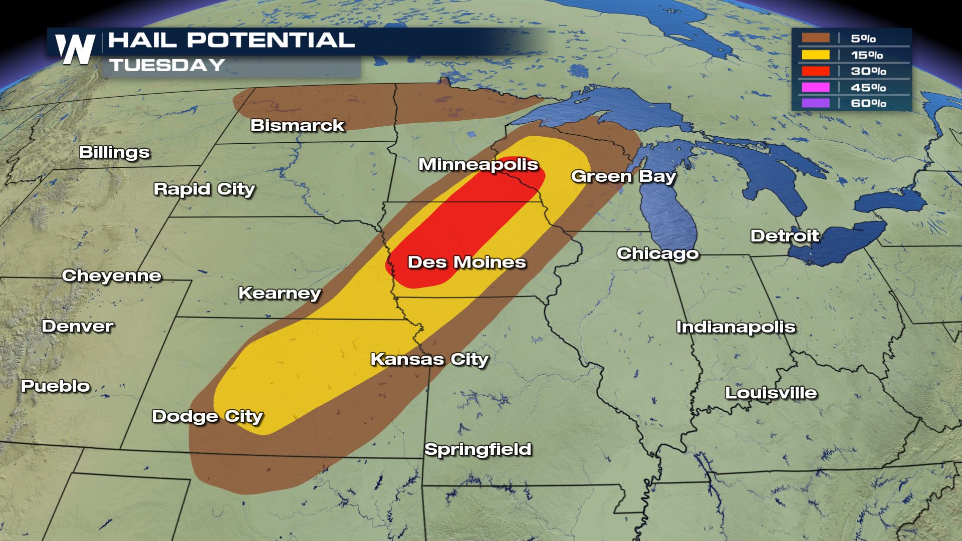
 All modes of severe weather will be in the forecast with large hail and tornadoes as the main weather risks. Hail greater than 2" in diameter will be possible along with the chance for a strong tornado or two. This is a situation where you don't want to be outdoors and will need to have a severe plan in place.
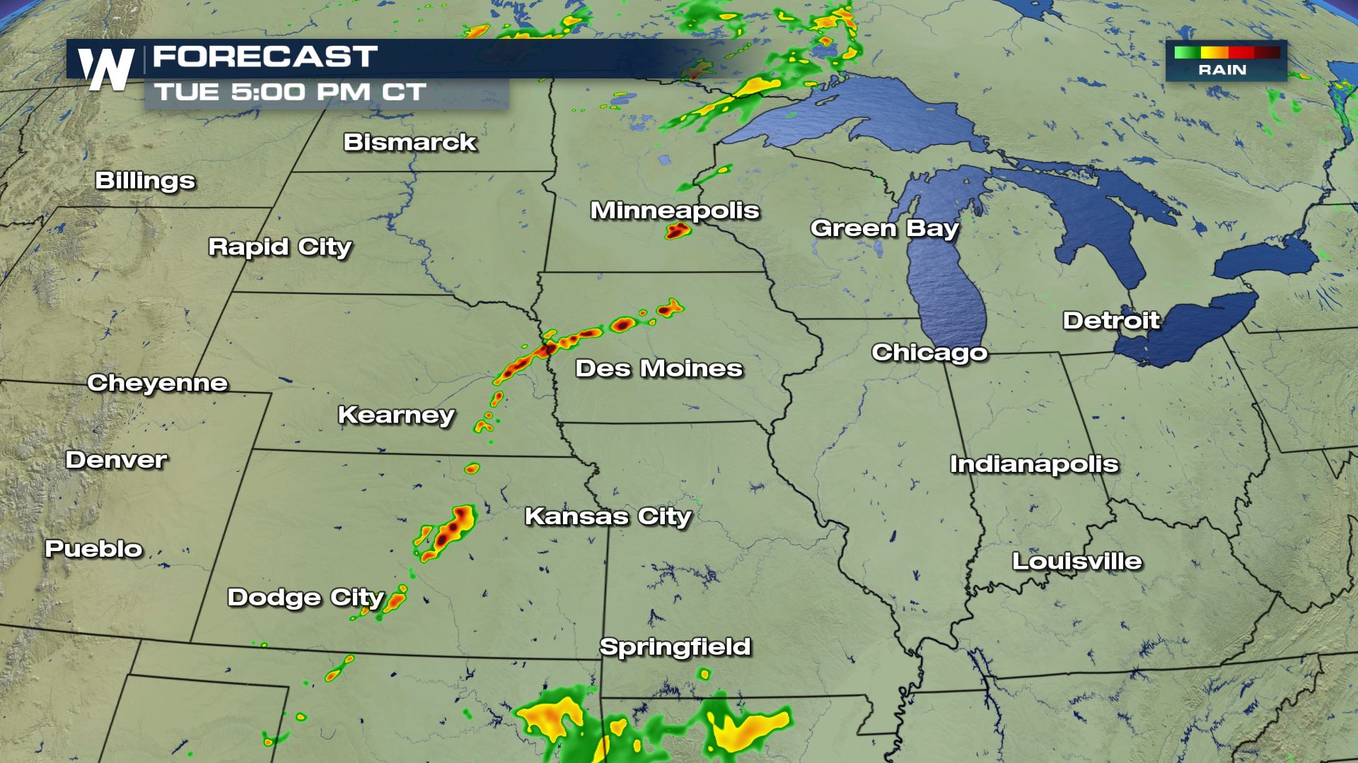

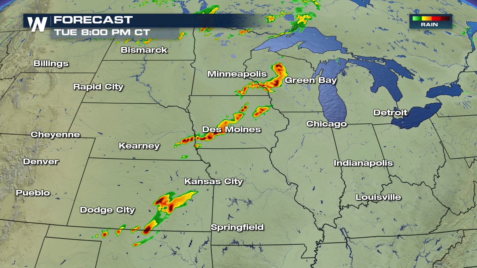
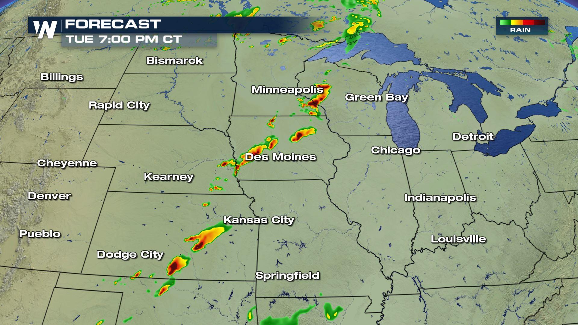
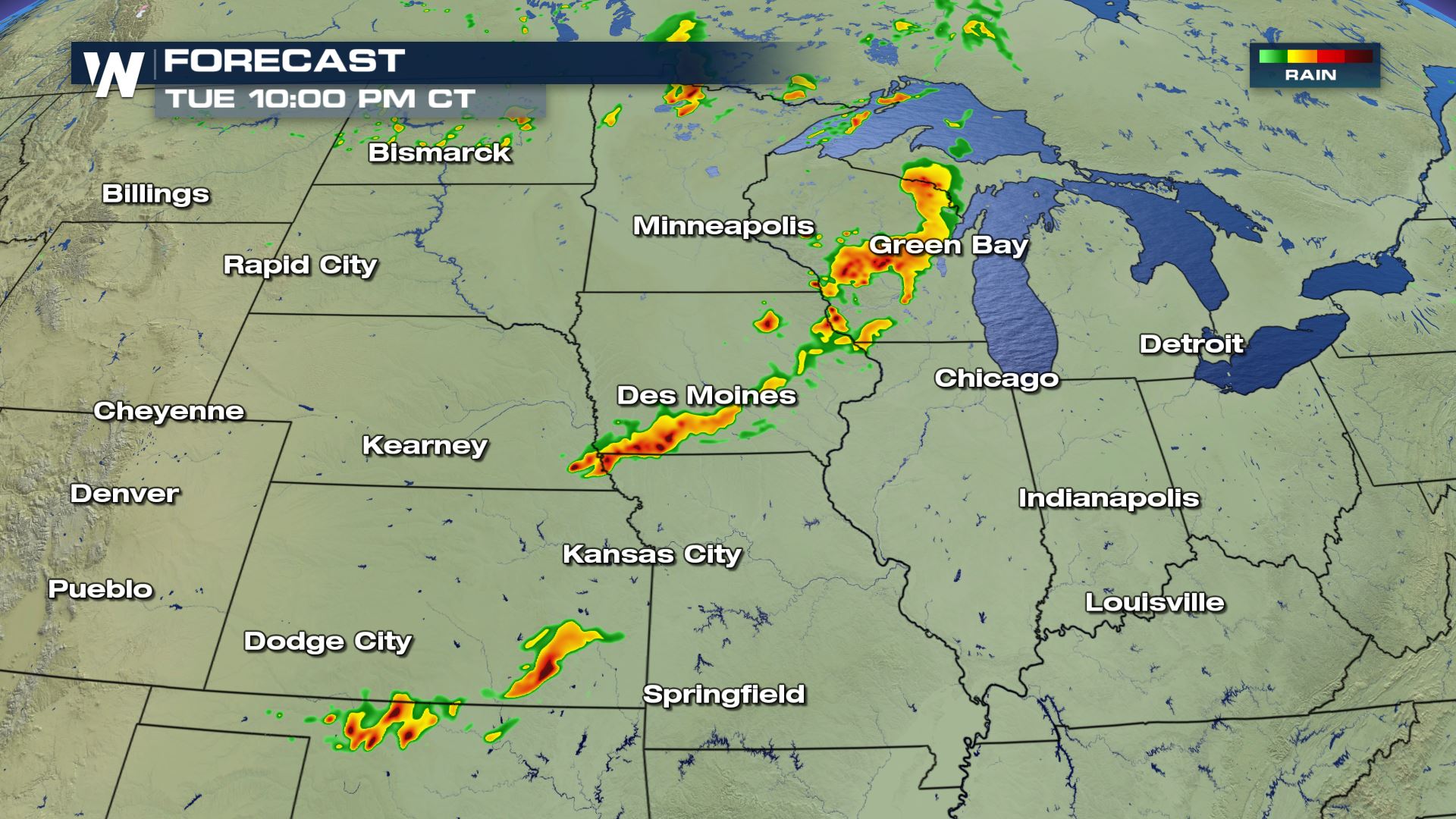 By the late afternoon and early evening the severe ingredients will be all coming together over parts of Iowa, Minnesota, Nebraska, Kansas and Missouri. You can see individual supercells popping up out ahead of the cold front and these are the storms that could have tornado potential.
Keep checking with WeatherNation for more updates.
By the late afternoon and early evening the severe ingredients will be all coming together over parts of Iowa, Minnesota, Nebraska, Kansas and Missouri. You can see individual supercells popping up out ahead of the cold front and these are the storms that could have tornado potential.
Keep checking with WeatherNation for more updates.
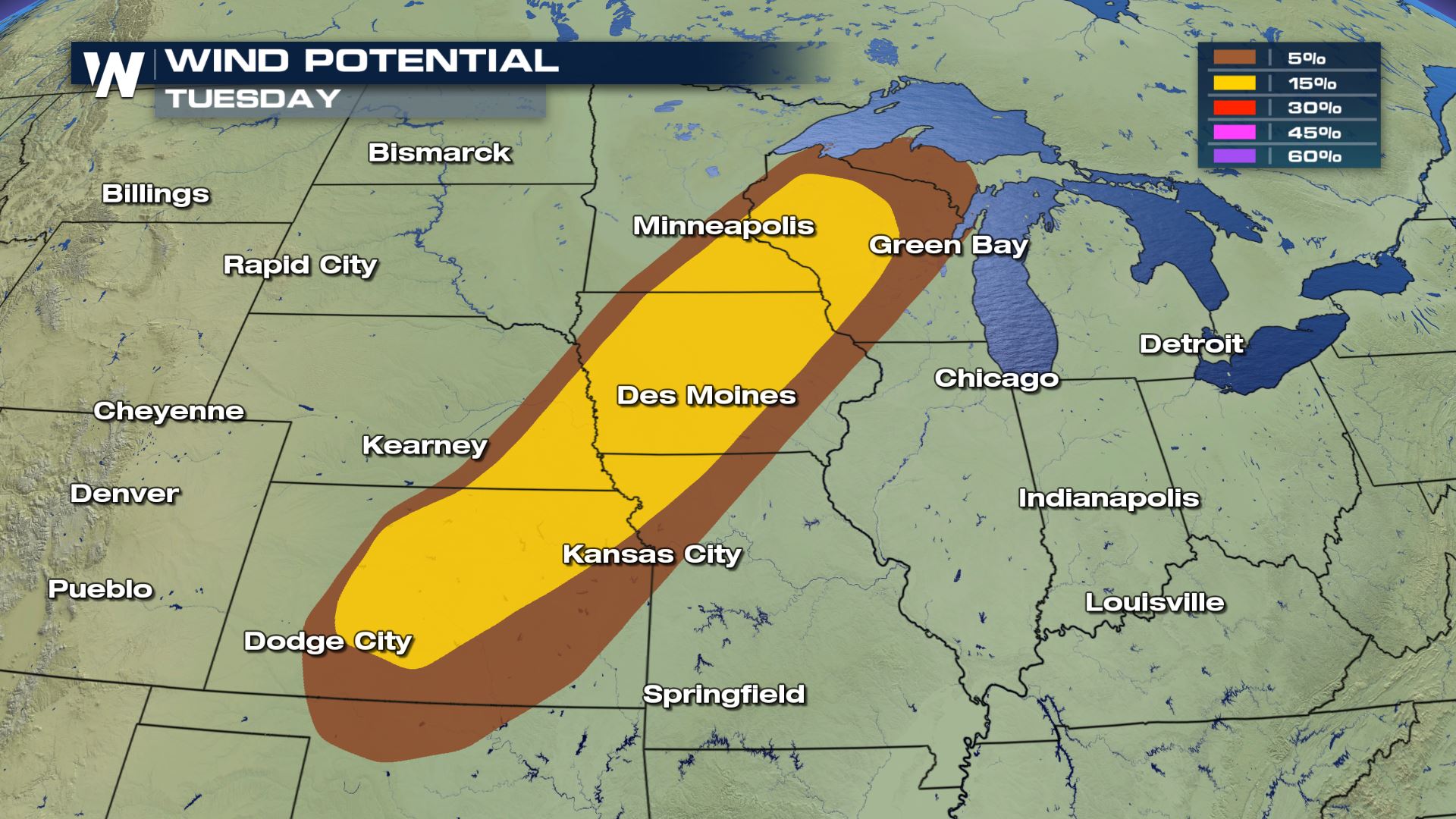
Severe Outlook
Scattered to numerous severe storms will be possible in the highlighted areas. If you have any things you have to get done outdoors or any errands you need to run, you will want to do that during the morning. By the afternoon the weather will likely deteriorate very rapidly.
Severe Risks
All modes of severe weather will be in the forecast with large hail and tornadoes as the main weather risks. Hail greater than 2" in diameter will be possible along with the chance for a strong tornado or two. This is a situation where you don't want to be outdoors and will need to have a severe plan in place.
Forecast
By the late afternoon and early evening the severe ingredients will be all coming together over parts of Iowa, Minnesota, Nebraska, Kansas and Missouri. You can see individual supercells popping up out ahead of the cold front and these are the storms that could have tornado potential.
Keep checking with WeatherNation for more updates.All Weather News
More
After Reaching Category 5, Genevieve Weakens in the Pacific
PacificGenevieve formed on last Friday south
2 Aug 2026 1:25 PM

More Storms for the East Sunday and Monday
A low-pressure system crashing through the Mi
2 Aug 2026 1:25 PM


Wildfire Outbreak in the Pacific Northwest
Conditions have been incredibly dry out west.
2 Aug 2026 12:20 PM

Flooding, Severe Storms Target the Midwest Again
After an active week of storms across the nor
1 Aug 2026 1:40 AM

Flooding Risk Increases as Heavy Rain Targets the Tri-State Area
Tuesday, heavy rainfall moved across the Nort
30 Jul 2026 12:25 AM

Severe Weather: Energy From the Midwest Now in the Southeast
UPPER MIDWEST - Through Monday, dangerous tor
29 Jul 2026 10:30 PM