Severe Storm Chances for Montana and the Northern High Plains Sunday
Top Stories
7 Jul 2019 4:10 AM
Strong instability in the atmosphere will lead to the risk of severe storms over areas of Montana and the High Plains. Here is the very latest.
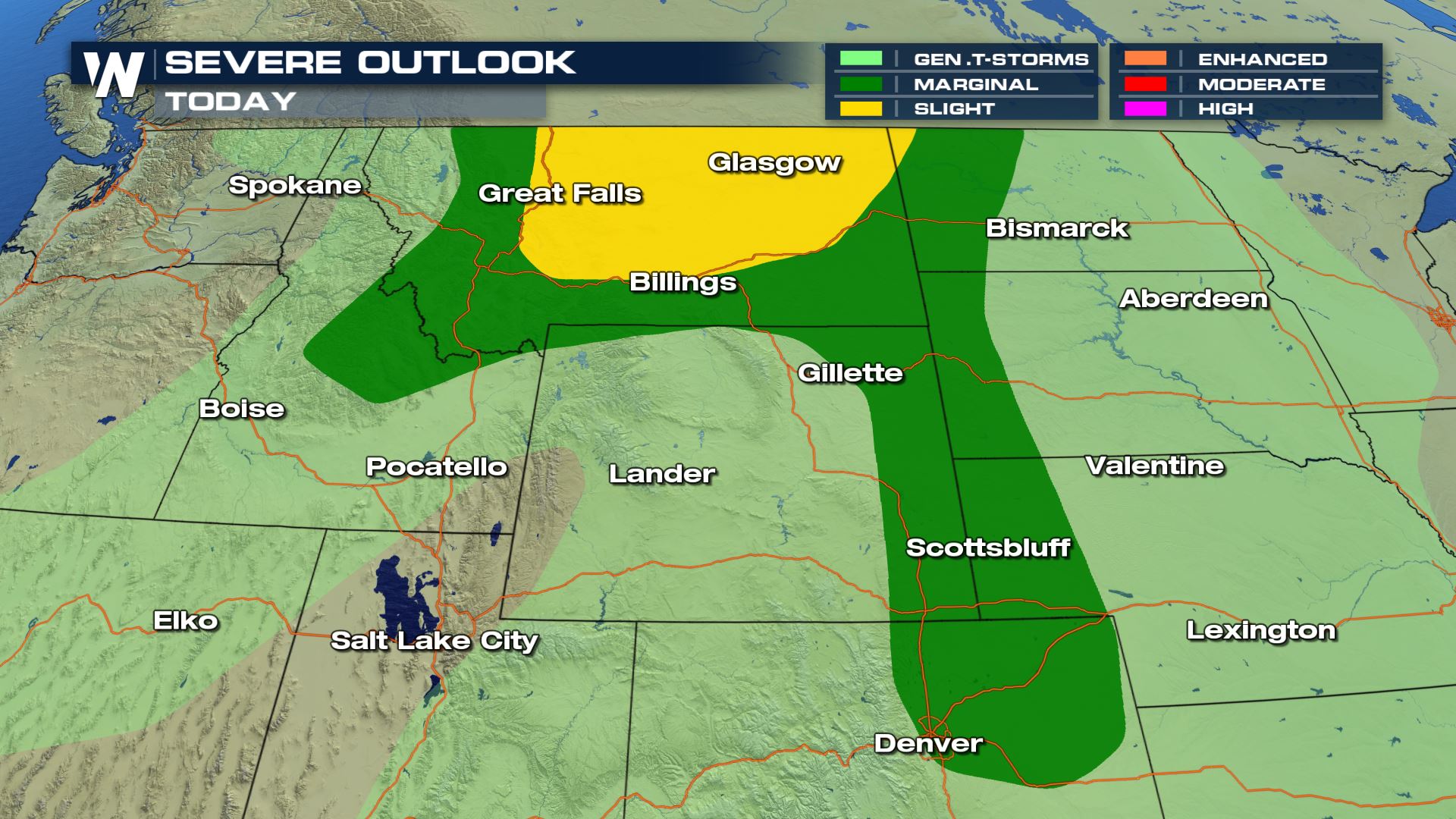 Isolated to scattered severe storms in the forecast for these areas of the High Plains. Today's highest risk for severe weather will be located over Montana.
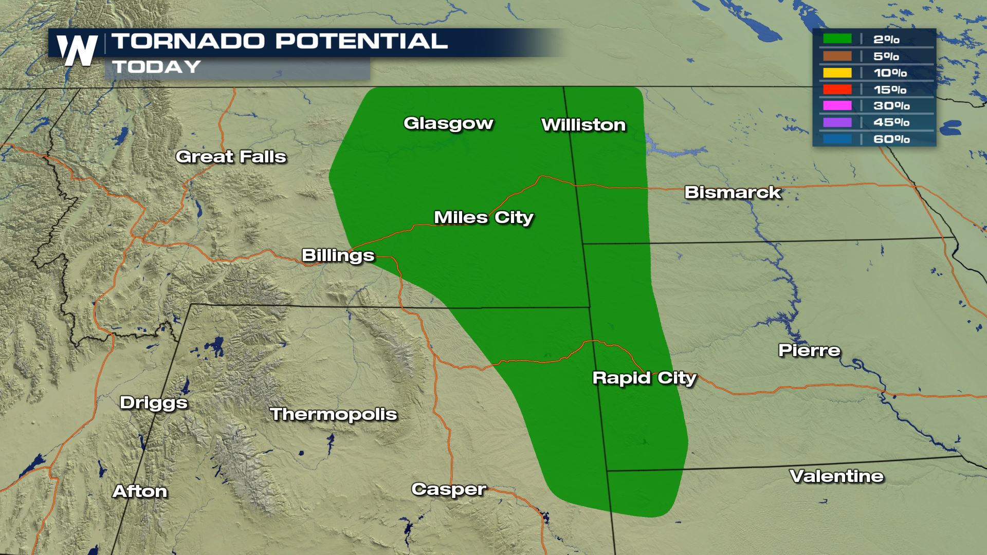
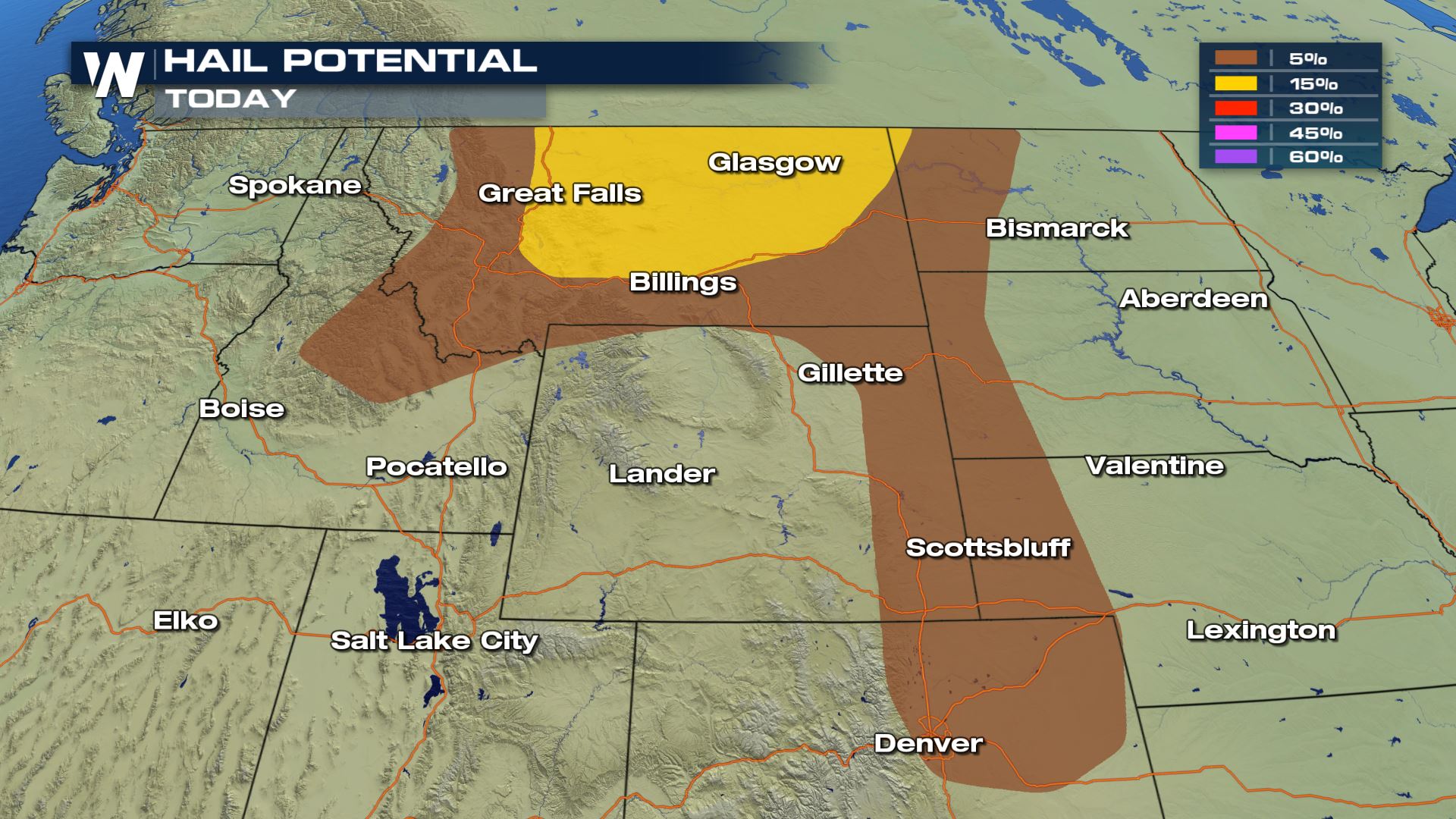
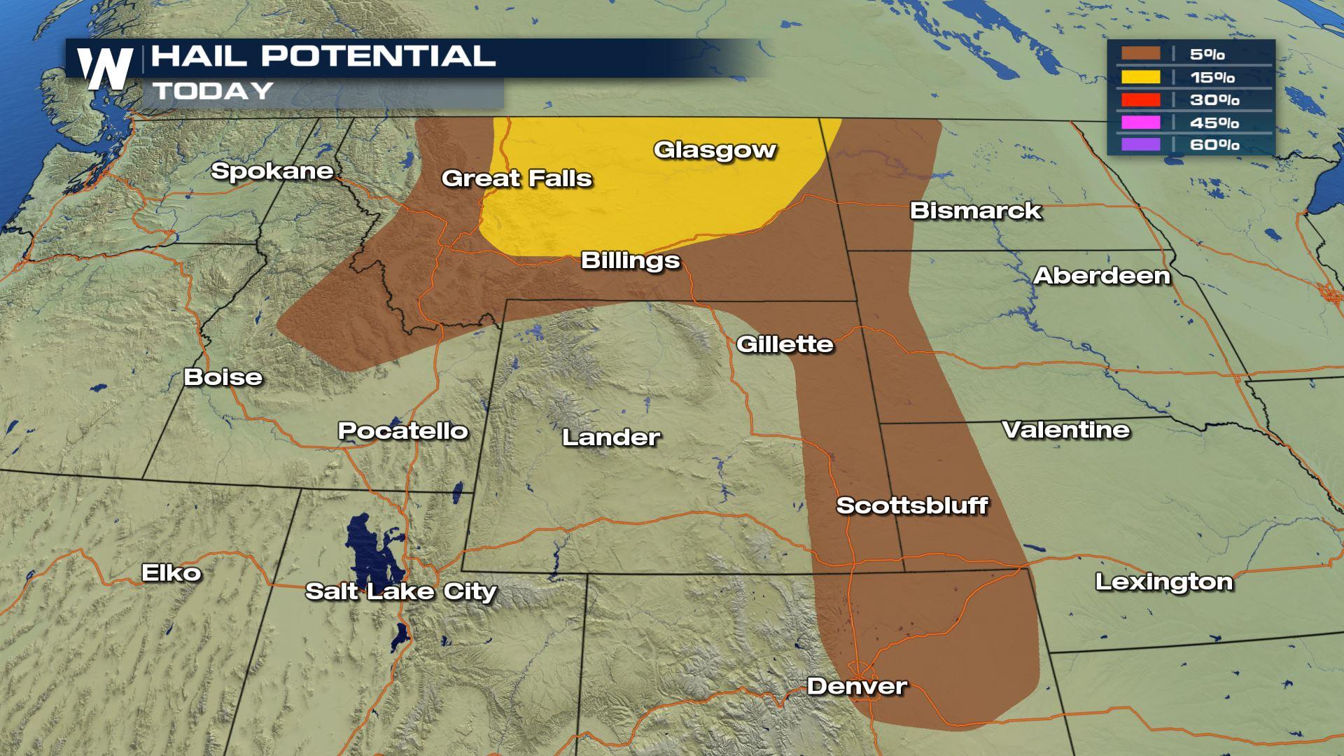
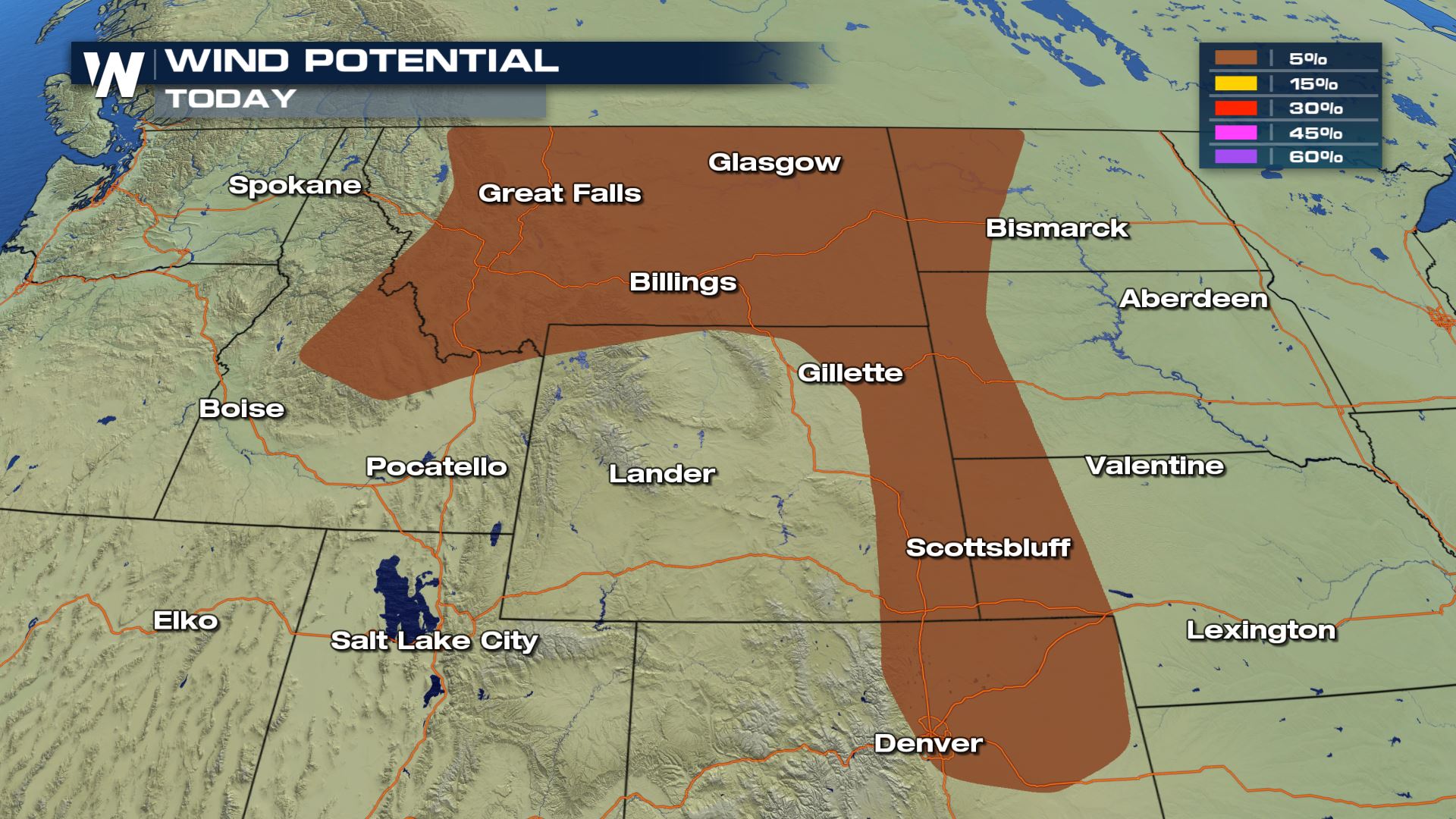 All modes of severe weather are in the forecast. The tornado risk will be more confined to areas of Montana, Wyoming and the Dakotas. The hail and wind risk will be possible all the way down into the eastern Plains of Colorado.
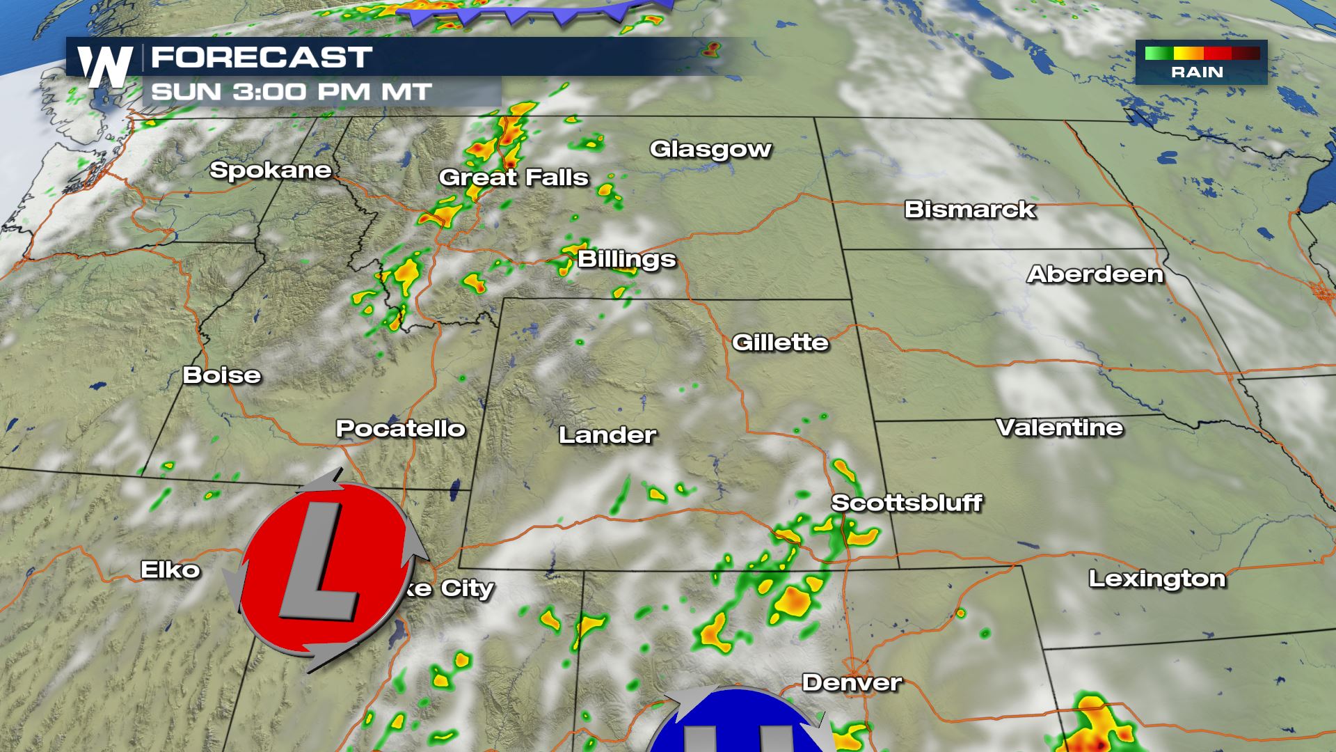
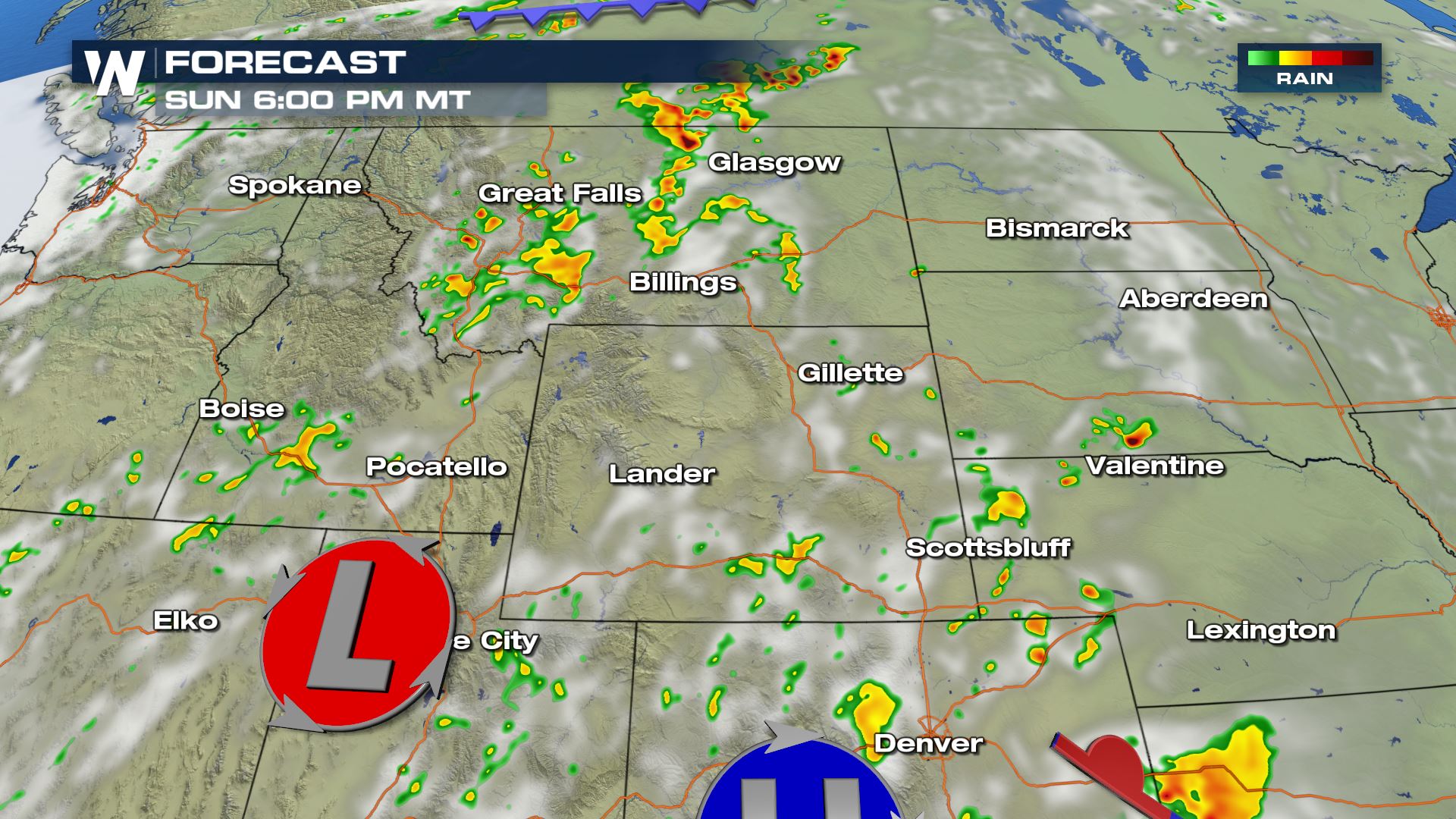
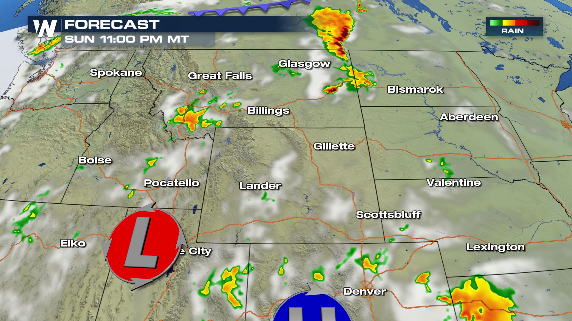 These storms will be heat driven, so in order for the storms to get going we will need to tap into the strong daytime heating. Once the sun sets, the severe weather risk will be decreasing. Keep checking with WeatherNation for more updates.
Severe Outlook
Isolated to scattered severe storms in the forecast for these areas of the High Plains. Today's highest risk for severe weather will be located over Montana.
Severe Risks
All modes of severe weather are in the forecast. The tornado risk will be more confined to areas of Montana, Wyoming and the Dakotas. The hail and wind risk will be possible all the way down into the eastern Plains of Colorado.
Forecast
These storms will be heat driven, so in order for the storms to get going we will need to tap into the strong daytime heating. Once the sun sets, the severe weather risk will be decreasing. Keep checking with WeatherNation for more updates.All Weather News
More
Flooding, Severe Storms Target the Midwest Again
After an active week of storms across the nor
31 Jul 2026 8:05 PM


After Reaching Category 5, Genevieve Weakens in the Pacific
PacificFausto is now a post-tropical cyclone.
31 Jul 2026 1:30 AM

Flooding Risk Increases as Heavy Rain Targets the Tri-State Area
Tuesday, heavy rainfall moved across the Nort
30 Jul 2026 12:25 AM

Severe Weather: Energy From the Midwest Now in the Southeast
UPPER MIDWEST - Through Monday, dangerous tor
29 Jul 2026 10:30 PM