Severe Storms Into the Tennessee Valley Monday
Top Stories
25 Jan 2021 1:01 PM
An isolated risk for severe storms will be in the forecast today from Mississippi to the Tennessee Valley. All modes of severe risks will be in the forecast. Here is the very latest.
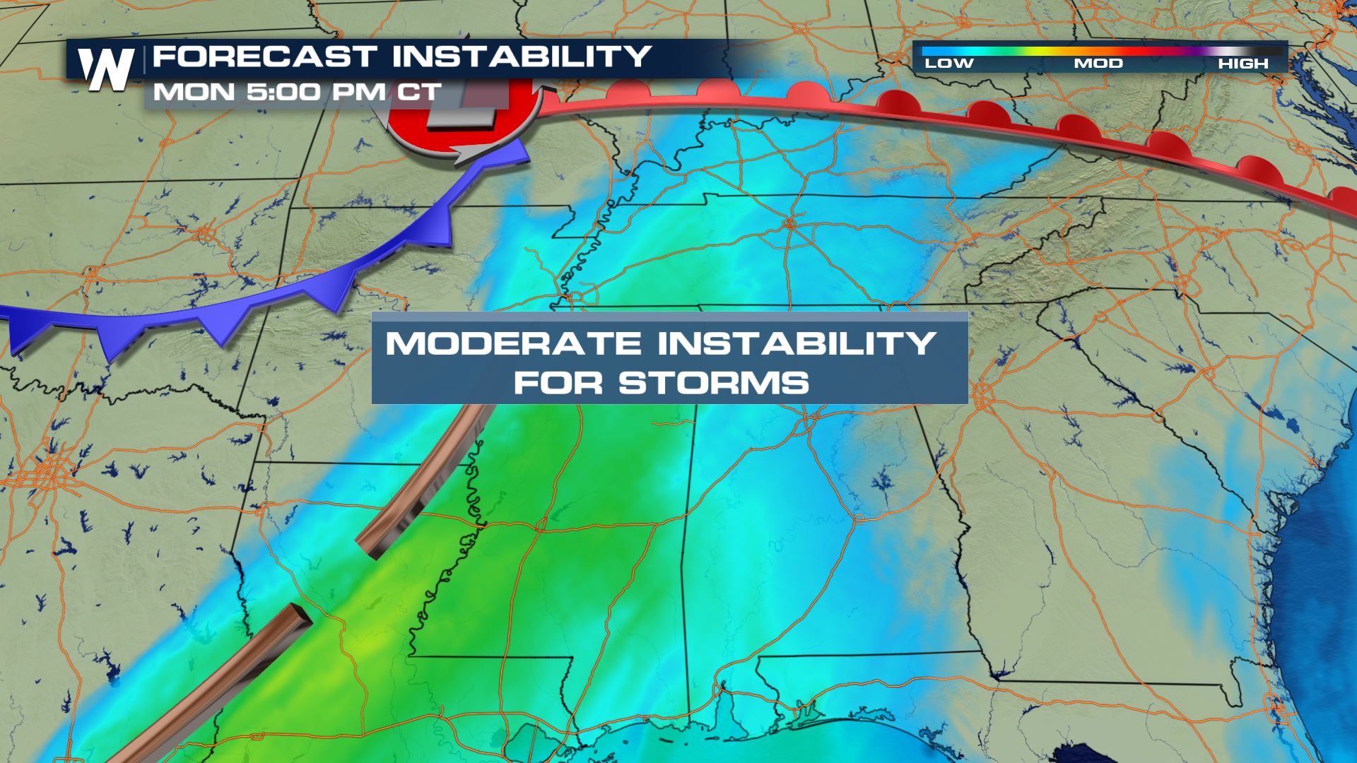 Low level return flow has increased temperatures and humidity Monday, destabilizing the atmosphere over Mississippi, Alabama and Tennessee.
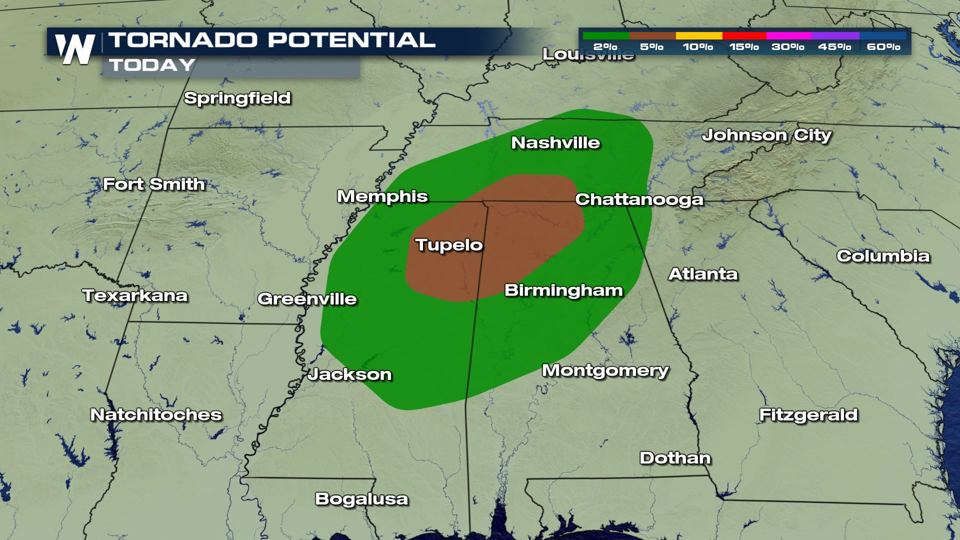
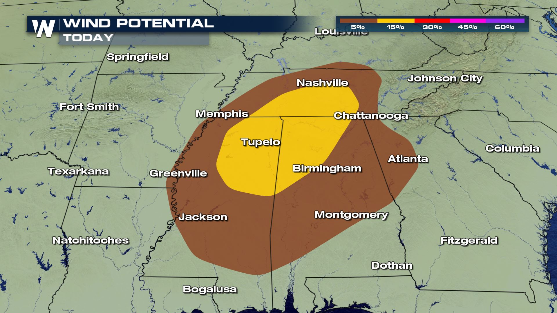 All modes will be in the forecast today including large hail and damaging winds. A small chance for rotation can't be ruled out for a tornado threat.
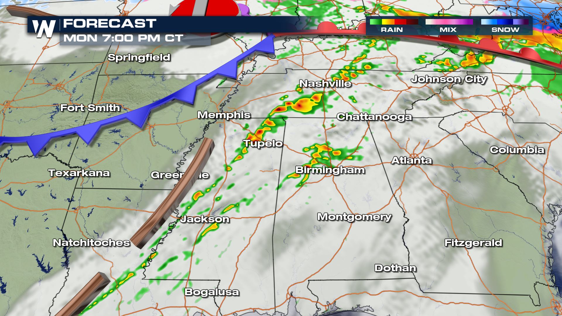
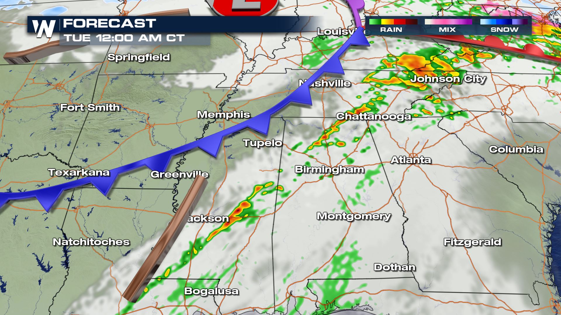 Storms will continue to move into moist, unstable air allowing for development into the afternoon and evening for the risk area. the system will continue to push east bringing a few storms and pockets of heavy rain overnight.
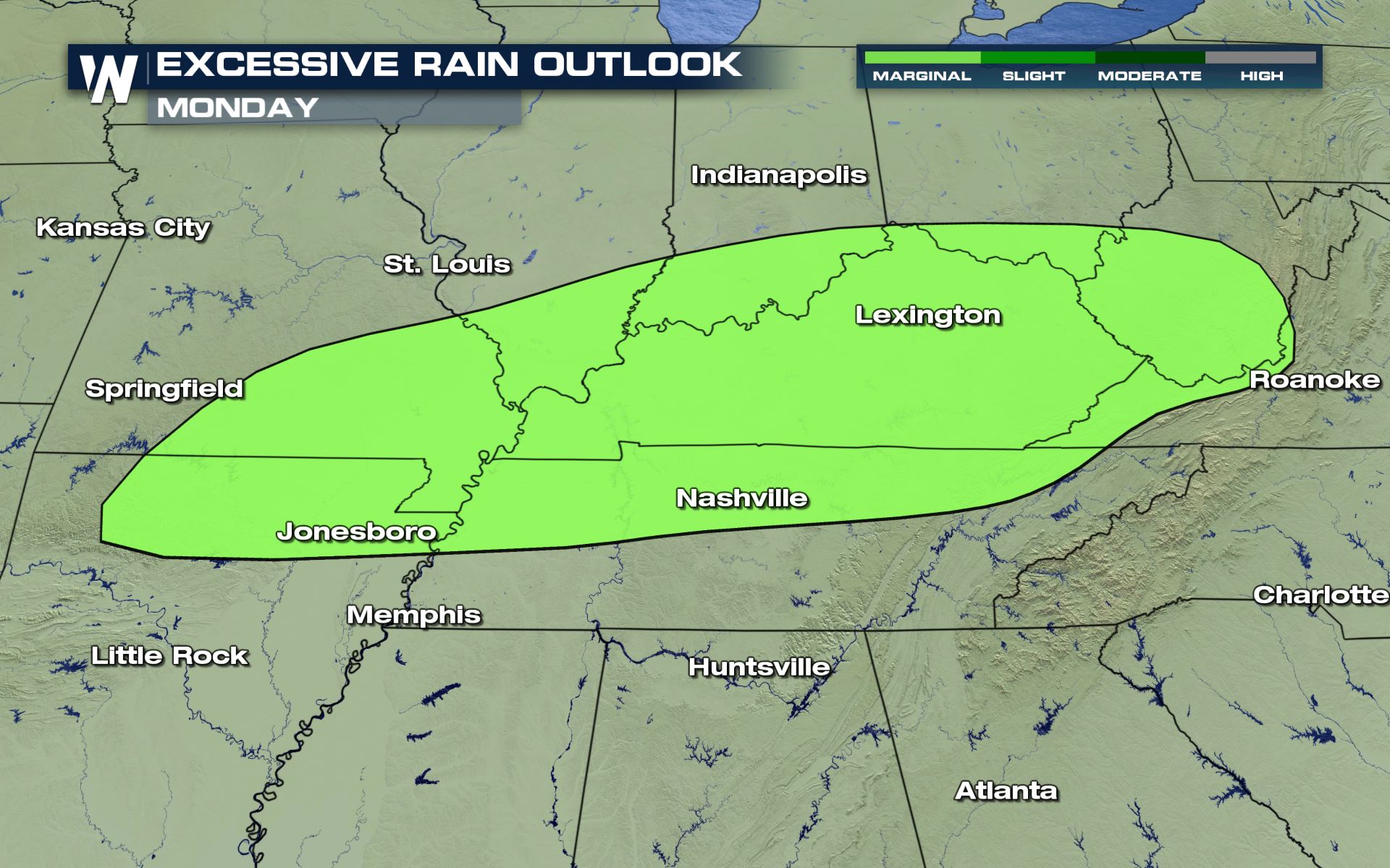
 A marginal risk for excessive rainfall is likely today across the Mid-South to the Ohio River Valley. Isolated areas could see over 3 inches of rain in a short period that will lead to a chance for flooding.
Keep checking with WeatherNation for the latest updates on the heavy rain and severe chances for Monday.
A marginal risk for excessive rainfall is likely today across the Mid-South to the Ohio River Valley. Isolated areas could see over 3 inches of rain in a short period that will lead to a chance for flooding.
Keep checking with WeatherNation for the latest updates on the heavy rain and severe chances for Monday.
Severe Set-Up
Low level return flow has increased temperatures and humidity Monday, destabilizing the atmosphere over Mississippi, Alabama and Tennessee.
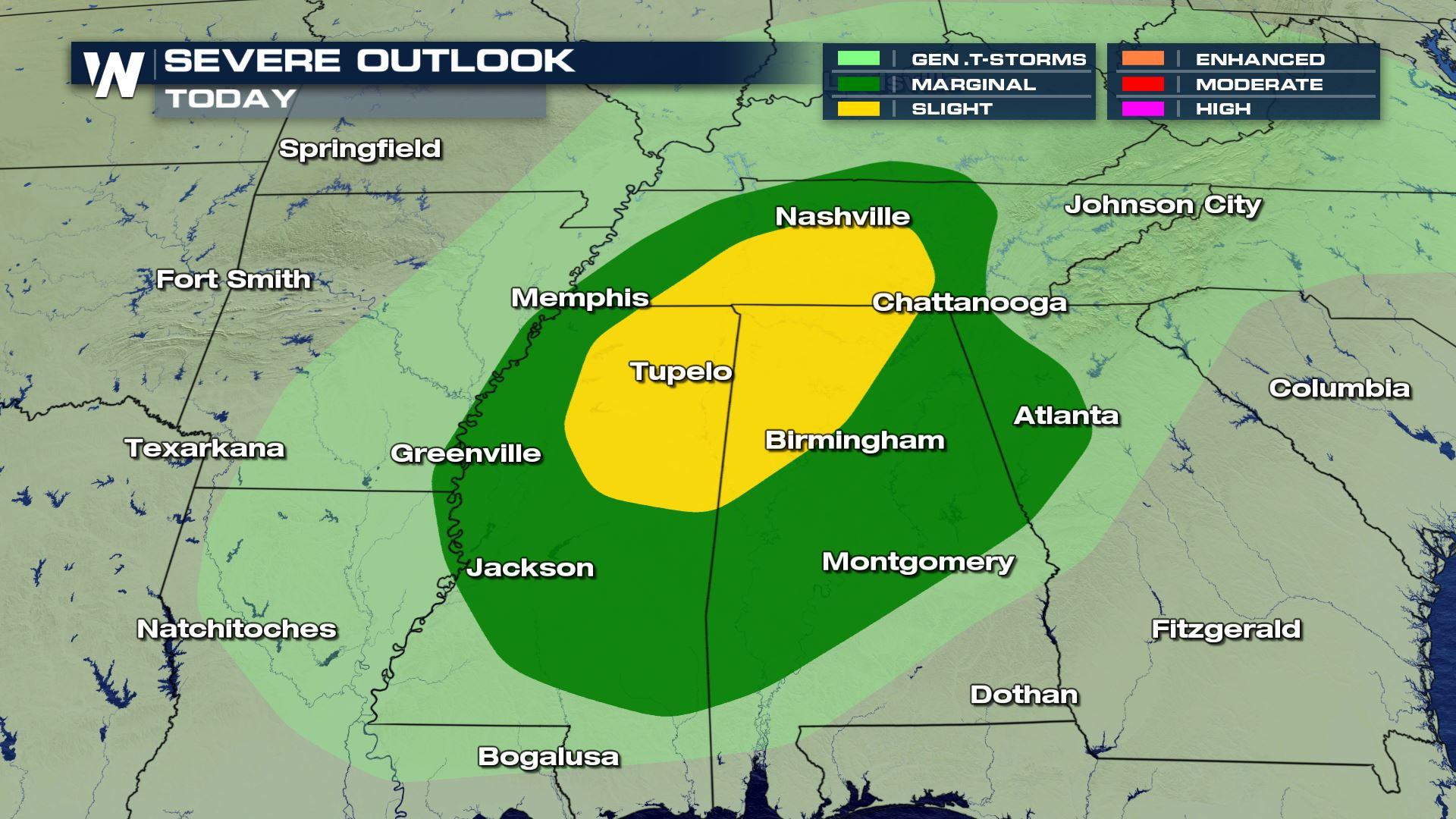
Severe Outlook
The Storm Prediction Center is highlighting areas in the Mississippi, Tennessee and Ohio River Valleys for a chance of strong storms.
All modes will be in the forecast today including large hail and damaging winds. A small chance for rotation can't be ruled out for a tornado threat.
Forecast
Storms will continue to move into moist, unstable air allowing for development into the afternoon and evening for the risk area. the system will continue to push east bringing a few storms and pockets of heavy rain overnight.
Rainfall Accumulation
A marginal risk for excessive rainfall is likely today across the Mid-South to the Ohio River Valley. Isolated areas could see over 3 inches of rain in a short period that will lead to a chance for flooding.
Keep checking with WeatherNation for the latest updates on the heavy rain and severe chances for Monday.
All Weather News
More
More Storms for the East Through Monday
The threat for flooding rain continues across
3 Aug 2026 6:00 PM


After Reaching Category 5, Genevieve Weakens in the Pacific
PacificGenevieve formed last Friday south of
3 Aug 2026 12:30 AM

Flooding, Severe Storms Target the Midwest Again
After an active week of storms across the nor
1 Aug 2026 1:40 AM

Flooding Risk Increases as Heavy Rain Targets the Tri-State Area
Tuesday, heavy rainfall moved across the Nort
30 Jul 2026 12:25 AM