Looking Back at Last Week's Severe Weather Outbreak

Tornadoes, hail, wind, and rain slammed the Midwest and Great Plains on Friday as a powerful storm system moved into the region. The same storm system was producing snow in Colorado while tornado warnings were being issued hundreds of miles to the east.
Unfortunately, tornadoes hit some residential areas causing damage to homes in several states and injuring at least one person in Iowa. Thankfully, no deaths have been reported thus far. We'll post summaries of the tornadoes, including their ratings, as that information comes in over the next few days. Head to the bottom of the page for radar loops from Friday.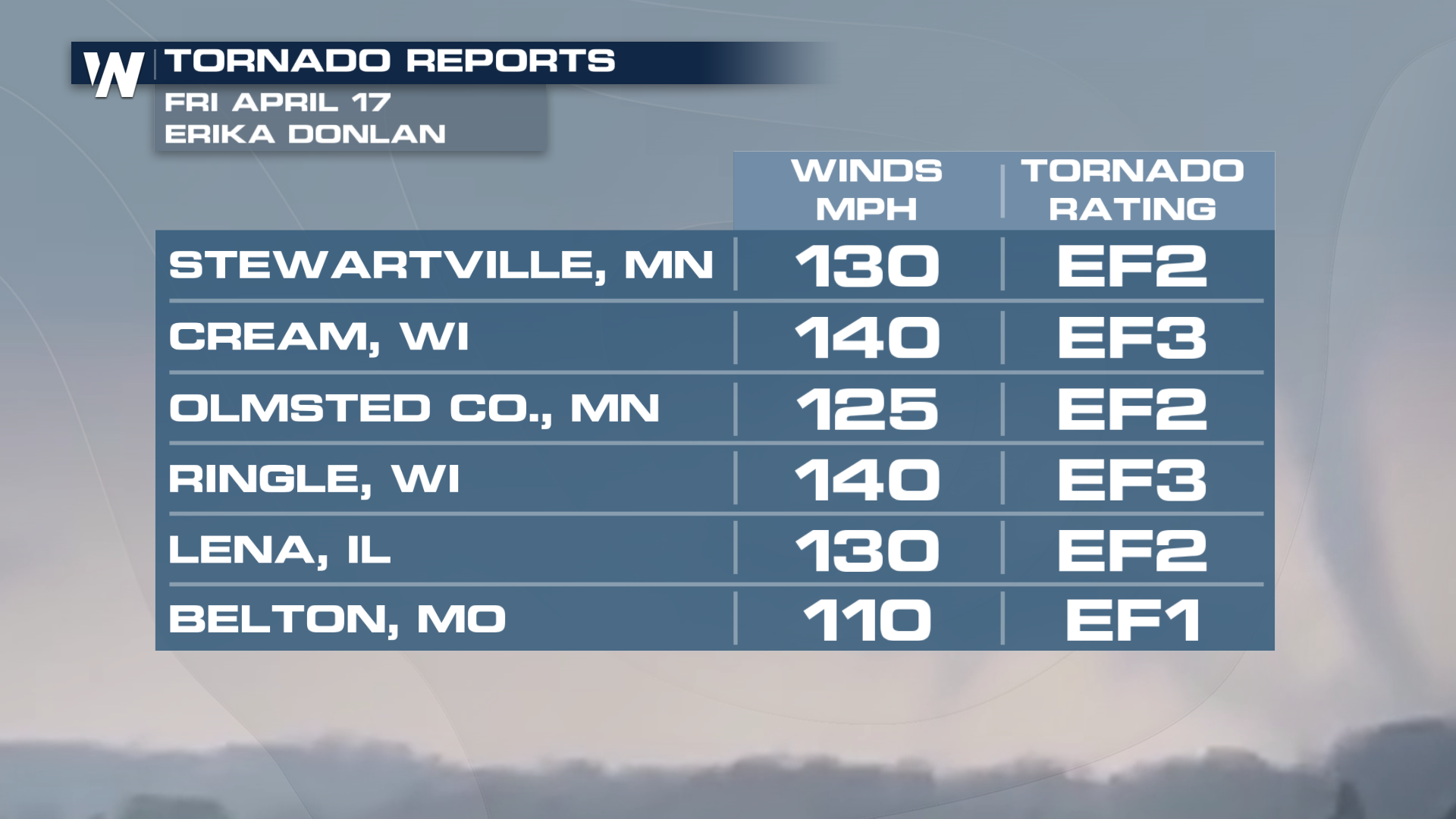
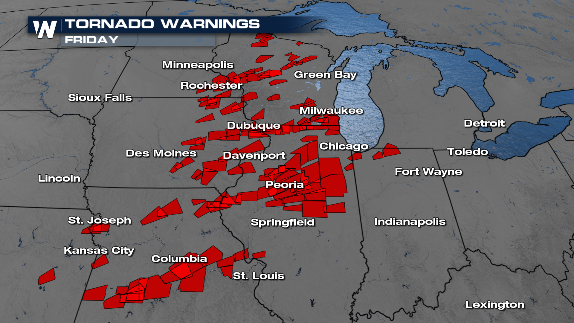 Over one hundred tornado warnings were issued with 25 reports of tornadoes either being spotted or causing damage.
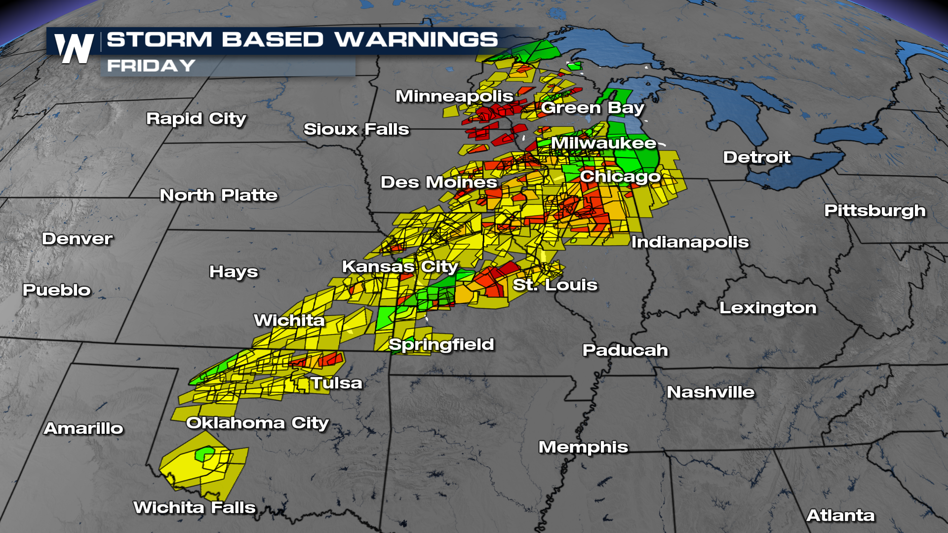 Many more severe thunderstorm warnings and flash flood warnings were issued on Friday, with many warnings confirmed by reports (below).
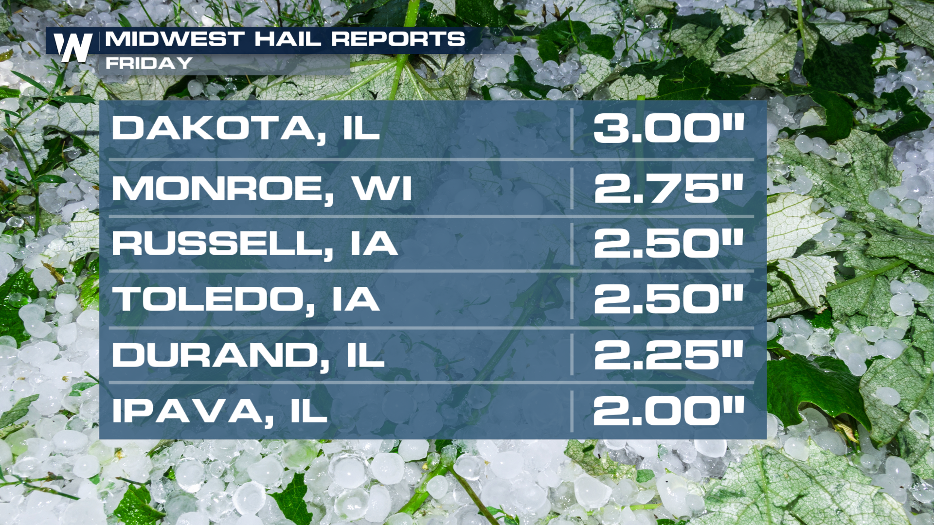
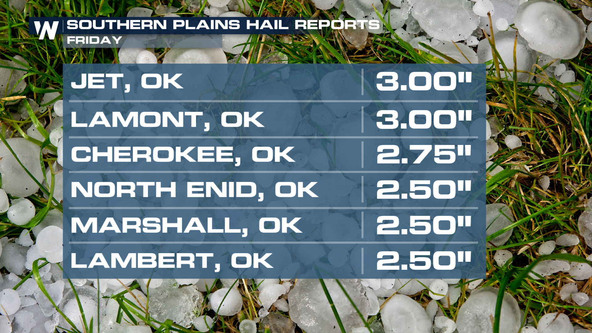
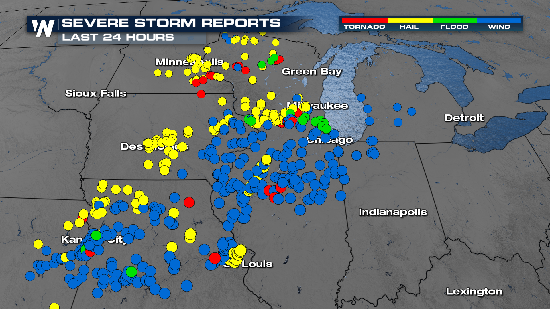 Hail topped 3 inches in diameter (bigger than baseballs) in both the Midwest and Plains on Friday, with many significant hail reports (over 2 inches).
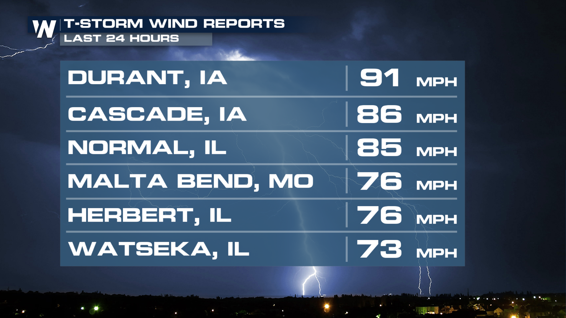
 Hurricane force wind gusts also verified on Friday, with at least 5 reported over hurricane strength in the Midwest. Squall lines formed late in the day to produce large bowing segments.
 Radar Review
Radar imagery from Friday was impressive, with many discrete supercells forming before the storms became more linear late in the evening. Many warnings were issued for storms, including confirmed tornado warnings (pink instead of red).


