Severe Storm Threat Continues Through Mid Week
Top Stories
17 May 2021 6:00 AM
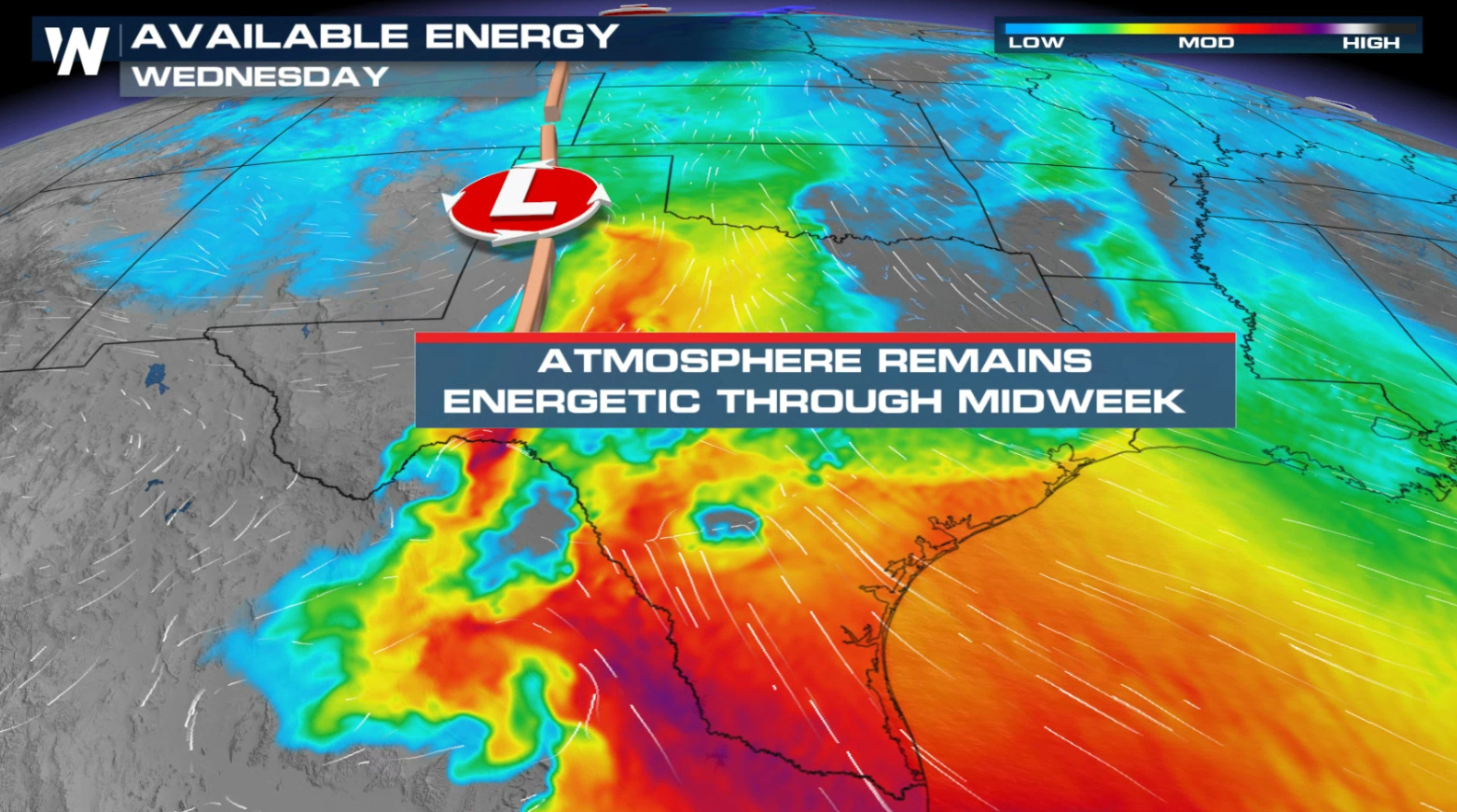
As we head through the work week, rounds of severe weather are expected in the central and southern Plains. A stalled low pressure system on the lee (east) side of the Rockies and connected dry line will be areas of focus for severe storm development.
RELATED ARTICLES:
Monday severe risk: Another Day of Severe Weather for the Southern Plains
Flooding potential: Flood Concerns for the Central and Southern Plains
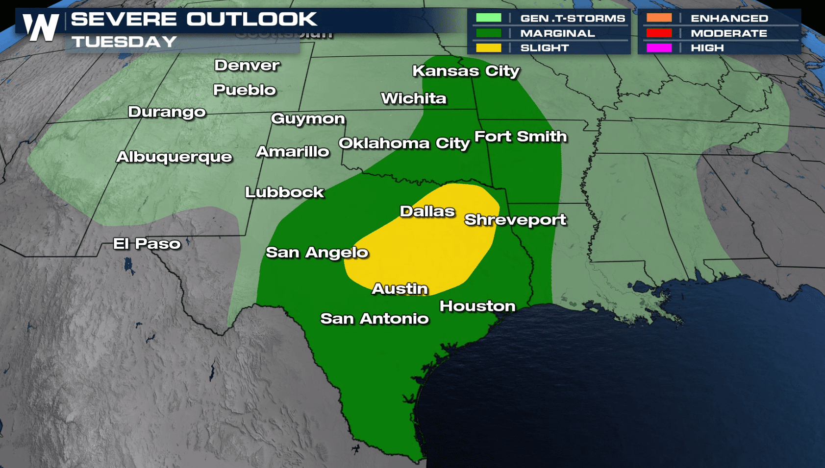
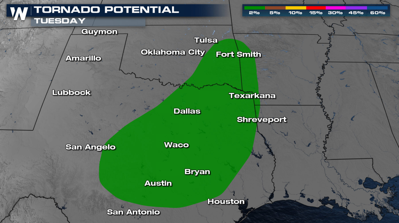
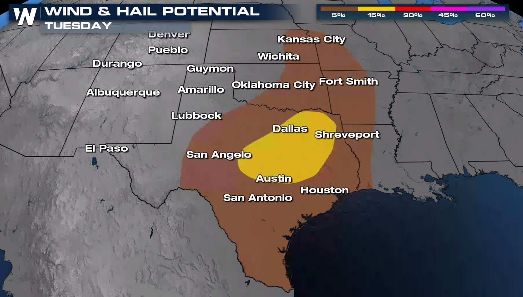
 There is a level II threat, or 'slight' risk for severe storms on Tuesday for eastern Texas. A marginal risk extends from the Rio Grande of Texas to near Kansas City. At this time, damaging winds over 58 mph and large hail over 1" in diameter are the primary threats, but an isolated tornado or two is also possible.
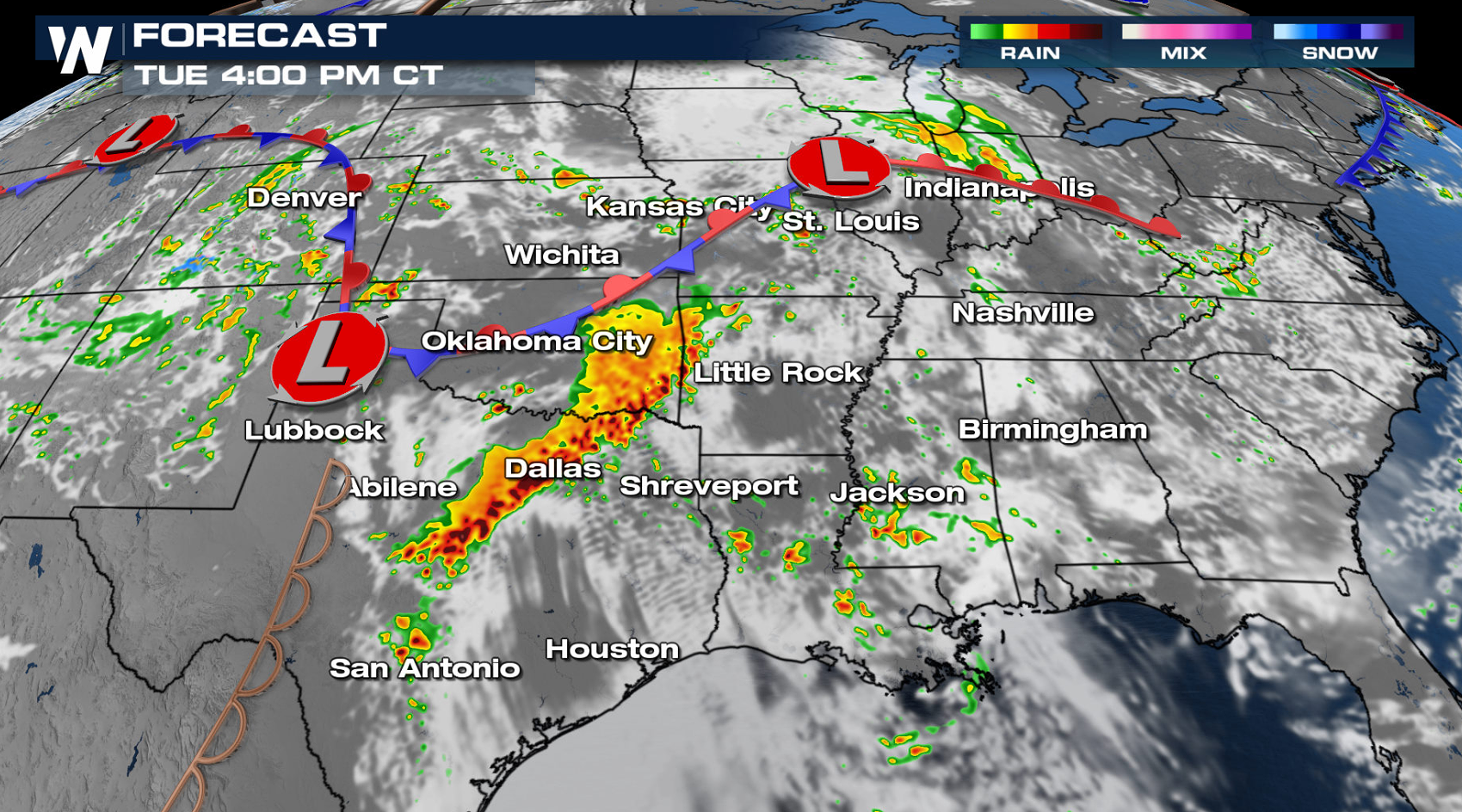
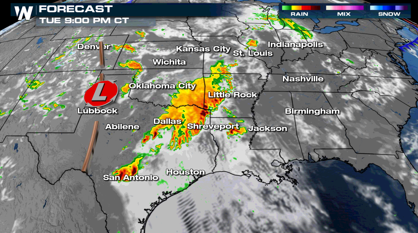
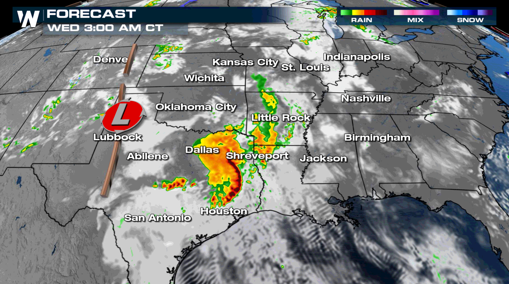
 Numerous thunderstorms will be found in the central and southern Plains Tuesday. Storms are expected to be rather potent from eastern Oklahoma into eastern Texas during the afternoon and evening hours. Storms may remain strong into early Wednesday morning, especially for eastern Texas.
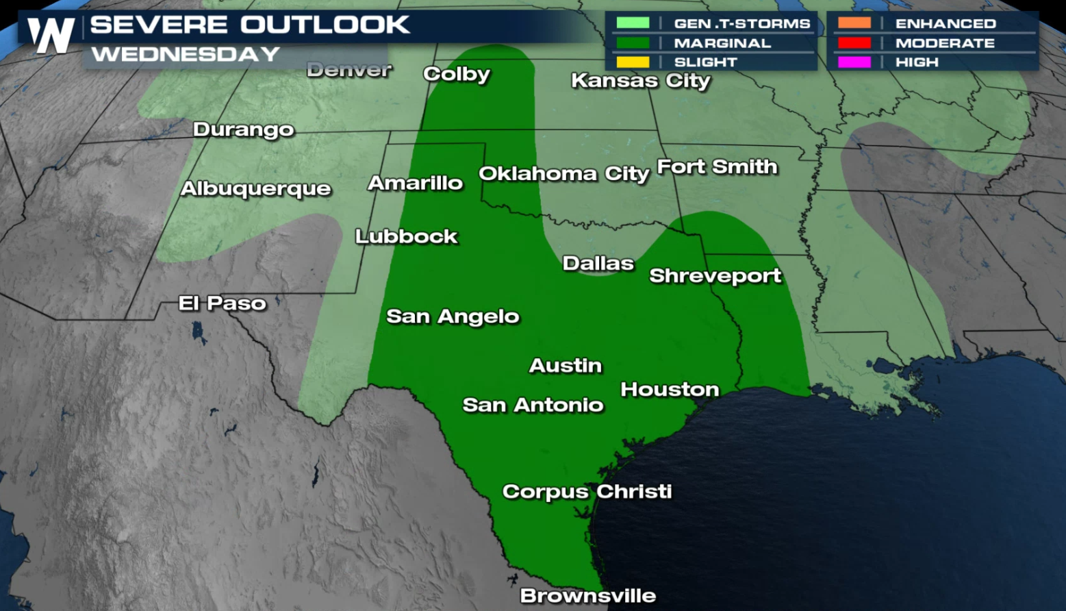 A marginal risk for severe thunderstorms (level 1 on a scale of 1 to 5) extends from Kansas to the Gulf of Mexico coastline in Louisiana and Texas. High instability and rich moisture will be present over the region, providing for the severe weather potential, especially near the dryline and weakening low pressure center.
 We'll be covering the severe weather chances as one of your top weather headlines but also in your central regional forecast :30 after the hour
Tuesday
There is a level II threat, or 'slight' risk for severe storms on Tuesday for eastern Texas. A marginal risk extends from the Rio Grande of Texas to near Kansas City. At this time, damaging winds over 58 mph and large hail over 1" in diameter are the primary threats, but an isolated tornado or two is also possible.
Numerous thunderstorms will be found in the central and southern Plains Tuesday. Storms are expected to be rather potent from eastern Oklahoma into eastern Texas during the afternoon and evening hours. Storms may remain strong into early Wednesday morning, especially for eastern Texas.
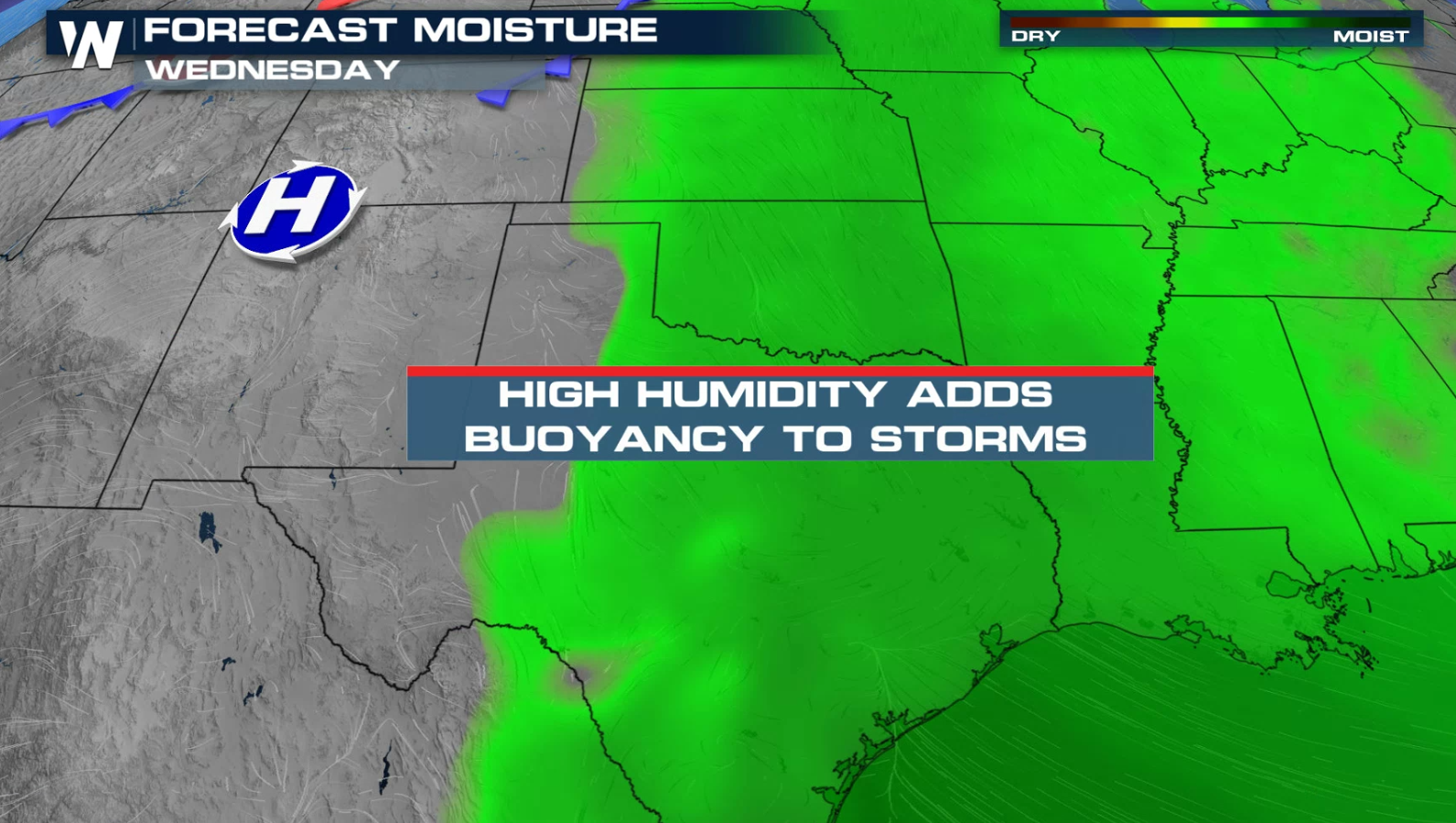
Wednesday
A marginal risk for severe thunderstorms (level 1 on a scale of 1 to 5) extends from Kansas to the Gulf of Mexico coastline in Louisiana and Texas. High instability and rich moisture will be present over the region, providing for the severe weather potential, especially near the dryline and weakening low pressure center.
We'll be covering the severe weather chances as one of your top weather headlines but also in your central regional forecast :30 after the hourAll Weather News
More
Wildfire Outbreak in the Pacific Northwest
SPOKANE, WA - On Saturday, August 1st, the Ol
3 Aug 2026 1:55 AM

More Storms for the East Through Monday
A low-pressure system that moved through the
3 Aug 2026 1:50 AM


After Reaching Category 5, Genevieve Weakens in the Pacific
PacificGenevieve formed last Friday south of
3 Aug 2026 12:30 AM

Flooding, Severe Storms Target the Midwest Again
After an active week of storms across the nor
1 Aug 2026 1:40 AM

Flooding Risk Increases as Heavy Rain Targets the Tri-State Area
Tuesday, heavy rainfall moved across the Nort
30 Jul 2026 12:25 AM

Severe Weather: Energy From the Midwest Now in the Southeast
UPPER MIDWEST - Through Monday, dangerous tor
29 Jul 2026 10:30 PM