Severe Storm Threat in Florida Continues Through the Weekend

Special Stories
25 Apr 2020 7:00 PM
The potential for severe storms will continue across parts of Florida on Sunday after strong storms raced across the Southeast earlier this week. A cold front has slowly been moving south across the state and will stall in the area on Sunday.
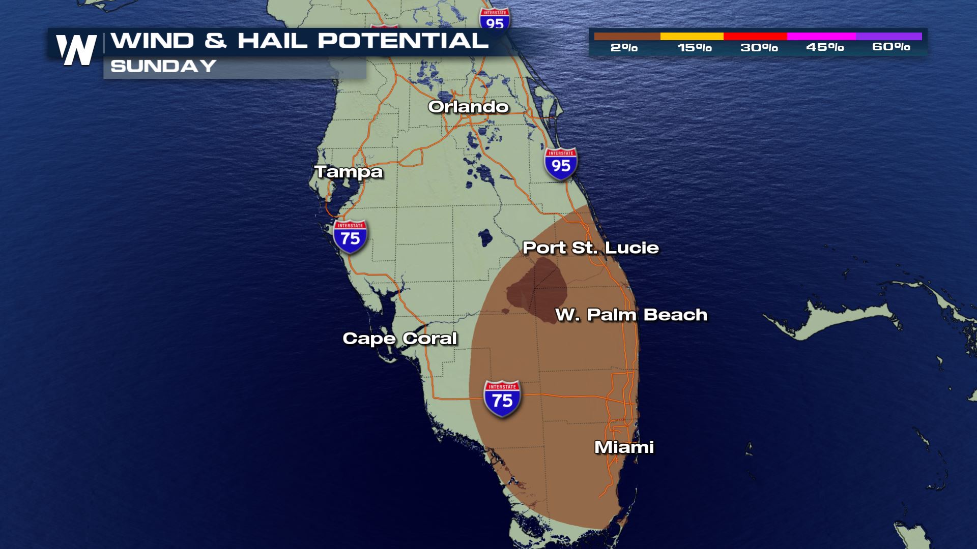
Damaging, straight-line winds will be possible in thunderstorms across the entire warned area in South Florida. Isolated tornadoes and waterspouts cannot be ruled out.
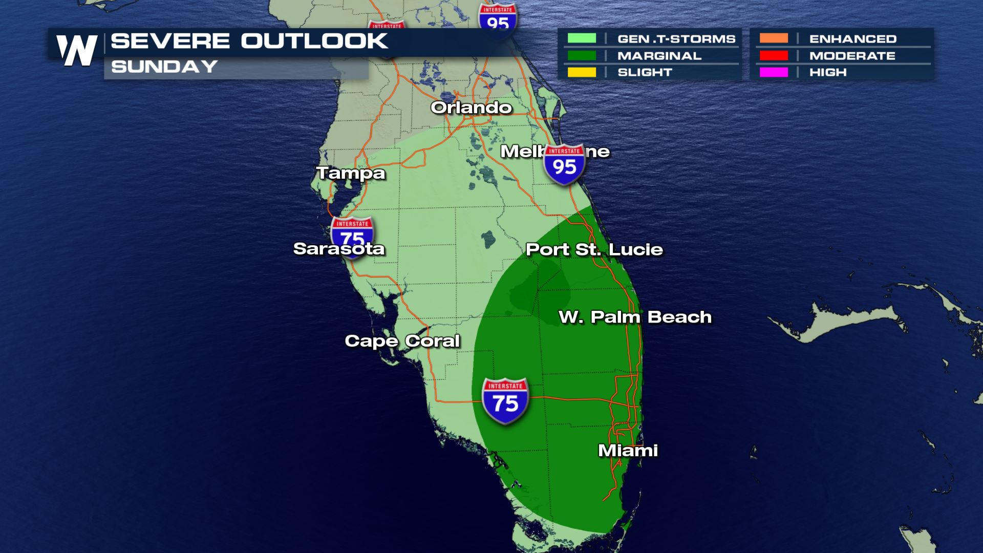 The main threats on Sunday appear to be damaging winds and large hail, though the possibility of an isolated tornado cannot be ruled out.
 By Saturday morning, storms should be more isolated or scattered, but a few isolated strong to severe storms are possible. The chance for severe thunderstorms will increase in the afternoon.
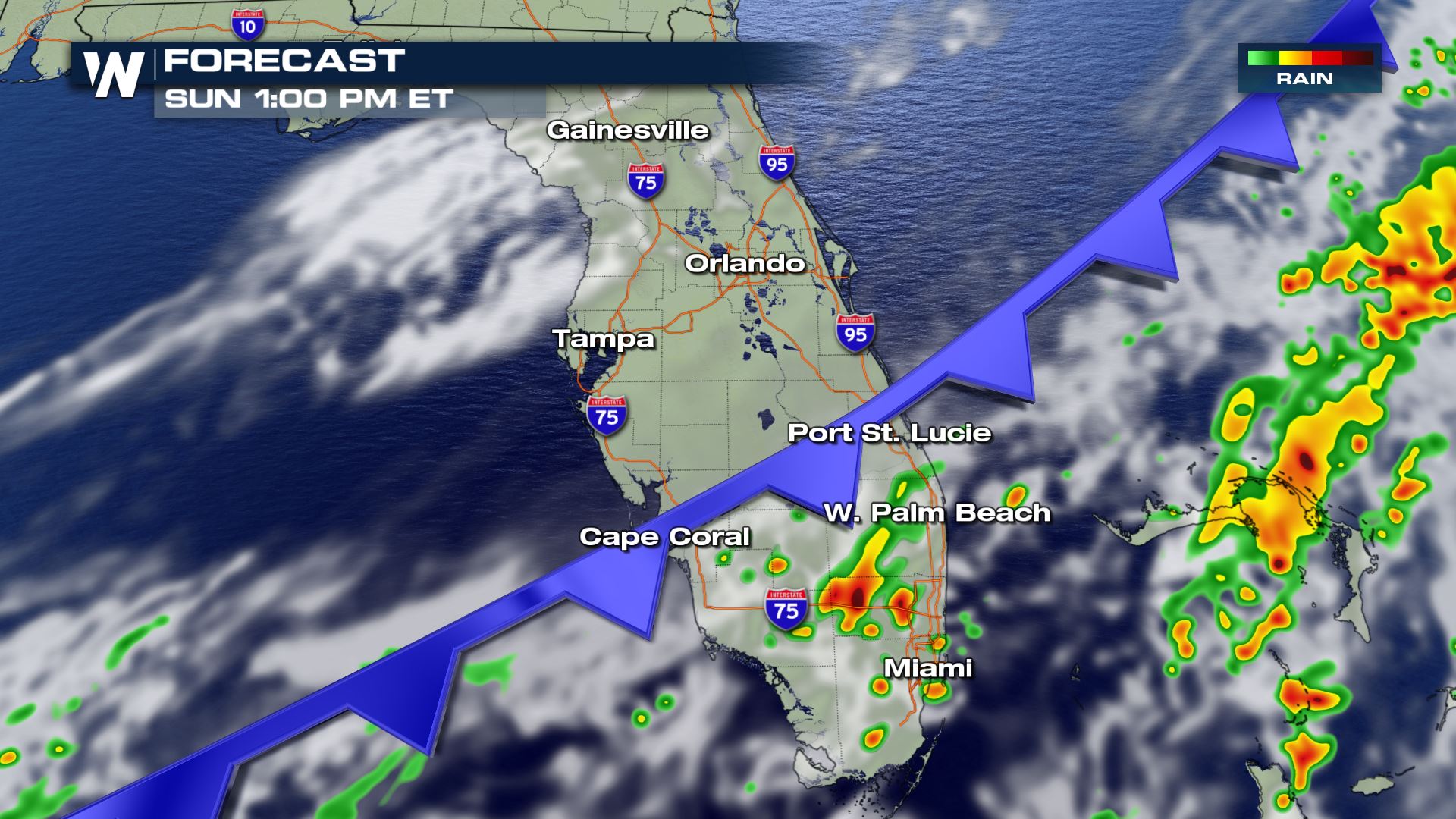
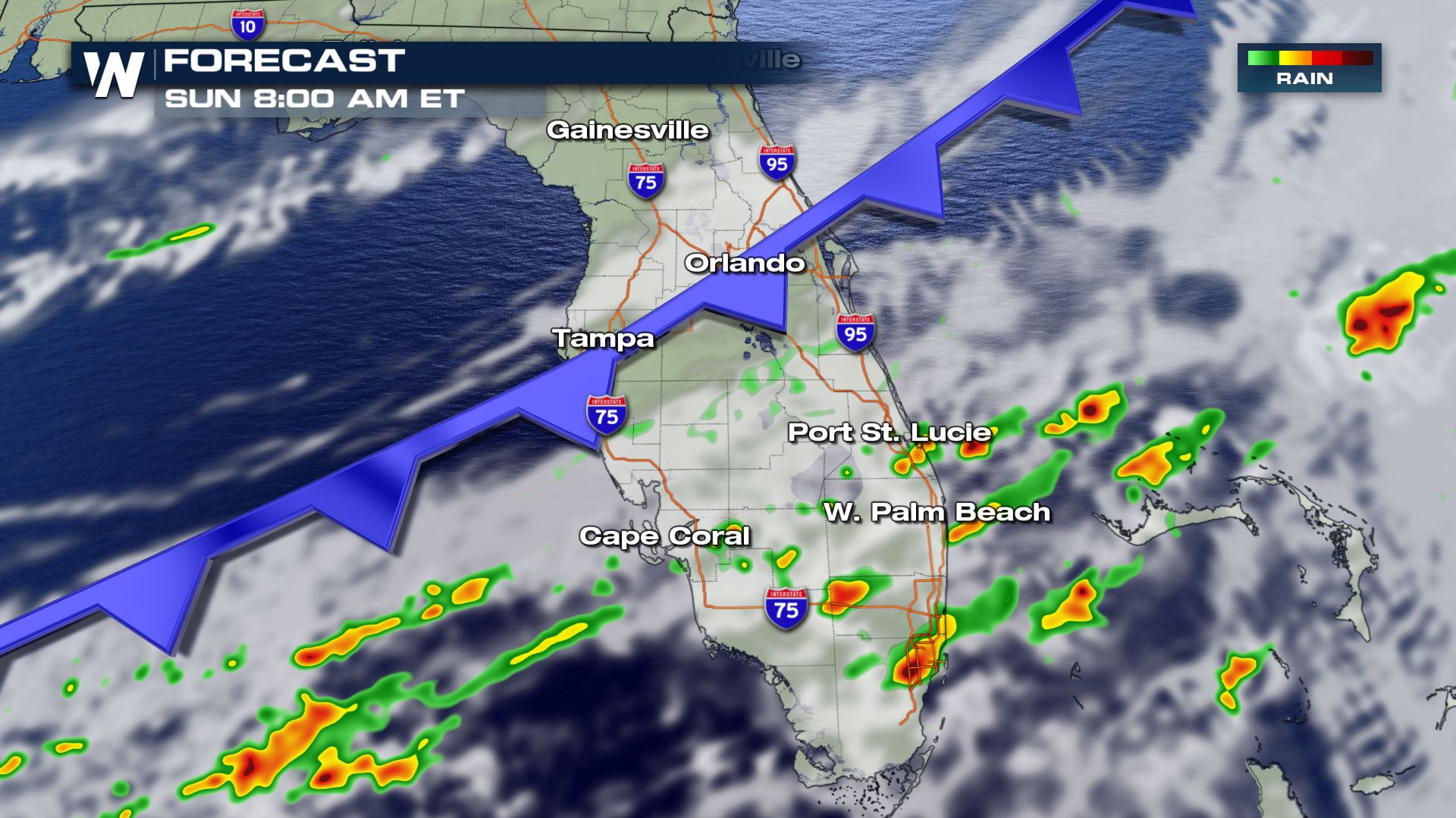 As a second cold front crosses Florida on Sunday, a few additional strong or severe storms will be possible before sunrise, with a better chance for stronger storms in the afternoon.
 Be sure to have multiple methods to receive warnings in case severe storms happen overnight. Stay with WeatherNation for updates and continuing coverage on the threat for severe storms.
The main threats on Sunday appear to be damaging winds and large hail, though the possibility of an isolated tornado cannot be ruled out.
By Saturday morning, storms should be more isolated or scattered, but a few isolated strong to severe storms are possible. The chance for severe thunderstorms will increase in the afternoon.
As a second cold front crosses Florida on Sunday, a few additional strong or severe storms will be possible before sunrise, with a better chance for stronger storms in the afternoon.
Be sure to have multiple methods to receive warnings in case severe storms happen overnight. Stay with WeatherNation for updates and continuing coverage on the threat for severe storms.All Weather News
More


More Storms for the East Sunday and Monday
A low-pressure system crashing through the Mi
2 Aug 2026 2:20 AM

After Reaching Category 5, Genevieve Weakens in the Pacific
PacificGenevieve formed on last Friday south
2 Aug 2026 1:30 AM

Flooding, Severe Storms Target the Midwest Again
After an active week of storms across the nor
1 Aug 2026 1:40 AM

Flooding Risk Increases as Heavy Rain Targets the Tri-State Area
Tuesday, heavy rainfall moved across the Nort
30 Jul 2026 12:25 AM

Severe Weather: Energy From the Midwest Now in the Southeast
UPPER MIDWEST - Through Monday, dangerous tor
29 Jul 2026 10:30 PM