Severe Storm Threat Targets the Great Lakes & Midwest Overnight
Top Stories
3 Aug 2022 8:05 PM
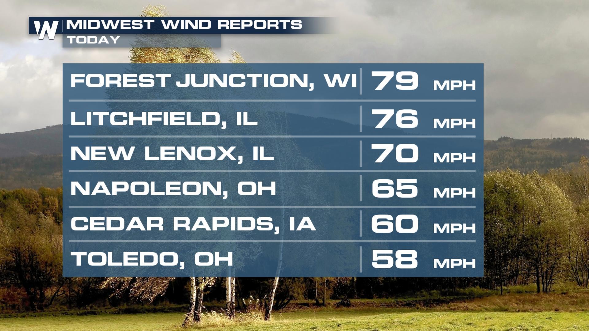
Damaging storms rolled across the Great Plains and Upper Midwest on Tuesday, creating wind damage in portions of South Dakota and Minnesota. As the cold front continues to move south and east Wednesday into Thursday, additional strong storms are expected.
 The WPC has outlined the regions below for the risk for flooding.
 For the latest forecast for the central region, tune-in anytime at :30 past the hour, or by streaming it on demand through the WeatherNation app.
Severe Outlook
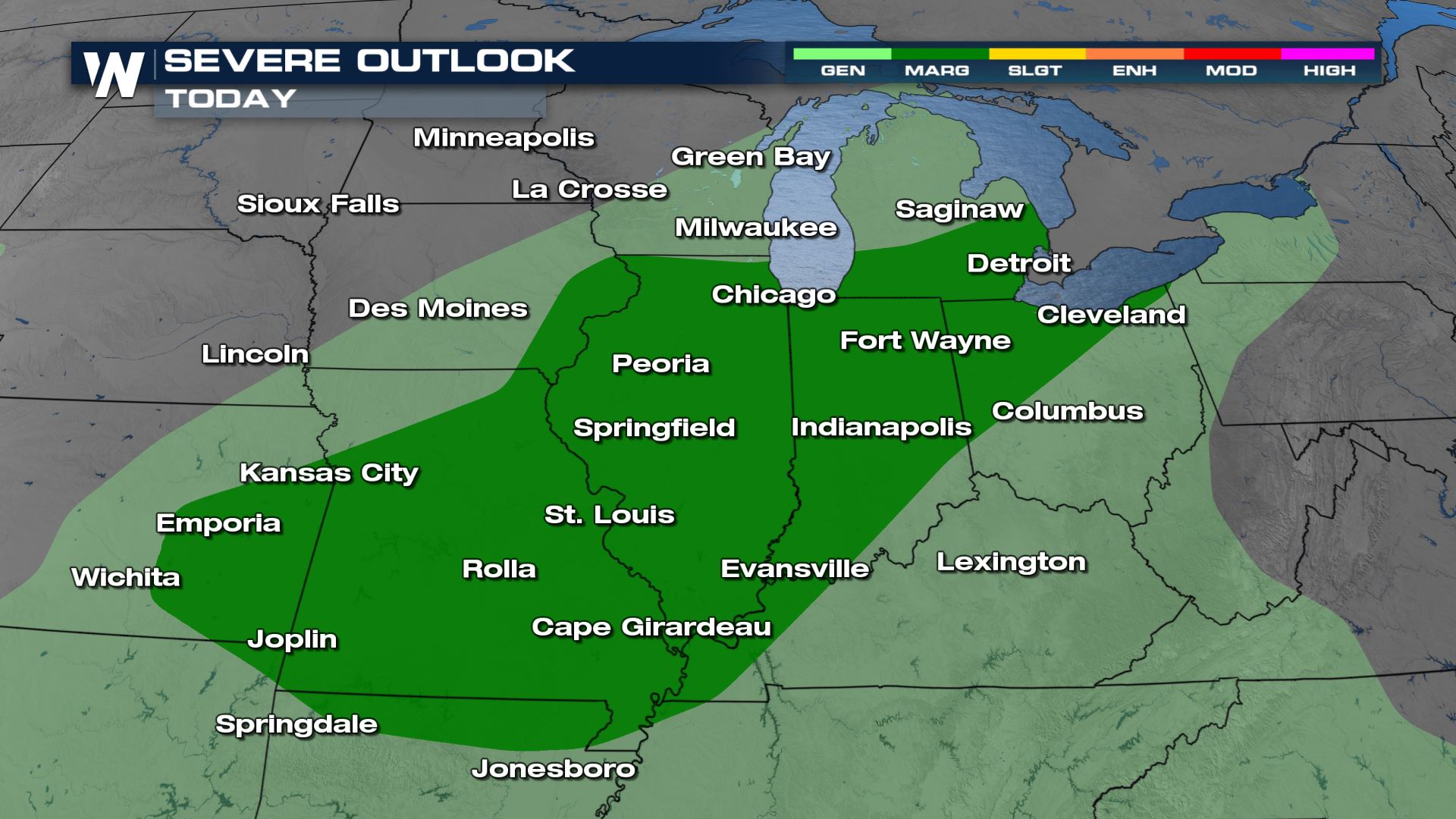
A Marginal (Level 1 out of 5) severe weather risk remains Wednesday overnight into Thursday from Chicago into the Ozarks. Damaging winds are the primary concern.
Timing
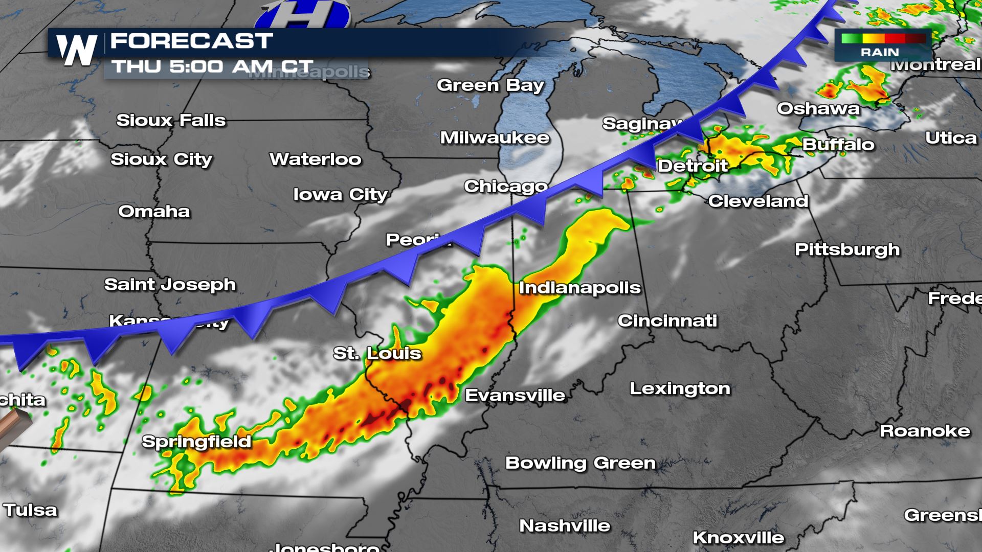
Some showers and storms will linger past dark, especially in the Midwest. We will be watching these for all modes of severe weather and flood threat, especially where grounds are saturated from the previous week of storm activity through the Mid-South.
Flood Threat
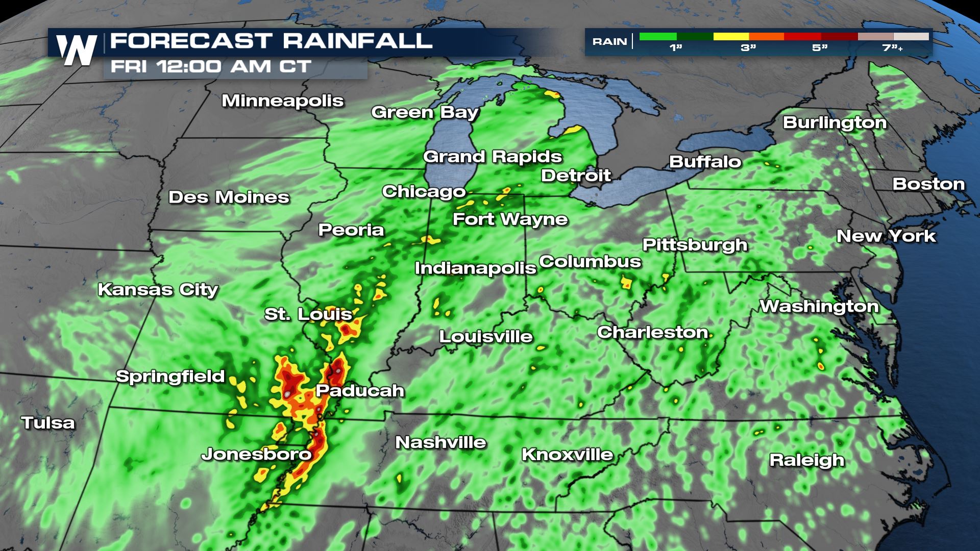
Heavy rain is expected with storms that from along the front Wednesday and Thursday. Accumulations topping 2-3 inches are possible, with isolated heavier totals.
The WPC has outlined the regions below for the risk for flooding.
For the latest forecast for the central region, tune-in anytime at :30 past the hour, or by streaming it on demand through the WeatherNation app.All Weather News
More
Front Range Overnight Storms, More Thursday and Friday
FRONT RANGE - Large hail and strong winds pus
25 Jun 2026 2:15 AM

'MCS' Season for Oklahoma, Kansas and the Ozarks
SOUTHERN PLAINS - Strong to severe thundersto
25 Jun 2026 2:05 AM

Utah Wildfires Explode in Size as Fire Danger Persists Across the West
UTAH - Numerous wildfires continue to burn ac
25 Jun 2026 2:00 AM


Weekend System To Shake up Pattern Across the Country
A significant early-summer trough is expected
25 Jun 2026 12:20 AM

Another Day of Heat For the West Before Changes
This week, an upper-level ridge has taken ove
24 Jun 2026 6:30 PM

I-95 Corridor Under Severe Risk Today
Devastating storms ripped through the heartla
23 Jun 2026 10:00 PM