Severe Storms Continue Overnight for Some
Top Stories
28 Jun 2018 10:40 PM
The threat of damaging wind, fierce lightning, and downpours of rain continue into early Friday morning, June 29.
One of the areas that will need close watching will be the general North Dakota region. The other area is the southern tier of the Mississippi River Valley.
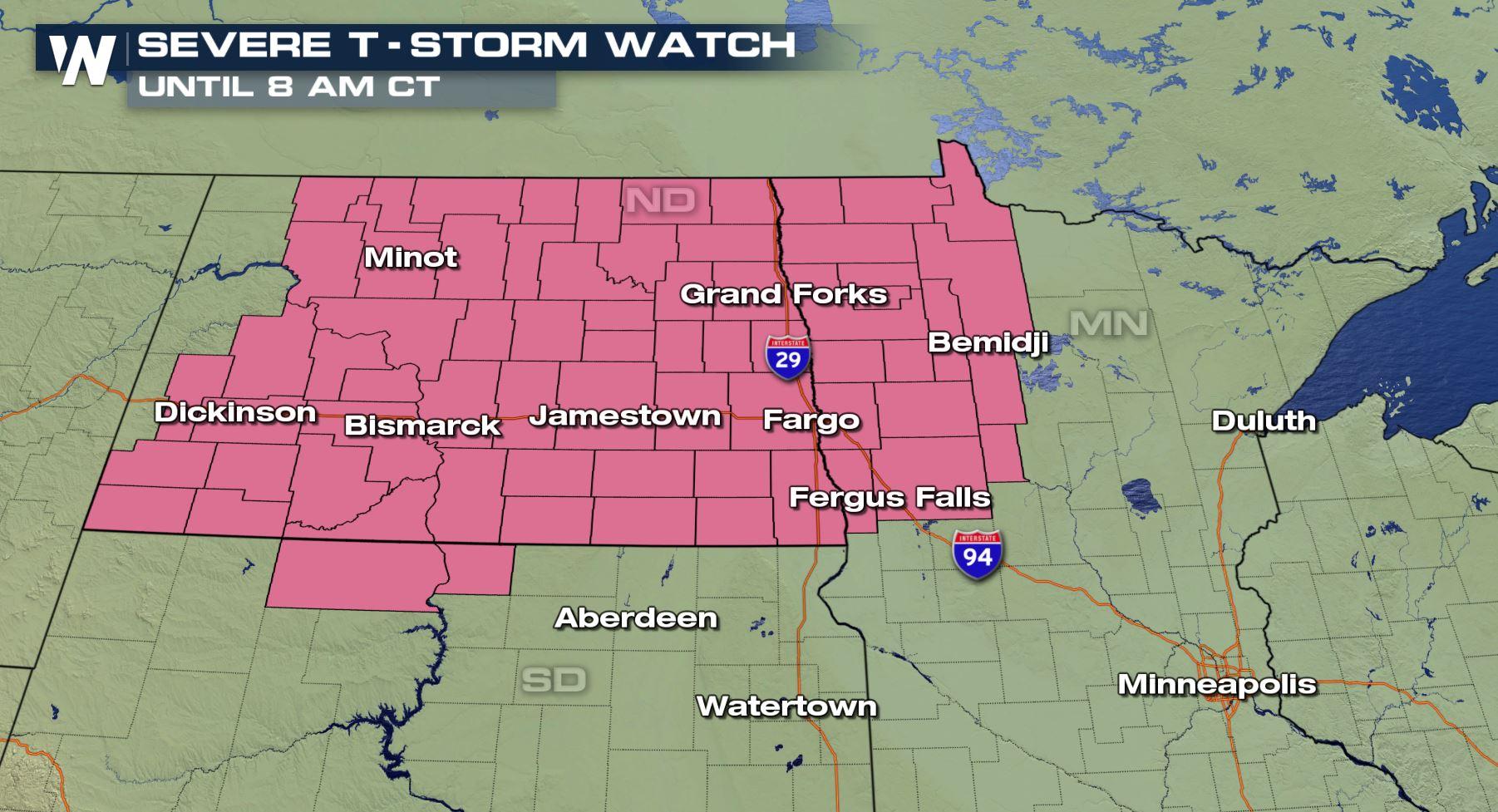
 A severe thunderstorm watch was issued by the National Weather Service for these areas until the daylight hours Friday.
Heavy thunderstorms will continue moving east toward Bismarck, Jamestown, and eventually Fargo and Bemidji. The primary threat with these storms will be wind up to 70 miles per hour, hailstones up to 2 inches thick, and an isolated tornado.
https://twitter.com/WeatherNation/status/1012548609701699584
For those in the alert area, make sure you have a way of getting weather warnings overnight. A warning means a storm has formed and we need to take action now. A watch means be prepared and on standby to take action.
That's not the only area we're watching into early Friday morning.
https://www.facebook.com/WeatherNation/posts/10156616119379874
A severe line of thunderstorms has moved south from the greater St. Louis area Thursday afternoon, now traveling nearly due south down the Mississippi River Valley and western Tennessee. The biggest hazard here will be one or two wind gusts up to 70 miles per hour, but the storms should diminish toward dawn.
Looking back to Thursday, we saw some impressive footage of multiple tornadoes in Montana and South Dakota, as well as huge hail in North Dakota.
A severe thunderstorm watch was issued by the National Weather Service for these areas until the daylight hours Friday.
Heavy thunderstorms will continue moving east toward Bismarck, Jamestown, and eventually Fargo and Bemidji. The primary threat with these storms will be wind up to 70 miles per hour, hailstones up to 2 inches thick, and an isolated tornado.
https://twitter.com/WeatherNation/status/1012548609701699584
For those in the alert area, make sure you have a way of getting weather warnings overnight. A warning means a storm has formed and we need to take action now. A watch means be prepared and on standby to take action.
That's not the only area we're watching into early Friday morning.
https://www.facebook.com/WeatherNation/posts/10156616119379874
A severe line of thunderstorms has moved south from the greater St. Louis area Thursday afternoon, now traveling nearly due south down the Mississippi River Valley and western Tennessee. The biggest hazard here will be one or two wind gusts up to 70 miles per hour, but the storms should diminish toward dawn.
Looking back to Thursday, we saw some impressive footage of multiple tornadoes in Montana and South Dakota, as well as huge hail in North Dakota.
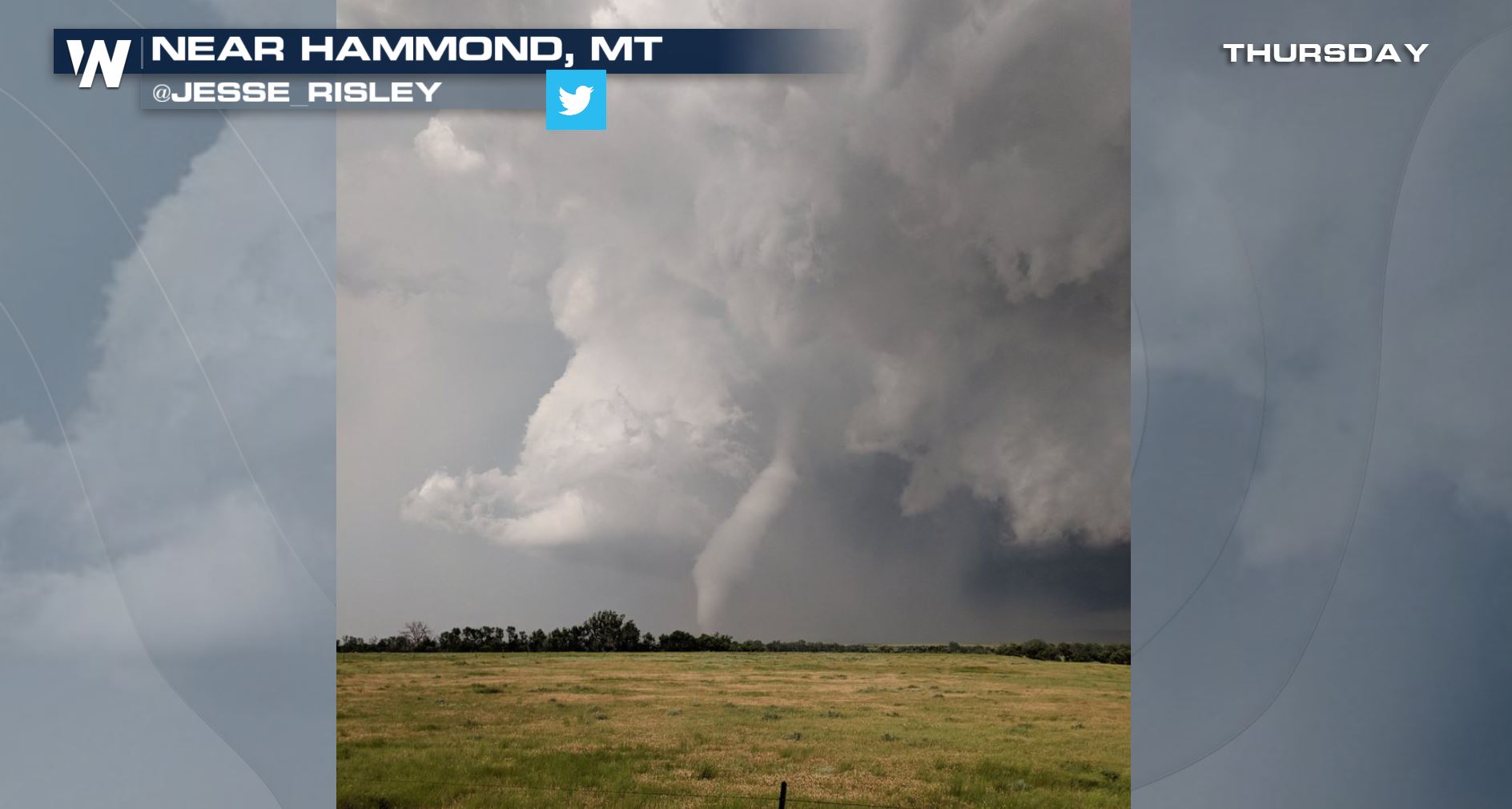 Courtesy Twitter user @Jesse_Risley
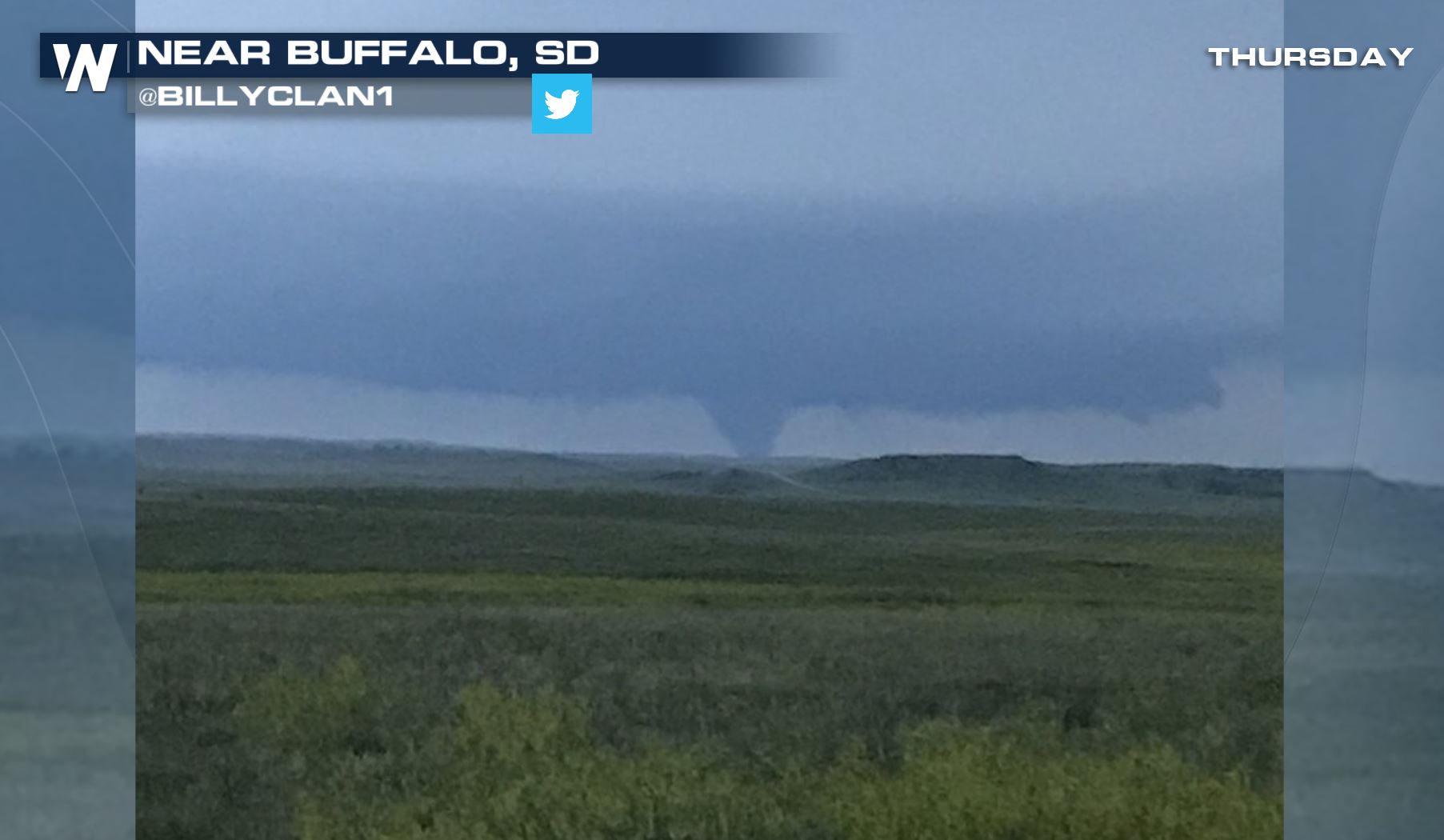 Courtesy Twitter user @BillyClan1
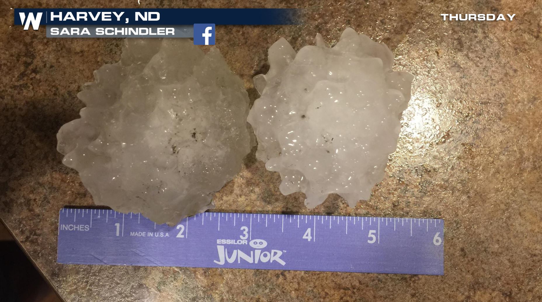 Courtesy Sara Schindler
For WeatherNation, Meteorologist Steve Glazier
Courtesy Sara Schindler
For WeatherNation, Meteorologist Steve Glazier
A severe thunderstorm watch was issued by the National Weather Service for these areas until the daylight hours Friday.
Heavy thunderstorms will continue moving east toward Bismarck, Jamestown, and eventually Fargo and Bemidji. The primary threat with these storms will be wind up to 70 miles per hour, hailstones up to 2 inches thick, and an isolated tornado.
https://twitter.com/WeatherNation/status/1012548609701699584
For those in the alert area, make sure you have a way of getting weather warnings overnight. A warning means a storm has formed and we need to take action now. A watch means be prepared and on standby to take action.
That's not the only area we're watching into early Friday morning.
https://www.facebook.com/WeatherNation/posts/10156616119379874
A severe line of thunderstorms has moved south from the greater St. Louis area Thursday afternoon, now traveling nearly due south down the Mississippi River Valley and western Tennessee. The biggest hazard here will be one or two wind gusts up to 70 miles per hour, but the storms should diminish toward dawn.
Looking back to Thursday, we saw some impressive footage of multiple tornadoes in Montana and South Dakota, as well as huge hail in North Dakota.
Courtesy Twitter user @Jesse_Risley
Courtesy Twitter user @BillyClan1
Courtesy Sara Schindler
For WeatherNation, Meteorologist Steve GlazierAll Weather News
More
East Gears Up for Stormy, Wet Weekend
A low pressure system crashing through the Mi
1 Aug 2026 11:35 AM


Flooding, Severe Storms Target the Midwest Again
After an active week of storms across the nor
1 Aug 2026 1:40 AM

After Reaching Category 5, Genevieve Weakens in the Pacific
PacificFausto is now a post-tropical cyclone.
31 Jul 2026 1:30 AM

Flooding Risk Increases as Heavy Rain Targets the Tri-State Area
Tuesday, heavy rainfall moved across the Nort
30 Jul 2026 12:25 AM

Severe Weather: Energy From the Midwest Now in the Southeast
UPPER MIDWEST - Through Monday, dangerous tor
29 Jul 2026 10:30 PM