Severe Storms for Nebraska and South Dakota Tuesday
Top Stories
10 Sep 2019 4:51 AM
An upper-level trough amplifying over the Western U.S. will bring the risk of severe storms today for parts of Nebraska and South Dakota. Significant damaging winds, large hail and a few tornadoes will all be possible. Here is the very latest.
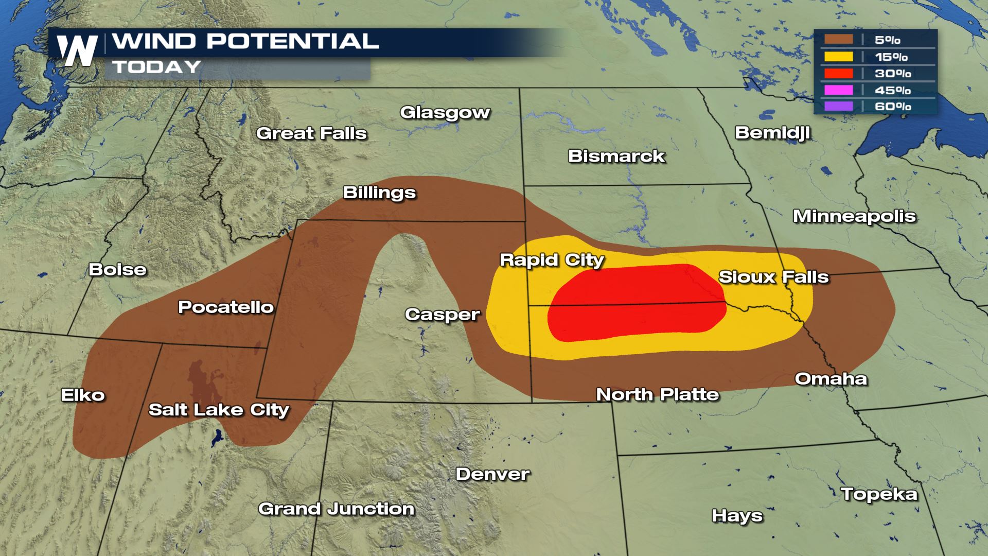
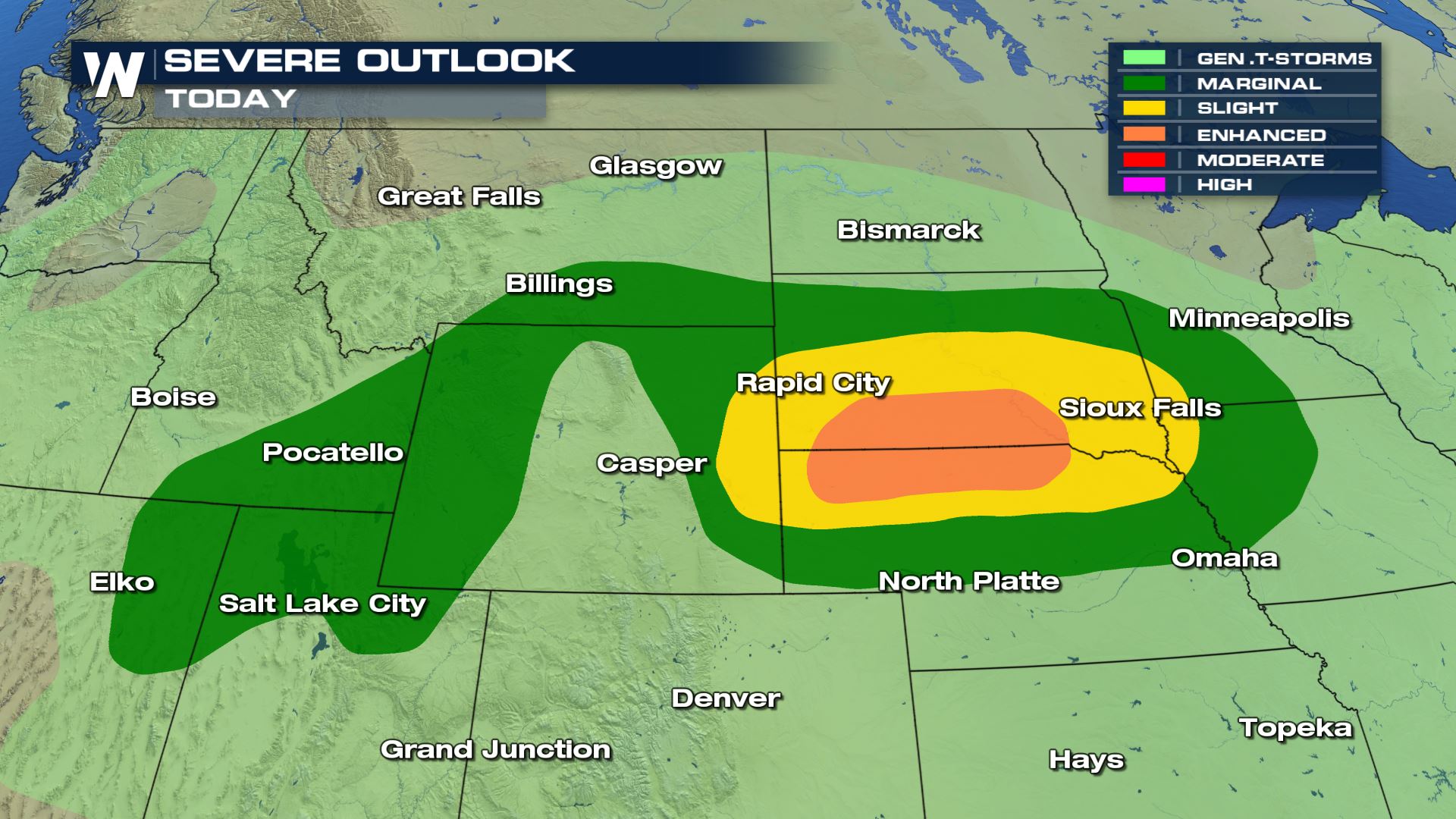 Scattered to numerous storms are possible today across the High Plains for this afternoon and evening. All modes of severe weather are in the forecast so you will need to be weather aware in these areas today.
Here is the definition of an Enhanced Risk of severe weather.
Scattered to numerous storms are possible today across the High Plains for this afternoon and evening. All modes of severe weather are in the forecast so you will need to be weather aware in these areas today.
Here is the definition of an Enhanced Risk of severe weather.
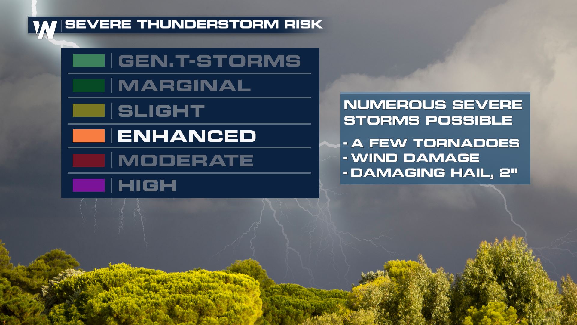
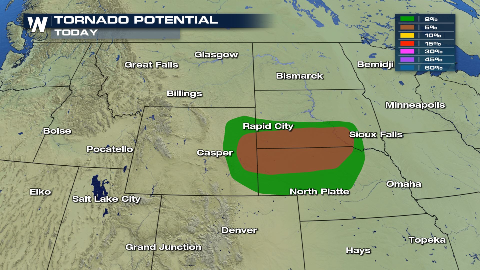
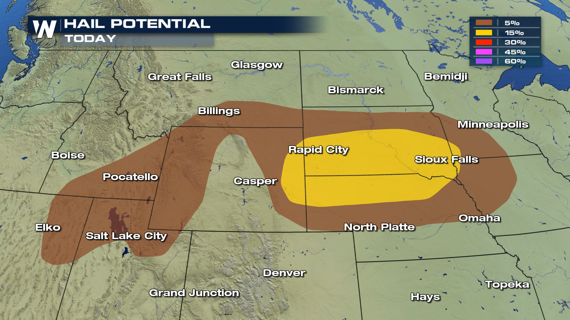 Hail stones between 1 and 2 inches will be possible, along with damaging winds over 70 mph. You want to secure and protect any outdoor items in these areas as damage will be likely.
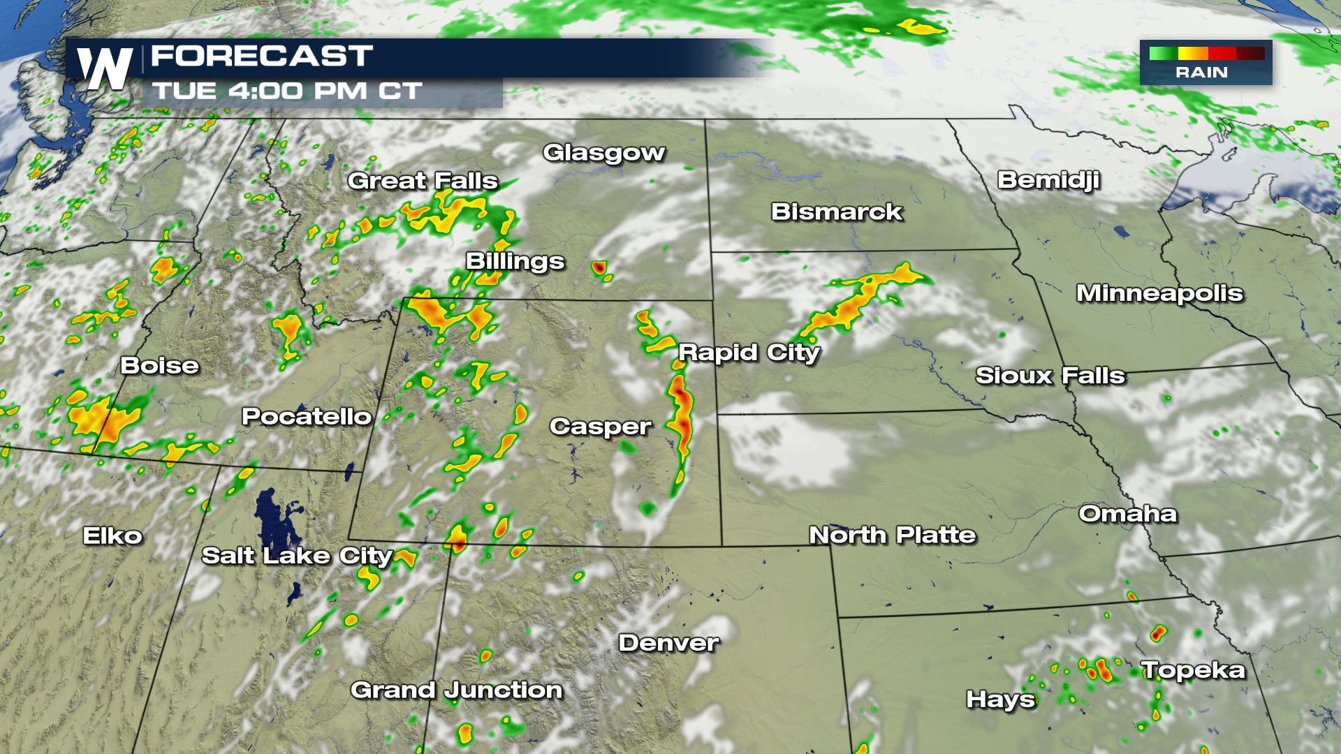
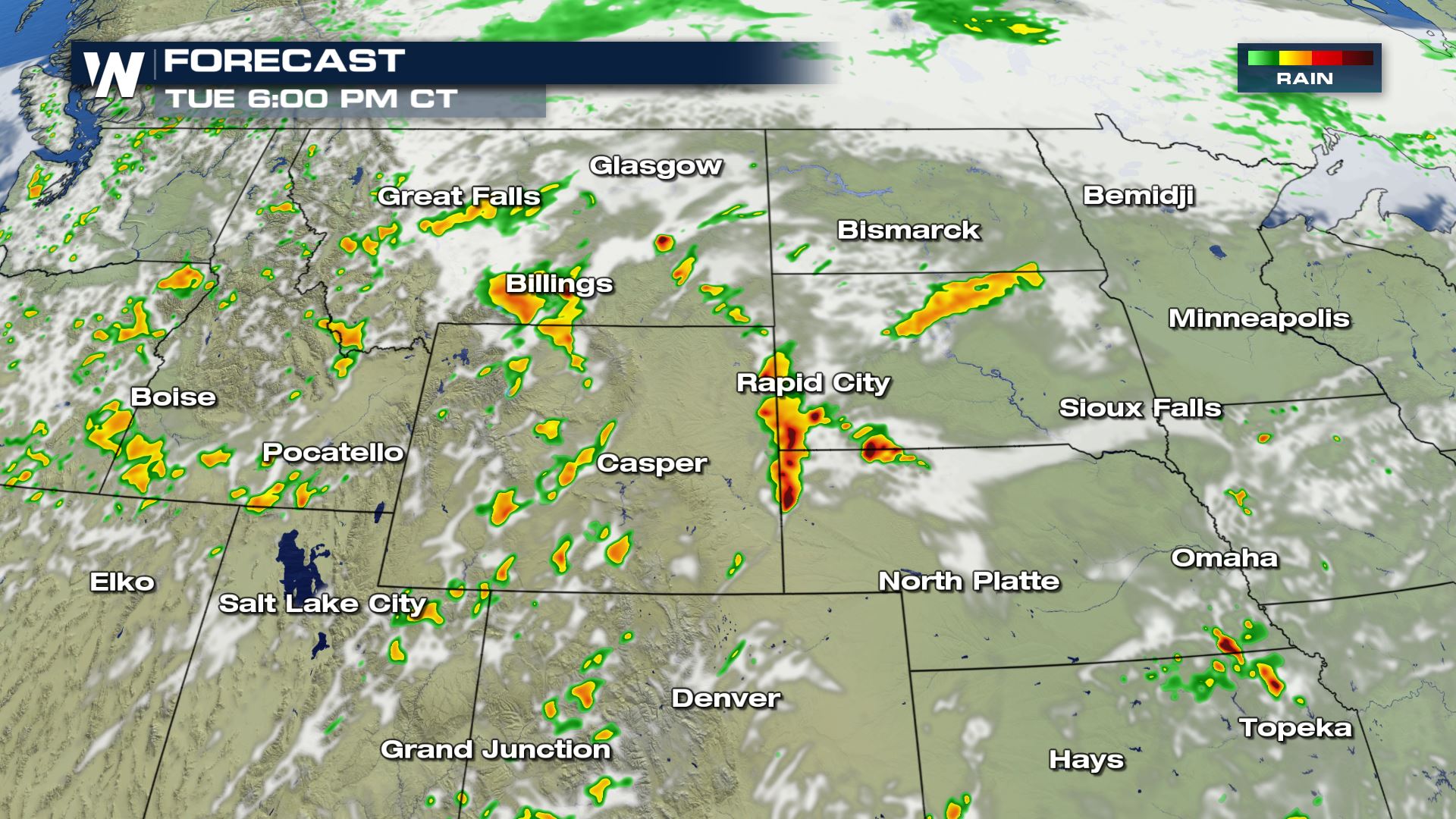
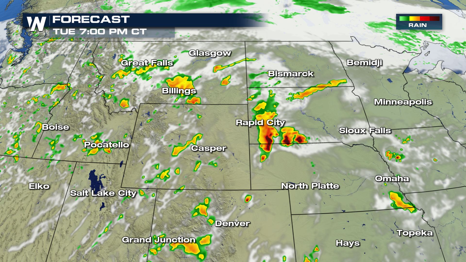
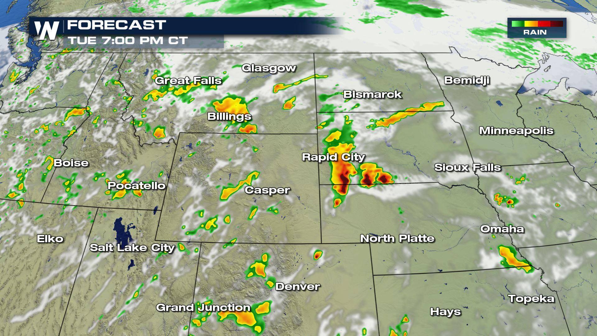
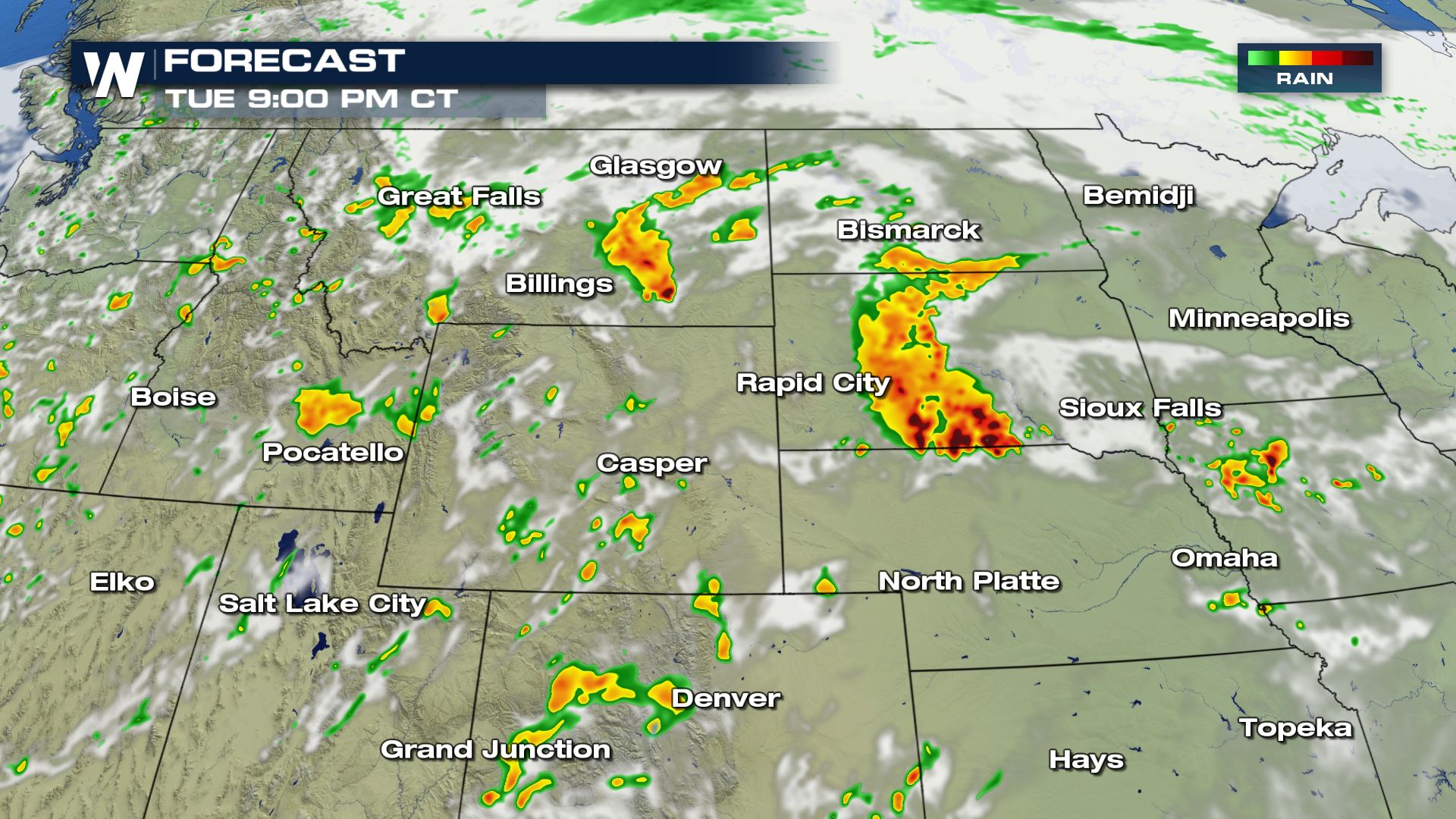 The timing of the storms today will be during the afternoon and evening. These storms will have strong upper-level winds to keep them going well past sunset and into the early morning hours of Wednesday.
Keep checking with WeatherNation throughout the day for more updates on today's severe weather chances.
___________________________________________________________________________
The timing of the storms today will be during the afternoon and evening. These storms will have strong upper-level winds to keep them going well past sunset and into the early morning hours of Wednesday.
Keep checking with WeatherNation throughout the day for more updates on today's severe weather chances.
___________________________________________________________________________
Severe Outlook
Scattered to numerous storms are possible today across the High Plains for this afternoon and evening. All modes of severe weather are in the forecast so you will need to be weather aware in these areas today.
Here is the definition of an Enhanced Risk of severe weather.
Severe Risks
Hail stones between 1 and 2 inches will be possible, along with damaging winds over 70 mph. You want to secure and protect any outdoor items in these areas as damage will be likely.
Forecast
The timing of the storms today will be during the afternoon and evening. These storms will have strong upper-level winds to keep them going well past sunset and into the early morning hours of Wednesday.
Keep checking with WeatherNation throughout the day for more updates on today's severe weather chances.
___________________________________________________________________________
All Weather News
More
Flooding, Severe Storms Target the Midwest Again
After an active week of storms across the nor
31 Jul 2026 4:15 PM


After Reaching Category 5, Genevieve Weakens in the Pacific
PacificFausto is now a post-tropical cyclone.
31 Jul 2026 1:30 AM

Flooding Risk Increases as Heavy Rain Targets the Tri-State Area
Tuesday, heavy rainfall moved across the Nort
30 Jul 2026 12:25 AM

Severe Weather: Energy From the Midwest Now in the Southeast
UPPER MIDWEST - Through Monday, dangerous tor
29 Jul 2026 10:30 PM