Severe Storms for the Northern Plains and Great Lakes into Wednesday
Special Stories
8 Jul 2019 4:24 PM
The risk for severe thunderstorms expands into the Upper Midwest and Northern Plains on Tuesday as a storm system slides slowly to the southeast. There is a slight risk for large hail, damaging wind, and isolated tornadoes from the Black Hills of South Dakota into Northern Nebraska. A marginal risk covers most of the rest of the region.
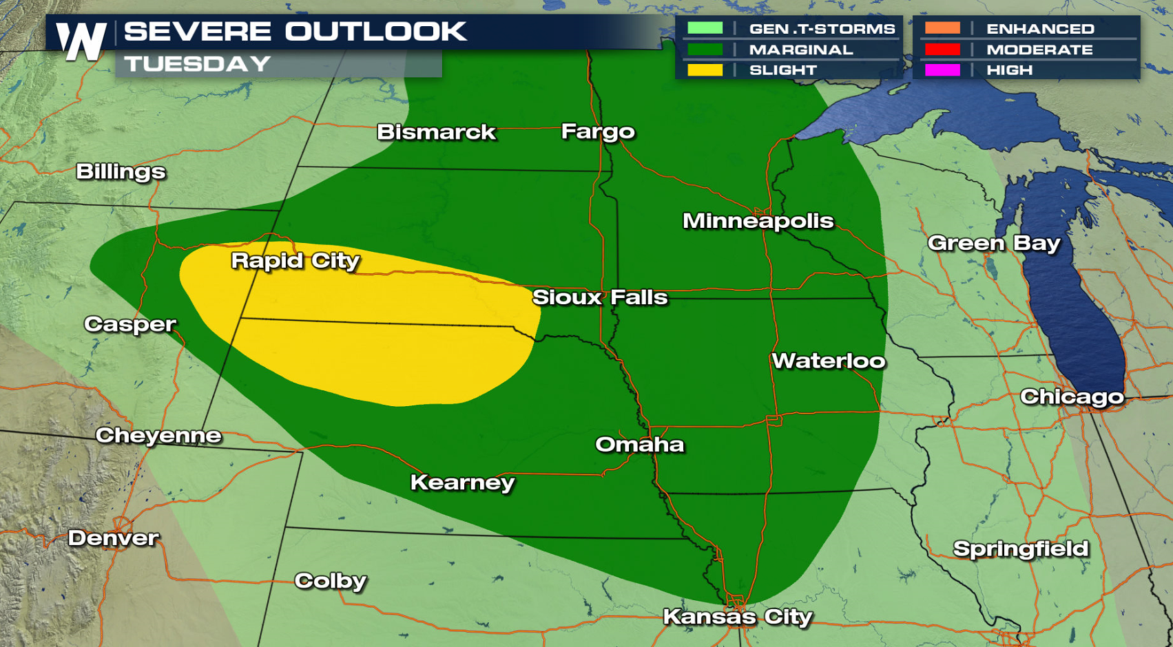
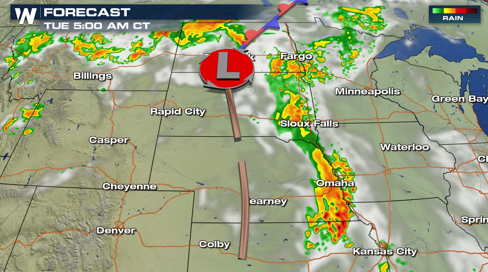
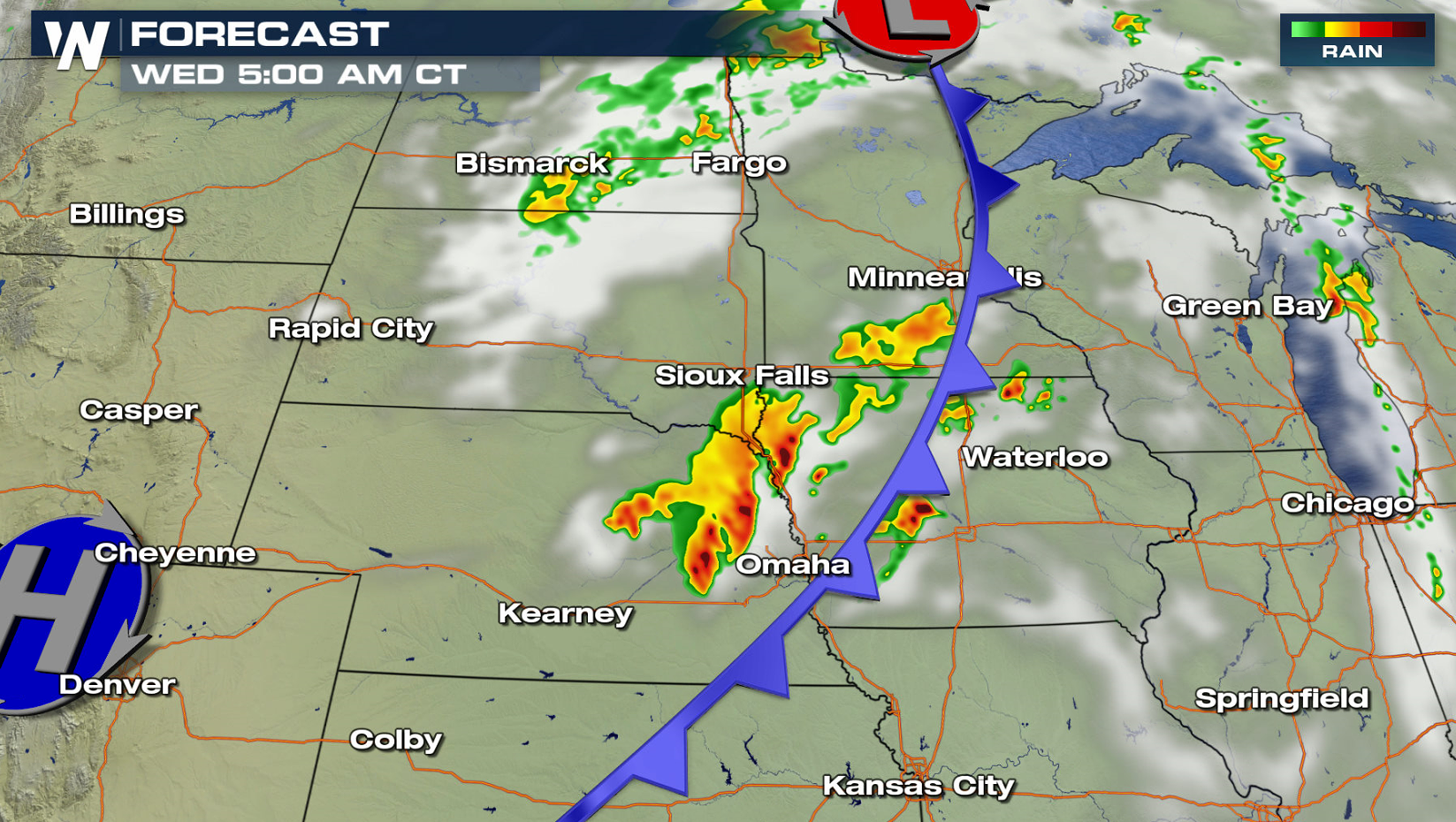
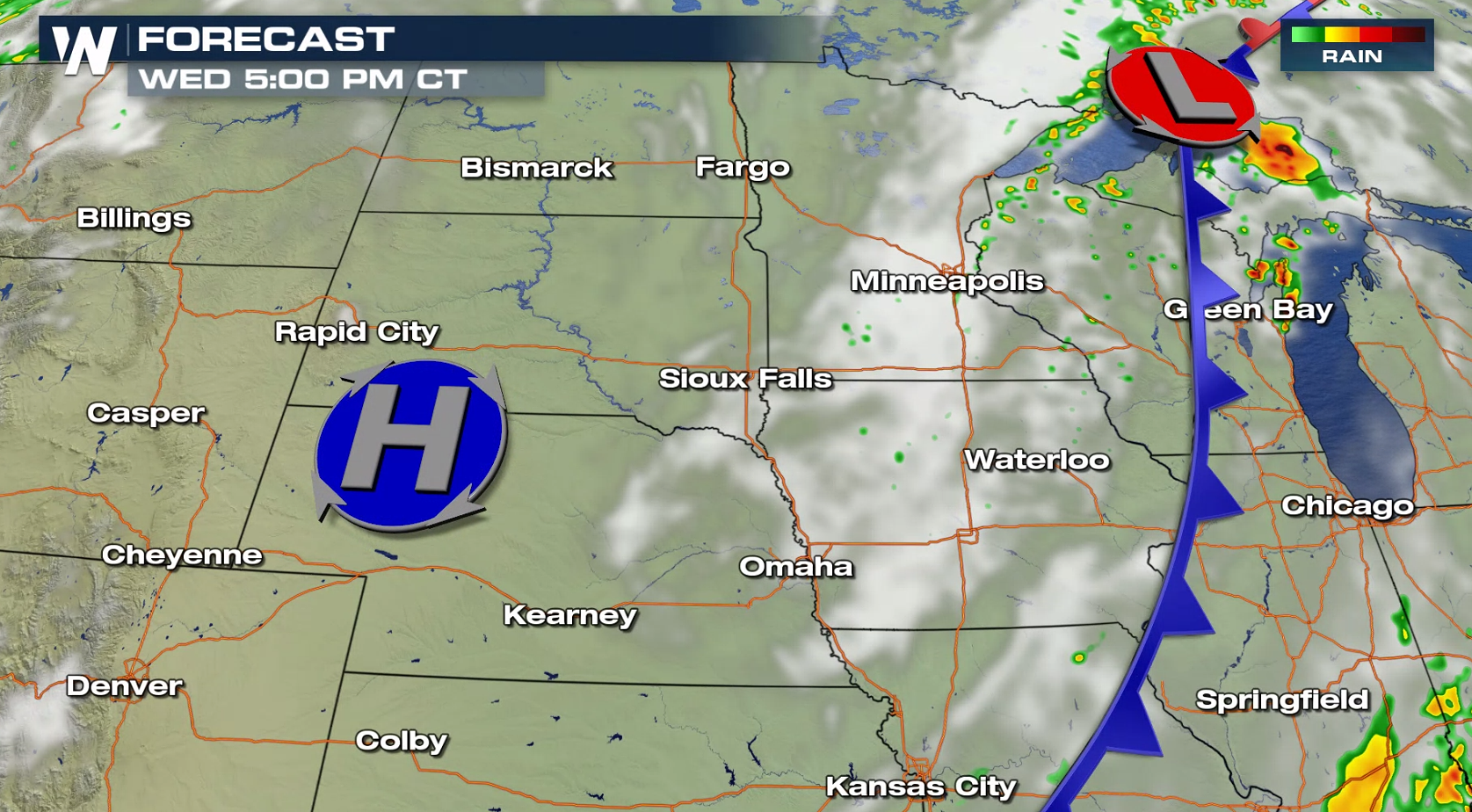
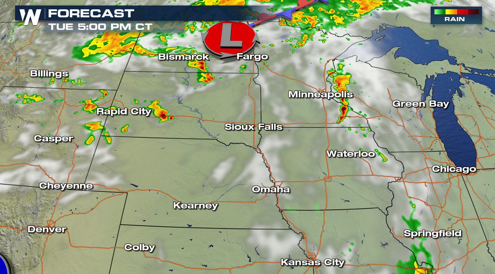 A low pressure center moving through North Dakota will fire a first round of shower and storms in the early morning hours. Strong wind gusts are possible with this wave of storms as it races eastward through the Dakotas. A second round will fire in the later afternoon and evening in the Black Hills and along the Missouri River. Large hail, damaging winds, and isolated tornadoes will all be possible.
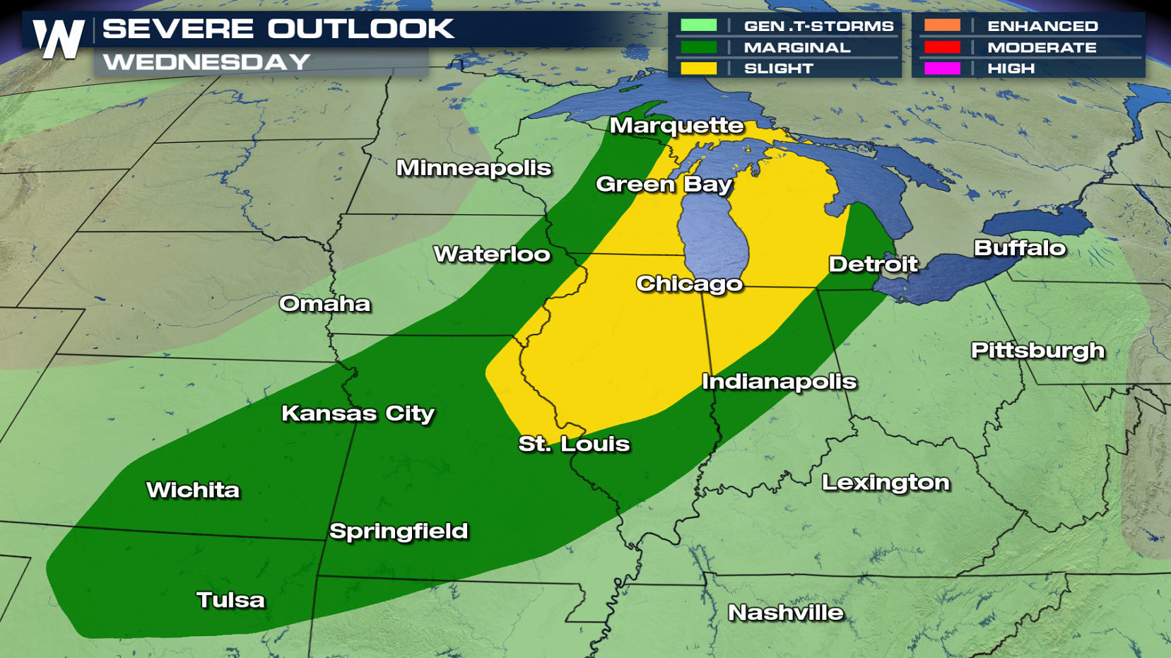
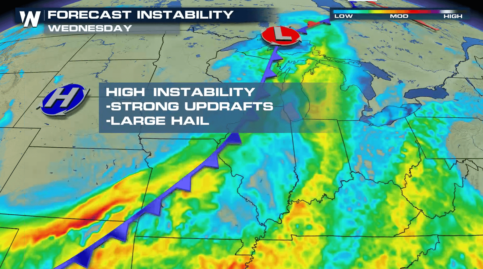
 As a cold front pushes to the east on Wednesday, more severe thunderstorms will be possible in the Great Lakes. A slight risk for severe weather has been outlined from the Storm Prediction Center from Lake Superior to St. Louis.
For WeatherNation: Meteorologist Mace Michaels
As a cold front pushes to the east on Wednesday, more severe thunderstorms will be possible in the Great Lakes. A slight risk for severe weather has been outlined from the Storm Prediction Center from Lake Superior to St. Louis.
For WeatherNation: Meteorologist Mace Michaels
A low pressure center moving through North Dakota will fire a first round of shower and storms in the early morning hours. Strong wind gusts are possible with this wave of storms as it races eastward through the Dakotas. A second round will fire in the later afternoon and evening in the Black Hills and along the Missouri River. Large hail, damaging winds, and isolated tornadoes will all be possible.
As a cold front pushes to the east on Wednesday, more severe thunderstorms will be possible in the Great Lakes. A slight risk for severe weather has been outlined from the Storm Prediction Center from Lake Superior to St. Louis.
For WeatherNation: Meteorologist Mace MichaelsAll Weather News
More
Wildfire Outbreak in the Pacific Northwest
SPOKANE, WA - On Saturday, August 1st, the Ol
3 Aug 2026 1:55 AM

More Storms for the East Through Monday
A low-pressure system that moved through the
3 Aug 2026 1:50 AM


After Reaching Category 5, Genevieve Weakens in the Pacific
PacificGenevieve formed last Friday south of
3 Aug 2026 12:30 AM

Flooding, Severe Storms Target the Midwest Again
After an active week of storms across the nor
1 Aug 2026 1:40 AM

Flooding Risk Increases as Heavy Rain Targets the Tri-State Area
Tuesday, heavy rainfall moved across the Nort
30 Jul 2026 12:25 AM

Severe Weather: Energy From the Midwest Now in the Southeast
UPPER MIDWEST - Through Monday, dangerous tor
29 Jul 2026 10:30 PM