Severe Storms & Heavy Rain for the East Coast Today
Top Stories
7 Apr 2022 9:02 PM
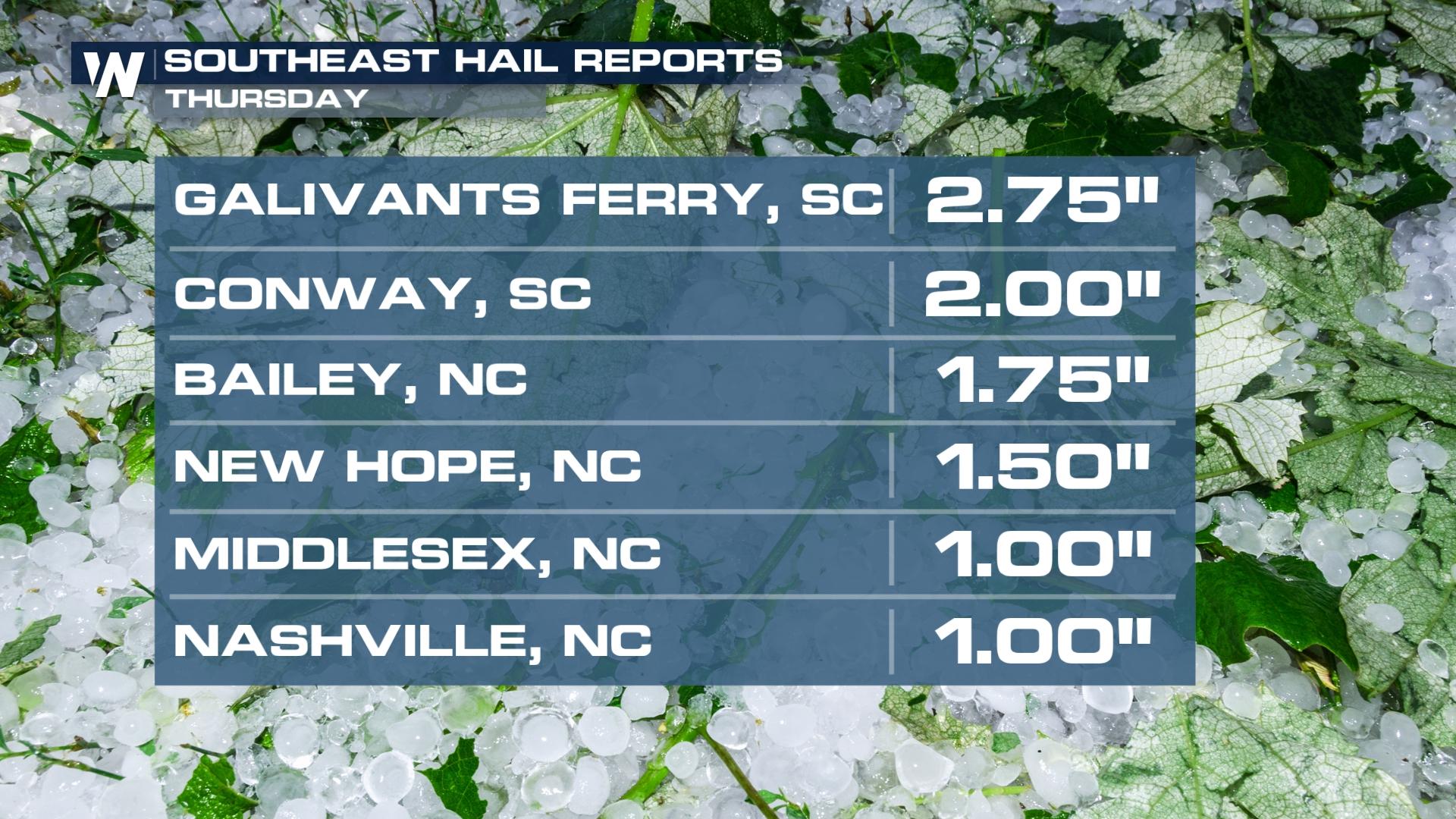
The risk for severe weather has concluded for Thursday night. Today's storms did produce some very large hailstones in the Carolinas. The largest hail stone was golf balls.
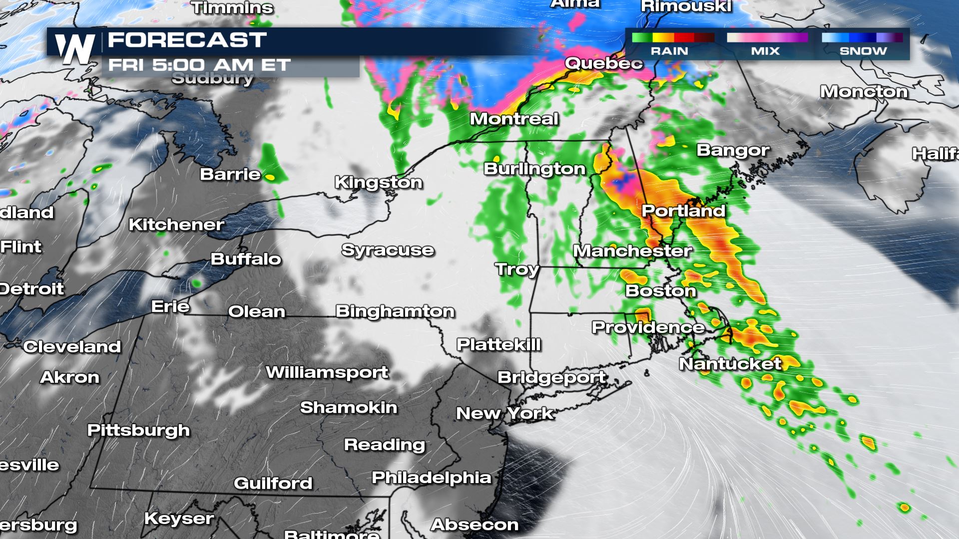
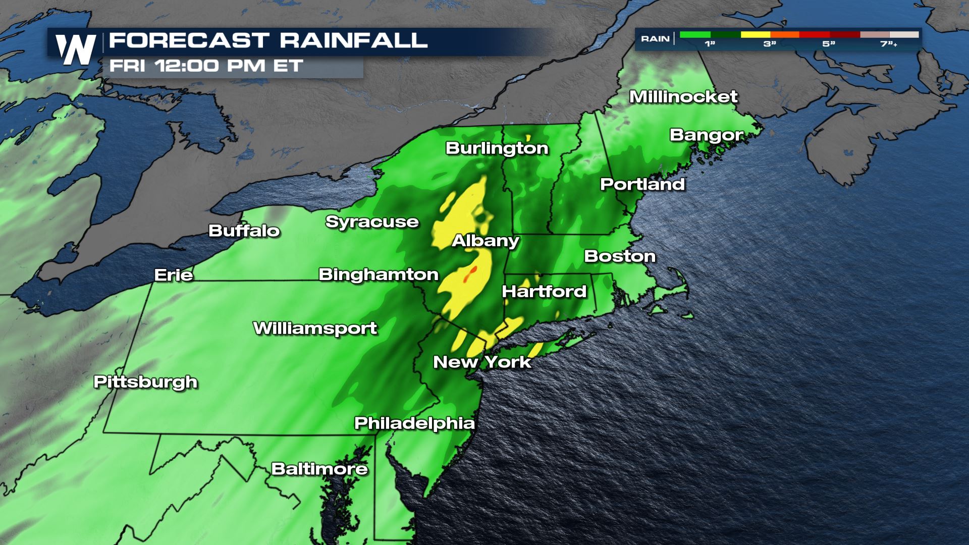
 We will be waking up to steady rain through New England on Friday morning, with some high elevation spring snowfall! Showers and storms move through from southwest to northeast, wrapping up by midday.
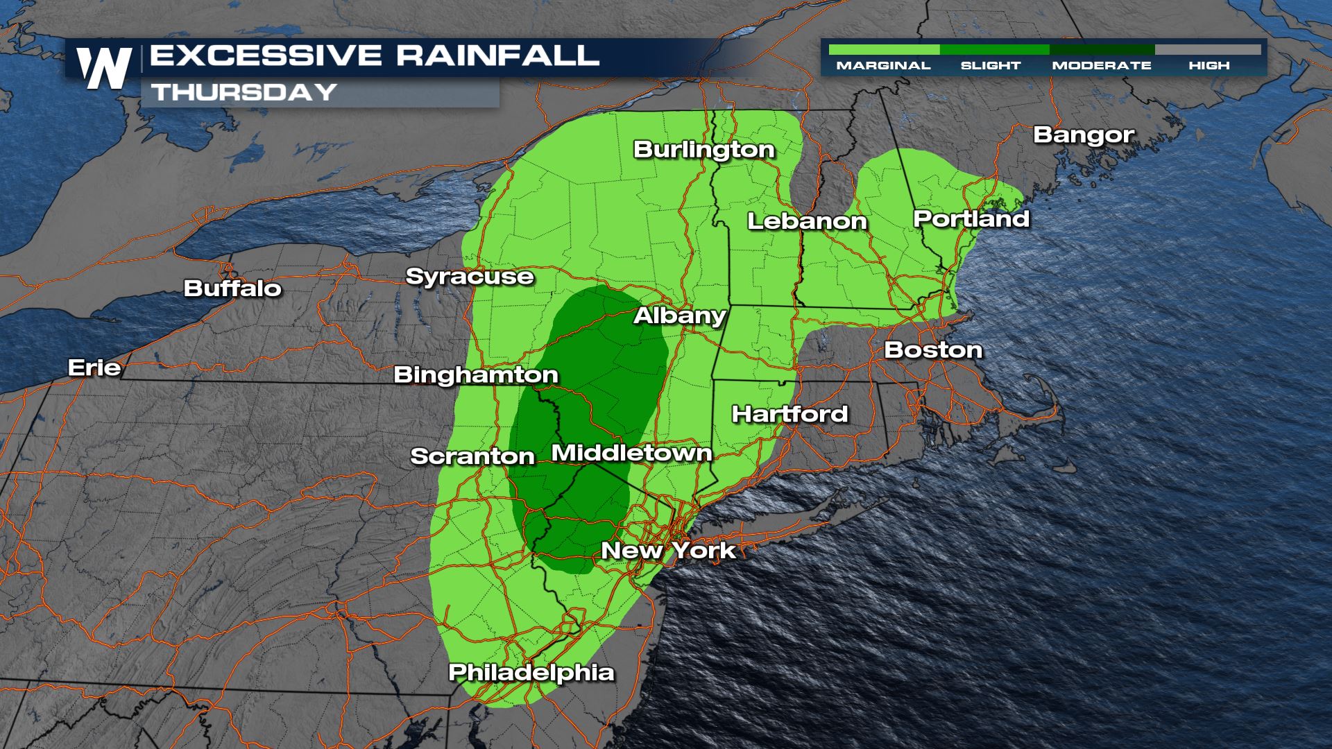
 The Weather Prediction Center (WPC) has issued a marginal and slight risk for excessive rainfall in these areas, meaning isolated flooding will be possible.
 Our forecast models are hinting at 1-3" of rainfall possible, especially through the Hudson River Valley.
 With another round of severe weather anticipated, stay with WeatherNation for the latest. We will be streaming 24/7 with the most up to date forecast information to keep you safe!
Timing
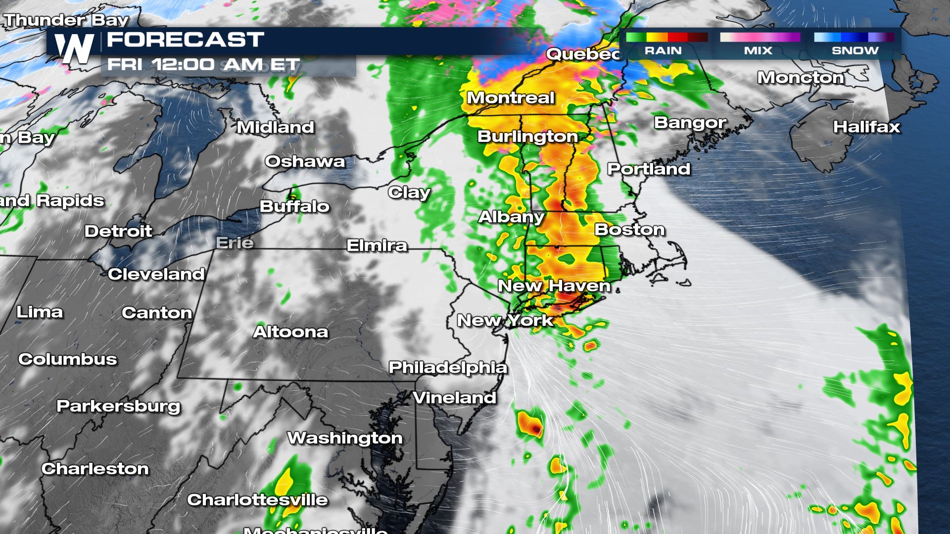
Storms move offshore from the Mid-Atlantic shortly after sundown, with drier and cooler air back behind the storm system. Meanwhile, heavy rain will impact the northeast through the evening and overnight hours.
We will be waking up to steady rain through New England on Friday morning, with some high elevation spring snowfall! Showers and storms move through from southwest to northeast, wrapping up by midday.
Rainfall
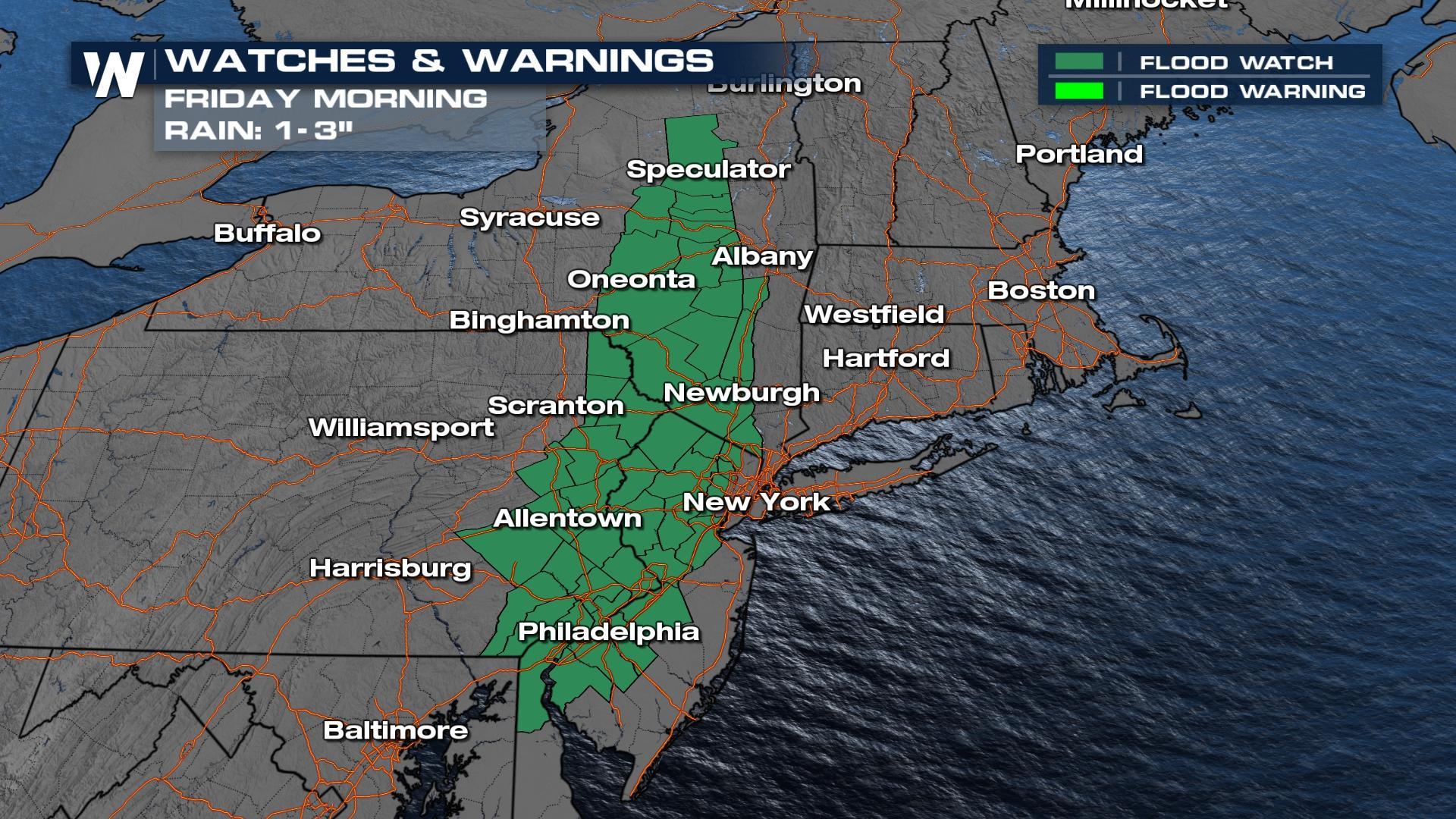
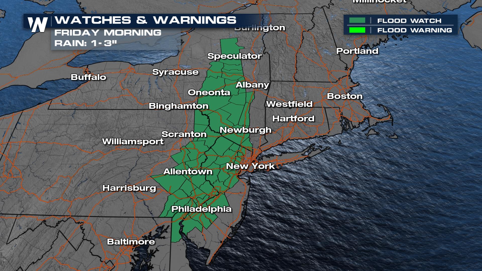
The heaviest rainfall is anticipated in New York and New England through the evening and overnight Thursday. A flood watch has been issued in New York and Pennsylvania for 1-3" of rainfall to create flooding concerns. This will mean rivers, creeks and streams will be running high.
The Weather Prediction Center (WPC) has issued a marginal and slight risk for excessive rainfall in these areas, meaning isolated flooding will be possible.
Our forecast models are hinting at 1-3" of rainfall possible, especially through the Hudson River Valley.
With another round of severe weather anticipated, stay with WeatherNation for the latest. We will be streaming 24/7 with the most up to date forecast information to keep you safe!All Weather News
More
Wildfire Outbreak in the Pacific Northwest
Conditions have been incredibly dry out west.
2 Aug 2026 12:20 PM


More Storms for the East Sunday and Monday
A low-pressure system crashing through the Mi
2 Aug 2026 2:20 AM

After Reaching Category 5, Genevieve Weakens in the Pacific
PacificGenevieve formed on last Friday south
2 Aug 2026 1:30 AM

Flooding, Severe Storms Target the Midwest Again
After an active week of storms across the nor
1 Aug 2026 1:40 AM

Flooding Risk Increases as Heavy Rain Targets the Tri-State Area
Tuesday, heavy rainfall moved across the Nort
30 Jul 2026 12:25 AM

Severe Weather: Energy From the Midwest Now in the Southeast
UPPER MIDWEST - Through Monday, dangerous tor
29 Jul 2026 10:30 PM