Severe Storms Likely Across The Upper Midwest Wednesday
Top Stories
3 Oct 2018 4:54 AM
Increasing severe weather chances today for parts of the Upper Mississippi Valley and Northern Michigan. All modes of severe weather will be in play today, including the potential for scattered tornadoes. Here is the very latest!
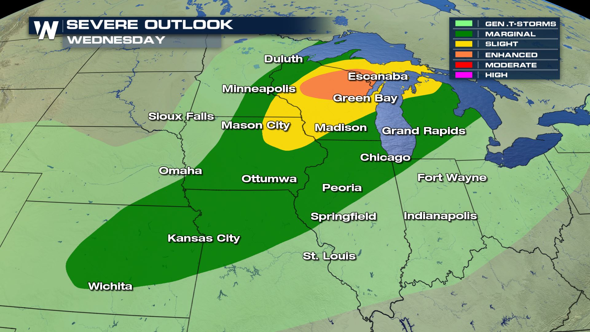 An enhanced risk of severe weather has been issued for parts of Wisconsin and the UP of Michigan. This means numerous severe storms will be possible. The slight risk (meaning scattered severe storms) extends through most of Wisconsin and down into Iowa.
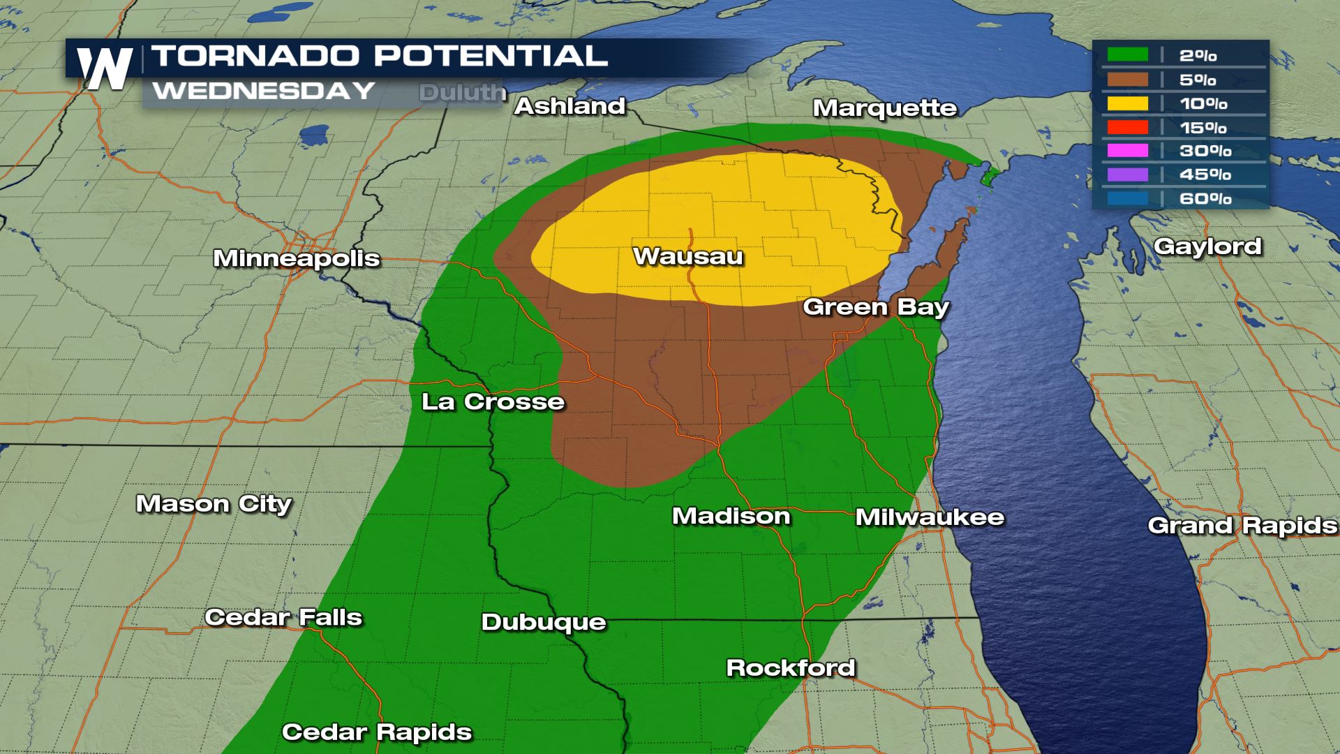
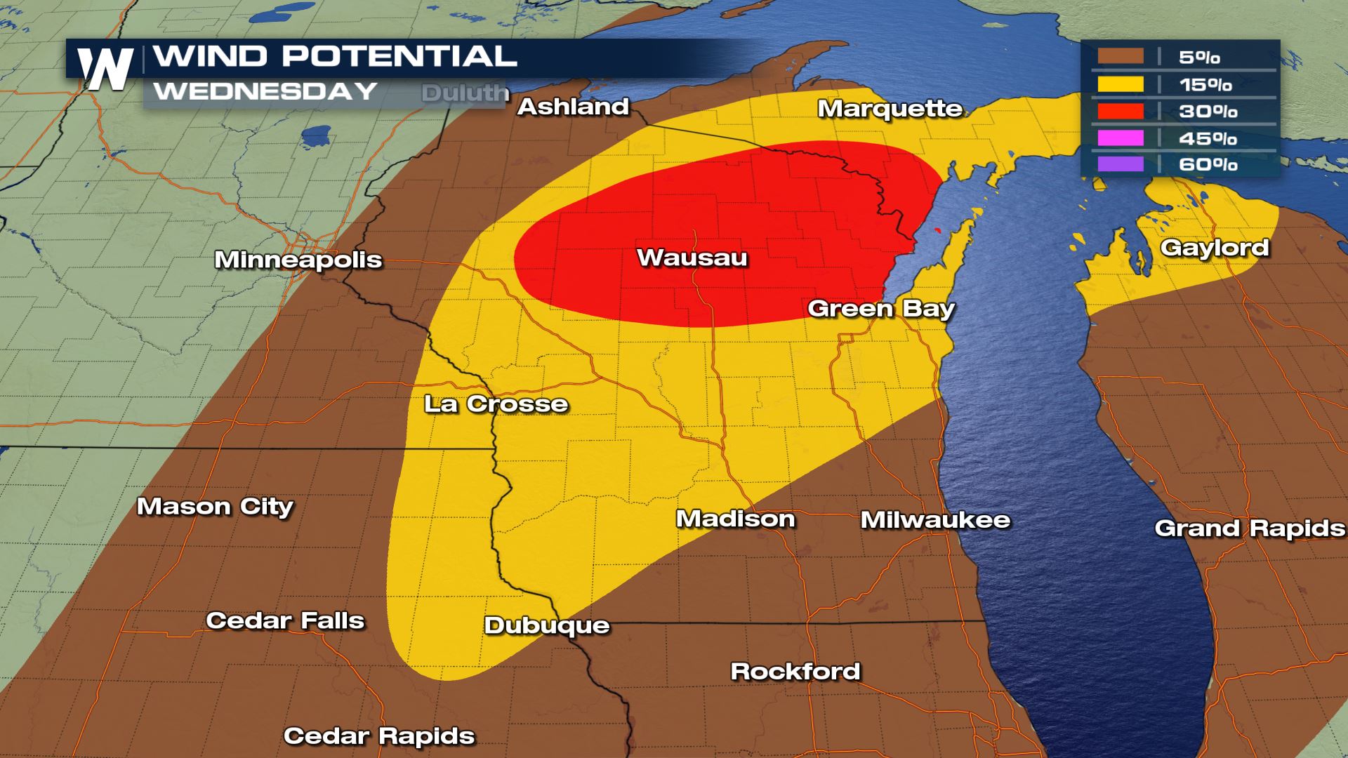
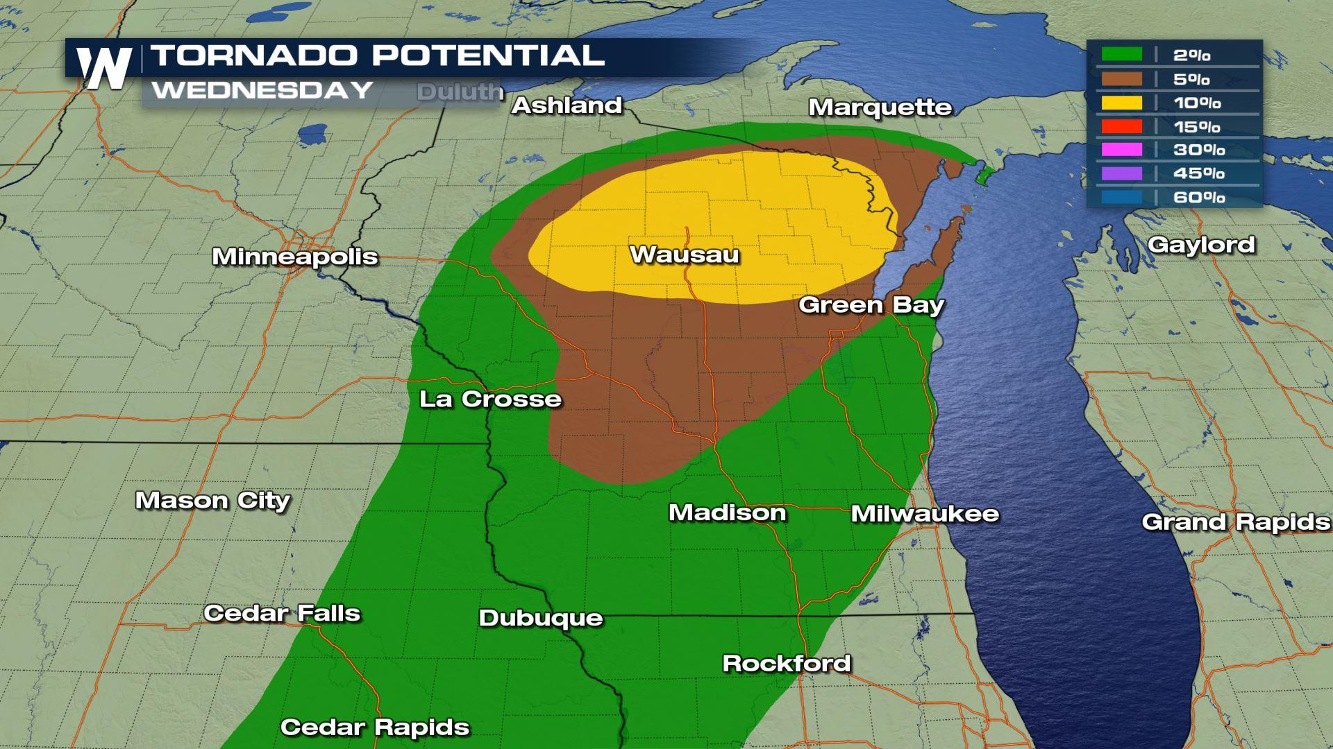
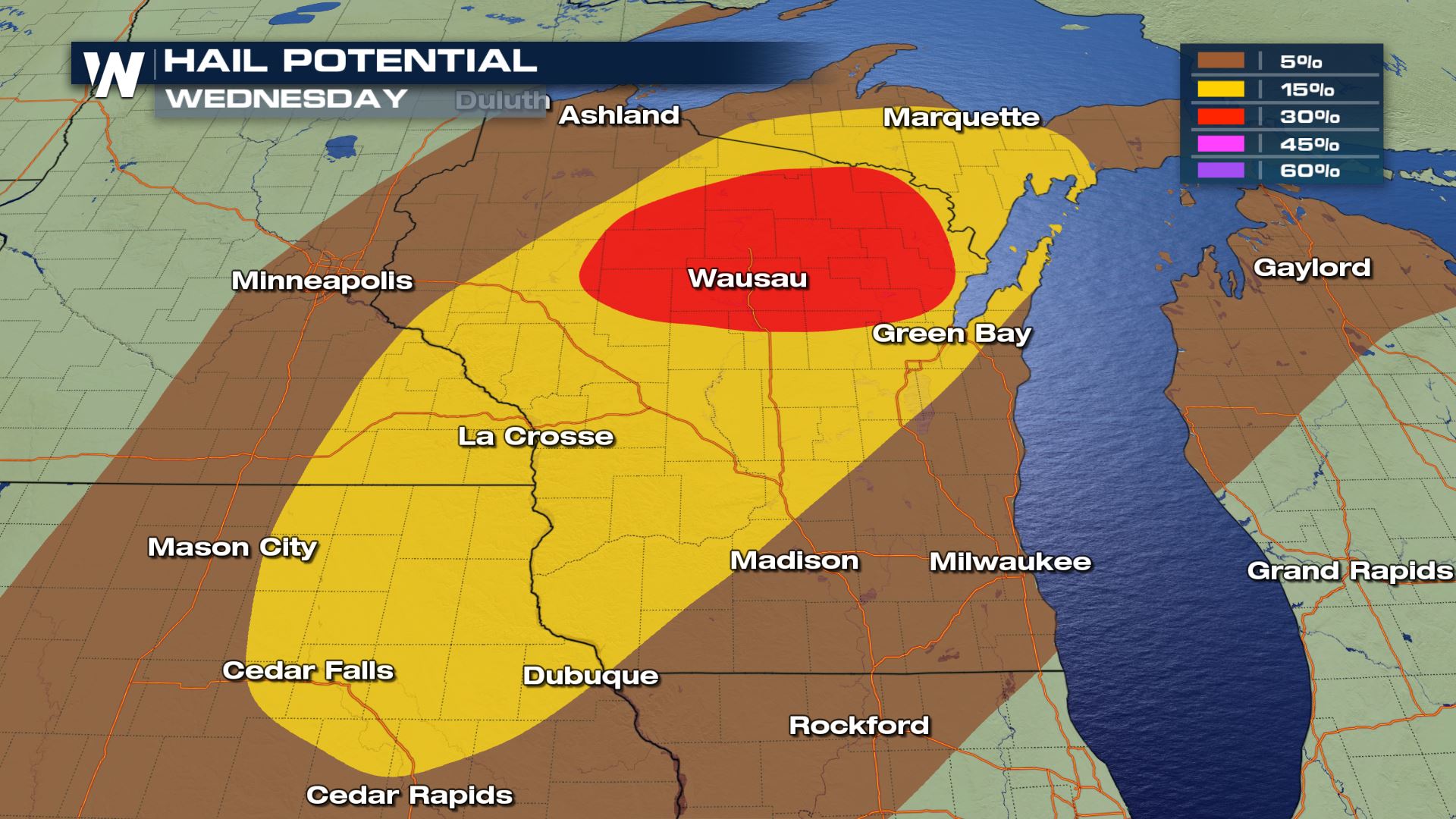 Here is a look at all the severe weather risks for the region. Central and Northern Wisconsin will have the highest chance of large hail (possibly great than 2" in diameter), damaging winds (in excess of 70 mph) and tornadoes. Keep in mind that heavy rain will also be associated with these storms and that could lead to areas of flash flooding.
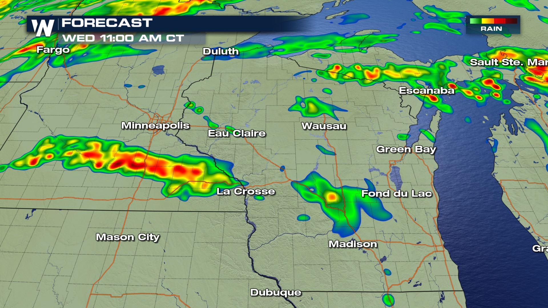
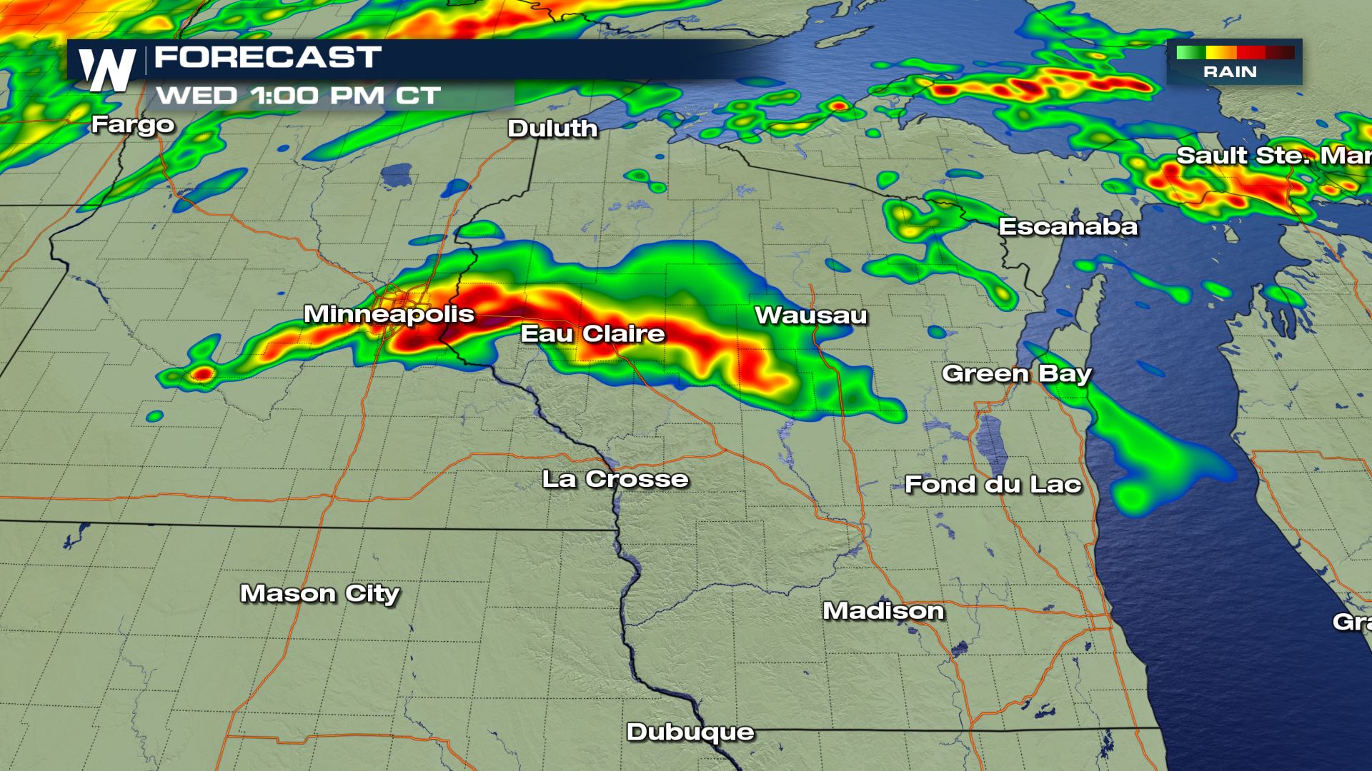
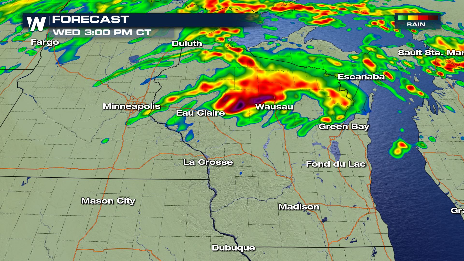
 The timing for today's severe storms will be for the afternoon and evening. Don't forget...you can stream WeatherNation anytime with many different options. You can head to our website to see how you can stream WeatherNation...or you can click on this LINK
Severe Outlook
An enhanced risk of severe weather has been issued for parts of Wisconsin and the UP of Michigan. This means numerous severe storms will be possible. The slight risk (meaning scattered severe storms) extends through most of Wisconsin and down into Iowa.
Severe Risks
Here is a look at all the severe weather risks for the region. Central and Northern Wisconsin will have the highest chance of large hail (possibly great than 2" in diameter), damaging winds (in excess of 70 mph) and tornadoes. Keep in mind that heavy rain will also be associated with these storms and that could lead to areas of flash flooding.
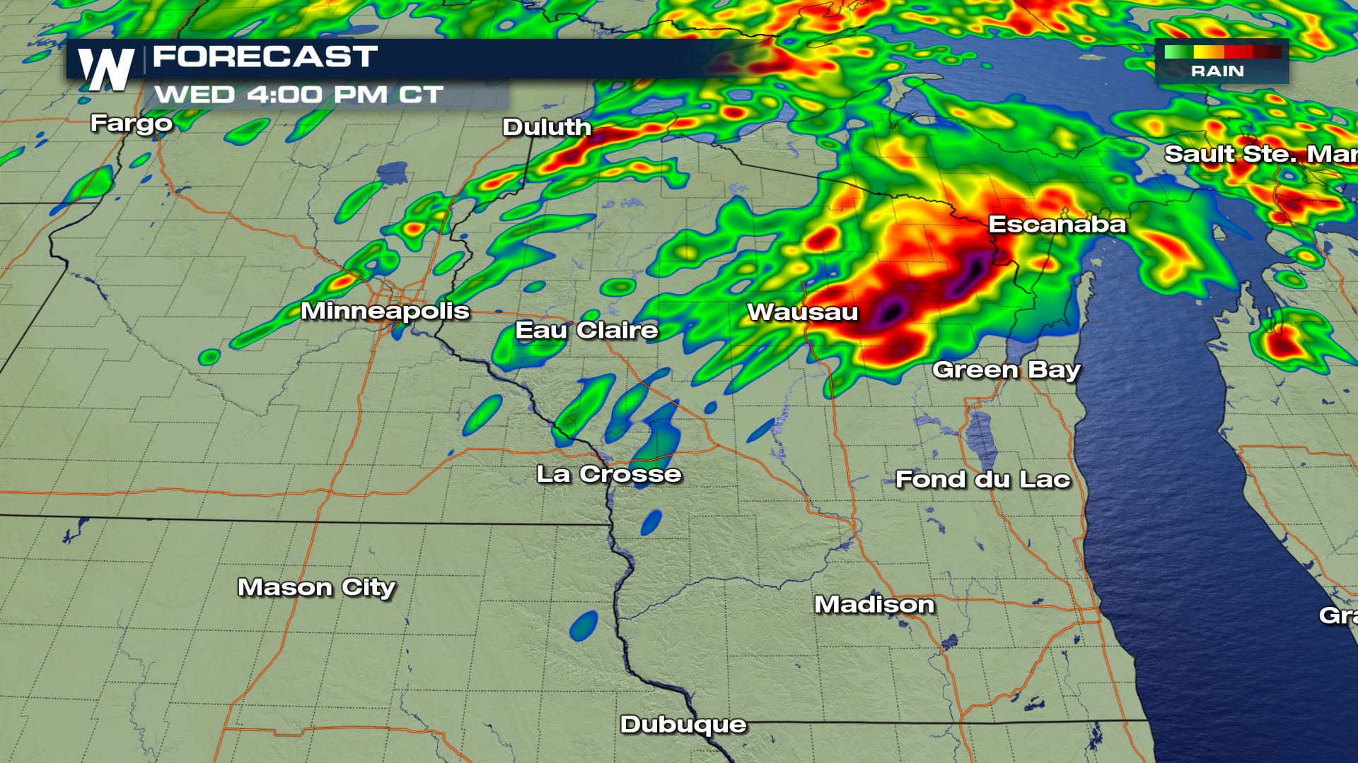
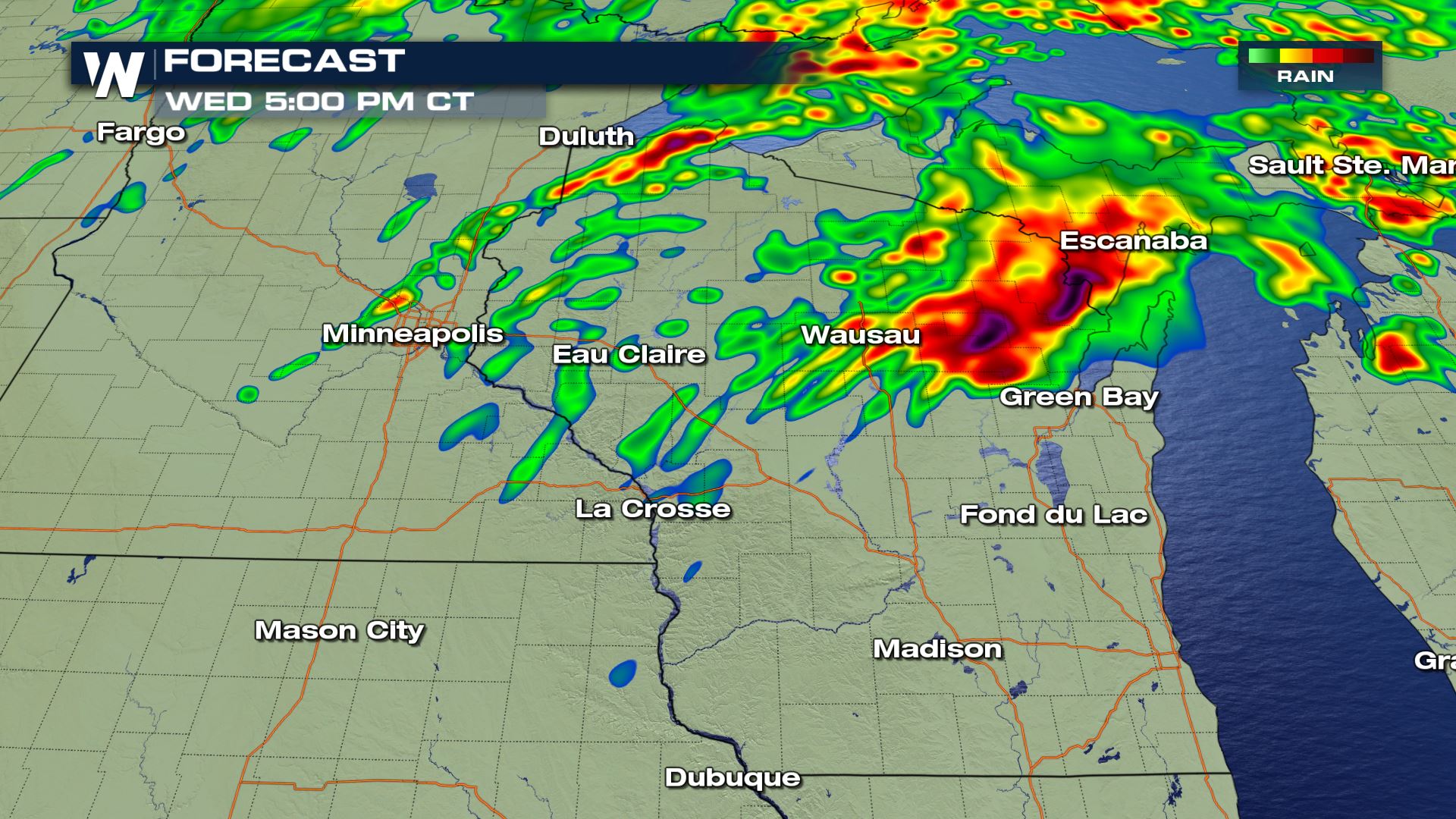
Forecast
The timing for today's severe storms will be for the afternoon and evening. Don't forget...you can stream WeatherNation anytime with many different options. You can head to our website to see how you can stream WeatherNation...or you can click on this LINKAll Weather News
More
After Reaching Category 5, Genevieve Weakens in the Pacific
PacificGenevieve formed on last Friday south
2 Aug 2026 1:25 PM

More Storms for the East Sunday and Monday
A low-pressure system crashing through the Mi
2 Aug 2026 1:25 PM


Wildfire Outbreak in the Pacific Northwest
Conditions have been incredibly dry out west.
2 Aug 2026 12:20 PM

Flooding, Severe Storms Target the Midwest Again
After an active week of storms across the nor
1 Aug 2026 1:40 AM

Flooding Risk Increases as Heavy Rain Targets the Tri-State Area
Tuesday, heavy rainfall moved across the Nort
30 Jul 2026 12:25 AM

Severe Weather: Energy From the Midwest Now in the Southeast
UPPER MIDWEST - Through Monday, dangerous tor
29 Jul 2026 10:30 PM