Severe Storms Likely for the High Plains Saturday
Special Stories
14 Jul 2018 5:46 AM
A strong cold front will bring scattered severe storm chances to the High Plains Saturday afternoon. All modes of severe weather will be in play with tornadoes and damaging winds being the main weather risks.
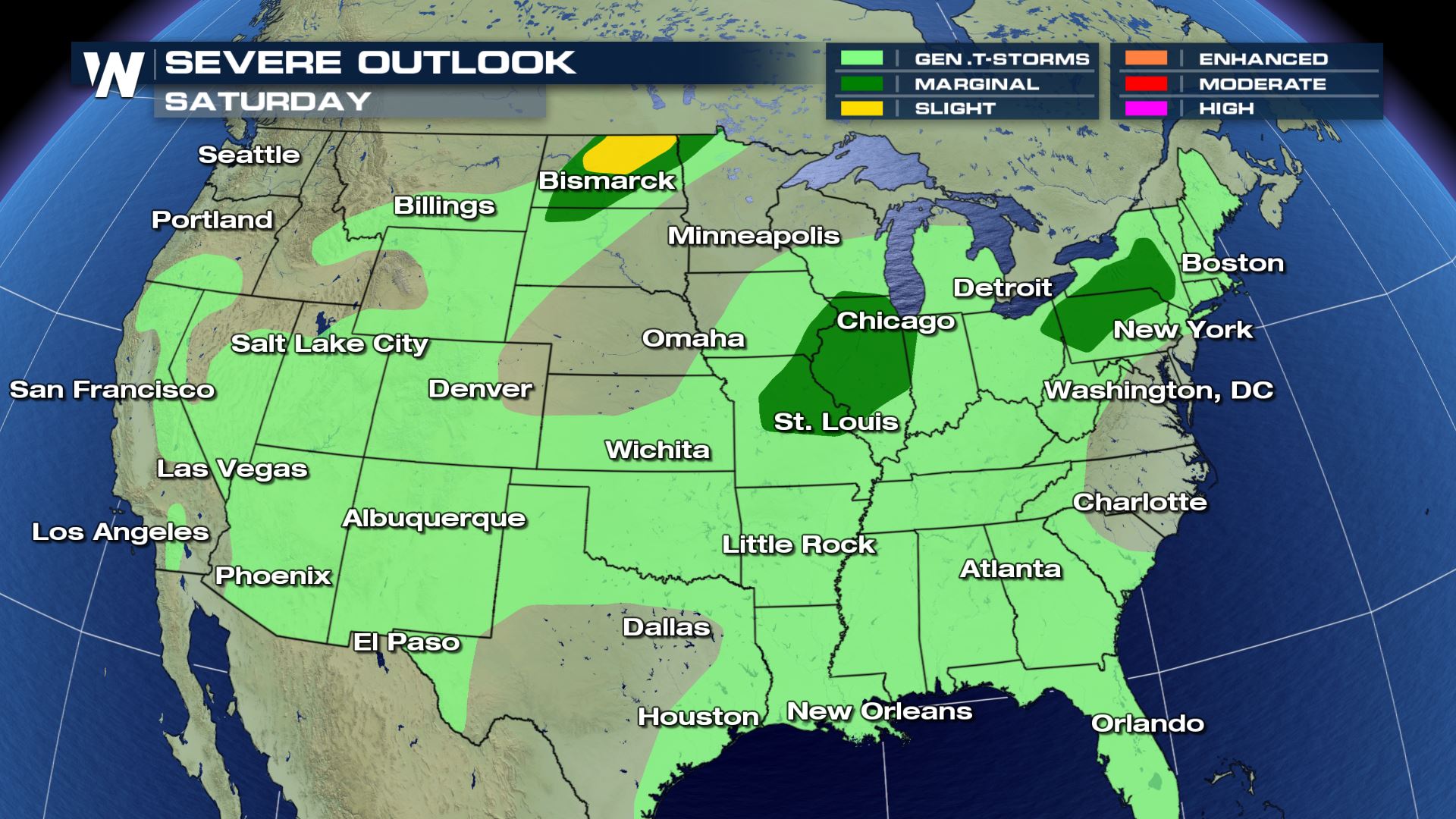
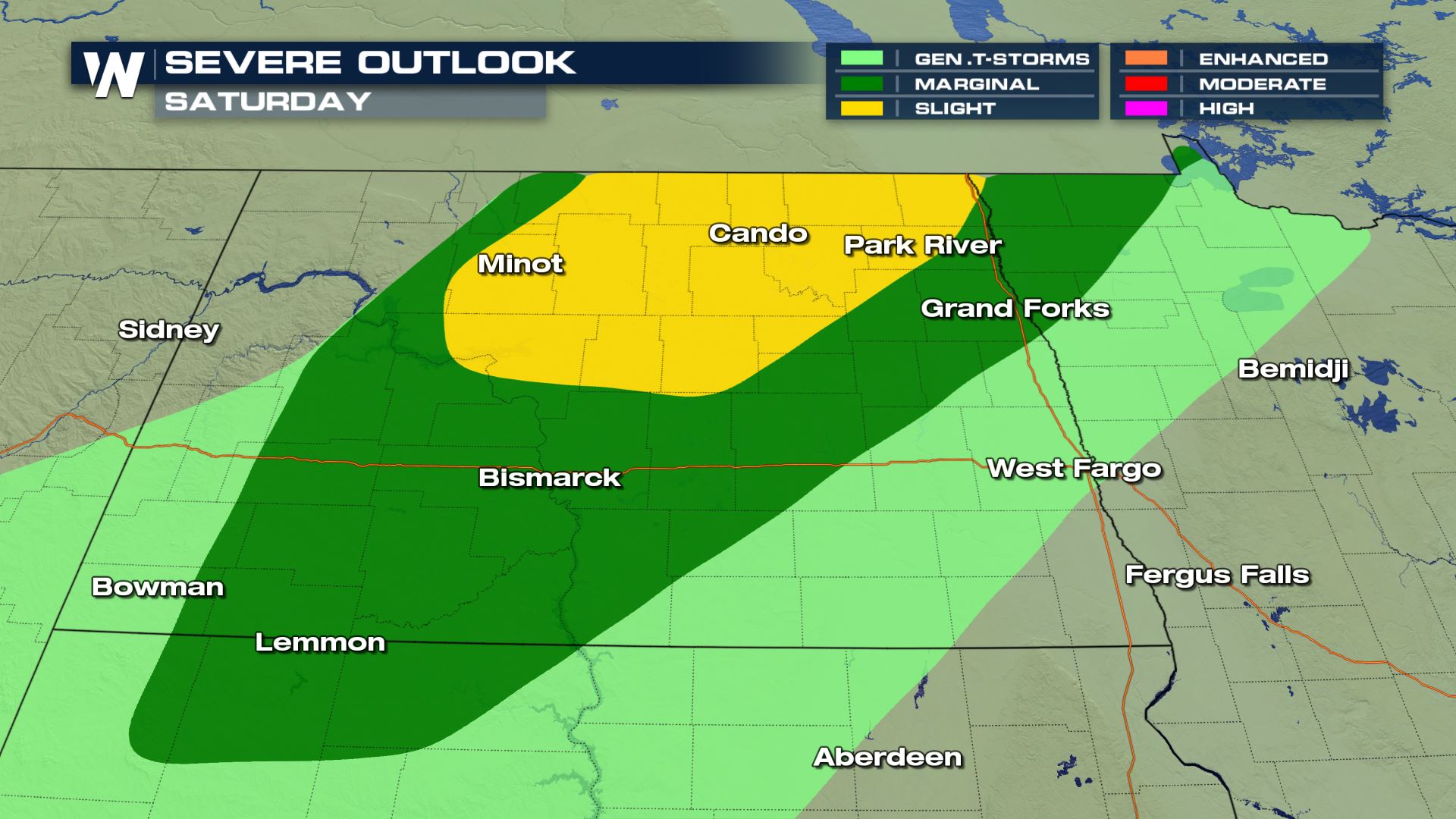 Areas that could see the most dangerous storms will be cities like Bismark, Minot and Cando of North Dakota. If you live in these areas, go ahead and start to prepare for what could be some very strong storms.
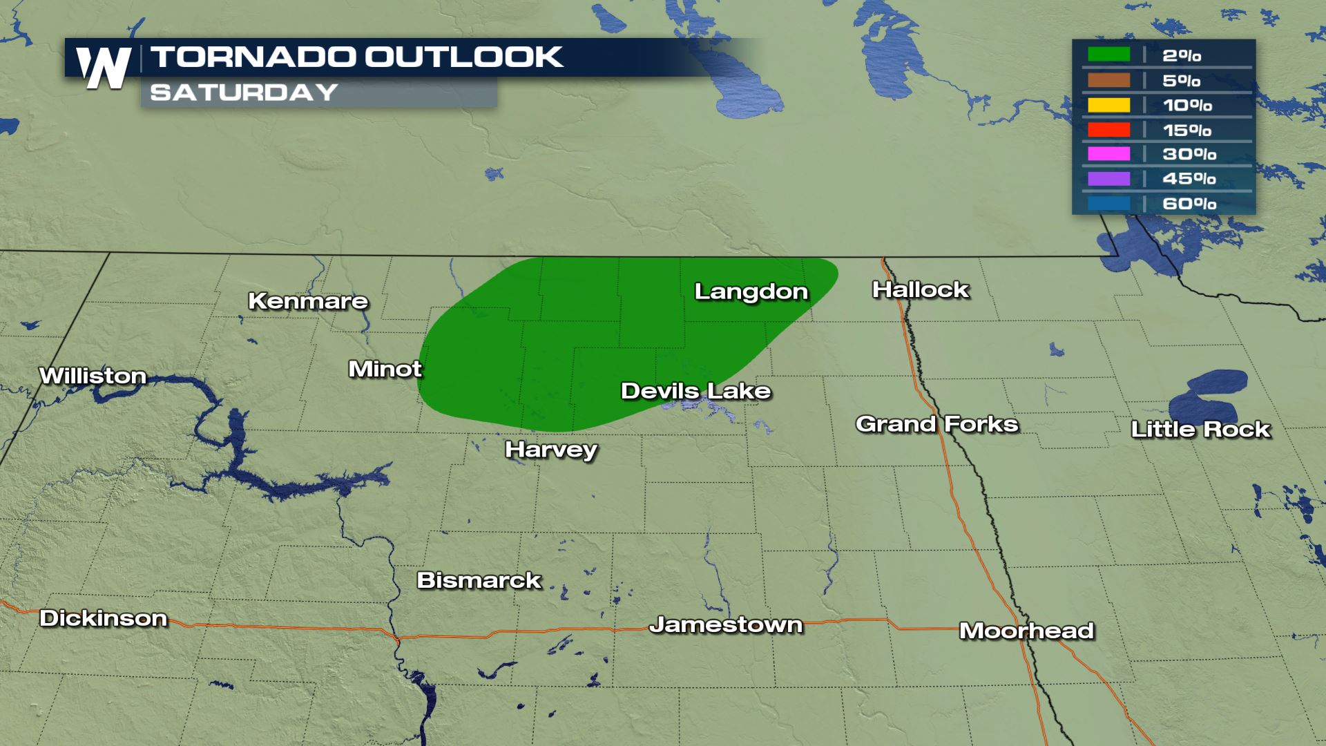
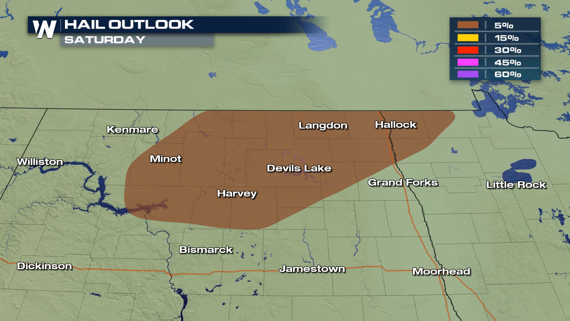
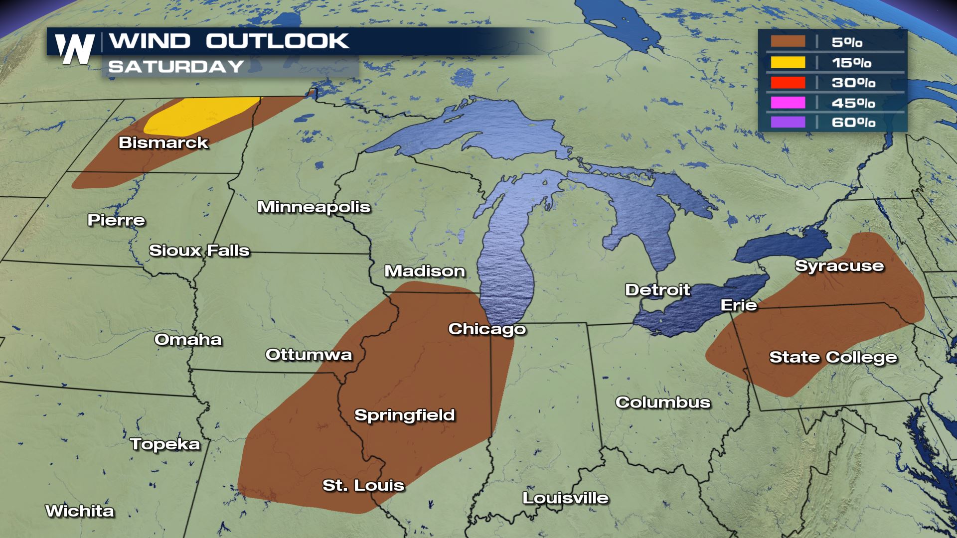 Large hail, damaging winds and tornadoes will all be possible if (or when) storms turn severe.
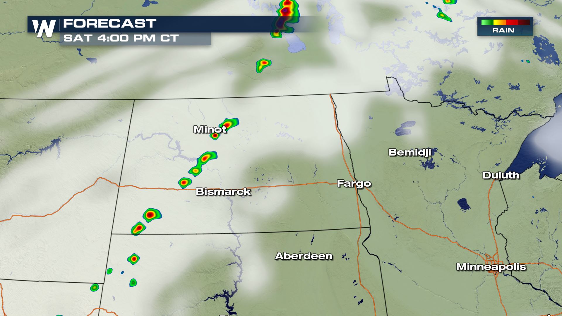

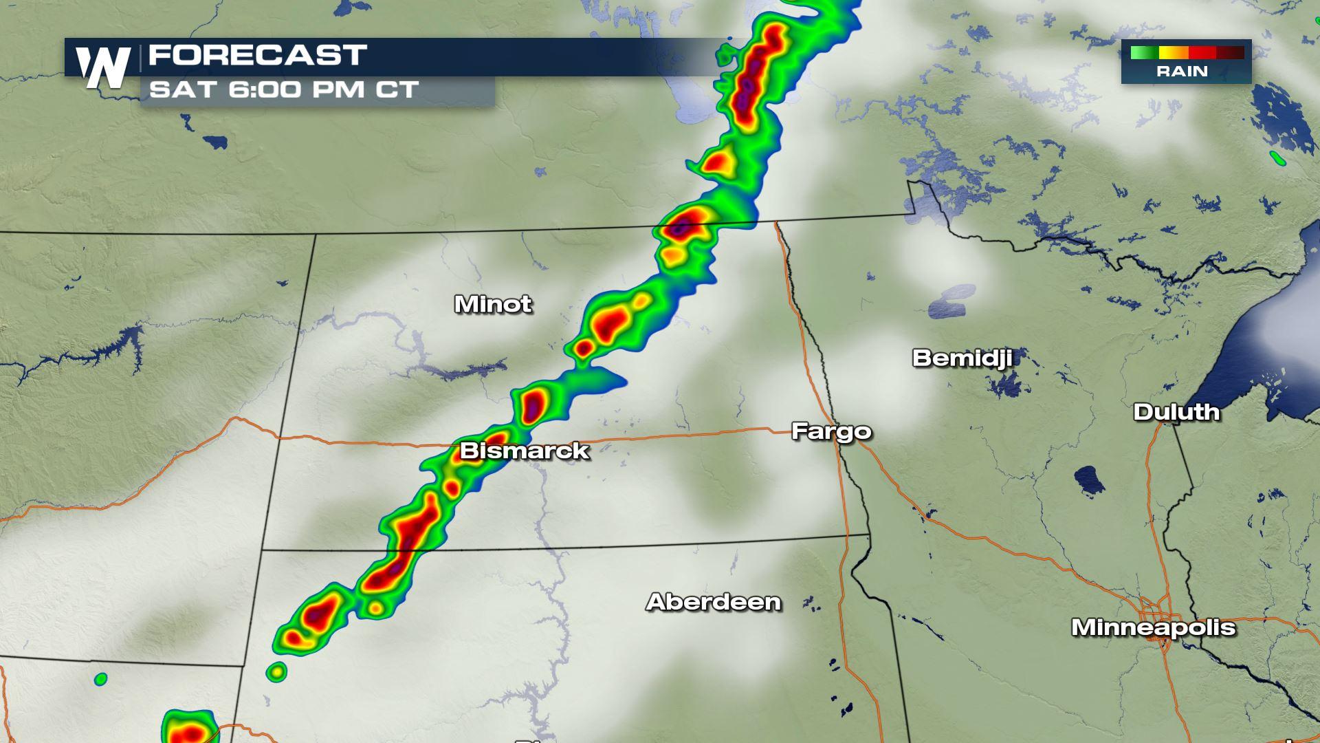
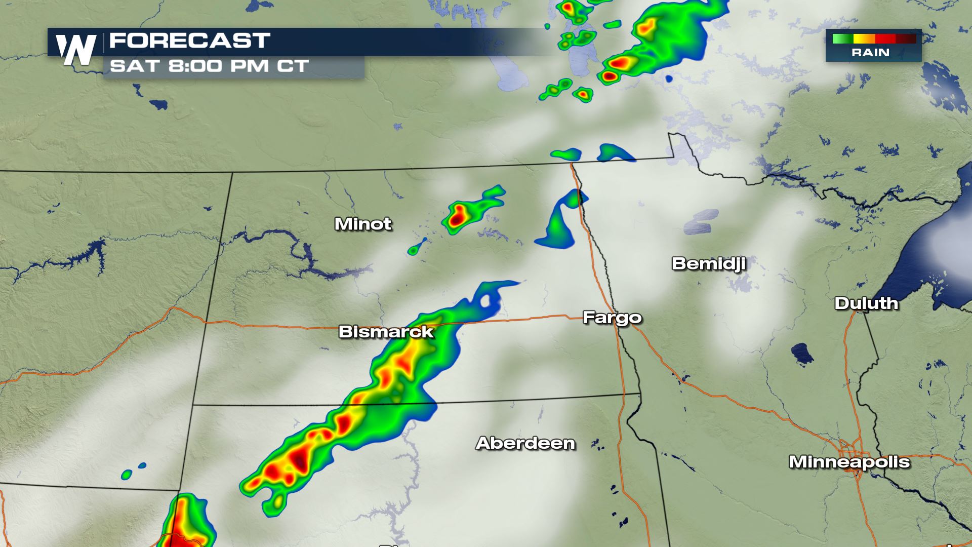 You can see the timing for today's severe storms will be during the afternoon and evening hours. The cold front could keep the storms in play through the early morning of Sunday too. Keep checking WeatherNation for the very latest updates.
Severe Outlook
Areas that could see the most dangerous storms will be cities like Bismark, Minot and Cando of North Dakota. If you live in these areas, go ahead and start to prepare for what could be some very strong storms.
Severe Risks
Large hail, damaging winds and tornadoes will all be possible if (or when) storms turn severe.
Forecast
You can see the timing for today's severe storms will be during the afternoon and evening hours. The cold front could keep the storms in play through the early morning of Sunday too. Keep checking WeatherNation for the very latest updates.All Weather News
More
Fronts Continue To Spark Severe Weather Across the Plains
A cold front that brought record lows to the
18 Jul 2025 10:40 PM

Extreme Heat Impacts for the East Coast & South
Extreme heat continues to impact several area
18 Jul 2025 10:05 PM

Flooding Threat Remains Elevated in the East
A cold front pushing through the Eastern Seab
18 Jul 2025 9:10 PM

EF-2 Firenado from the Deer Creek Fire in Utah
A fire tornado was spotted near La Sal, Utah
18 Jul 2025 7:30 AM

Tropical System Brings Flood Risk to the Central Gulf
Time has run out for notable tropical develop
18 Jul 2025 3:05 AM

Heavy Rain, Flooding Threat Returns to Florida
Keep the rain boots handy in Florida - heavy
13 Jul 2025 12:50 PM

Severe Storm Risk Pushes into the Great Lakes, Ohio Valley
Friday was another busy day with severe weath
12 Jul 2025 8:00 PM