Severe Storms Likely in the High Plains
Special Stories
10 Jul 2018 10:06 AM
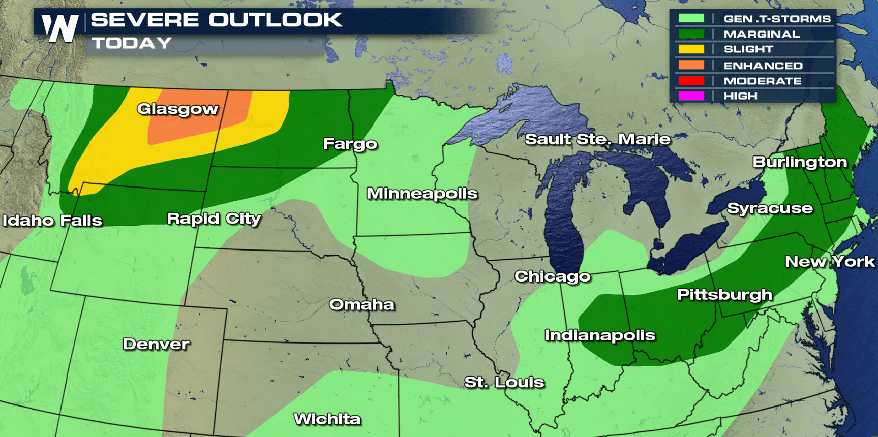
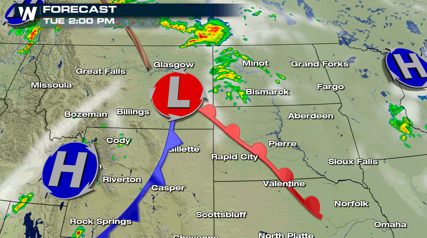
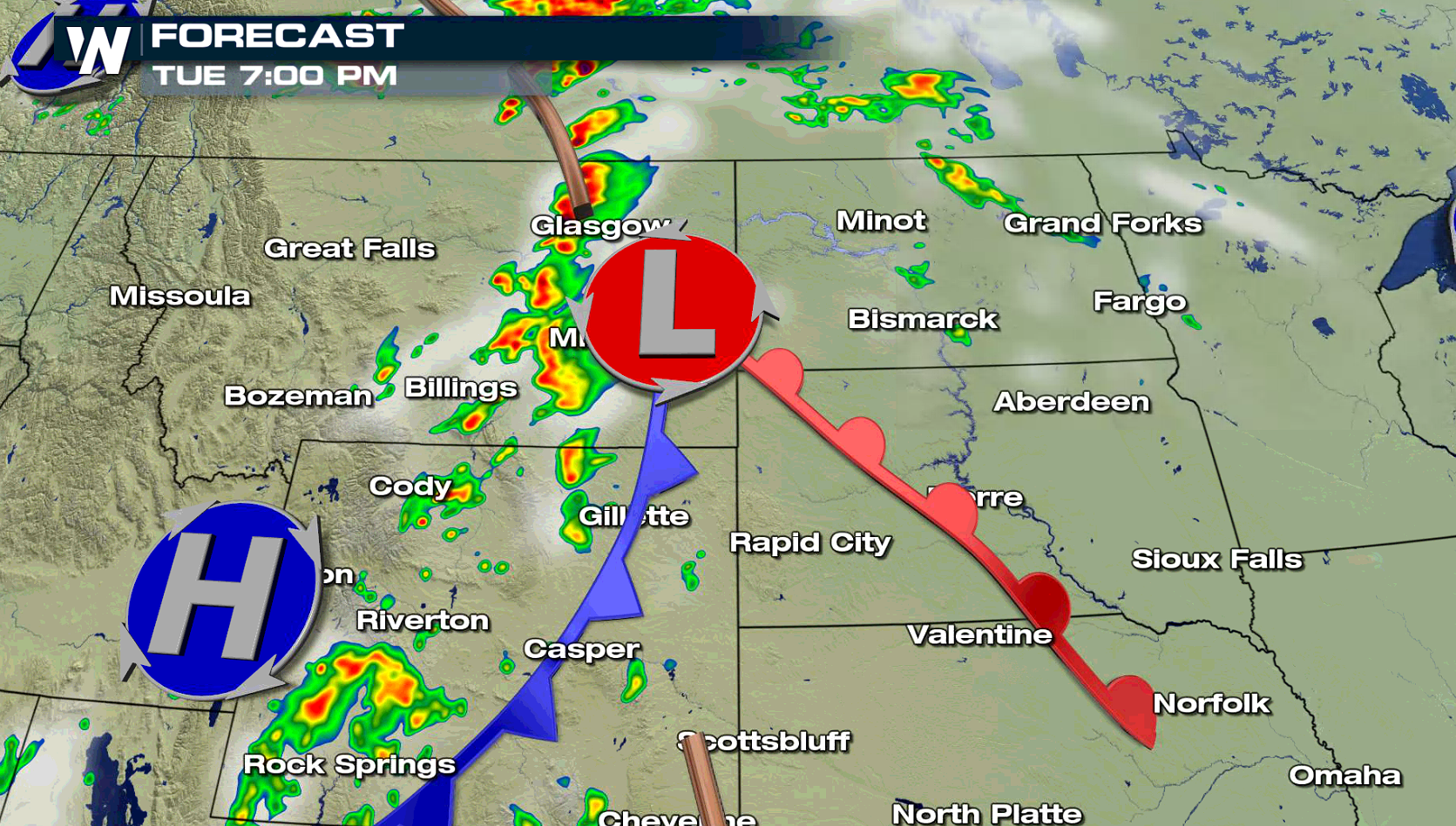
Wind damage will be the biggest concern with severe thunderstorms that are likely to develop in the High Plains today (Tuesday), focused in Montana and North Dakota. Large hail and isolated tornadoes are also possible in the late afternoon and evening. The Northeast may see isolated severe storms as well.
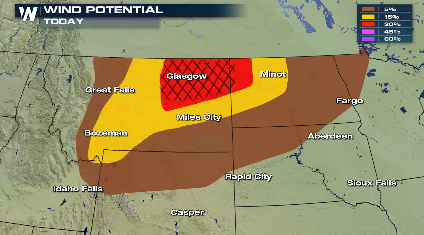
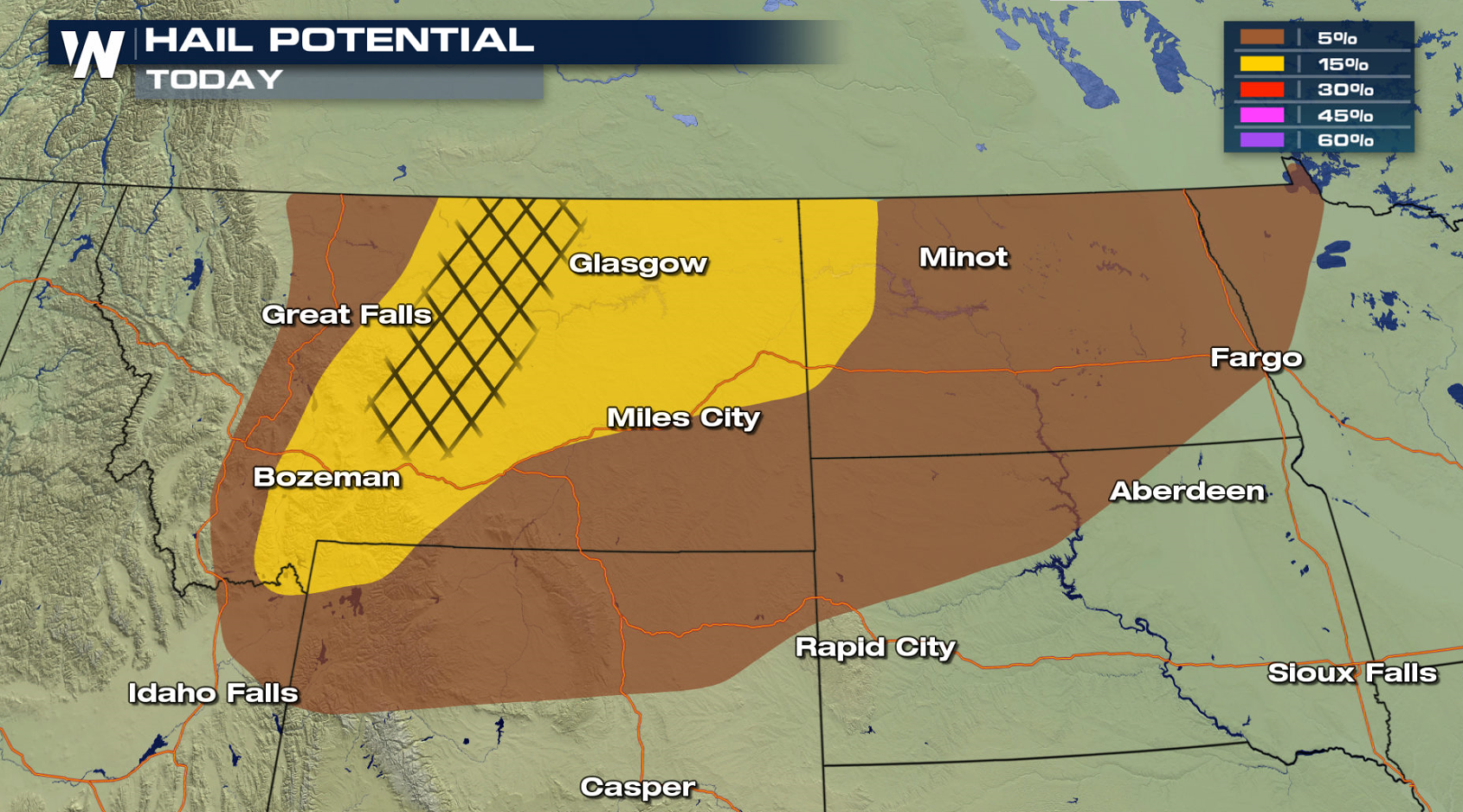
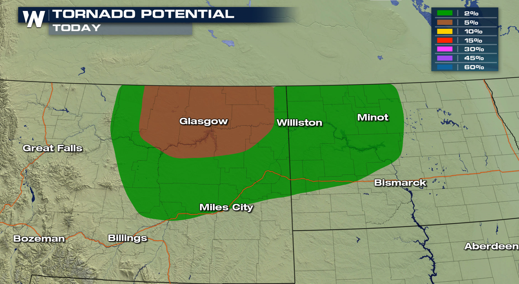 A storm system pulling out of the Rockies will push into the High Plains. Upper level energy will lift across the region, aiding severe weather development. Storms may form into a thunderstorm complex with strong wind gusts into the overnight.
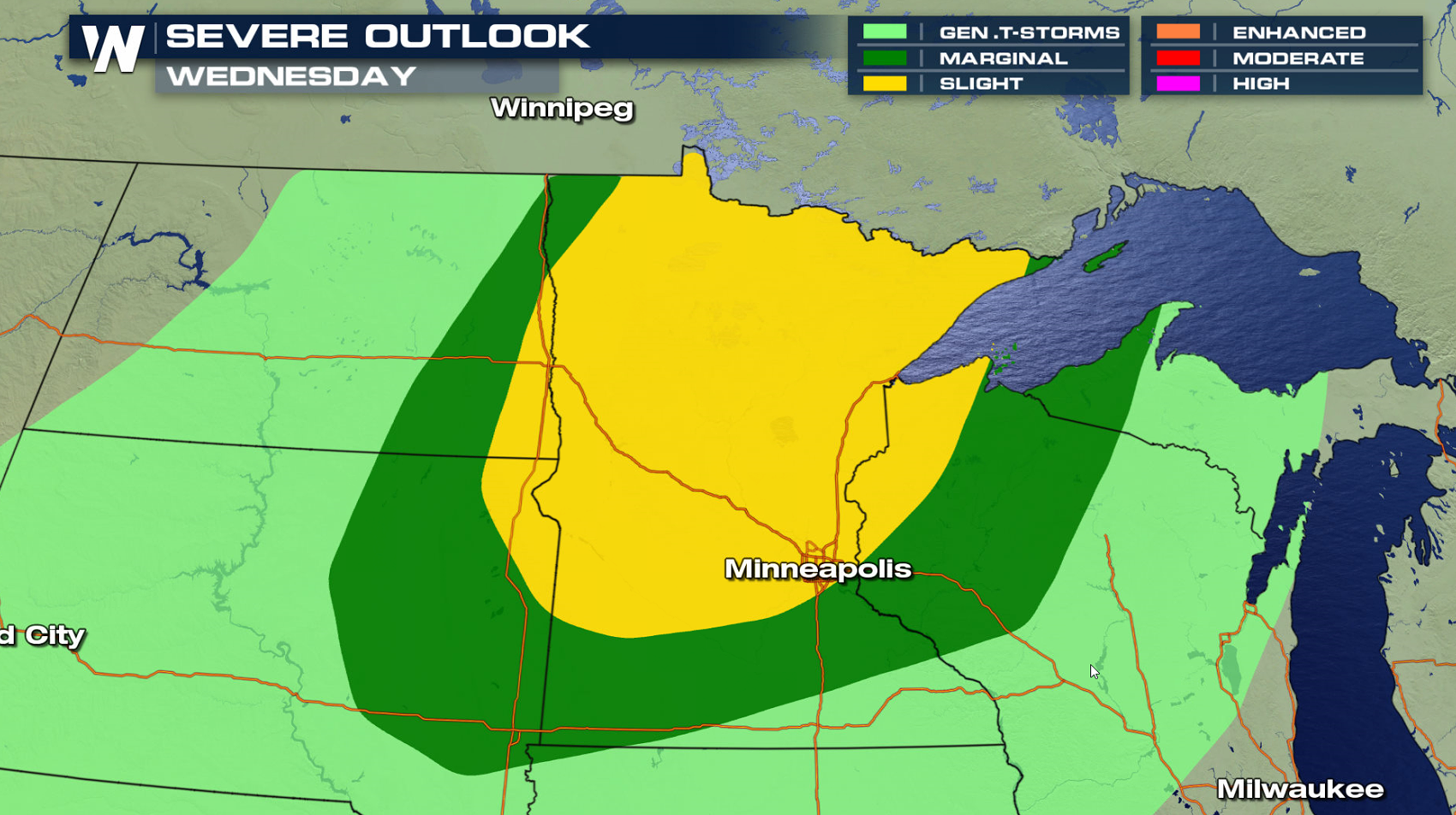
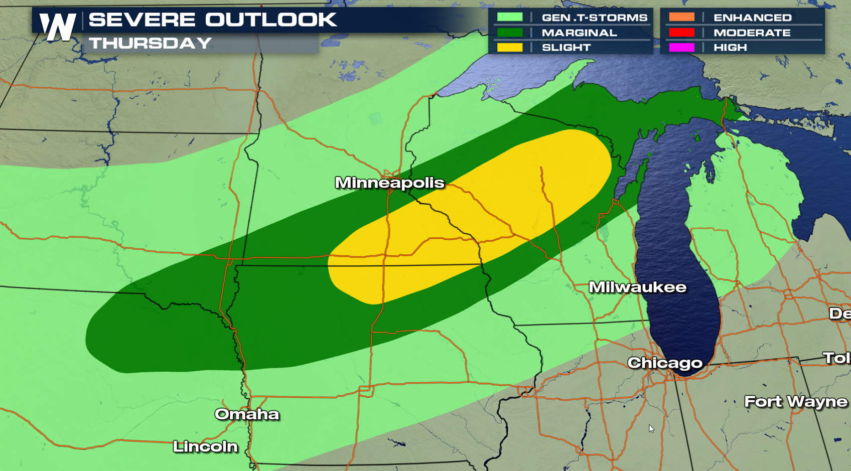
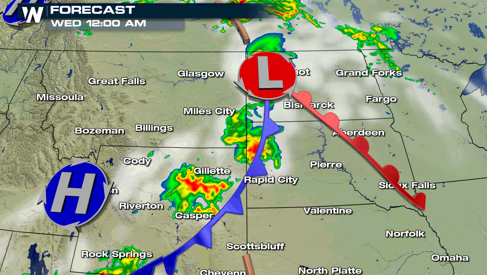 The low pressure center and fronts will roll into Minnesota and Wisconsin Wednesday and Thursday. The threat for severe weather will move towards the western Great Lakes with heat and humidity building ahead of the storm system, likely leading to a few severe thunderstorms.
 For WeatherNation: Meteorologist Mace Michaels
A storm system pulling out of the Rockies will push into the High Plains. Upper level energy will lift across the region, aiding severe weather development. Storms may form into a thunderstorm complex with strong wind gusts into the overnight.
The low pressure center and fronts will roll into Minnesota and Wisconsin Wednesday and Thursday. The threat for severe weather will move towards the western Great Lakes with heat and humidity building ahead of the storm system, likely leading to a few severe thunderstorms.
For WeatherNation: Meteorologist Mace MichaelsAll Weather News
More
Fronts Continue To Spark Severe Weather Across the Plains
A cold front that brought record lows to the
18 Jul 2025 10:40 PM

Extreme Heat Impacts for the East Coast & South
Extreme heat continues to impact several area
18 Jul 2025 10:05 PM

Flooding Threat Remains Elevated in the East
A cold front pushing through the Eastern Seab
18 Jul 2025 9:10 PM

EF-2 Firenado from the Deer Creek Fire in Utah
A fire tornado was spotted near La Sal, Utah
18 Jul 2025 7:30 AM

Tropical System Brings Flood Risk to the Central Gulf
Time has run out for notable tropical develop
18 Jul 2025 3:05 AM

Heavy Rain, Flooding Threat Returns to Florida
Keep the rain boots handy in Florida - heavy
13 Jul 2025 12:50 PM

Severe Storm Risk Pushes into the Great Lakes, Ohio Valley
Friday was another busy day with severe weath
12 Jul 2025 8:00 PM