Severe Storms Likely Saturday for the High Plains and Upper Mississippi Valley

Special Stories
16 Jun 2018 5:29 AM
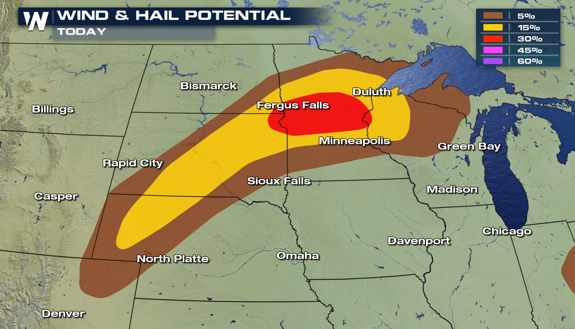
We are looking at a strong chance for large hail, damaging winds and isolated tornadoes over parts of Central Minnesota down into Western Nebraska. Heavy rain will also be a high risk for these areas meaning flooding potential.
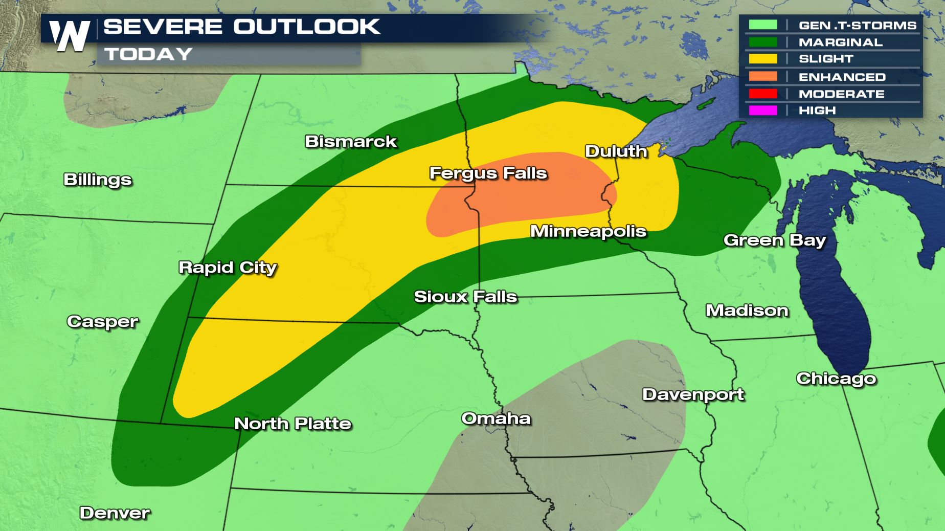 You can see a slight and enhanced risk of severe storms today for southern Central Minnesota down into Western Nebraska. Cities like Duluth, Fergus Falls and Fargo will need to be weather aware today for the risk of severe weather.
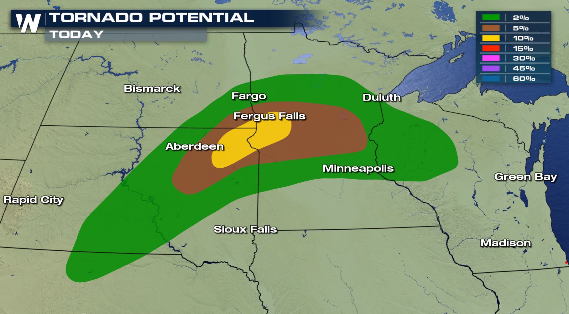 The tornado and damaging wind risks will be the highest threat in these areas. Especially for the Duluth area where we could extreme winds and tornadoes this afternoon and evening.
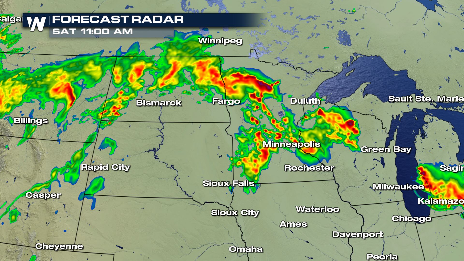
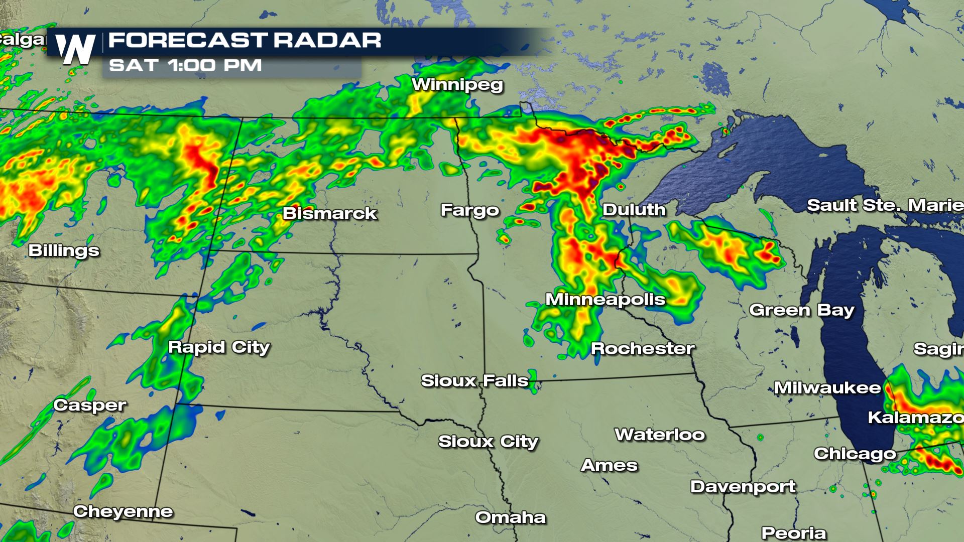
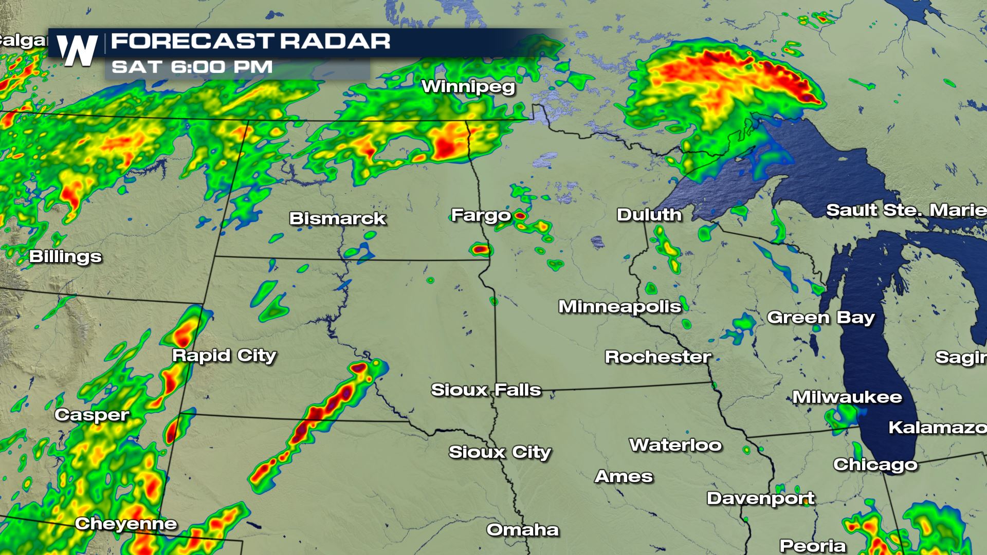 You can see the timing for today's severe storms will be during the afternoon and evening hours. Keep checking WeatherNation for the very latest updates.
Meteorologist Patrick Crawford
You can see the timing for today's severe storms will be during the afternoon and evening hours. Keep checking WeatherNation for the very latest updates.
Meteorologist Patrick Crawford
Severe Outlook
You can see a slight and enhanced risk of severe storms today for southern Central Minnesota down into Western Nebraska. Cities like Duluth, Fergus Falls and Fargo will need to be weather aware today for the risk of severe weather.
Severe Risks
The tornado and damaging wind risks will be the highest threat in these areas. Especially for the Duluth area where we could extreme winds and tornadoes this afternoon and evening.
Forecast
Storm chances will be in the forecast throughout the morning and into the afternoon. The severe weather risk should increasing by the late morning and continue through the evening.
You can see the timing for today's severe storms will be during the afternoon and evening hours. Keep checking WeatherNation for the very latest updates.
Meteorologist Patrick CrawfordAll Weather News
More
East Gears Up for Stormy, Wet Weekend
A low pressure system crashing through the Mi
1 Aug 2026 11:35 AM


Flooding, Severe Storms Target the Midwest Again
After an active week of storms across the nor
1 Aug 2026 1:40 AM


After Reaching Category 5, Genevieve Weakens in the Pacific
PacificFausto is now a post-tropical cyclone.
31 Jul 2026 1:30 AM

Flooding Risk Increases as Heavy Rain Targets the Tri-State Area
Tuesday, heavy rainfall moved across the Nort
30 Jul 2026 12:25 AM

Severe Weather: Energy From the Midwest Now in the Southeast
UPPER MIDWEST - Through Monday, dangerous tor
29 Jul 2026 10:30 PM