More Severe Storms for the Northeast
Top Stories
15 May 2018 9:44 AM
Severe storms ripped across the country Monday. Many locations saw strong winds and hail. You can read more about the severe storms on Monday here.
https://twitter.com/WeatherNation/status/996255353011490816
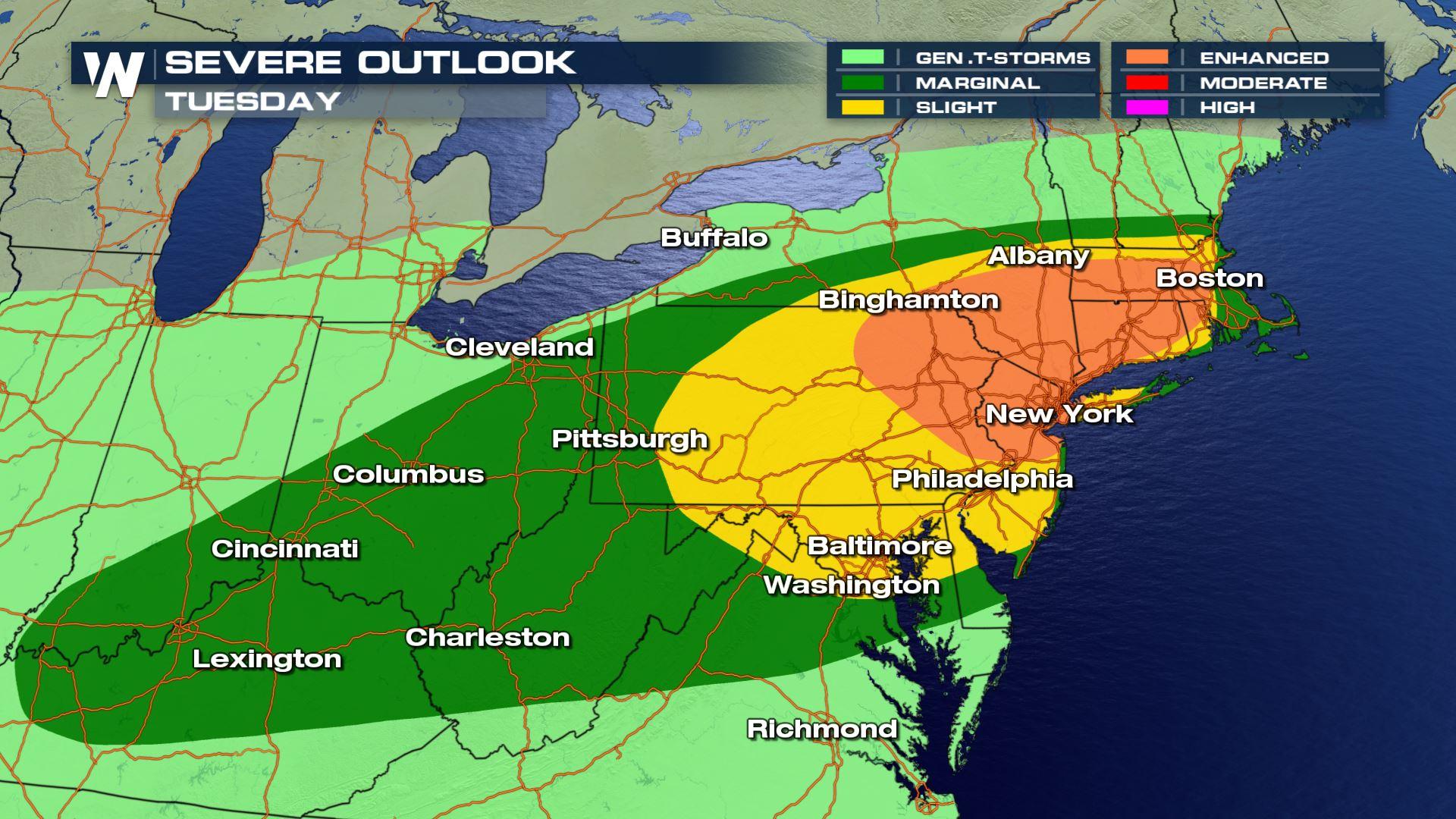
For this Tuesday, we are tracking more severe storms across a similar area. Today, we are closely watching the Northeast for the chance for numerous severe storms.
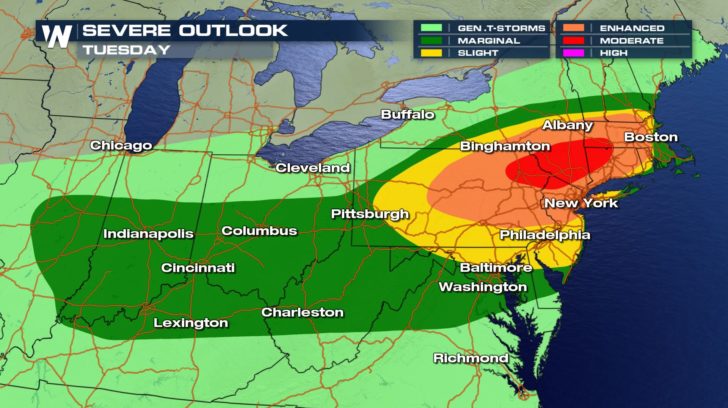 The time frame for these severe storms will be around late afternoon and into the evening hours.
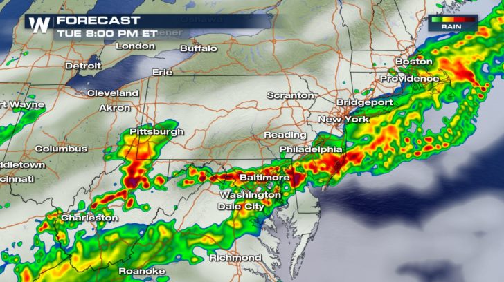
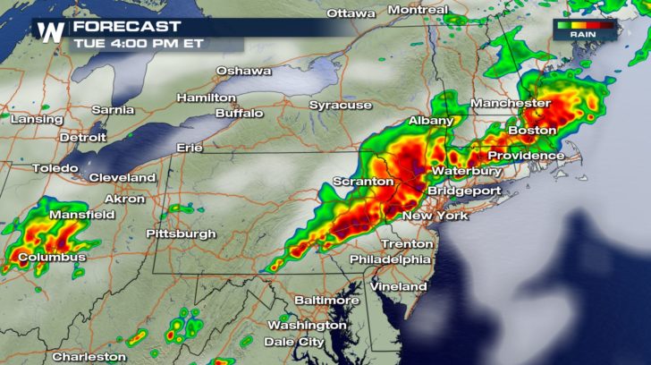 The storms will take a more linear line and approach the I-95 corridor around rush hour. After moving eastward, the line will push south into the Baltimore-D.C. area in the evening.
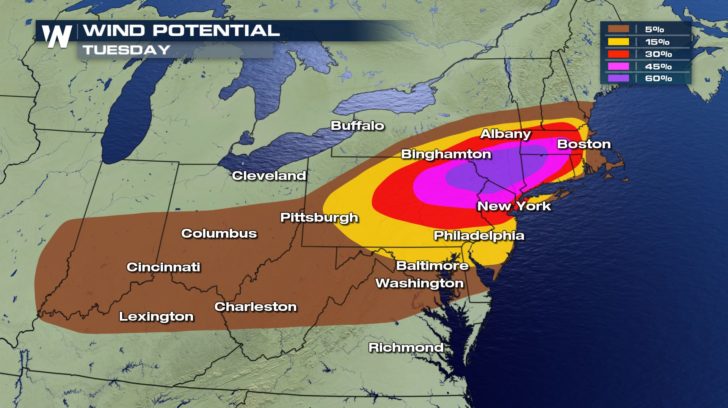
 The main concern for these storms will be the potential for damaging winds. The area on the map hatched means that region has the possibility of seeing winds at or greater than 75 mph. Winds at that strength can easily bring down large tree limbs and cause power outages.
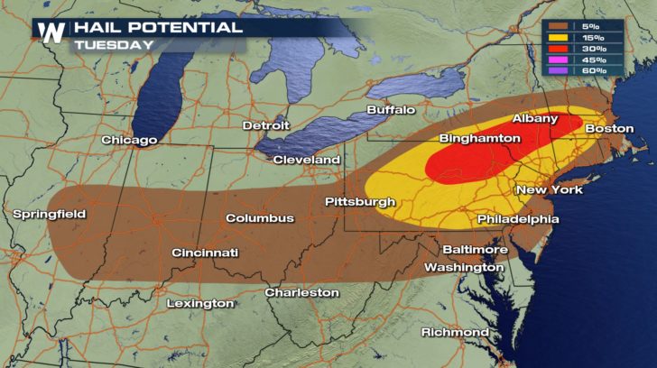
 Large hail stones as large as 2 inches in diameter will also be possible.
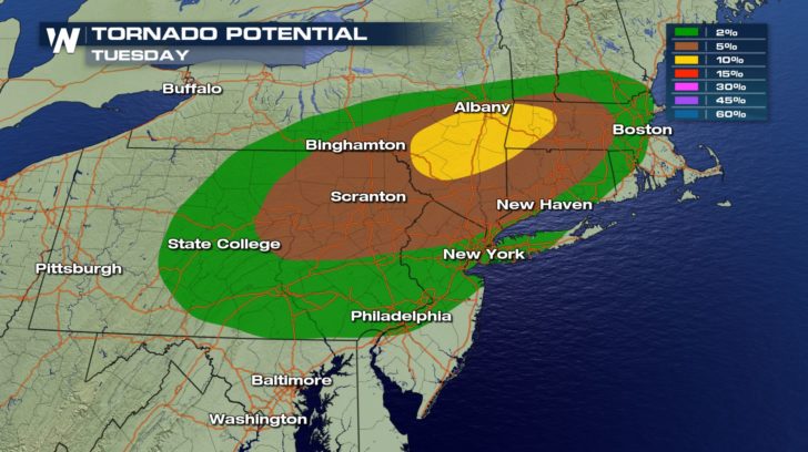
 Unfortunately, tornadoes cannot be ruled out either today.
 Be sure to stay with WeatherNation throughout this Tuesday as we track severe storms.
For WeatherNation, Meteorologist Kate Mantych
Be sure to stay with WeatherNation throughout this Tuesday as we track severe storms.
For WeatherNation, Meteorologist Kate Mantych
The time frame for these severe storms will be around late afternoon and into the evening hours.
The storms will take a more linear line and approach the I-95 corridor around rush hour. After moving eastward, the line will push south into the Baltimore-D.C. area in the evening.
The main concern for these storms will be the potential for damaging winds. The area on the map hatched means that region has the possibility of seeing winds at or greater than 75 mph. Winds at that strength can easily bring down large tree limbs and cause power outages.
Large hail stones as large as 2 inches in diameter will also be possible.
Unfortunately, tornadoes cannot be ruled out either today.
Be sure to stay with WeatherNation throughout this Tuesday as we track severe storms.
For WeatherNation, Meteorologist Kate MantychAll Weather News
More
Wildfire Outbreak in the Pacific Northwest
Conditions have been incredibly dry out west.
2 Aug 2026 12:20 PM


More Storms for the East Sunday and Monday
A low-pressure system crashing through the Mi
2 Aug 2026 2:20 AM

After Reaching Category 5, Genevieve Weakens in the Pacific
PacificGenevieve formed on last Friday south
2 Aug 2026 1:30 AM

Flooding, Severe Storms Target the Midwest Again
After an active week of storms across the nor
1 Aug 2026 1:40 AM

Flooding Risk Increases as Heavy Rain Targets the Tri-State Area
Tuesday, heavy rainfall moved across the Nort
30 Jul 2026 12:25 AM

Severe Weather: Energy From the Midwest Now in the Southeast
UPPER MIDWEST - Through Monday, dangerous tor
29 Jul 2026 10:30 PM