Severe Storms Possible From Minnesota to Arkansas

Special Stories
30 Aug 2018 8:22 AM
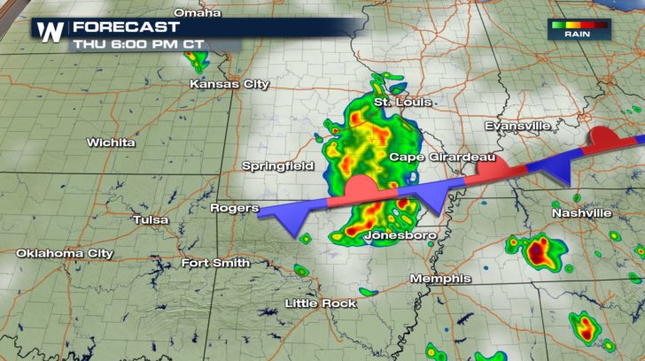
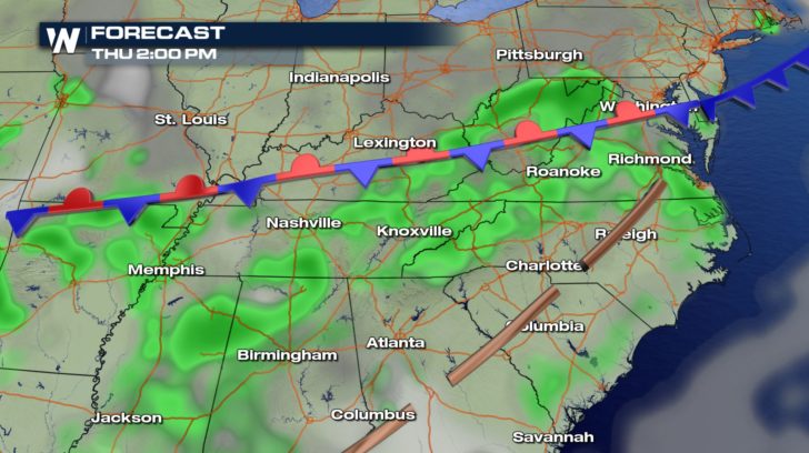
Severe storms return to the forecast Thursday. The main focus will be over the central U.S. along a frontal boundary mid-afternoon to early evening.
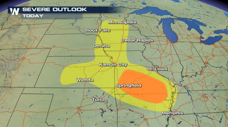
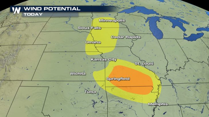
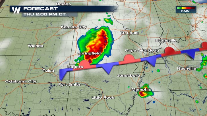
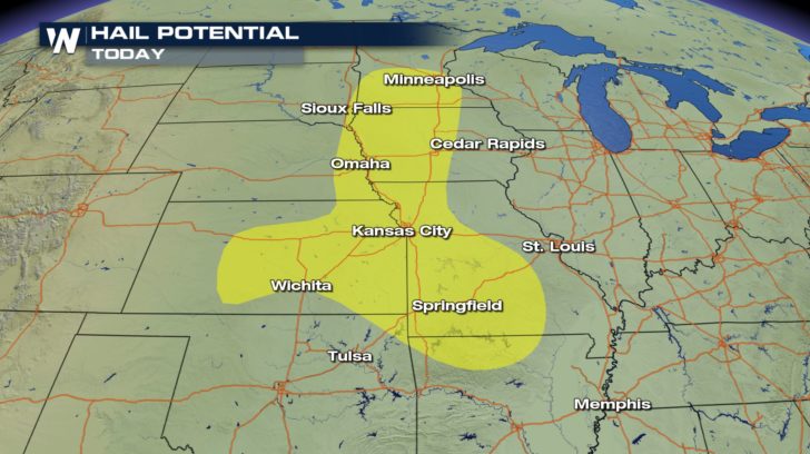 The severe weather risk stretches all the way up to Minnesota from N Arkansas, but the orange areas (see above) see the greatest risk today. Here we could see large hail and damaging winds as well as heavy rain. Storms will fire along a stationary from starting early afternoon. They'll likely be strongest by 2 to 3 P.M. and weaken in the evening.
 We see a smaller area with a severe weather risk on the other end of that same stationary front, over parts of the mid-Atlantic. Damaging winds are the main threat with these storms, mainly impacting the Virginias.
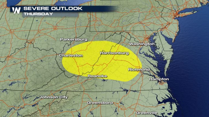 Widespread storms are possible south of the frontal boundary, but the strongest storms will be along the front across West Virginia and Virginia.
 Stay up to date through the day as severe storms roll through on-air and online with Weather Nation.
For Weather Nation: Meteorologist Emily Roehler
Stay up to date through the day as severe storms roll through on-air and online with Weather Nation.
For Weather Nation: Meteorologist Emily Roehler
The severe weather risk stretches all the way up to Minnesota from N Arkansas, but the orange areas (see above) see the greatest risk today. Here we could see large hail and damaging winds as well as heavy rain. Storms will fire along a stationary from starting early afternoon. They'll likely be strongest by 2 to 3 P.M. and weaken in the evening.
We see a smaller area with a severe weather risk on the other end of that same stationary front, over parts of the mid-Atlantic. Damaging winds are the main threat with these storms, mainly impacting the Virginias.
Widespread storms are possible south of the frontal boundary, but the strongest storms will be along the front across West Virginia and Virginia.
Stay up to date through the day as severe storms roll through on-air and online with Weather Nation.
For Weather Nation: Meteorologist Emily Roehler
All Weather News
More
Severe Storms Target the Midwest to the Northeast
UPPER MIDWEST - Dangerous tornadoes have alre
28 Jul 2026 1:45 AM

Tropics: Fausto Heads towards Hawaii; Genevieve Cat 4 Hurricane
PacificHurricane Fausto continues to track we
28 Jul 2026 1:45 AM


Southeast Flood Risk Lingers Near Stalled Front
A stalled boundary over the Southeast will ke
25 Jul 2026 10:55 AM

Another Round of Storms Targets the Northeast
Tuesday brought severe weather again across p
23 Jul 2026 1:15 AM

Another Round of Severe Weather for the Upper Midwest and Great Lakes
The upper-level low train continues to keep t
21 Jul 2026 1:45 AM