Severe Storms Possible in the Pacific Northwest

Top Stories
29 May 2026 6:00 PM
SET-UP
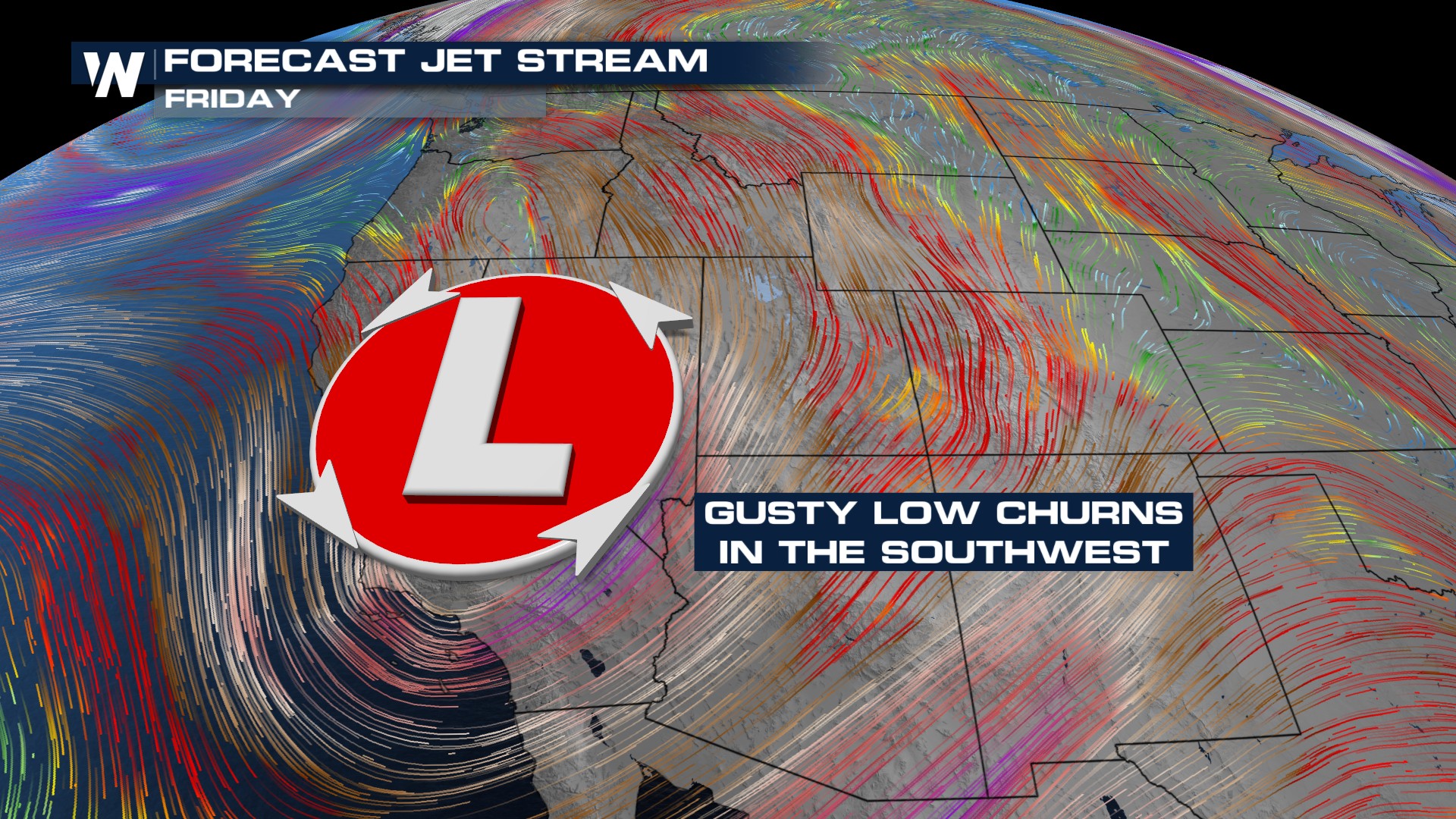 An upper low is sitting and spinning over the Great Basin out west. That puts our friends in the northwest on the northern side of this feature. Usually, you're looking at areas on the southern and eastern peripheries with the best dynamics for storms. Regardless, a strong corridor of winds is expected to spark storms each afternoon over the next few days.
IMPACTS
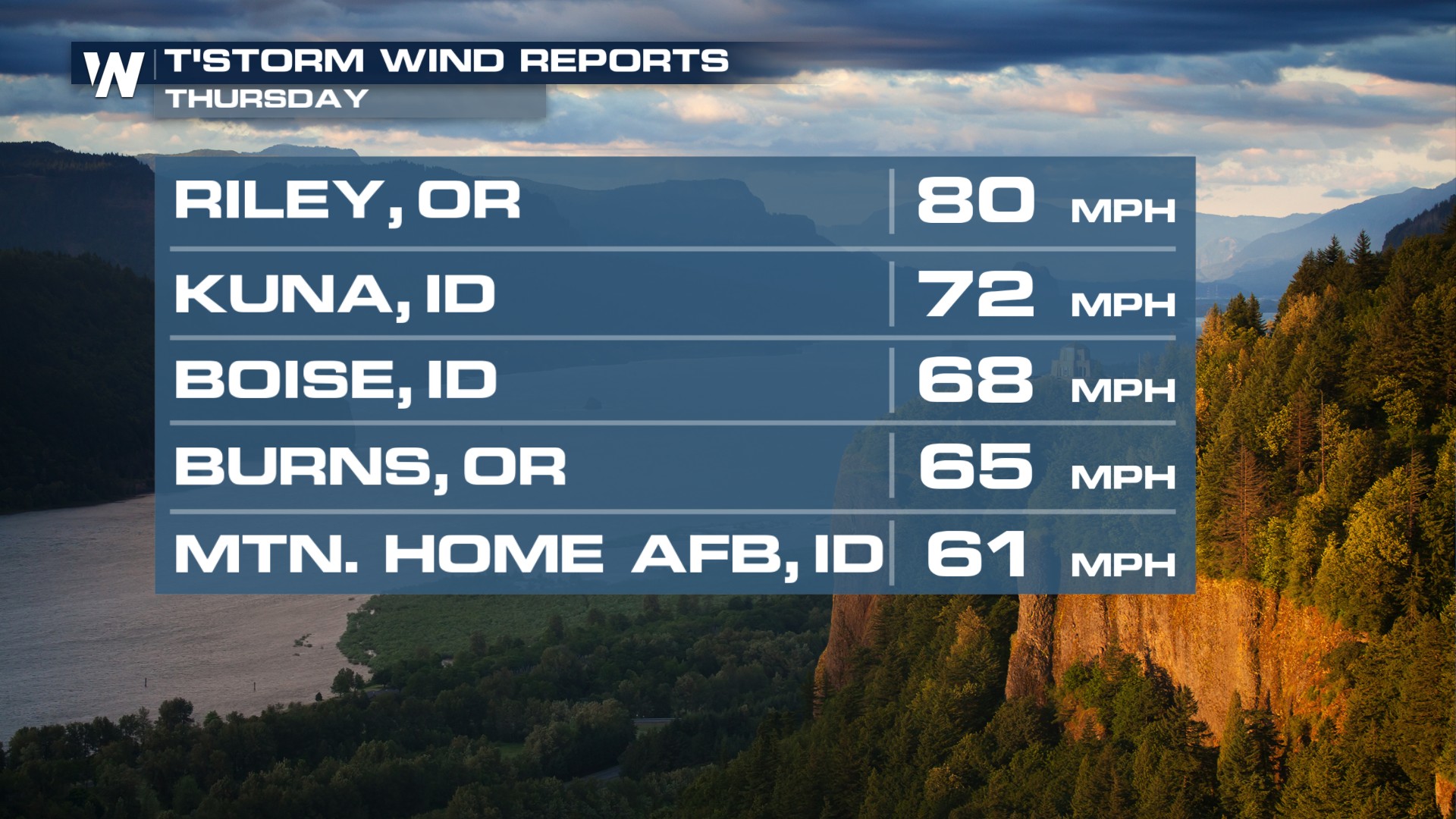
Check out some of the damaging wind reports from Thursday's storms.
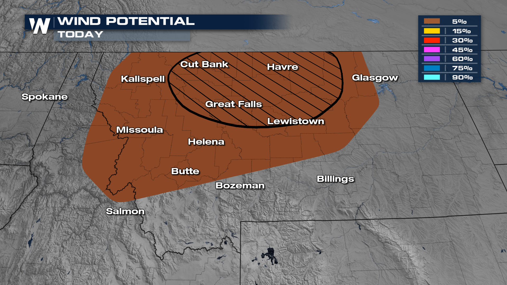
The wind threat will be the primary severe weather threat for Friday.
TIMING
Showers will be sporadic but strengthen each afternoon. Notice they'll rotate from east to west since we're staying north of the low spinning up these severe chances.
All Weather News
More
Dangerous Stretch of Heat Shaping Up This Week
The hottest temperatures of the year are loom
30 Jun 2026 2:00 AM

Massive Fires Burn in the Four Corners
Photo: Iron Fire getting doused with a retard
30 Jun 2026 1:50 AM

Slow-Moving Front Could Turn Tropical This Week
Early in the season, we watch closer to the c
30 Jun 2026 12:50 AM

Severe Storms Keep Northern U.S. Active
Monday morning, one storm brought significant
30 Jun 2026 12:45 AM

Storms Spark up in the Northeast Ahead of Heatwave
Severe storms will be possible Tuesday and We
29 Jun 2026 10:30 PM

'MCS' Season Brings Severe and Flooding Threats Across the Southeast
As Summer settles in across the Central U.S.,
28 Jun 2026 2:10 AM

Severe Threat Tracks into the Northeast Friday
Another day, another Illinois tornado. That's
26 Jun 2026 2:25 AM