Severe Storms Possible in the South Wednesday to Friday
Special Stories
25 Nov 2020 11:25 AM
A slow moving front will settle across the southern Plains and Lower Mississippi Valley the next few days, bringing a risk for severe weather. Below we will take closer look at the severe weather potential for the days ahead:
 A well established southerly flow from the Gulf of Mexico will increase the humidity across the region. The added mositure into the air, coupled with robust jet stream energy, will aid in the development of severe storms.
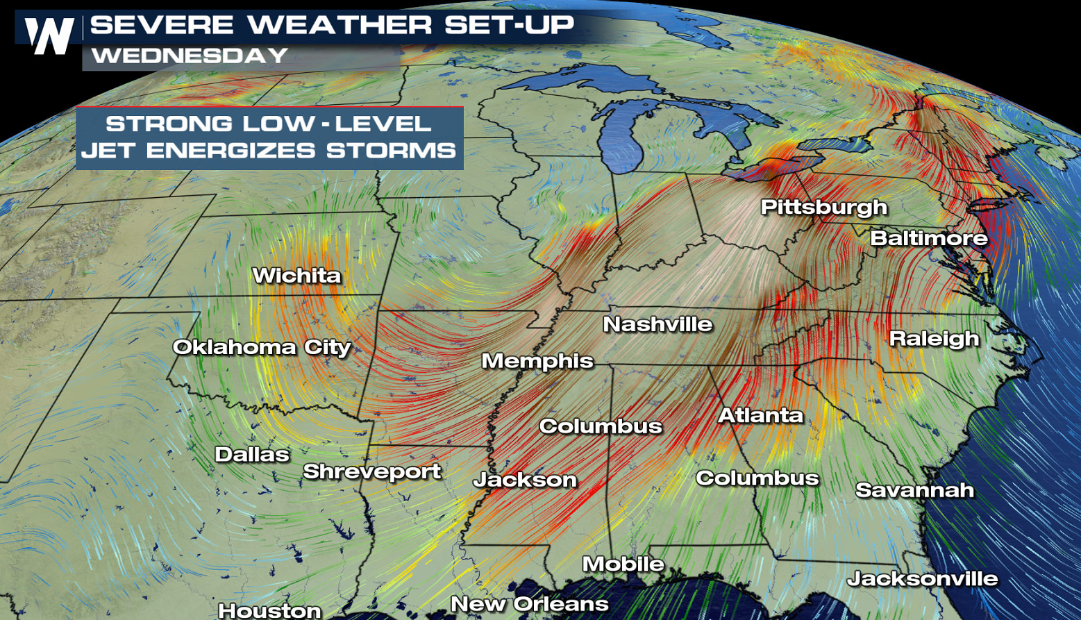 A few thunderstorms will fire in the late afternoon along and ahead of the cold front from the Ohio Valley to the Gulf of Mexico. Coverage will expand into the early evening, and a few severe storms are likely. Damaging wind gusts are the main concern, although isolated tornadoes are possible.
 With less jet stream energy, overall thunderstorm coverage will be limited on Thursday. A few storms will develop in the late afternoon and evening which could become severe. Large hail is the biggest concern.
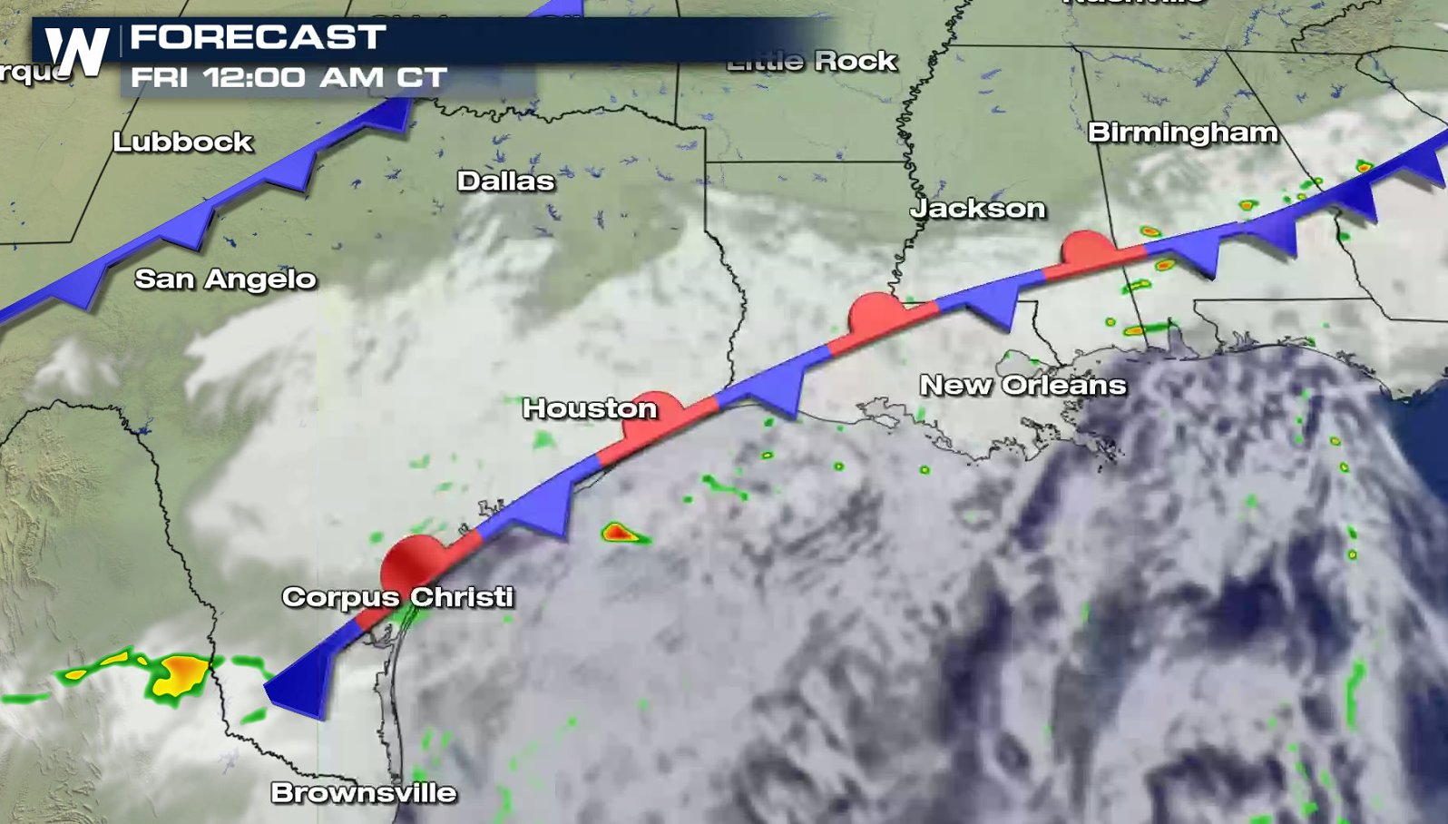
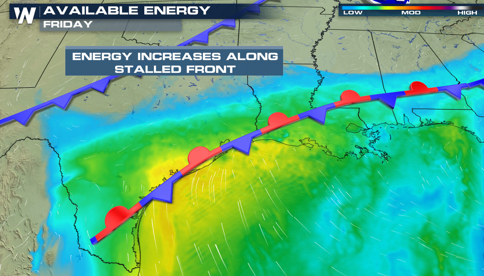
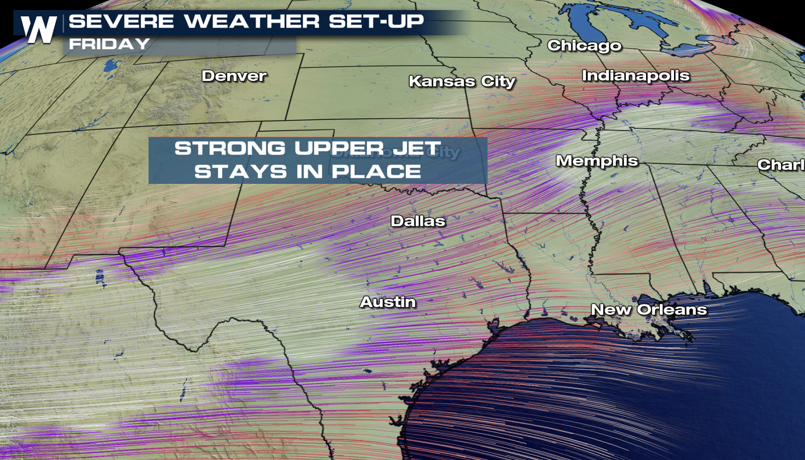
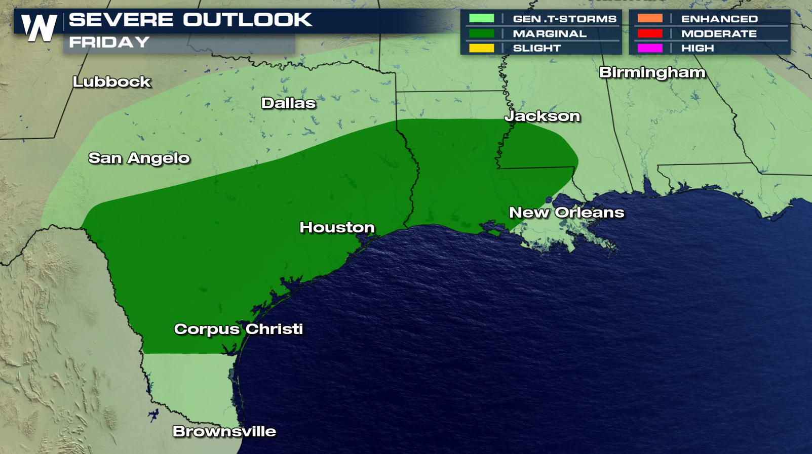 Stronger jet stream energy and warmer temperatures will bring more thunderstorms on Friday along the stalled front near the Gulf Coast. The marginal risk area (level one on the scale of 1 to 5) extends from southern areas of Texas into Louisiana and Mississippi.
 If you are in the risk areas, be sure to check back with WeatherNation for severe weather updates on-air and online. Have a great Thanksgiving!
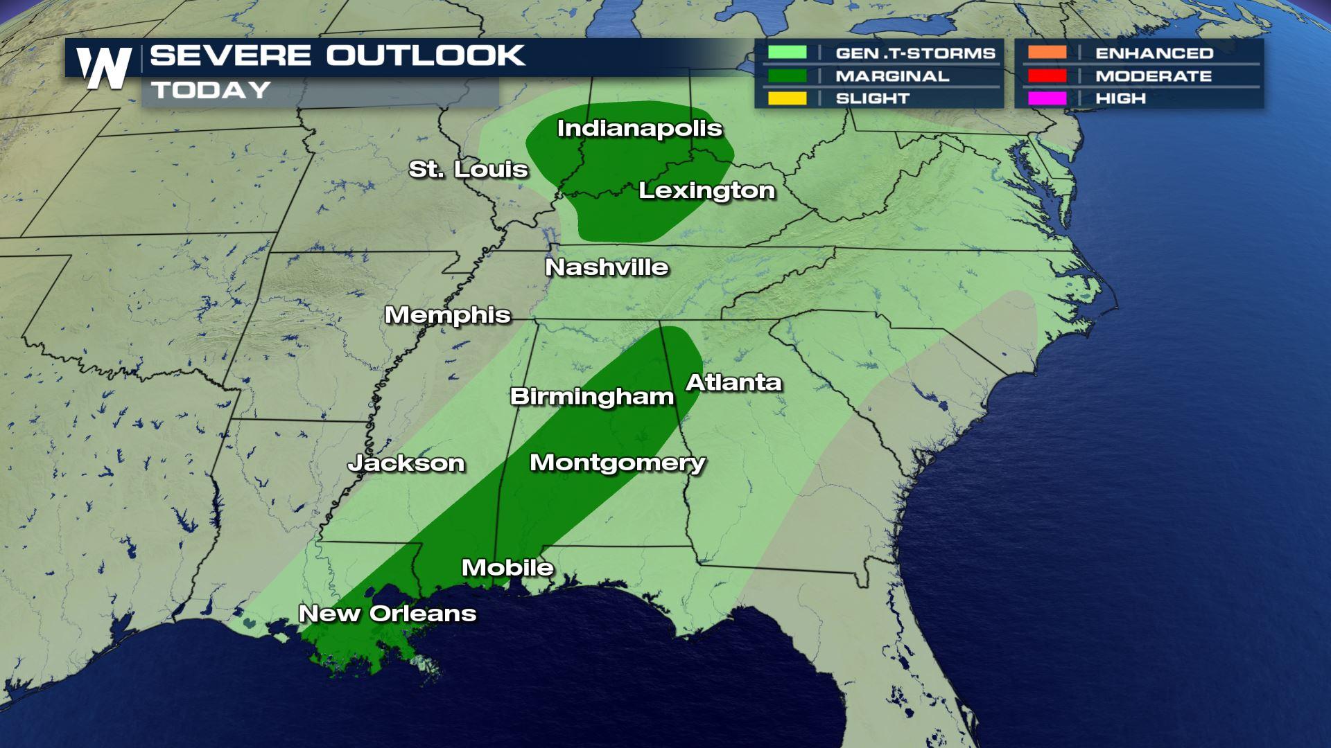
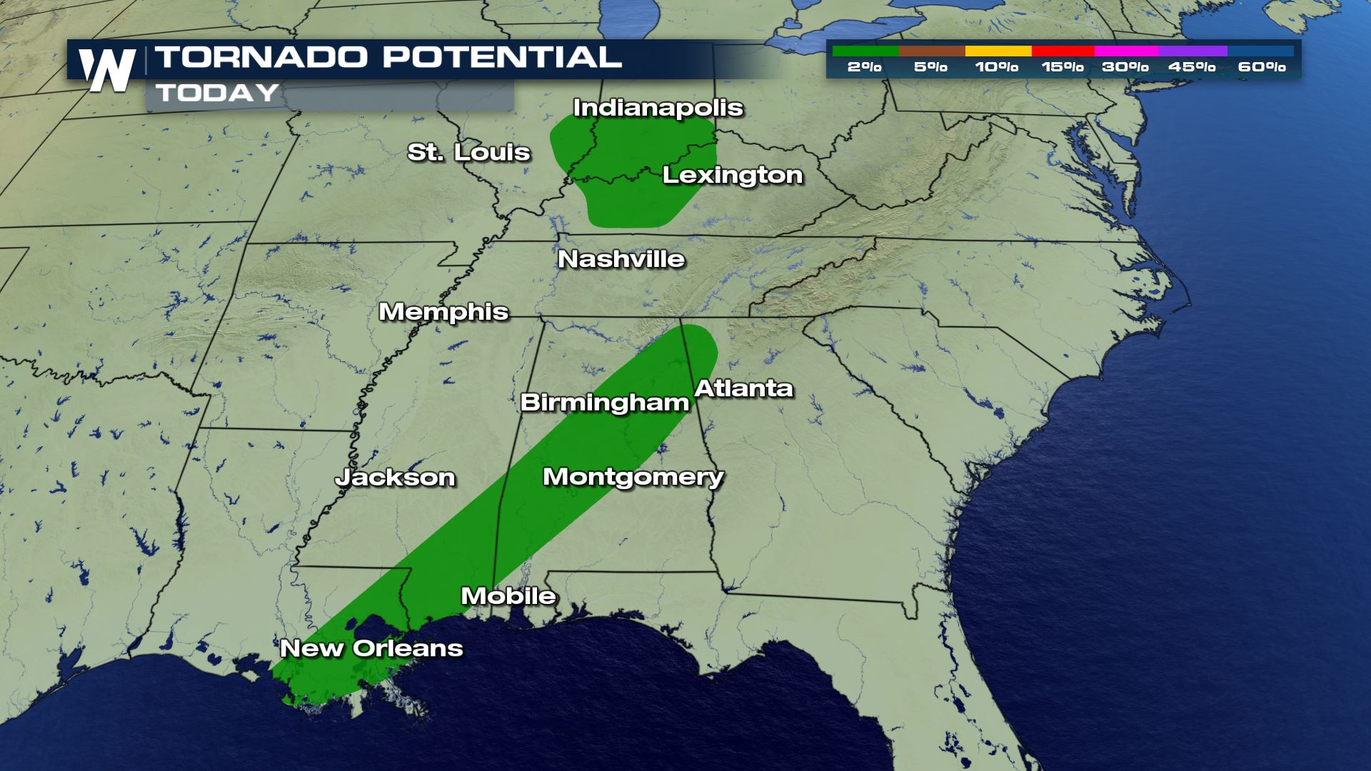
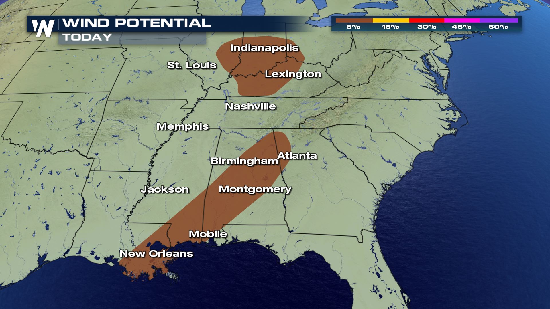
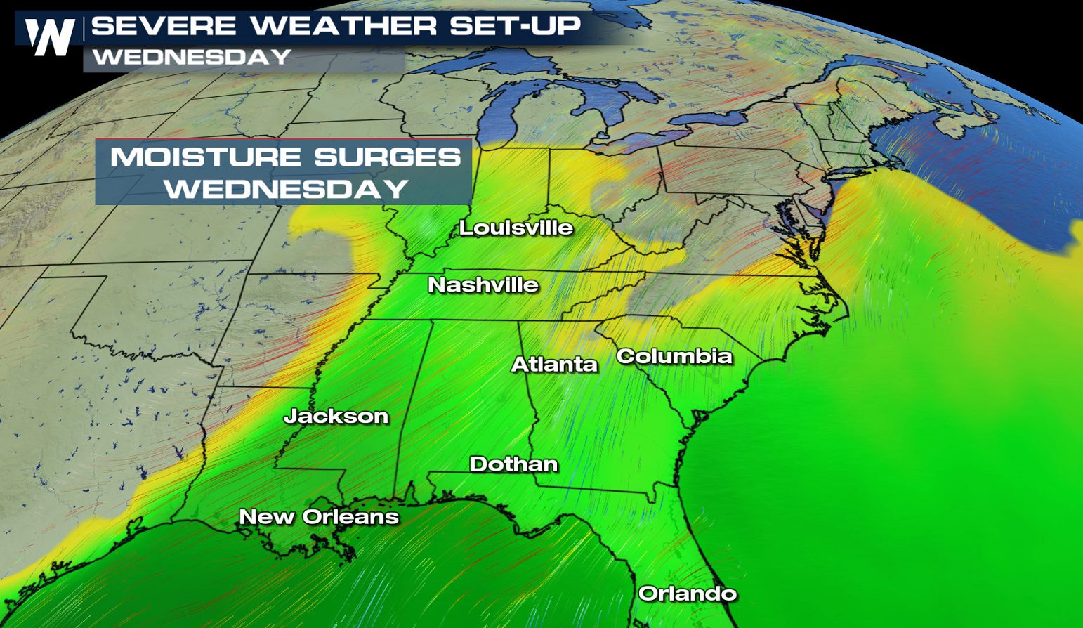
WEDNESDAY
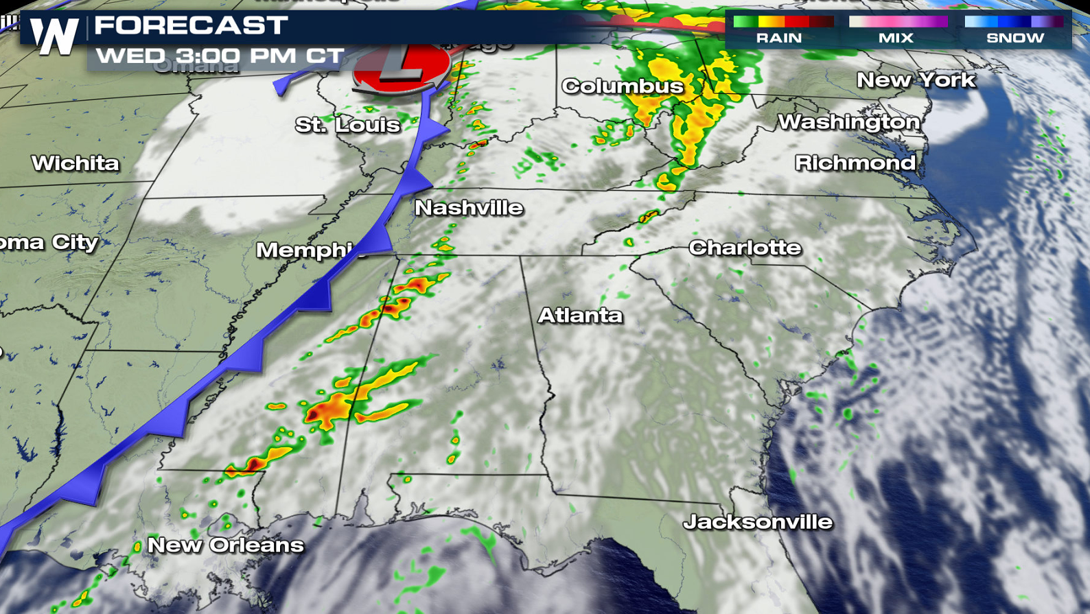
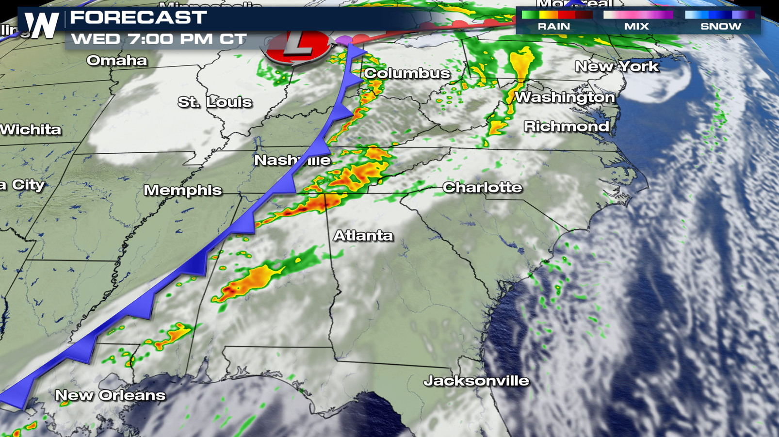
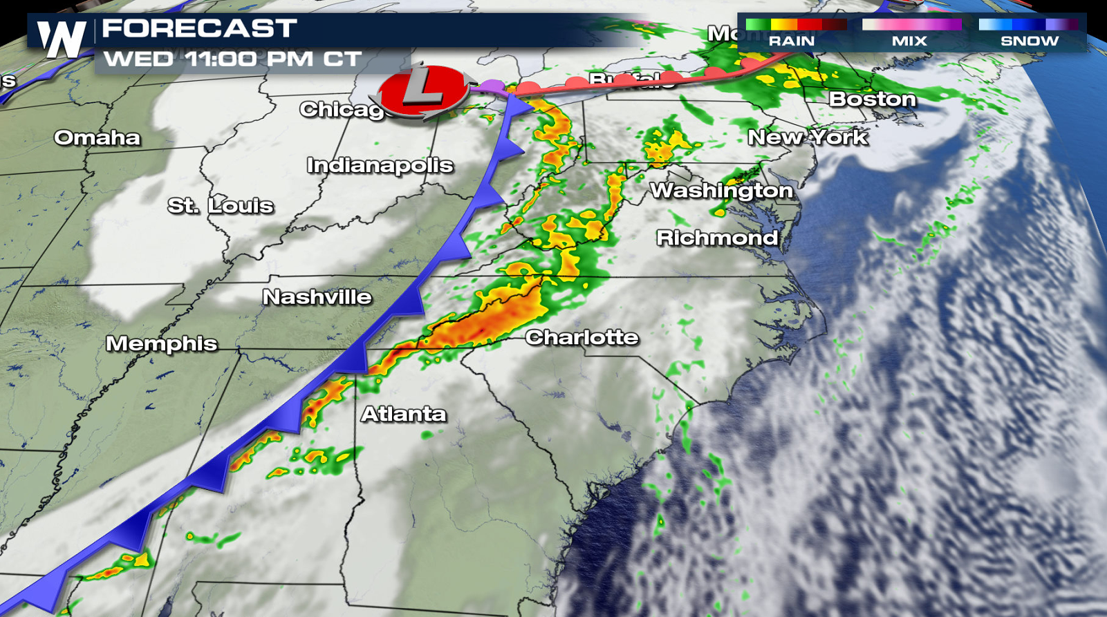
For today (Wednesday), there is a a marginal risk (level 1 on a scale of 1 to 5) from Atlanta to New Orleans. Another small risk area includes portions of the Ohio Valley.
A well established southerly flow from the Gulf of Mexico will increase the humidity across the region. The added mositure into the air, coupled with robust jet stream energy, will aid in the development of severe storms.
A few thunderstorms will fire in the late afternoon along and ahead of the cold front from the Ohio Valley to the Gulf of Mexico. Coverage will expand into the early evening, and a few severe storms are likely. Damaging wind gusts are the main concern, although isolated tornadoes are possible.
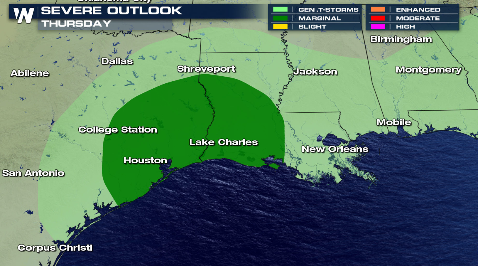
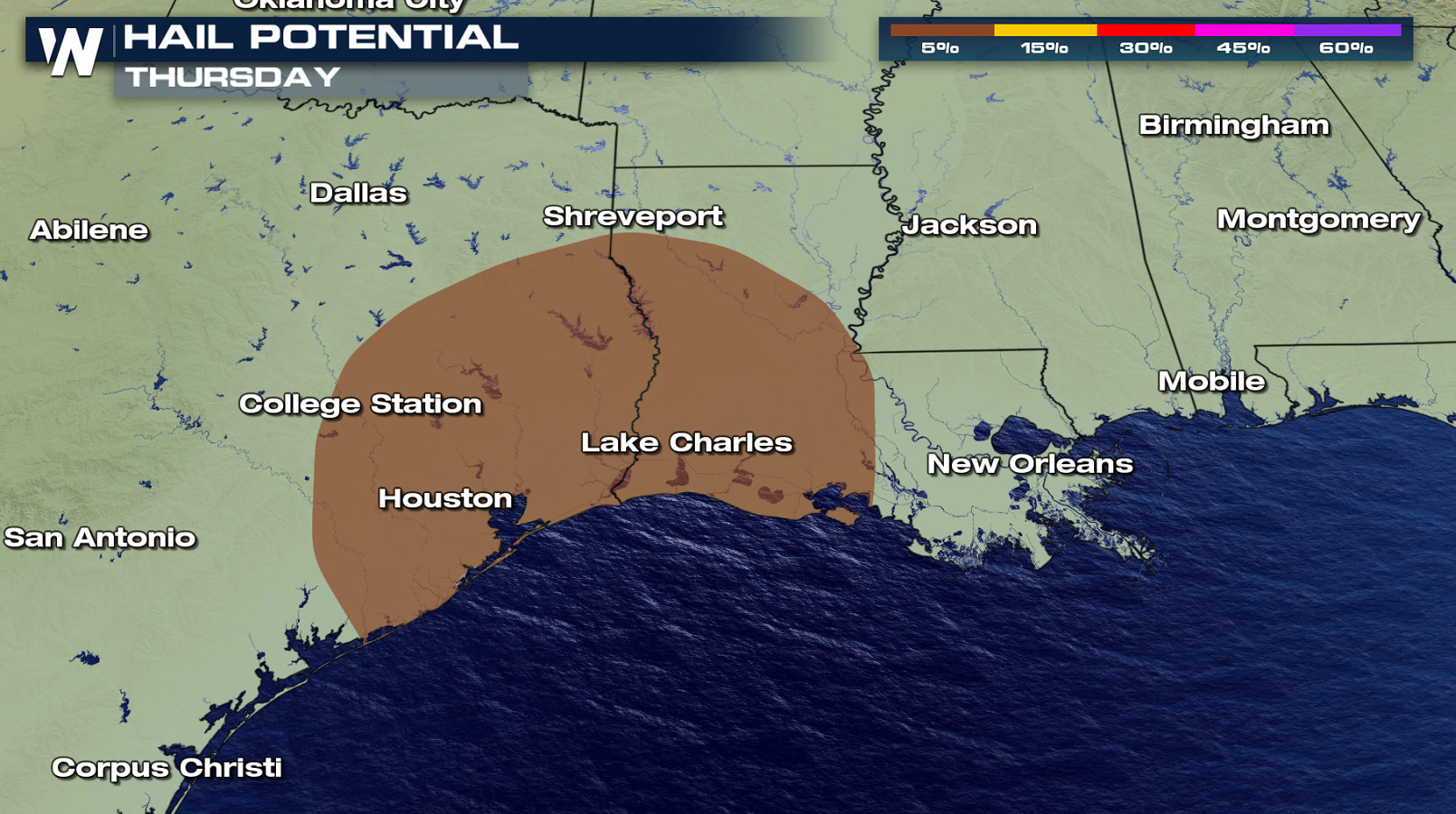
THURSDAY
With less jet stream energy, overall thunderstorm coverage will be limited on Thursday. A few storms will develop in the late afternoon and evening which could become severe. Large hail is the biggest concern.
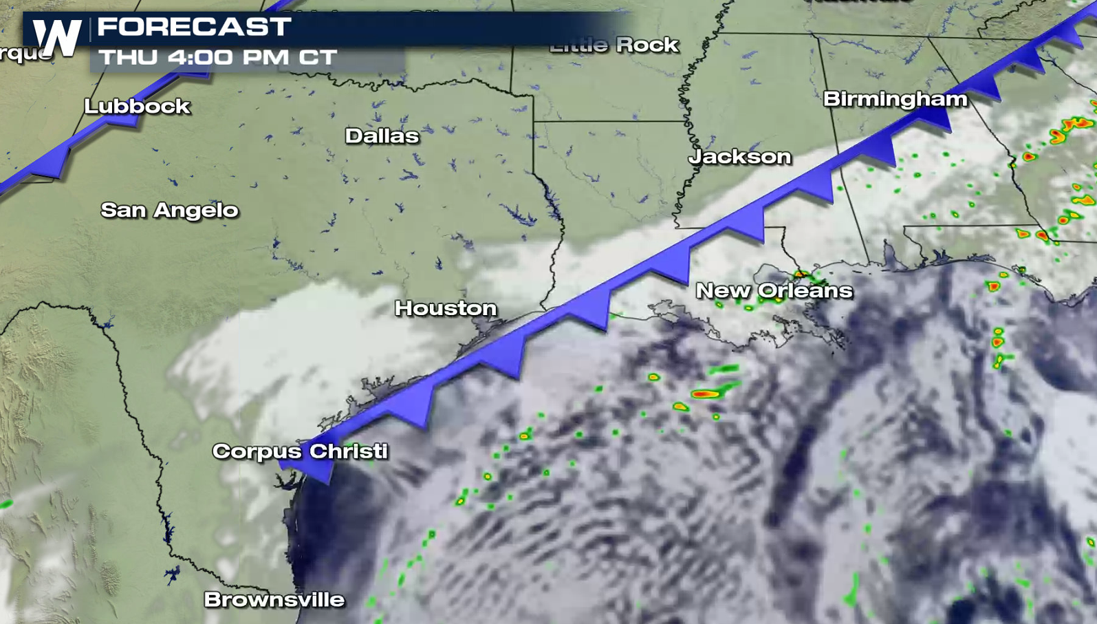
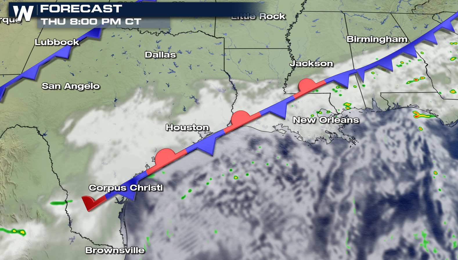
FRIDAY
Stronger jet stream energy and warmer temperatures will bring more thunderstorms on Friday along the stalled front near the Gulf Coast. The marginal risk area (level one on the scale of 1 to 5) extends from southern areas of Texas into Louisiana and Mississippi.
If you are in the risk areas, be sure to check back with WeatherNation for severe weather updates on-air and online. Have a great Thanksgiving!All Weather News
More
Texas Facing Major Flood Threat This week
Texas is facing a major flooding threat this
15 Jul 2026 1:45 AM

Canadian Wildfires to Send Thick Dense Smoke Across The Northern U.S.
As temperatures have soared across the Northe
15 Jul 2026 1:45 AM

Rare Enhanced Severe Threat For New England
WHAT TO EXPECT The SPC has issued a severe ou
15 Jul 2026 1:35 AM

Historic Heatwave Hits the Northern Rockies, California Heat Expands
Dangerous heat and record high temperatures c
15 Jul 2026 1:30 AM

Monsoon Moisture Returns to the Southwest, Increasing Storm and Flash Flood Potential
After weeks of hot and mostly dry weather, th
14 Jul 2026 4:15 PM

Saharan Dust and Excessive Heat Impact the Southeast
Hazy skies will be hovering over portions of
14 Jul 2026 10:05 AM

Another Day of Storms for the Plains & Front Range
Several rounds of severe weather have been ro
11 Jul 2026 1:50 AM