Severe Storms Possible in the Upper Midwest
Special Stories
10 Mar 2021 10:15 AM
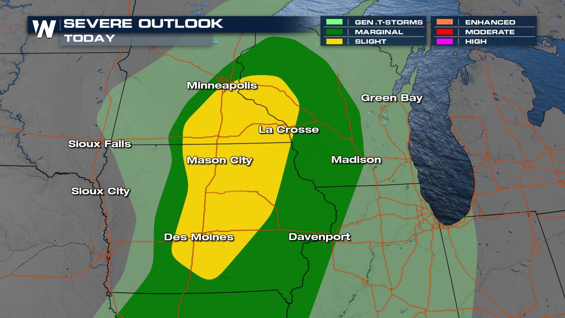
A strong storm system moving into the Upper Midwest may produce a few severe thunderstorms this afternoon and evening. There is a slight risk (level 2 on a scale of 1 to 5) from western Wisconsin to northeastern Iowa. A marginal risk extends down the Mississippi River into Iowa and Missouri.
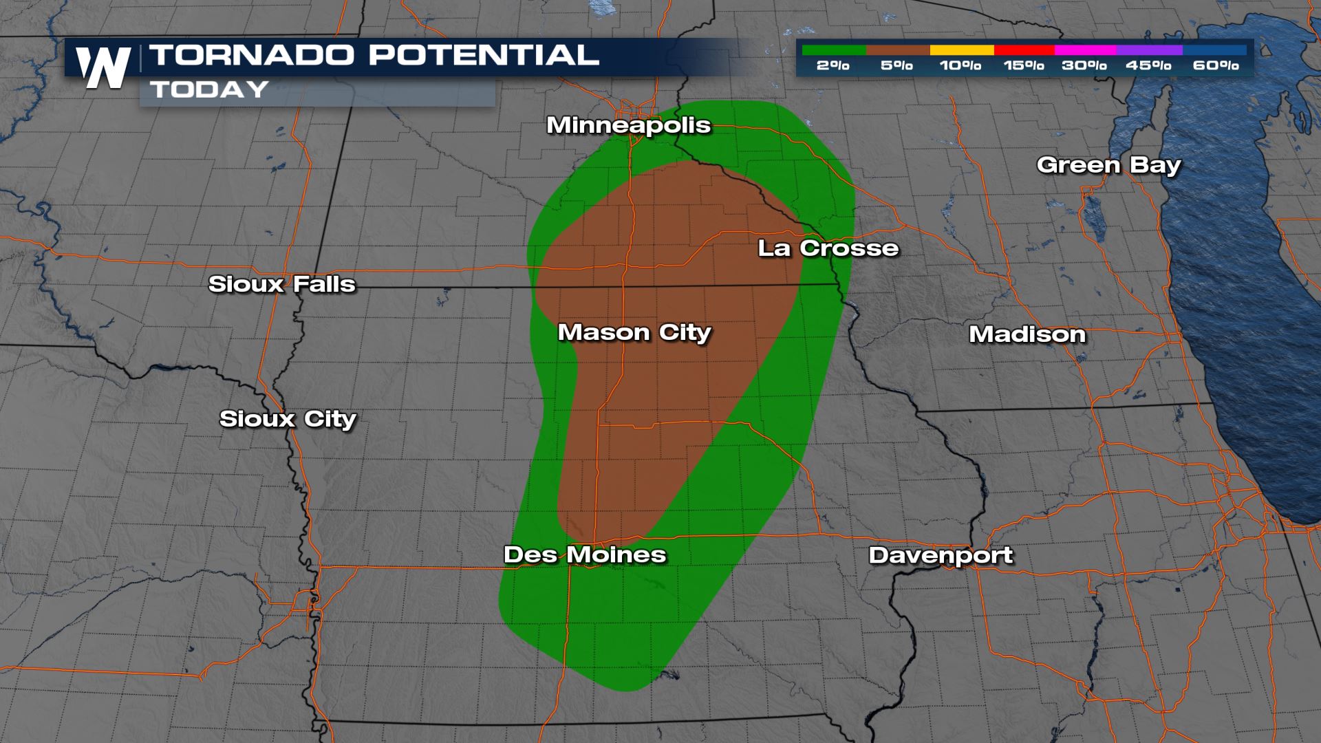
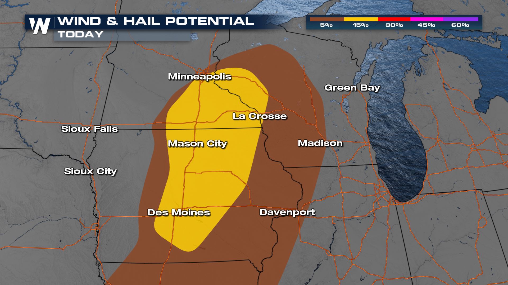 Tornadoes, large hail and damaging wind gusts are possible. The window for severe development is narrow, near peak instability in the later afternoon and early evening. As the low moves from eastern Minnesota into northern Wisconsin, a cold front will move eastward. Areas along the front have the potential to see severe storms.
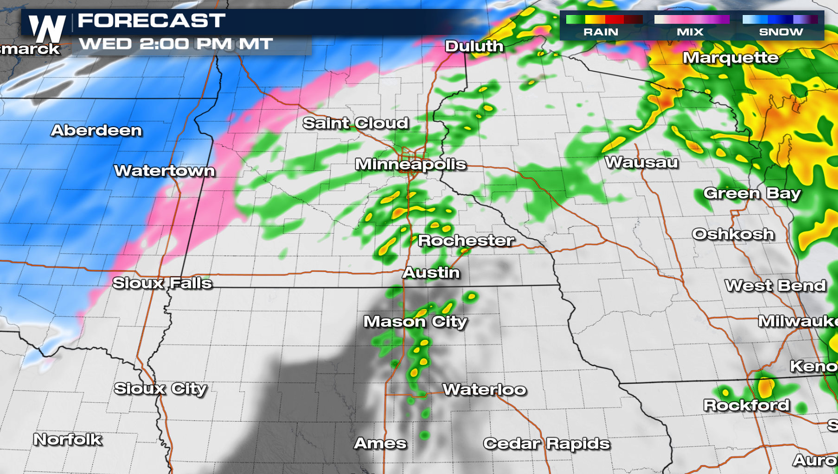
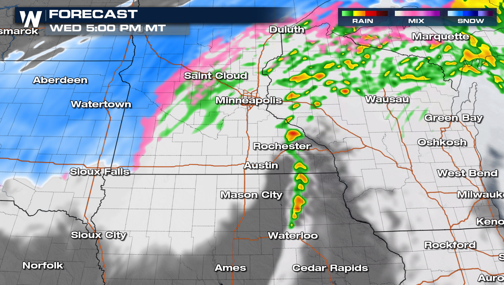
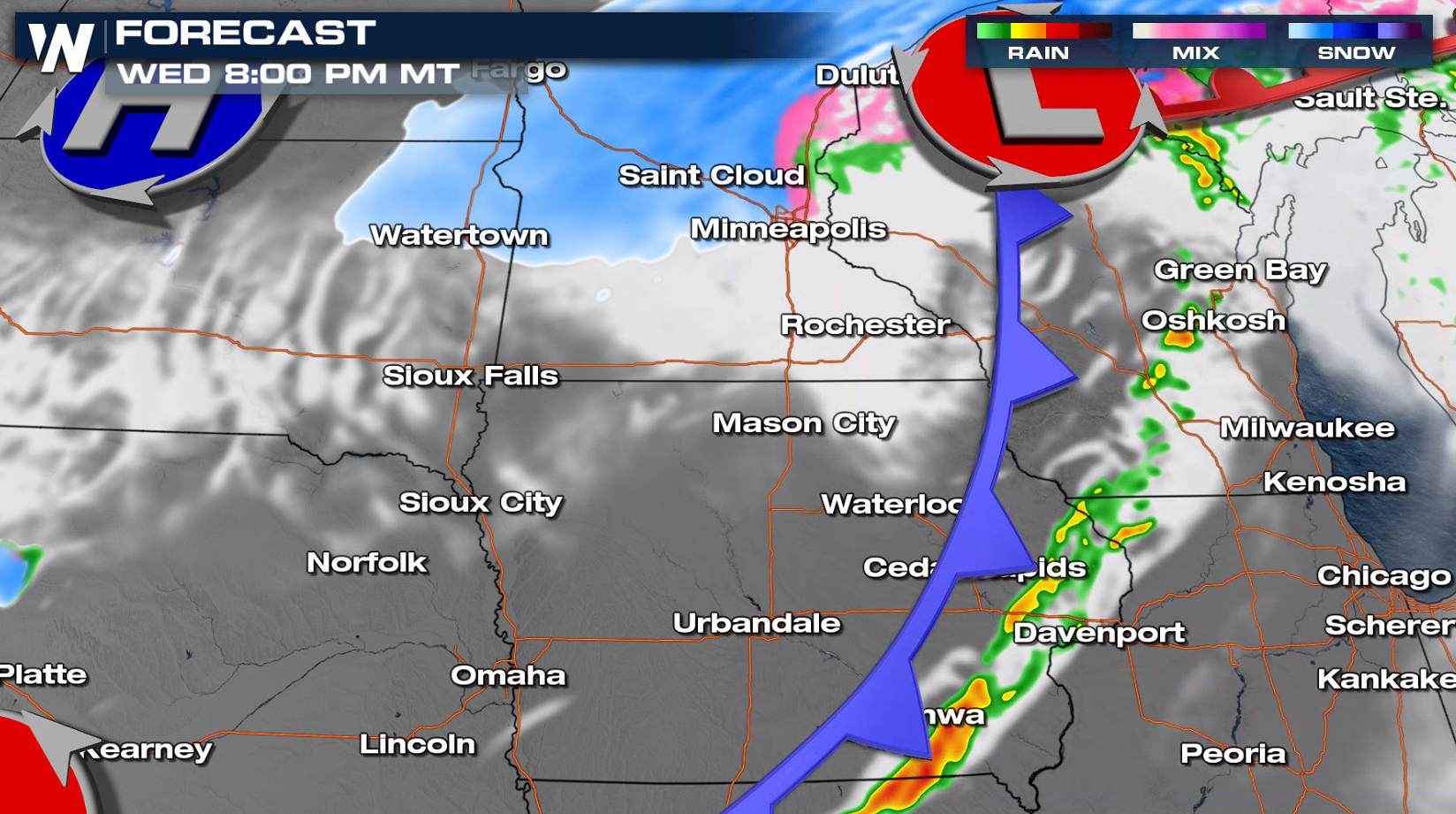 In the much colder air northwest of the low, heavy snow is possible. Stay tuned to WeatherNation on-air and online for the latest updates.
Tornadoes, large hail and damaging wind gusts are possible. The window for severe development is narrow, near peak instability in the later afternoon and early evening. As the low moves from eastern Minnesota into northern Wisconsin, a cold front will move eastward. Areas along the front have the potential to see severe storms.
In the much colder air northwest of the low, heavy snow is possible. Stay tuned to WeatherNation on-air and online for the latest updates.All Weather News
More
Fronts Continue To Spark Severe Weather Across the Plains
A cold front that brought record lows to the
18 Jul 2025 10:40 PM

Extreme Heat Impacts for the East Coast & South
Extreme heat continues to impact several area
18 Jul 2025 10:05 PM

Flooding Threat Remains Elevated in the East
A cold front pushing through the Eastern Seab
18 Jul 2025 9:10 PM

EF-2 Firenado from the Deer Creek Fire in Utah
A fire tornado was spotted near La Sal, Utah
18 Jul 2025 7:30 AM

Tropical System Brings Flood Risk to the Central Gulf
Time has run out for notable tropical develop
18 Jul 2025 3:05 AM

Heavy Rain, Flooding Threat Returns to Florida
Keep the rain boots handy in Florida - heavy
13 Jul 2025 12:50 PM

Severe Storm Risk Pushes into the Great Lakes, Ohio Valley
Friday was another busy day with severe weath
12 Jul 2025 8:00 PM