Severe Storms and Flooding Return to the Plains & Midwest

Severe weather looks to return to parts of the Plains and Midwest this week as a big western trough cuts into record warmth to the east. As these air masses clash, tropical moisture from Simon will be pulled north, adding fuel for storms and downpours.
Outlook & Timing
The fronts begin to clash Tuesday afternoon from Texas through Illinois. The SPC has issued a large marginal risk for Tuesday (level 1 threat) with a slight risk (scattered severe storms) issued from western Kansas through the Texas Panhandle. Hail will likely be a bigger threat early in the day with a few tornadoes possible. Storms could grow into storm complexes with an increasing wind threat by the evening.
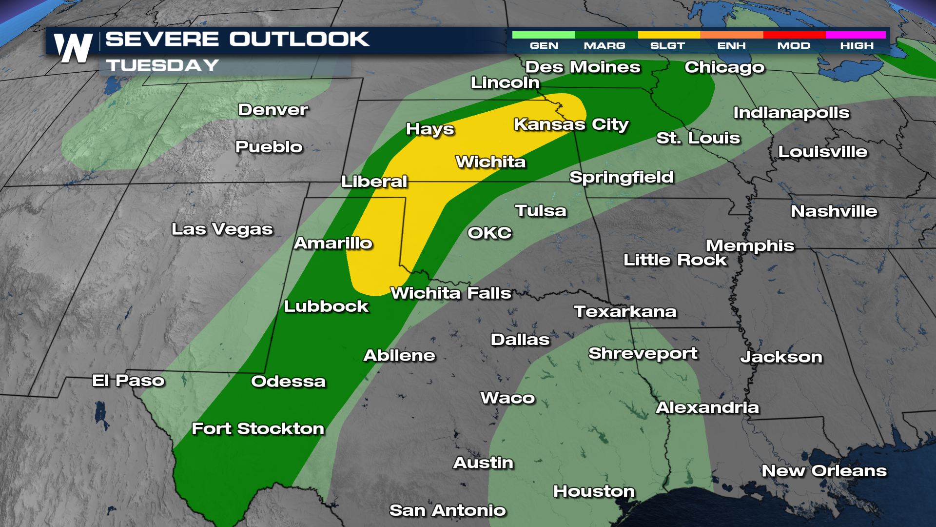
Scattered showers will kick the day off but will gain enough energy by the afternoon for severe storms to form. Storm coverage will likely increase gradually before bigger clusters of storms take over during the evening and overnight hours. Additional rounds of severe storms and heavy look to persist in the Plains and Midwest through at least Thursday.
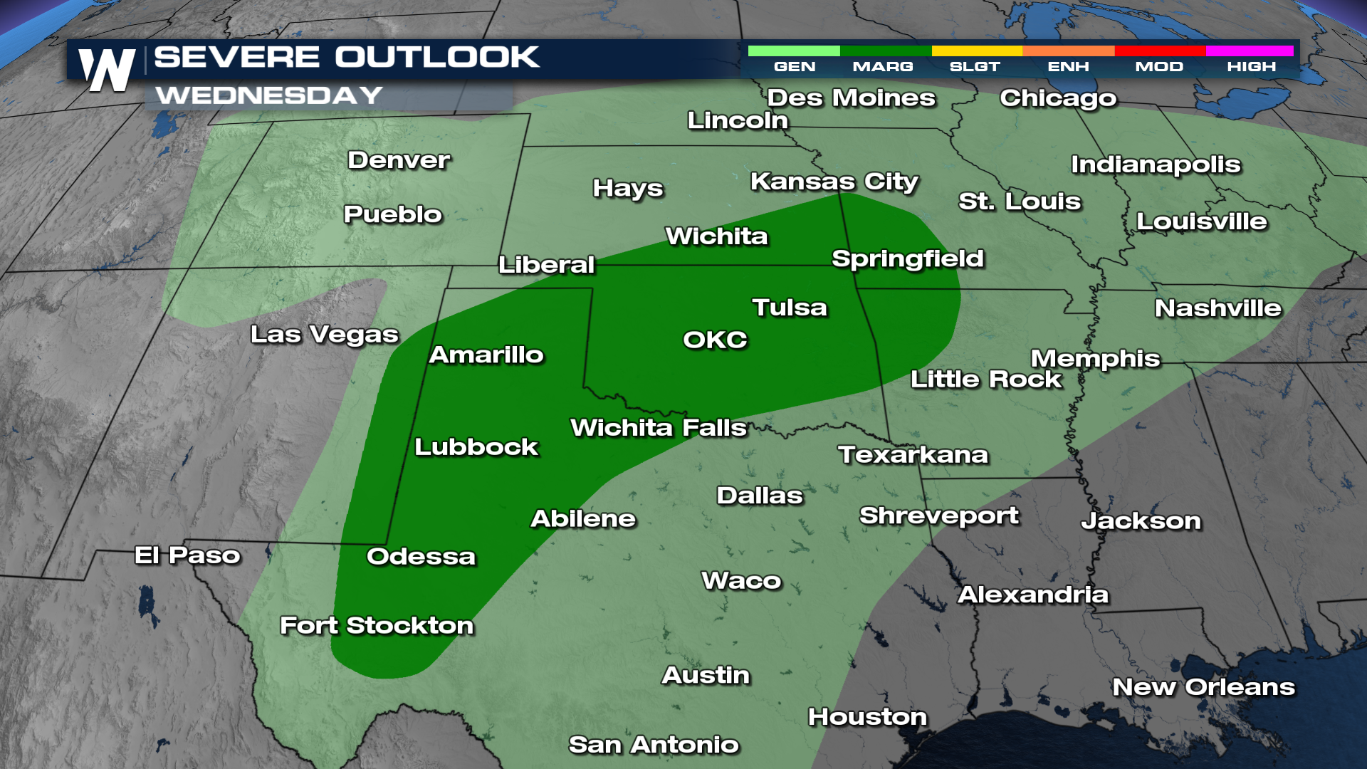
With a multi-day storm threat in the area, we can't rule out some more severe come Wednesday. A MARGINAL (level 1 out of 5) risk for severe weather remains in place for areas in the Southern Plains and Texas.
Flood Threat
With the added moisture from Simon in the Pacific, heavy rainfall rates appear likely at times Tuesday through Friday morning. Rain could fall at more than 2 inches per hour in some areas, with totals surpassing six inches in a few locations.
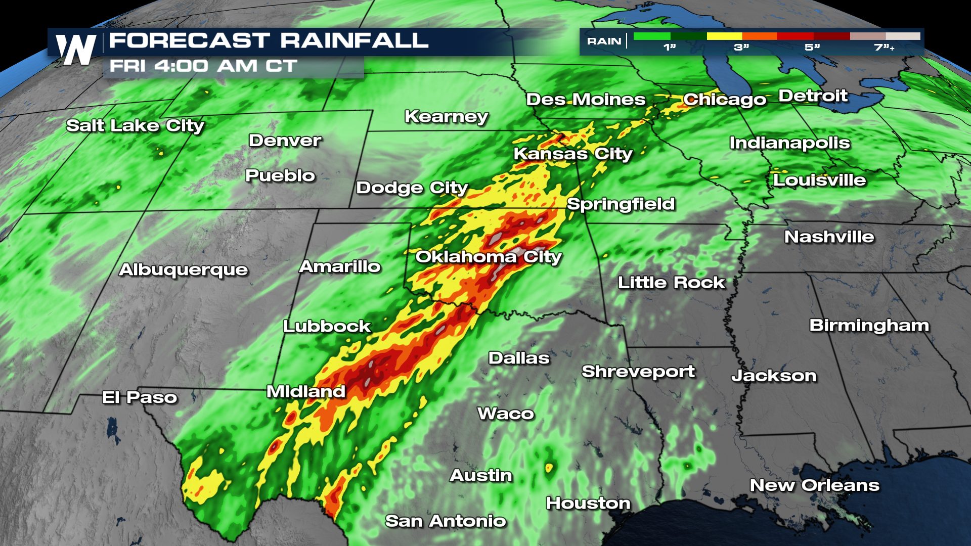
The heavy rainfall rates will present a risk for flash flooding/ The WPC is highlighting areas from central Missouri through west Texas with a level 2 risk (slight) for flash flooding for multiple days in a row!
These outlooks and the timing will change as we inch closer to Tuesday and Wednesday. Be sure to check back in for updates!


