Severe Storms for the Northeast and Ohio Valley
Top Stories
8 Aug 2019 7:31 AM
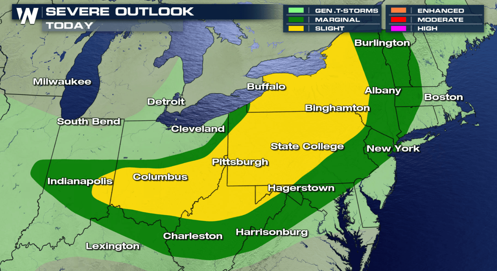
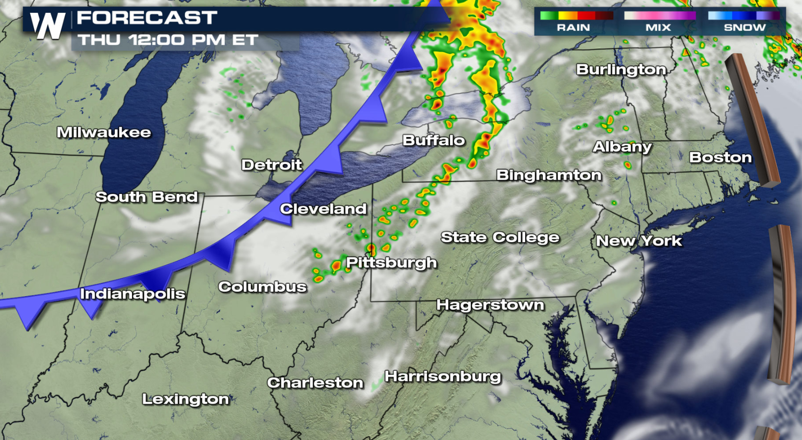
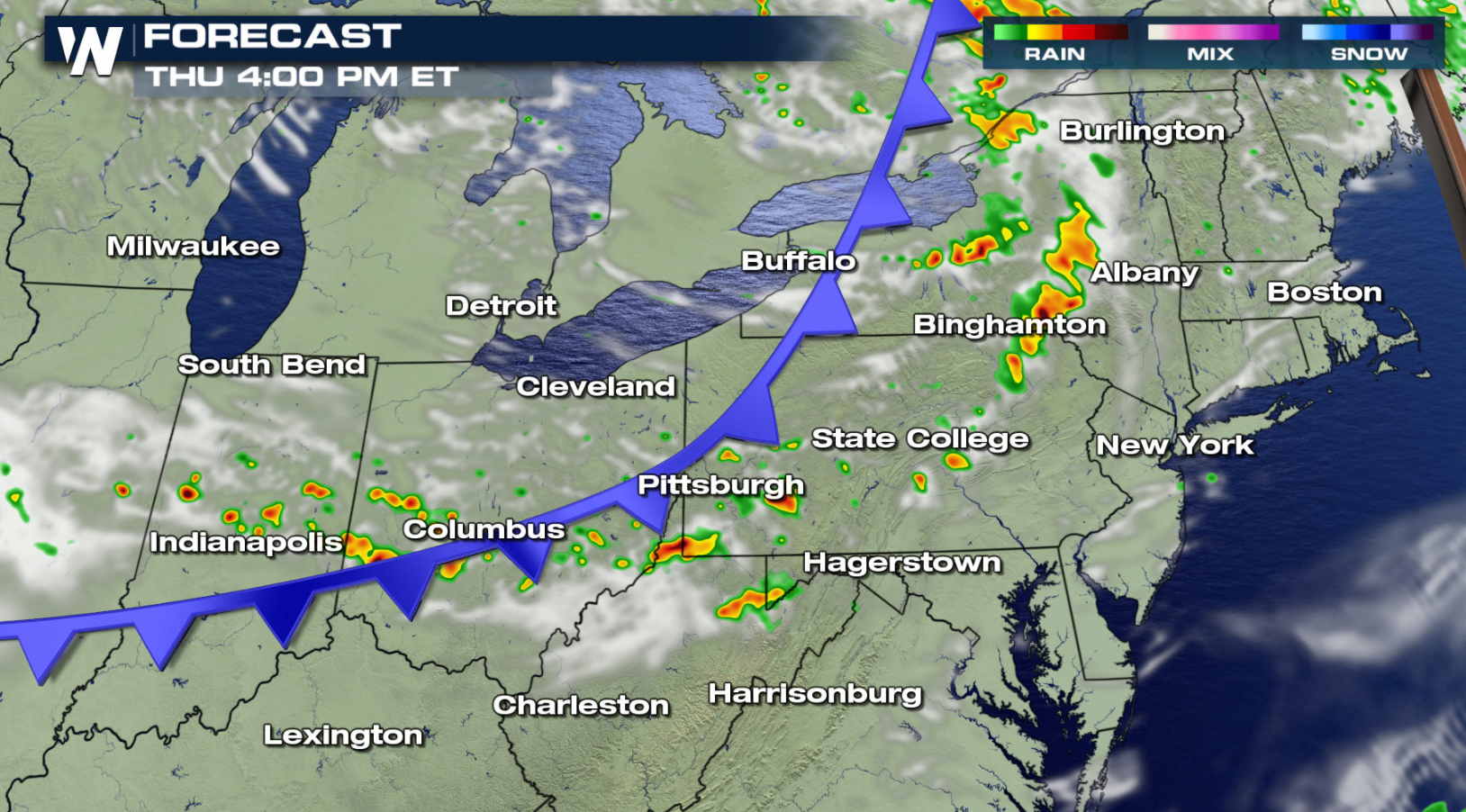
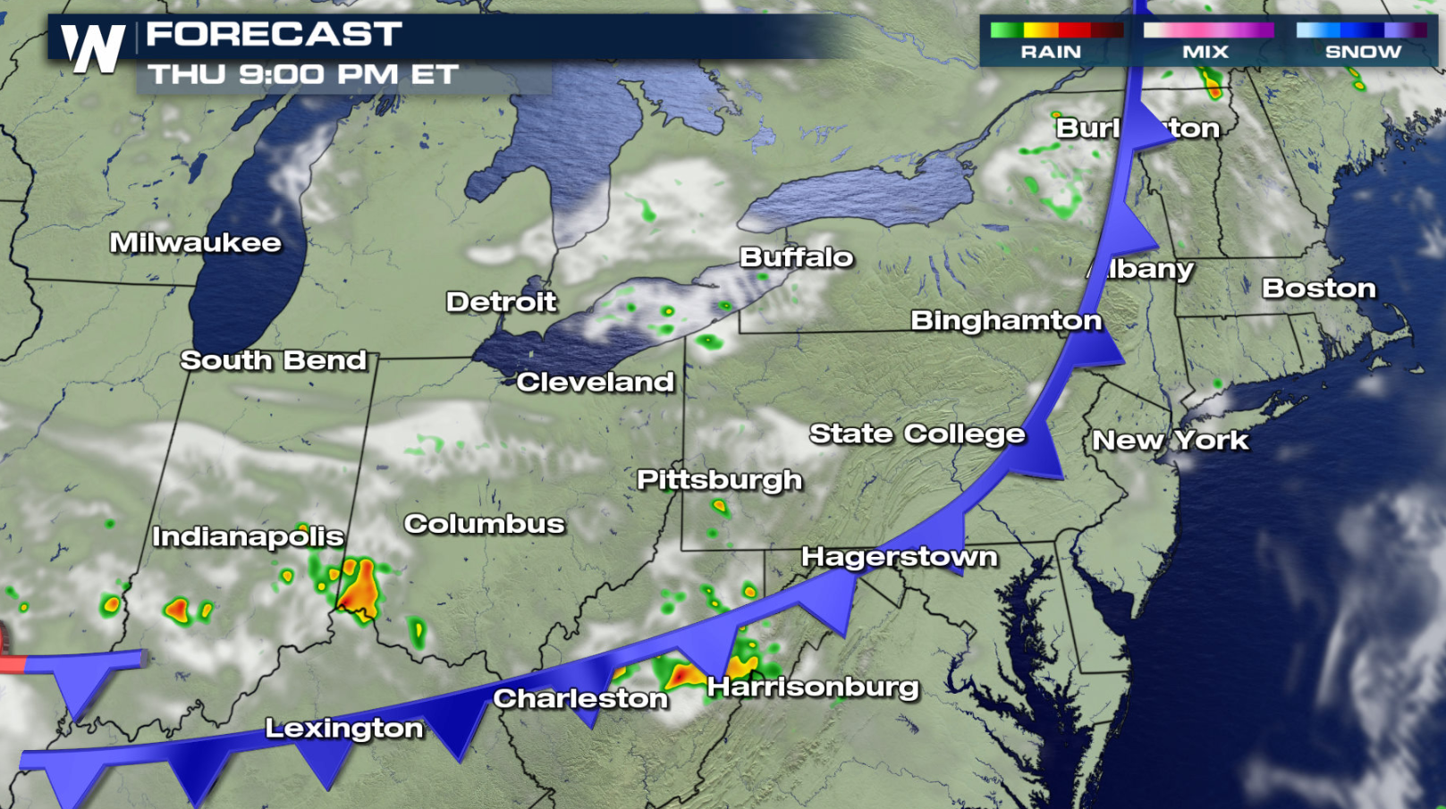
A cold front moving through the Northeast and Ohio Valley today (Thursday) will provide a risk of severe weather. Scattered severe storms are possible from Indiana up into New England. Large hail and damaging winds will be possible.
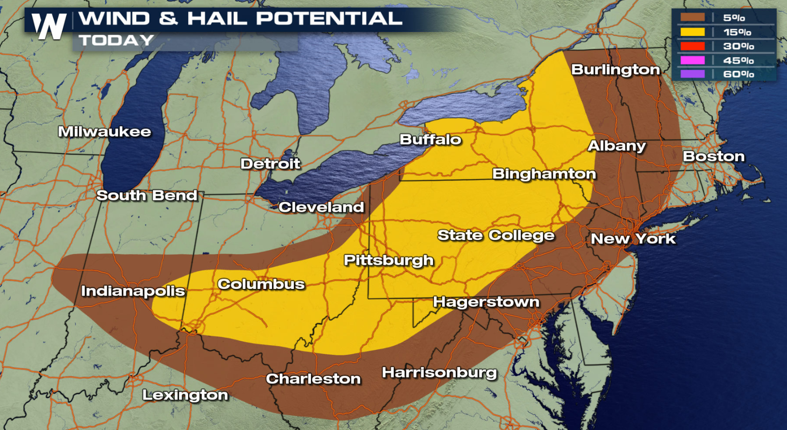
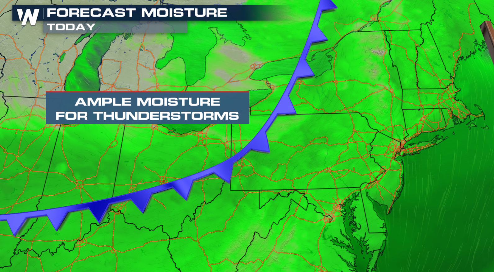
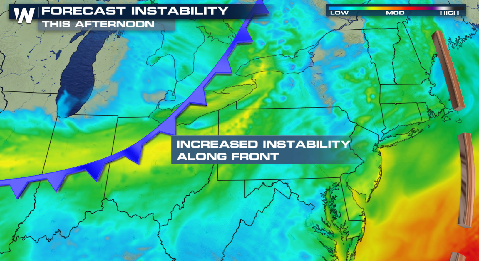 With increasing instability and plenty of moisture, storms will be able to grow and sustain strength along and ahead of the cold front. The timing will be from midday into the evening.
 Keep checking with WeatherNation for more updates on-air and online for any watches and warnings.
With increasing instability and plenty of moisture, storms will be able to grow and sustain strength along and ahead of the cold front. The timing will be from midday into the evening.
Keep checking with WeatherNation for more updates on-air and online for any watches and warnings.All Weather News
More

More Storms for the East Through Monday
A low-pressure system that moved through the
3 Aug 2026 12:20 PM


After Reaching Category 5, Genevieve Weakens in the Pacific
PacificGenevieve formed last Friday south of
3 Aug 2026 12:30 AM

Flooding, Severe Storms Target the Midwest Again
After an active week of storms across the nor
1 Aug 2026 1:40 AM

Flooding Risk Increases as Heavy Rain Targets the Tri-State Area
Tuesday, heavy rainfall moved across the Nort
30 Jul 2026 12:25 AM