Severe Threat Shifts to the Southeast for Wednesday and Thursday
Special Stories
29 Apr 2020 6:00 AM
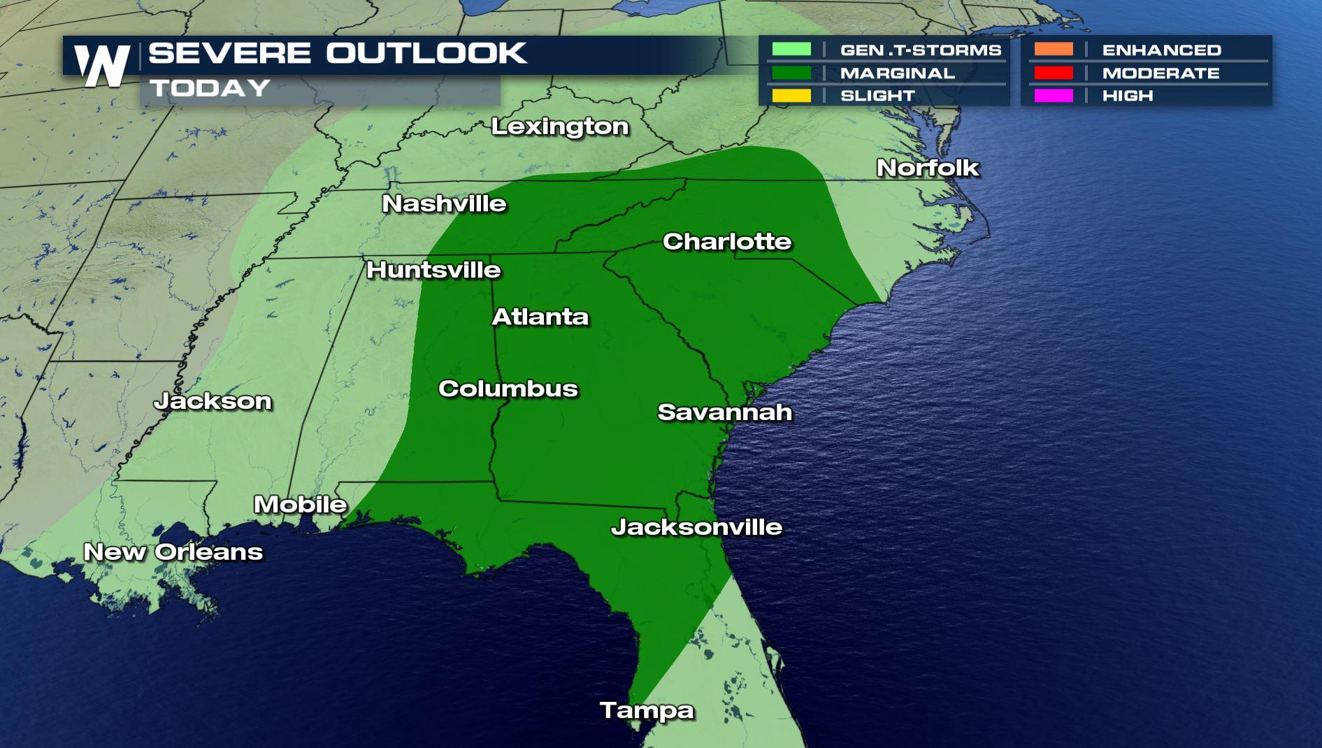
A storm system bringing severe storms to the Plains will move into the Southeast for Wednesday and Thursday, keeping the threat of severe weather in the forecast. The Wednesday marginal risk extends along the Gulf of Mexico coastline from Texas to Florida, and northward to extreme Southern Virginia.
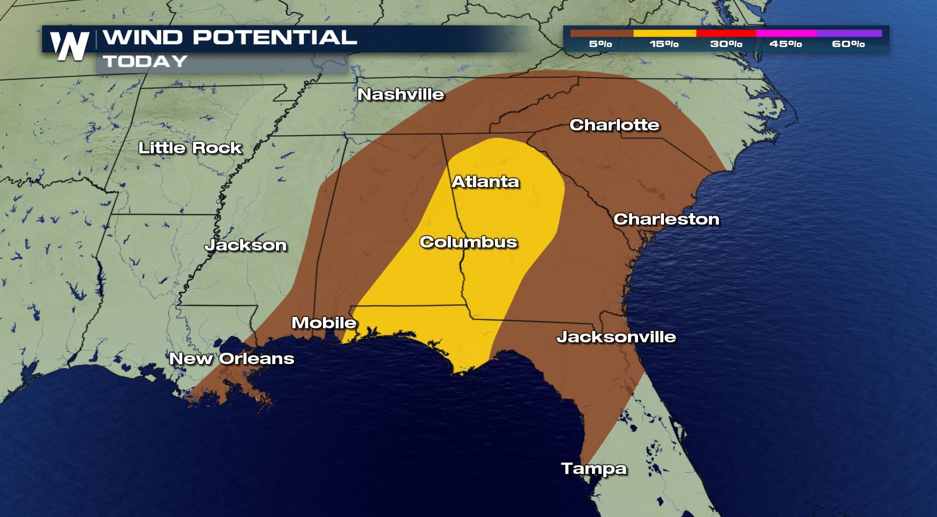
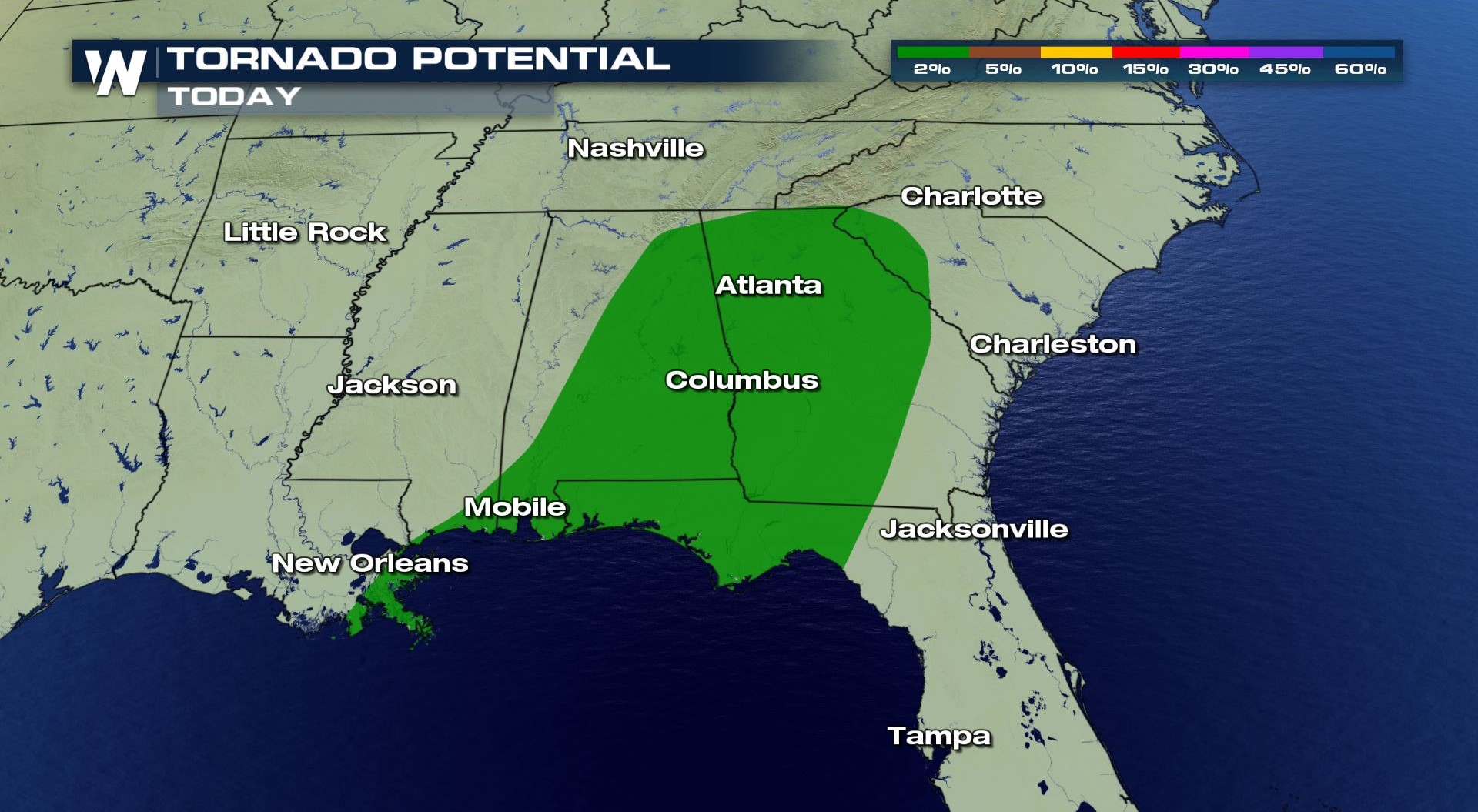
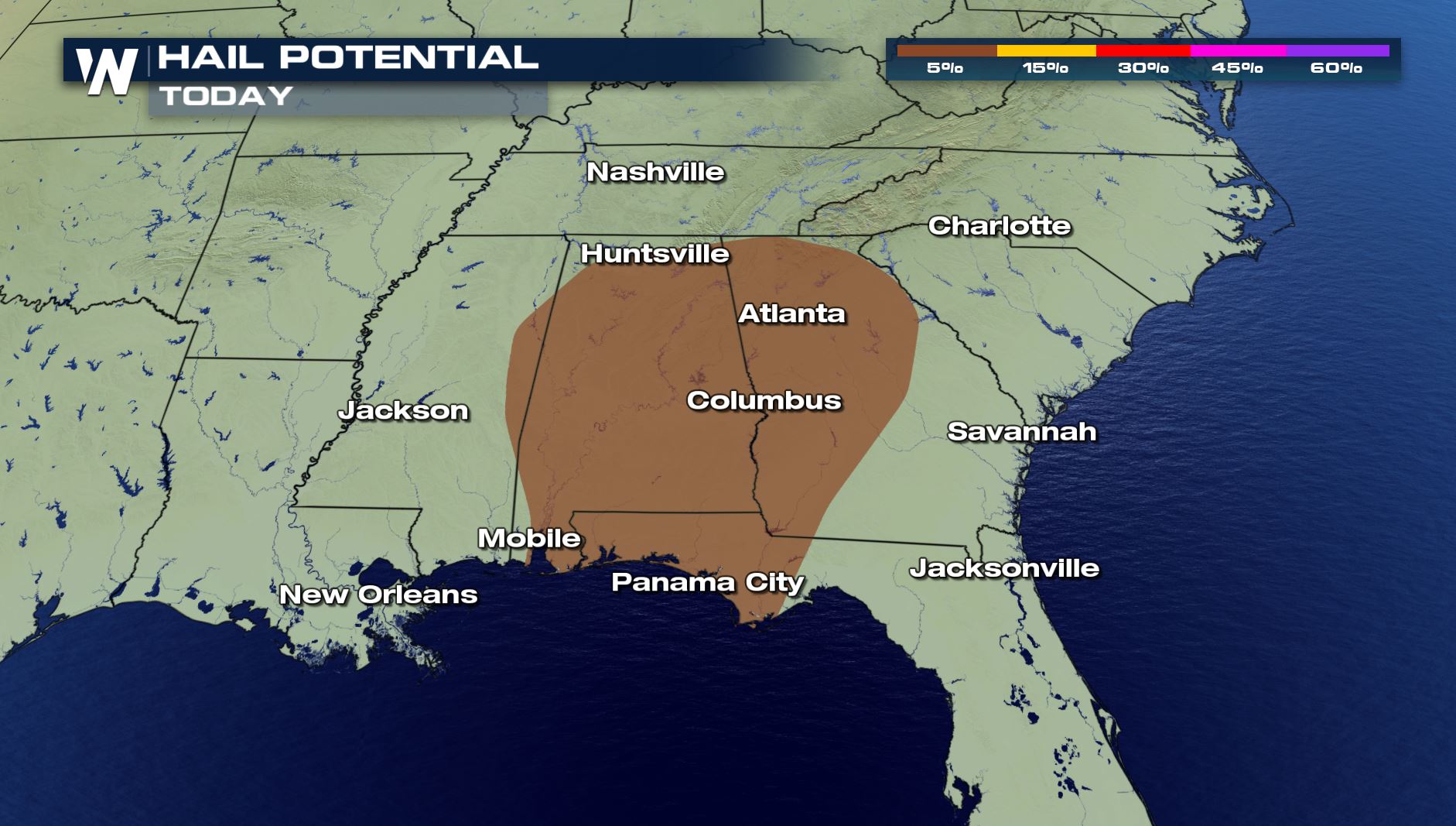 Large hail, greater than the size of a quarter, is the biggest concern for Wednesday. Isolated tornadoes and damaging wind gusts are also possible.
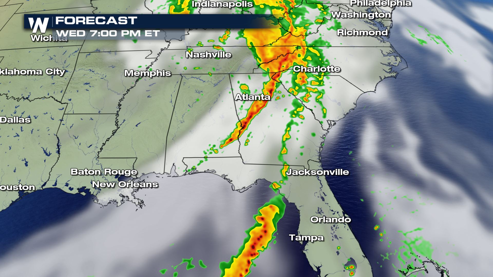
 Storms may be ongoing in the morning and midday along a trough of low pressure ahead of the cold front. In the afternoon and evening, this line of storms will likely increase in intensity and coverage, with a few severe storms likely. Additional development is possible along the cold front.
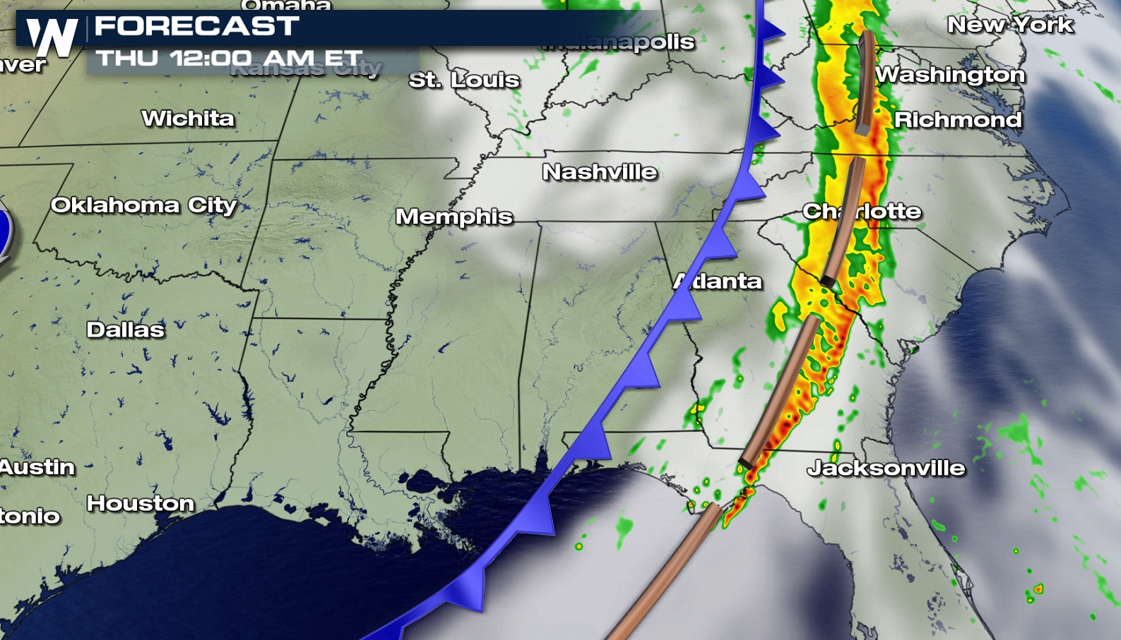
 The strongest jet stream energy is expected to move offshore by Thursday, however, the cold front will lingering across Florida and into North and South Carolina, keeping a marginal severe weather threat in the forecast.
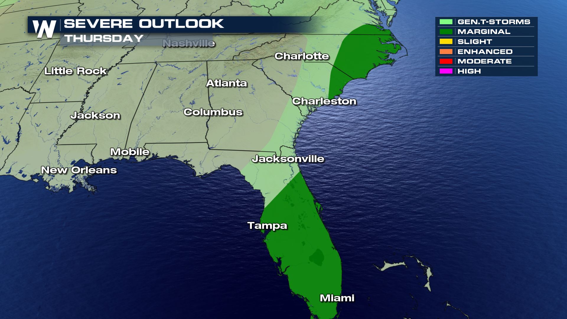
 The chance for strong or isolated severe storms will gradually push southeast across the Florida Peninsula Thursday morning through the mid-afternoon hours. Hail and wind damage will likely be the main threats, although isolated waterspouts or a brief tornado is possible.
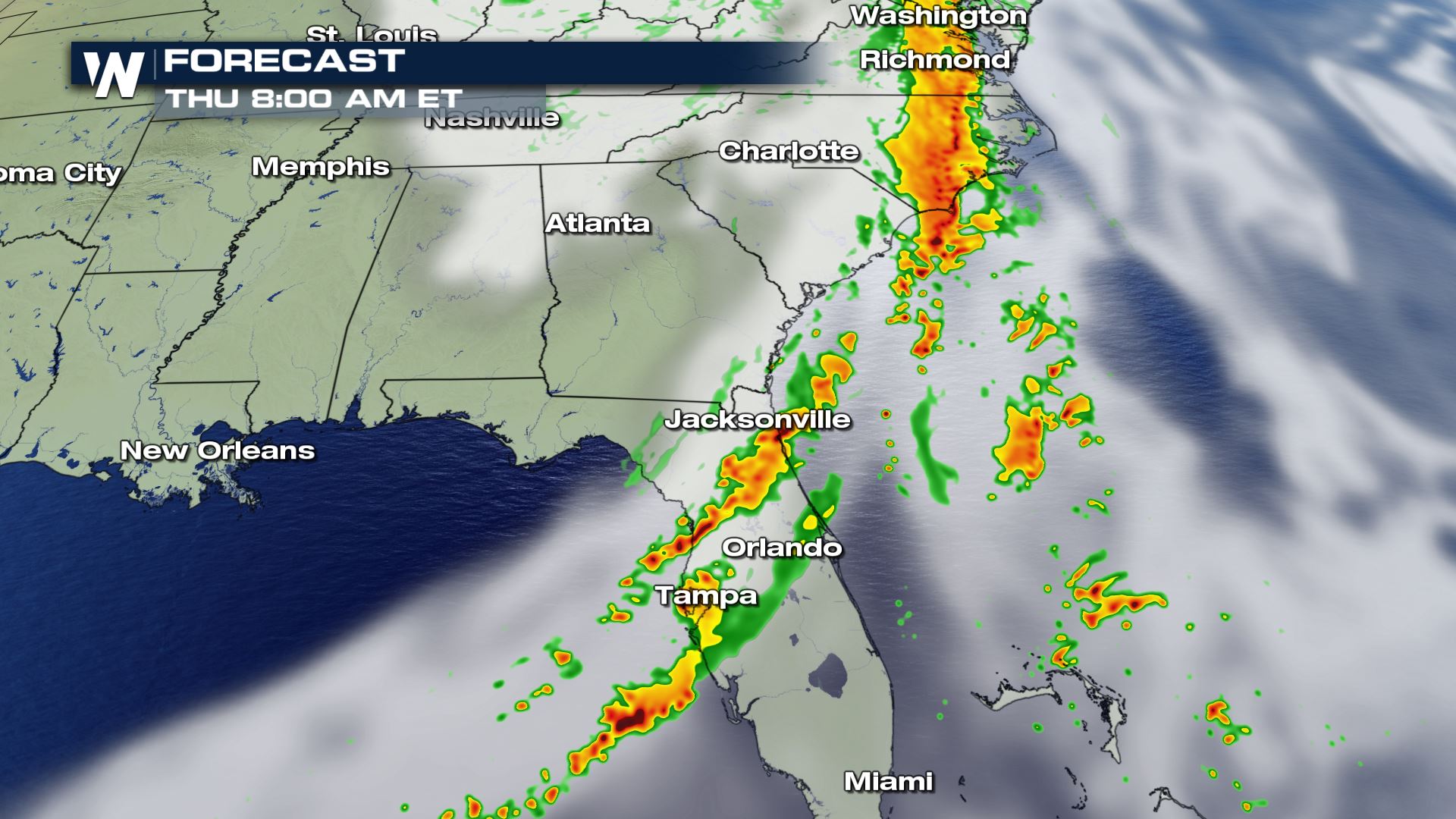
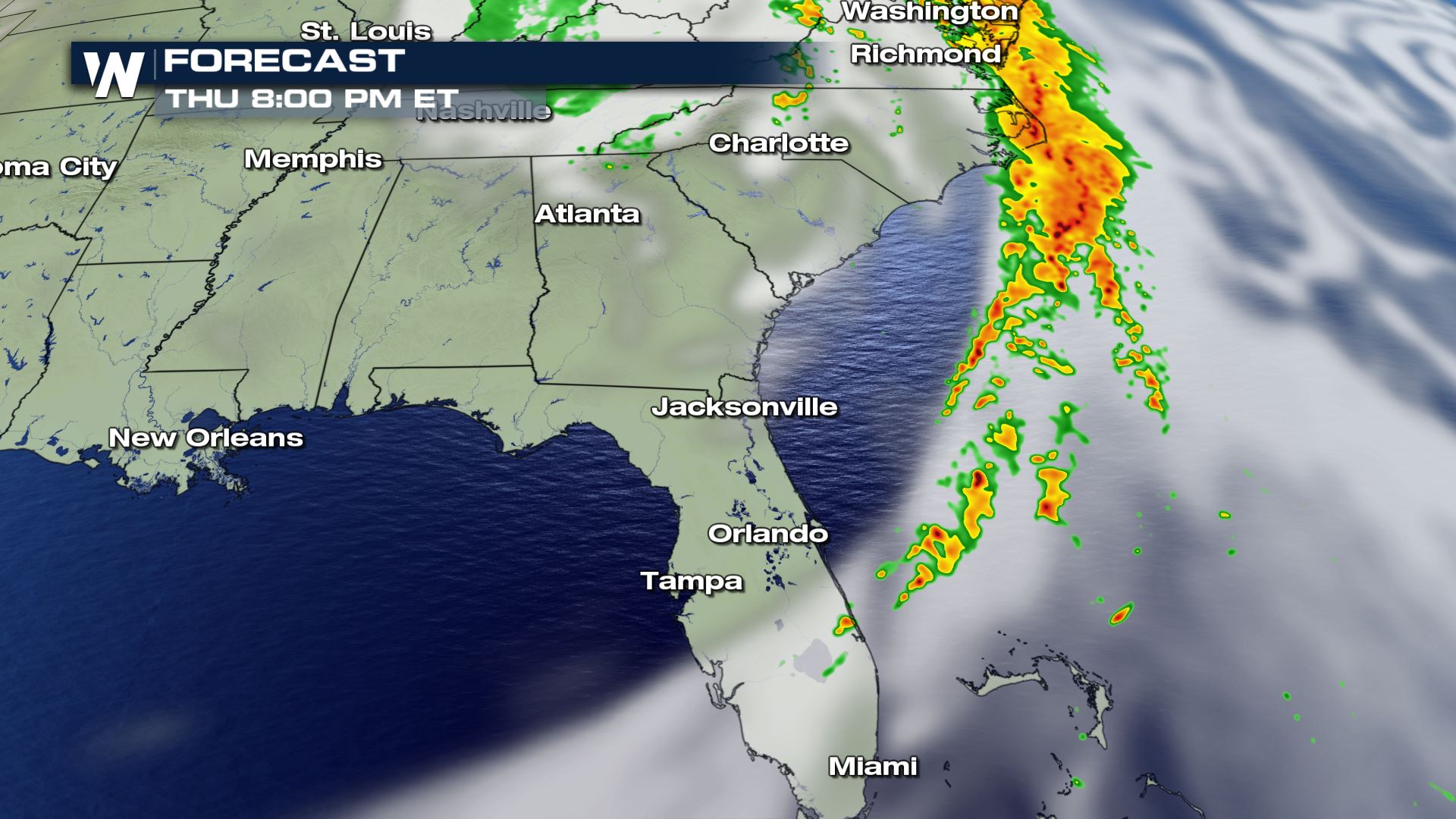 By Thursday evening, the threat for severe weather is expected to come to an end, however, some storms may continue to impact the Outer Banks until 8 or 9 pm Eastern.
Large hail, greater than the size of a quarter, is the biggest concern for Wednesday. Isolated tornadoes and damaging wind gusts are also possible.
Storms may be ongoing in the morning and midday along a trough of low pressure ahead of the cold front. In the afternoon and evening, this line of storms will likely increase in intensity and coverage, with a few severe storms likely. Additional development is possible along the cold front.
The strongest jet stream energy is expected to move offshore by Thursday, however, the cold front will lingering across Florida and into North and South Carolina, keeping a marginal severe weather threat in the forecast.
The chance for strong or isolated severe storms will gradually push southeast across the Florida Peninsula Thursday morning through the mid-afternoon hours. Hail and wind damage will likely be the main threats, although isolated waterspouts or a brief tornado is possible.
By Thursday evening, the threat for severe weather is expected to come to an end, however, some storms may continue to impact the Outer Banks until 8 or 9 pm Eastern.All Weather News
More
Fronts Continue To Spark Severe Weather Across the Plains
A cold front that brought record lows to the
18 Jul 2025 10:40 PM

Extreme Heat Impacts for the East Coast & South
Extreme heat continues to impact several area
18 Jul 2025 10:05 PM

Flooding Threat Remains Elevated in the East
A cold front pushing through the Eastern Seab
18 Jul 2025 9:10 PM

EF-2 Firenado from the Deer Creek Fire in Utah
A fire tornado was spotted near La Sal, Utah
18 Jul 2025 7:30 AM

Tropical System Brings Flood Risk to the Central Gulf
Time has run out for notable tropical develop
18 Jul 2025 3:05 AM

Heavy Rain, Flooding Threat Returns to Florida
Keep the rain boots handy in Florida - heavy
13 Jul 2025 12:50 PM

Severe Storm Risk Pushes into the Great Lakes, Ohio Valley
Friday was another busy day with severe weath
12 Jul 2025 8:00 PM