Severe Thunderstorm Watch Issued for the Northeast

Top Stories
17 Aug 2018 2:54 PM
A severe thunderstorm watch remains in effect for several Northeast states for the remainder of Friday. The potential for damaging wind gusts, hail, and tornadoes exists within these thunderstorms.
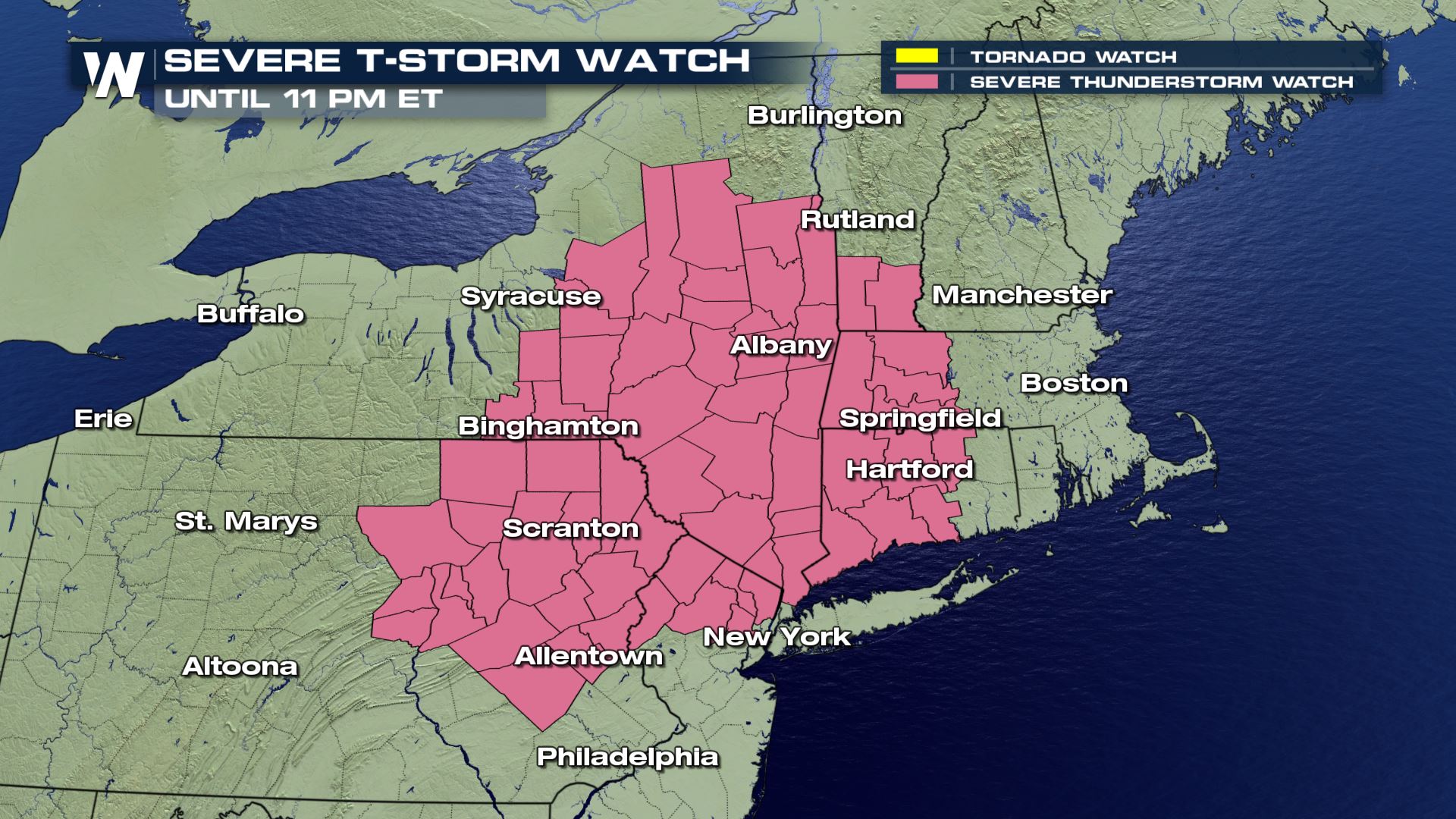 Shaded areas under a severe thunderstorm watch until 11 pm. ET Friday, August 17
 Thunderstorms will continue to fire up along a cold front pressing to the east. This front won't really cool a lot of you East folks down, rather give you more rainfall after a wet summer so far.
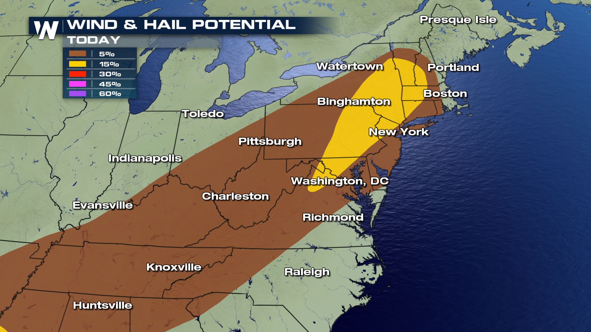 The potential for severe wind and hail appears to be most likely for much of the East Friday, August 17
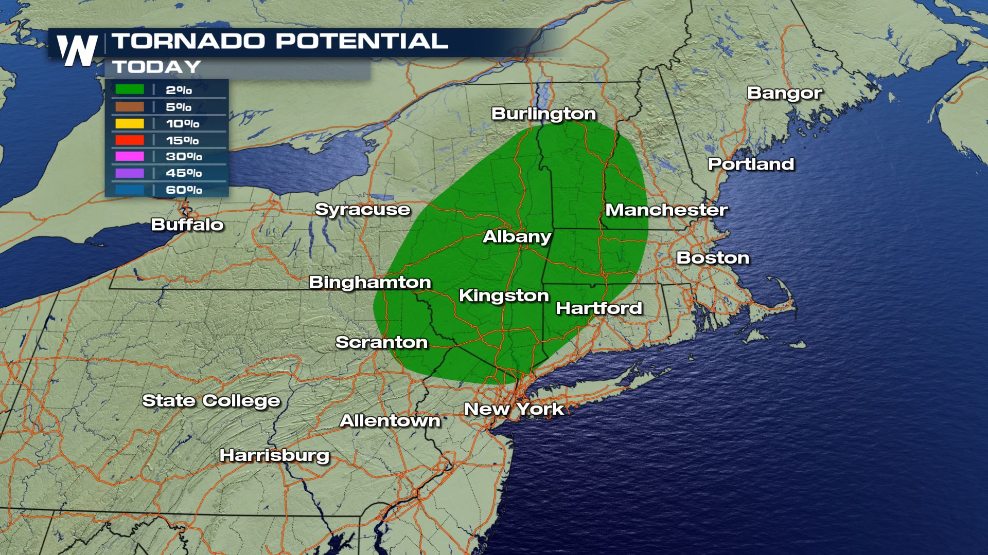 The tornado potential is lower than the hail/wind threat, but still exists for parts of the Northeast.
Areas of rain will continue to move to the east/northeast between 20-30 miles per hour. Keep an eye on the west/southwest sky for incoming storms.
The tornado potential is lower than the hail/wind threat, but still exists for parts of the Northeast.
Areas of rain will continue to move to the east/northeast between 20-30 miles per hour. Keep an eye on the west/southwest sky for incoming storms.
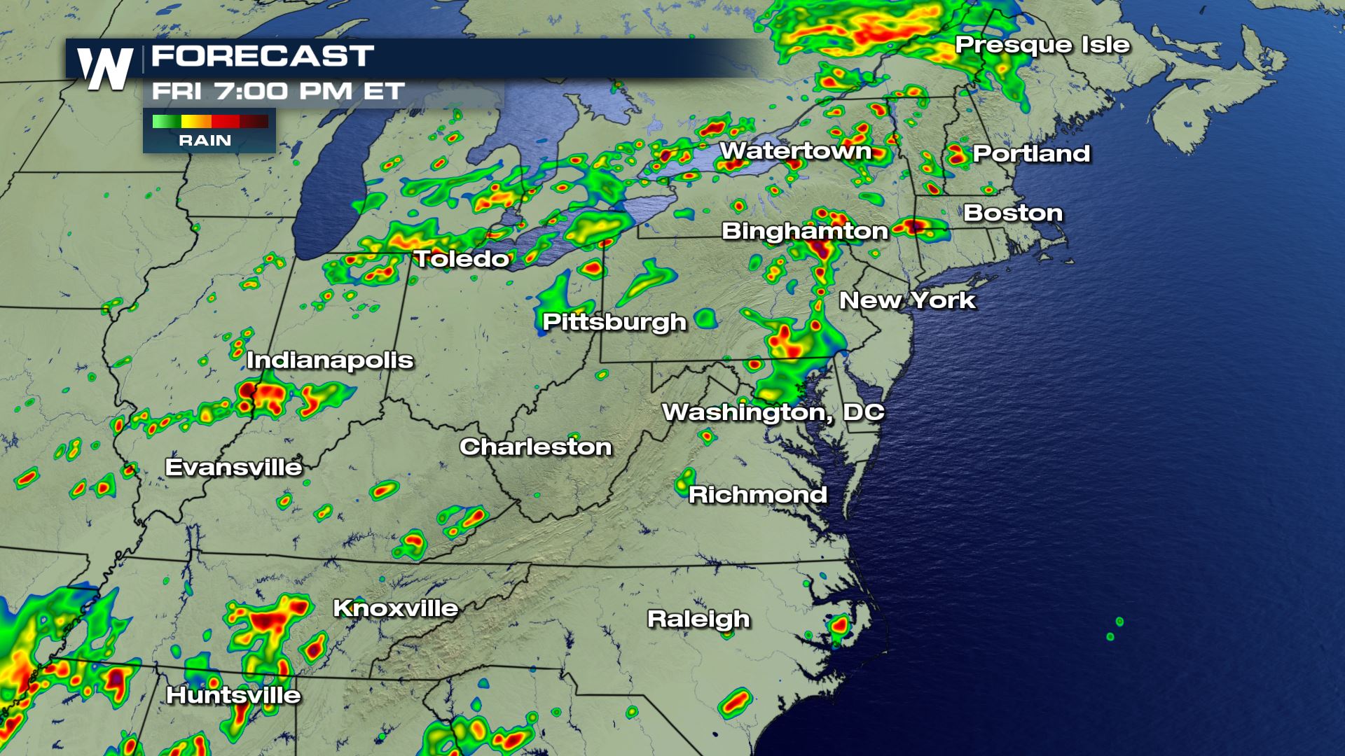 Simulated radar Friday evening, August 17 where red shows the most likely placement of thunderstorms.
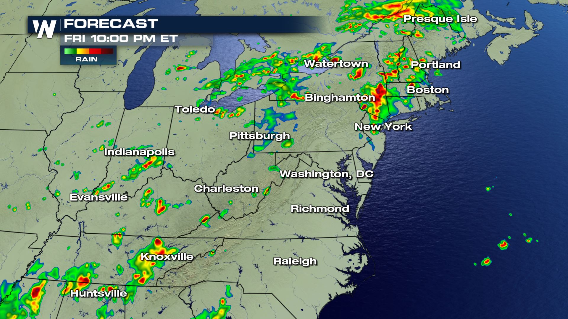 Forecast radar late Friday evening, August 17 which shows the potential for storms to last longest in southern New England.
Things to keep in mind:
Forecast radar late Friday evening, August 17 which shows the potential for storms to last longest in southern New England.
Things to keep in mind:
Shaded areas under a severe thunderstorm watch until 11 pm. ET Friday, August 17
Thunderstorms will continue to fire up along a cold front pressing to the east. This front won't really cool a lot of you East folks down, rather give you more rainfall after a wet summer so far.
The potential for severe wind and hail appears to be most likely for much of the East Friday, August 17
The tornado potential is lower than the hail/wind threat, but still exists for parts of the Northeast.
Areas of rain will continue to move to the east/northeast between 20-30 miles per hour. Keep an eye on the west/southwest sky for incoming storms.
Simulated radar Friday evening, August 17 where red shows the most likely placement of thunderstorms.
Forecast radar late Friday evening, August 17 which shows the potential for storms to last longest in southern New England.
Things to keep in mind:
- Stay weather aware if you plan to spend a lot of time outdoors in this area
- Have a way of getting weather warnings for your location
- Prepare to take action if needed due to these storms
- Give yourself extra travel time through rainy areas
All Weather News
More
Wildfire Outbreak in the Pacific Northwest
SPOKANE, WA - On Saturday, August 1st, the Ol
3 Aug 2026 1:55 AM

More Storms for the East Through Monday
A low-pressure system that moved through the
3 Aug 2026 1:50 AM


After Reaching Category 5, Genevieve Weakens in the Pacific
PacificGenevieve formed last Friday south of
3 Aug 2026 12:30 AM

Flooding, Severe Storms Target the Midwest Again
After an active week of storms across the nor
1 Aug 2026 1:40 AM

Flooding Risk Increases as Heavy Rain Targets the Tri-State Area
Tuesday, heavy rainfall moved across the Nort
30 Jul 2026 12:25 AM

Severe Weather: Energy From the Midwest Now in the Southeast
UPPER MIDWEST - Through Monday, dangerous tor
29 Jul 2026 10:30 PM