Severe Thunderstorms Ahead for Central and Southern Plains
Special Stories
10 Oct 2019 11:10 AM
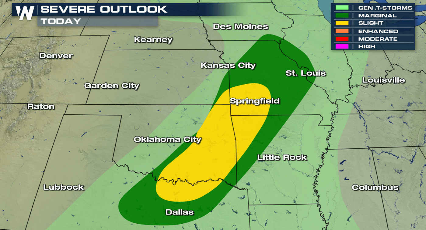
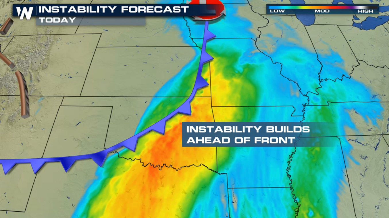
A sharp cold front moving through the Plains will bring severe thunderstorms to the nation's mid-section today (Thursday). A slight risk for severe thunderstorms extends from Southwest Missouri to the Red River of the South in Texas.
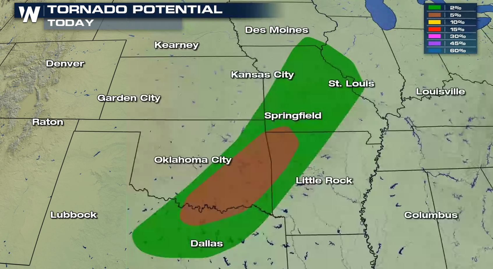
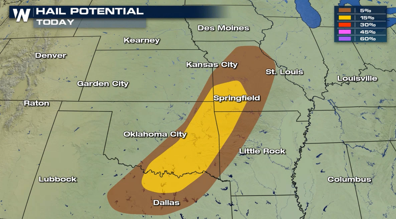 Strong wind gusts greater than 60 mph, large hail greater than an inch in diameter, and a few tornadoes are likely in the strongest storms. Strong Jet Stream energy above the cold front coupled with building instability will aid in the development of severe thunderstorms.
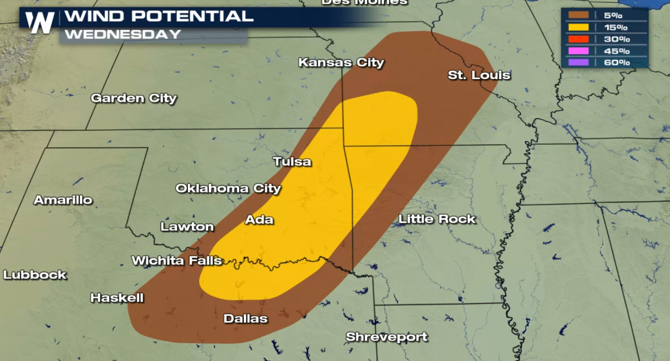
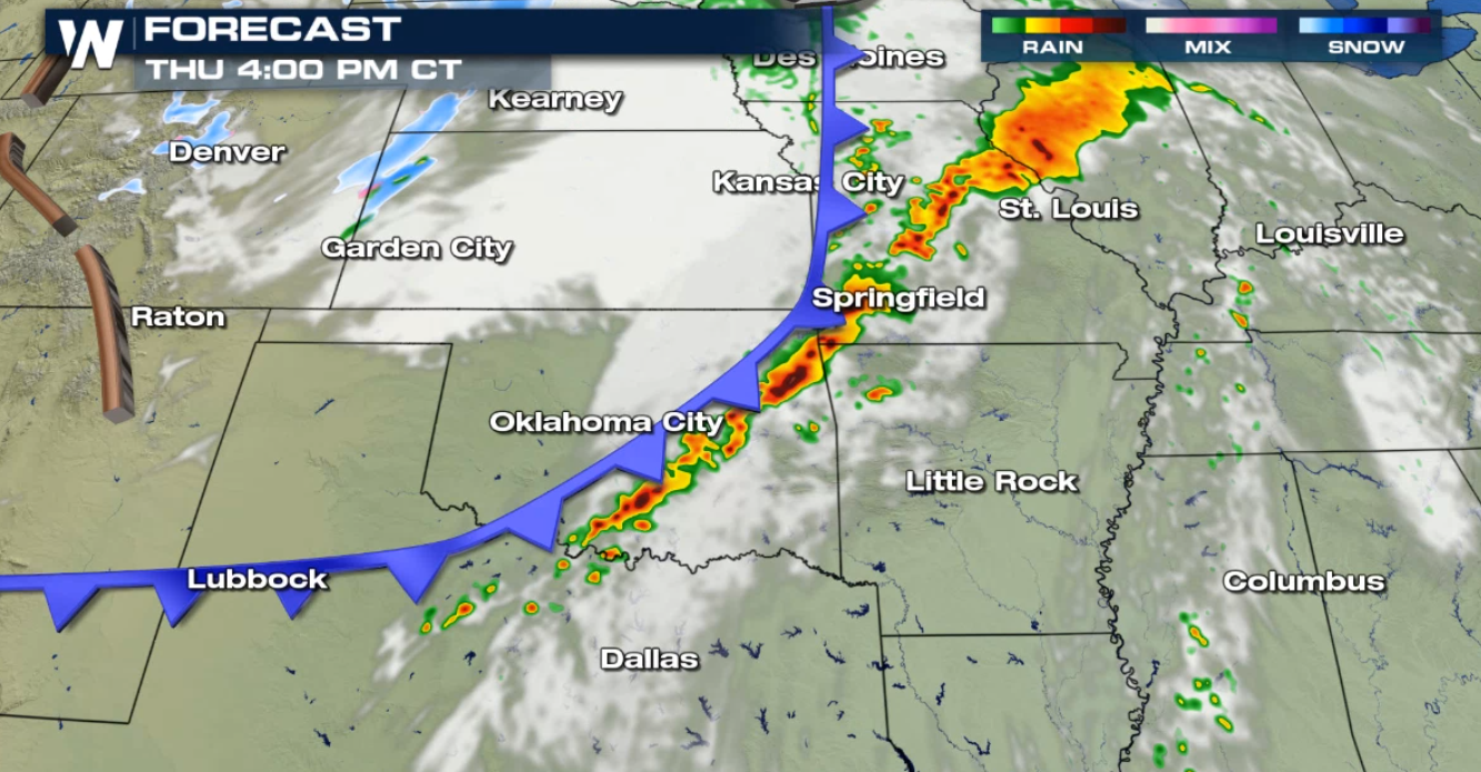
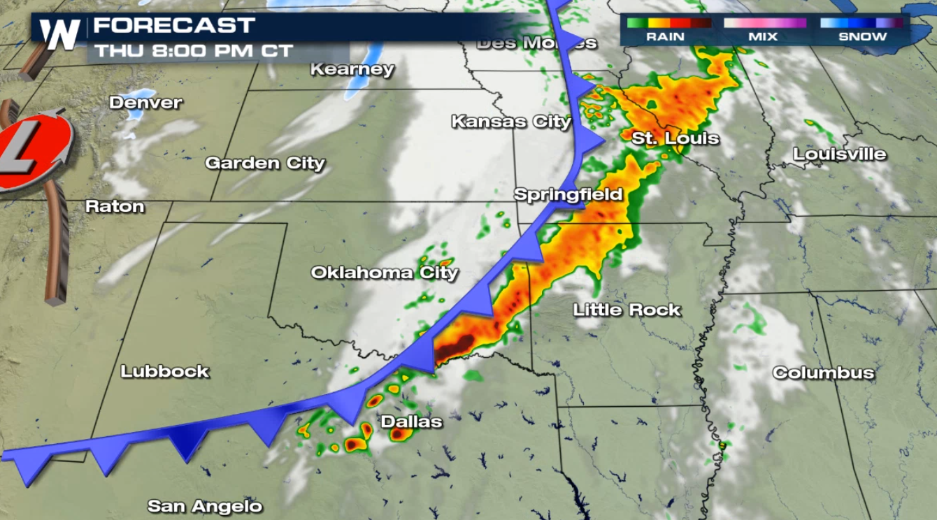
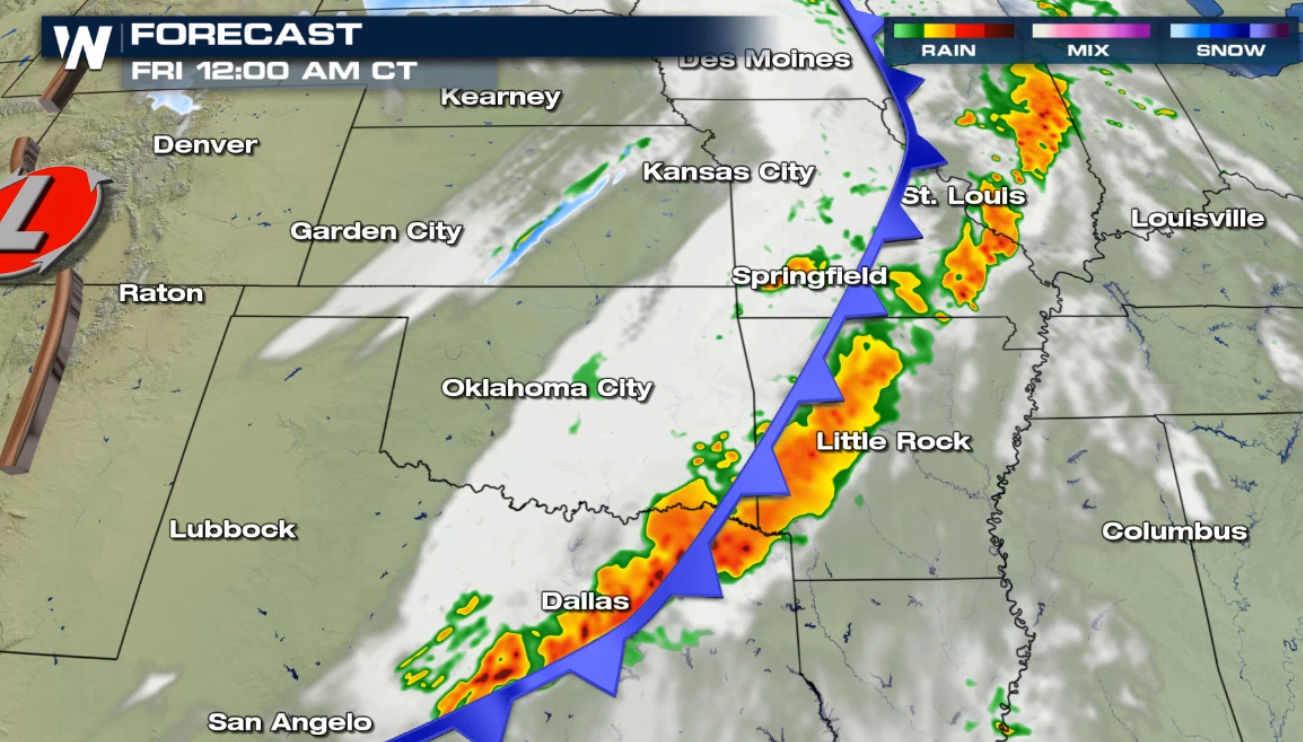
 A line of storms will form in the late afternoon and early evening. The wave of storms will expand throughout the evening, with severe storms forming and pushing eastward. Heavy rain is also possible.
 Check back with WeatherNation on-air and online for the latest severe weather information.
Strong wind gusts greater than 60 mph, large hail greater than an inch in diameter, and a few tornadoes are likely in the strongest storms. Strong Jet Stream energy above the cold front coupled with building instability will aid in the development of severe thunderstorms.
A line of storms will form in the late afternoon and early evening. The wave of storms will expand throughout the evening, with severe storms forming and pushing eastward. Heavy rain is also possible.
Check back with WeatherNation on-air and online for the latest severe weather information.All Weather News
More
More Storms for the East Through Monday
A low-pressure system that moved through the
2 Aug 2026 10:40 PM

Wildfire Outbreak in the Pacific Northwest
SPOKANE, WA - On Saturday, August 1st, the Ol
2 Aug 2026 10:35 PM


After Reaching Category 5, Genevieve Weakens in the Pacific
PacificGenevieve formed on last Friday south
2 Aug 2026 6:25 PM

Flooding, Severe Storms Target the Midwest Again
After an active week of storms across the nor
1 Aug 2026 1:40 AM

Flooding Risk Increases as Heavy Rain Targets the Tri-State Area
Tuesday, heavy rainfall moved across the Nort
30 Jul 2026 12:25 AM

Severe Weather: Energy From the Midwest Now in the Southeast
UPPER MIDWEST - Through Monday, dangerous tor
29 Jul 2026 10:30 PM