Severe Thunderstorms Likely in the High Plains Today
Top Stories
8 Jul 2021 2:50 PM
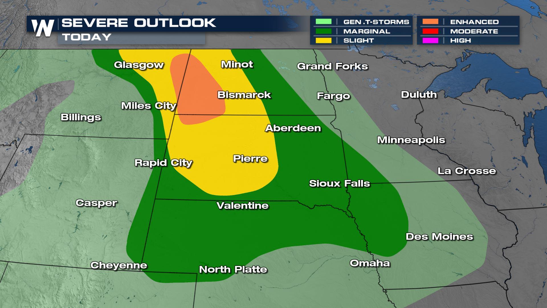
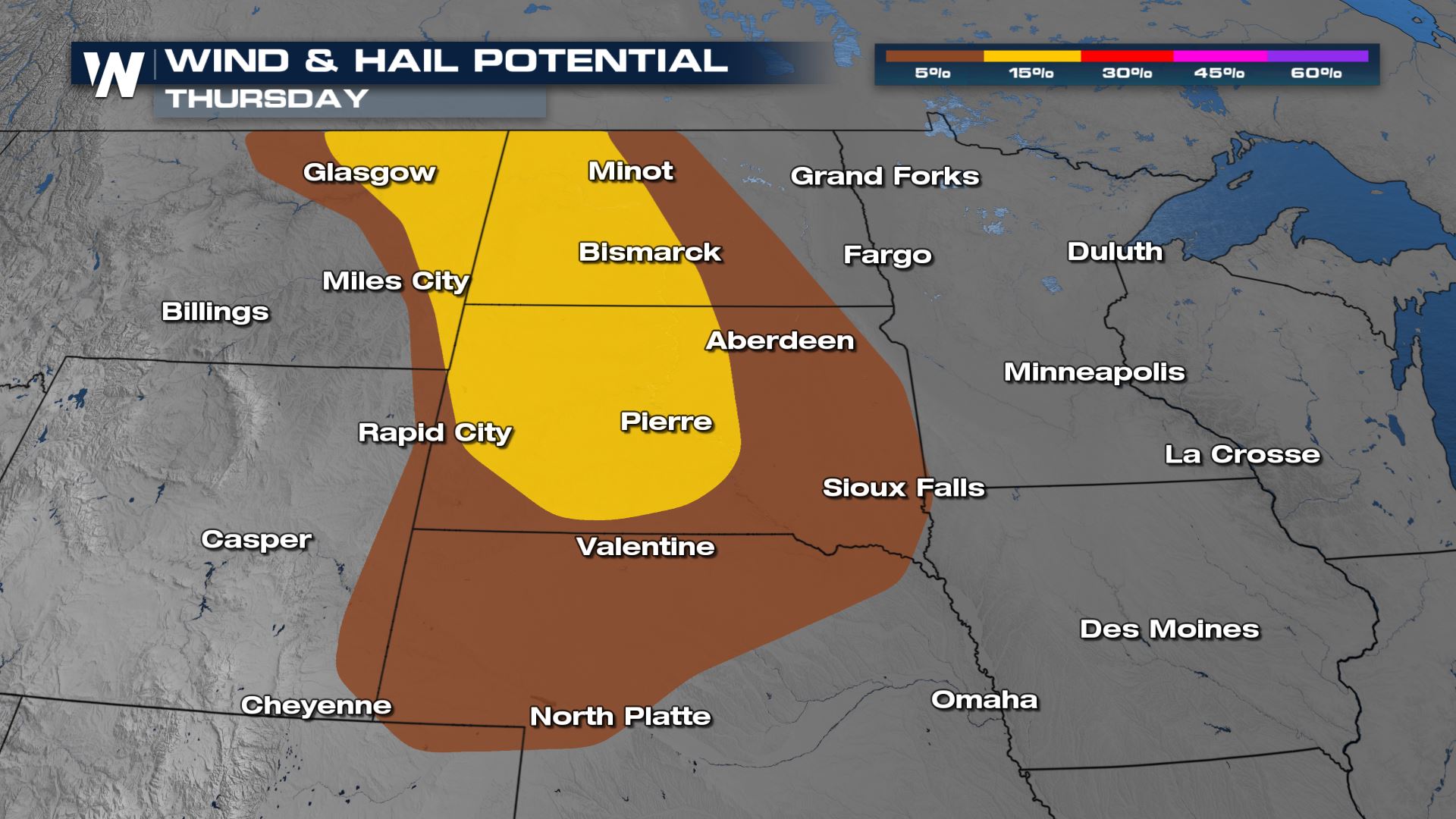
After strong wind gusts from severe thunderstorms moved across Montana Wednesday, the threat for severe weather continues today (Thursday) for the High Plains and Black Hills of South Dakota. All modes of severe weather will be possible across the risk area: tornadoes, damaging wind gusts, and large hail. There is an enhanced risk for severe storms (orange, level 3 on a scale of 1 to 5) in Eastern Montana, Western North Dakota, and Northern South Dakota with adjacent surrounding areas in a slight risk (level 2, in yellow).

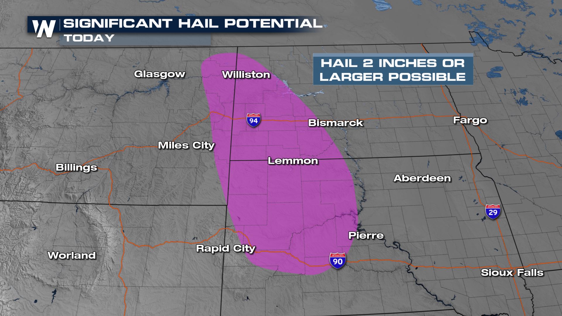
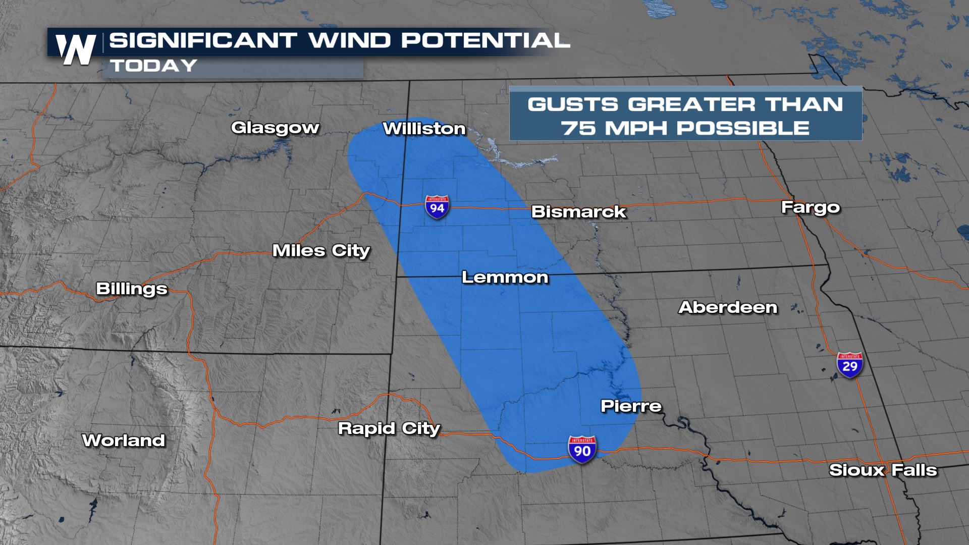
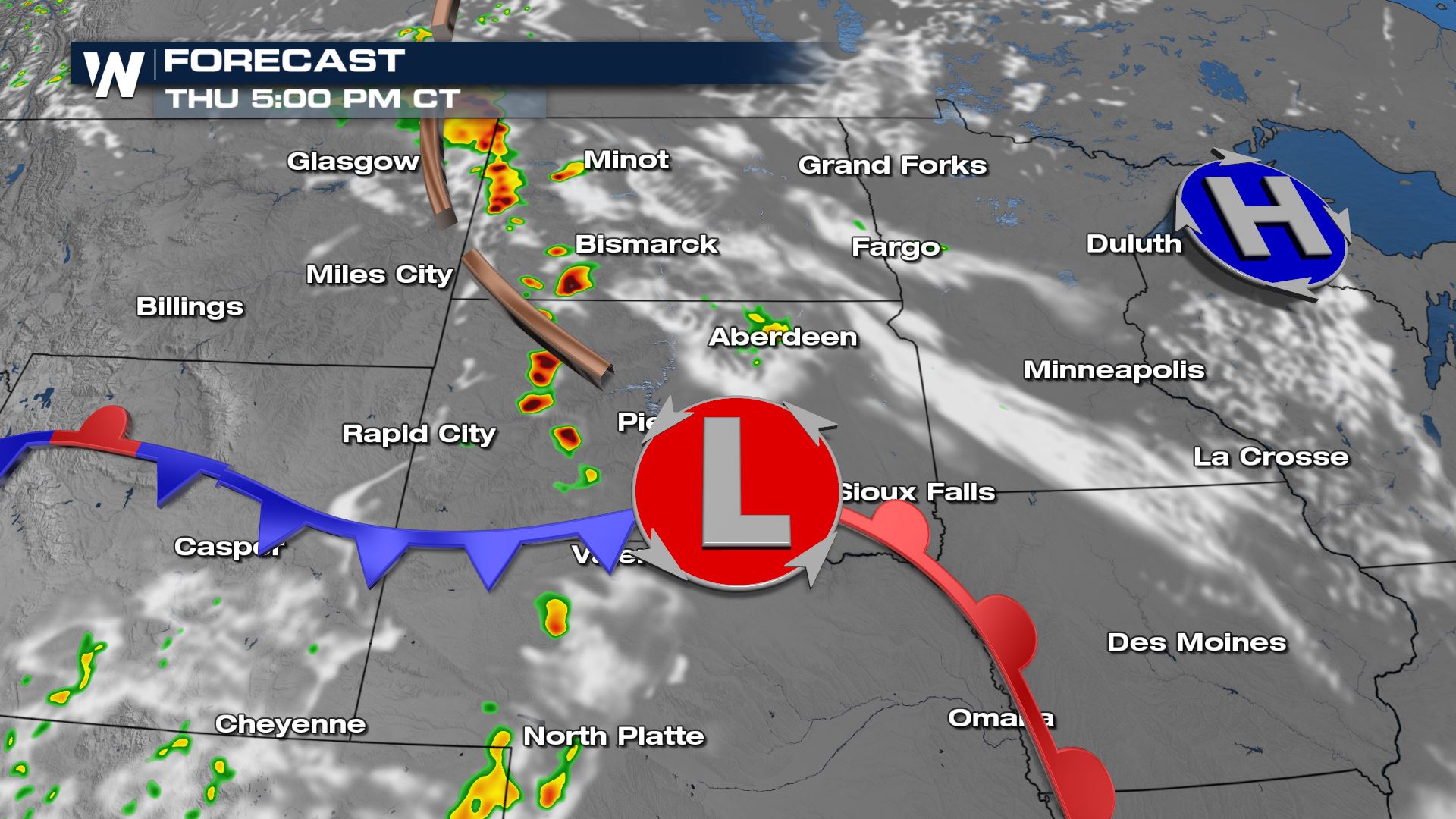
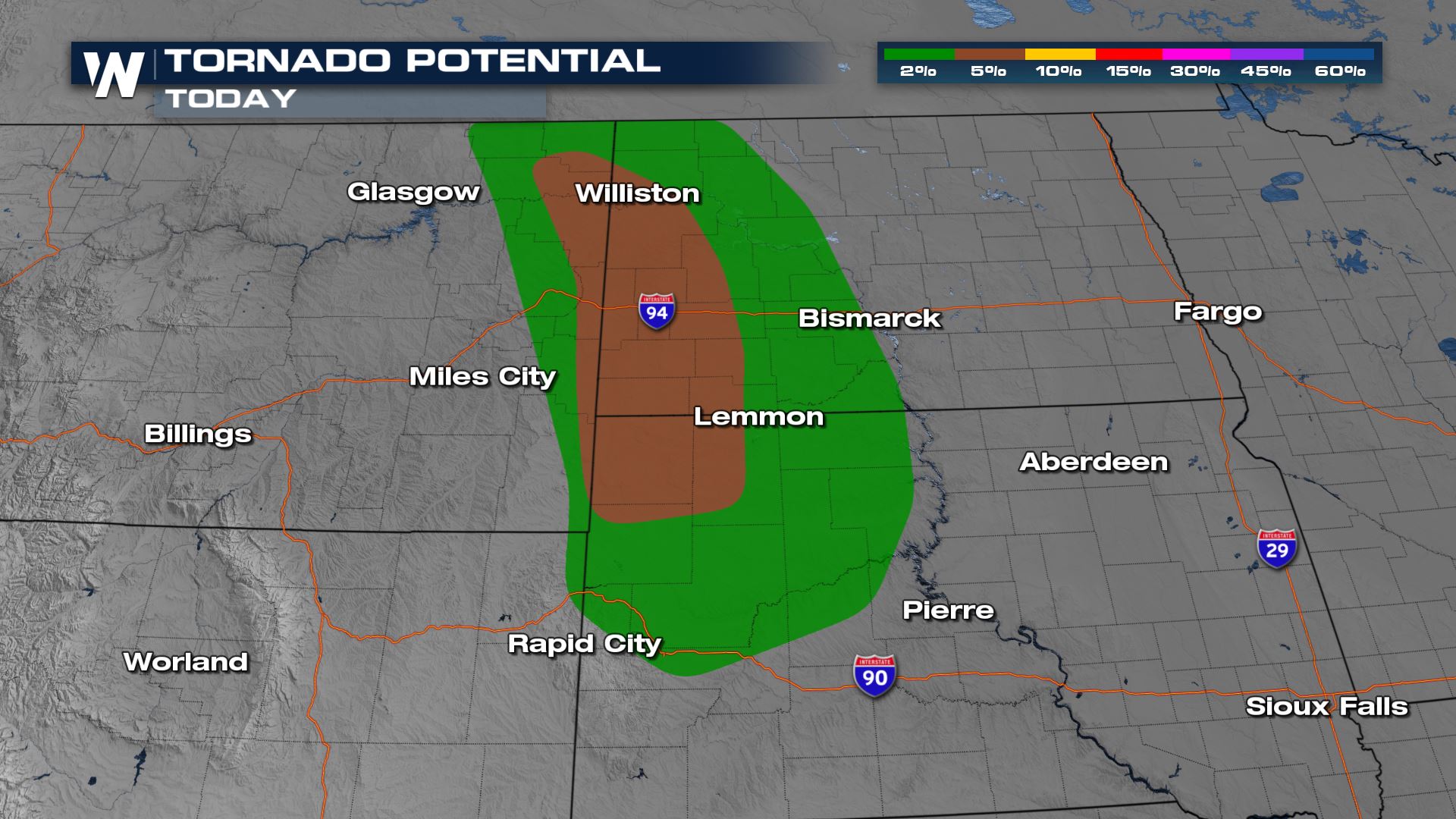 A few supercells will form in the late afternoon and early evening. There is a risk for isolated tornadoes, with the highest probabilities in North & South Dakota from Williston to Reva. Supercells may also produce significant reports of hail and strong winds. Large hail, greater than 2" in diameter, and damaging wind gusts, higher than 75 mph, are possible.
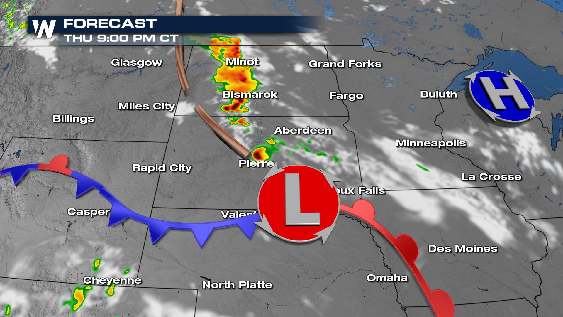
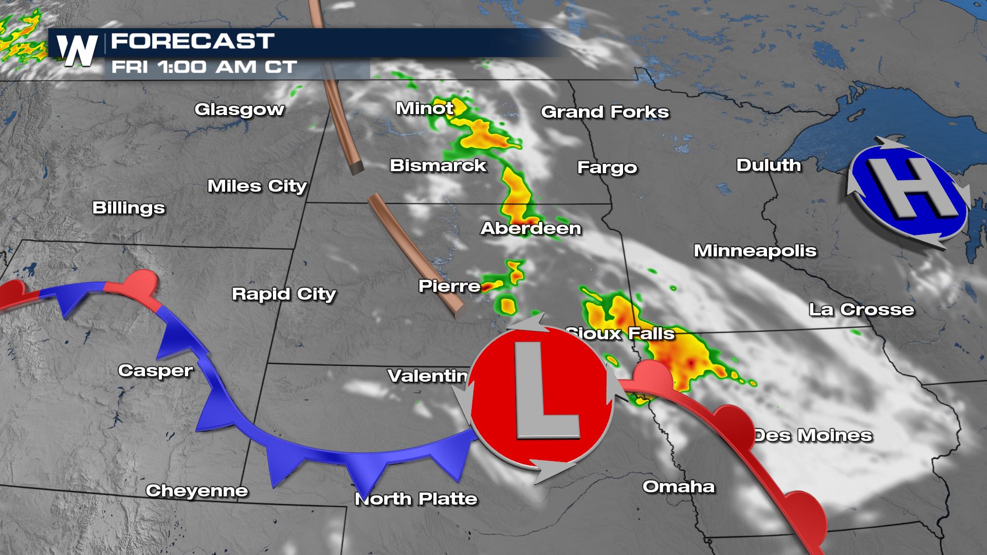
 Afternoon storm development will likely be most robust along a surface trough north of the low pressure center. Coverage will expand into the evening, with severe storms likely. Intensity will diminish into the overnight, but some stronger storms are still possible.
 WeatherNation will have updates on-air and online all day on the potential for severe thunderstorms in the High Plains. Check back with us for updates!
A few supercells will form in the late afternoon and early evening. There is a risk for isolated tornadoes, with the highest probabilities in North & South Dakota from Williston to Reva. Supercells may also produce significant reports of hail and strong winds. Large hail, greater than 2" in diameter, and damaging wind gusts, higher than 75 mph, are possible.
Afternoon storm development will likely be most robust along a surface trough north of the low pressure center. Coverage will expand into the evening, with severe storms likely. Intensity will diminish into the overnight, but some stronger storms are still possible.
WeatherNation will have updates on-air and online all day on the potential for severe thunderstorms in the High Plains. Check back with us for updates!All Weather News
More
More Storms for the East Through Monday
A low-pressure system that moved through the
2 Aug 2026 10:40 PM

Wildfire Outbreak in the Pacific Northwest
SPOKANE, WA - On Saturday, August 1st, the Ol
2 Aug 2026 10:35 PM


After Reaching Category 5, Genevieve Weakens in the Pacific
PacificGenevieve formed on last Friday south
2 Aug 2026 6:25 PM

Flooding, Severe Storms Target the Midwest Again
After an active week of storms across the nor
1 Aug 2026 1:40 AM

Flooding Risk Increases as Heavy Rain Targets the Tri-State Area
Tuesday, heavy rainfall moved across the Nort
30 Jul 2026 12:25 AM

Severe Weather: Energy From the Midwest Now in the Southeast
UPPER MIDWEST - Through Monday, dangerous tor
29 Jul 2026 10:30 PM