Severe Storms Possible in the Plains and Great Lakes into the Weekend
Special Stories
24 Aug 2018 10:41 AM
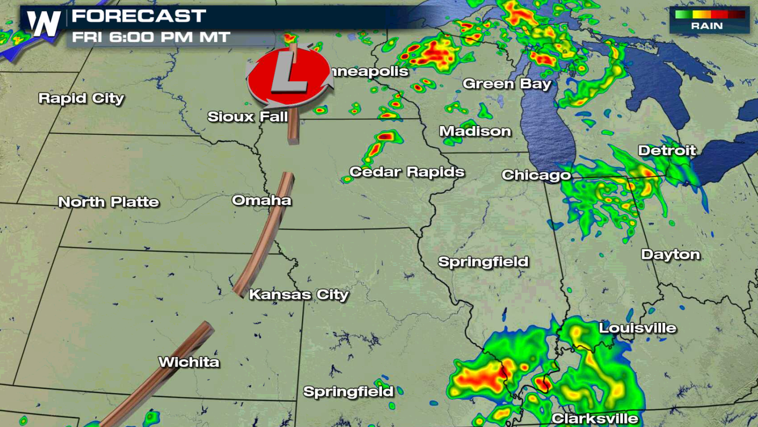
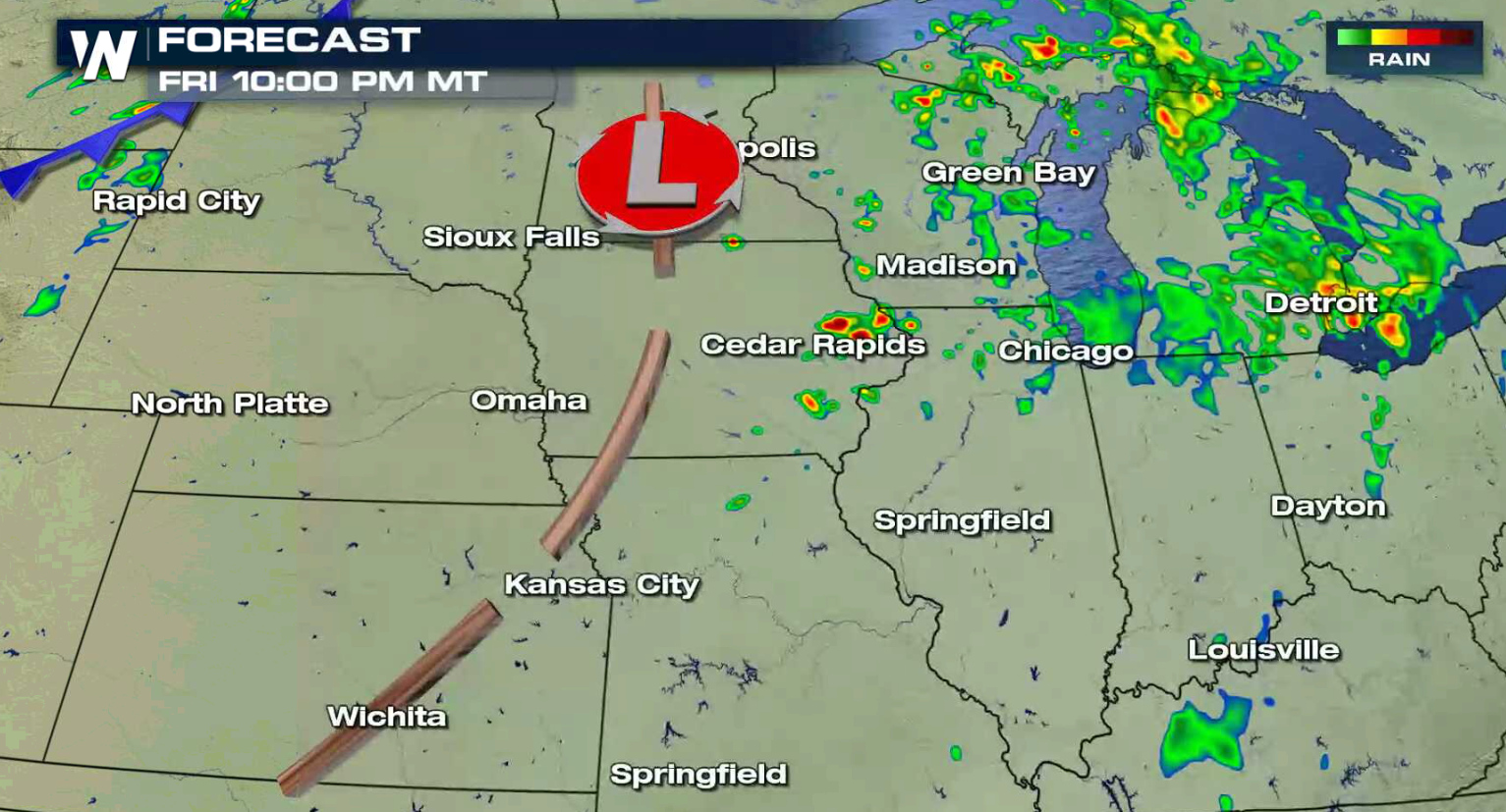
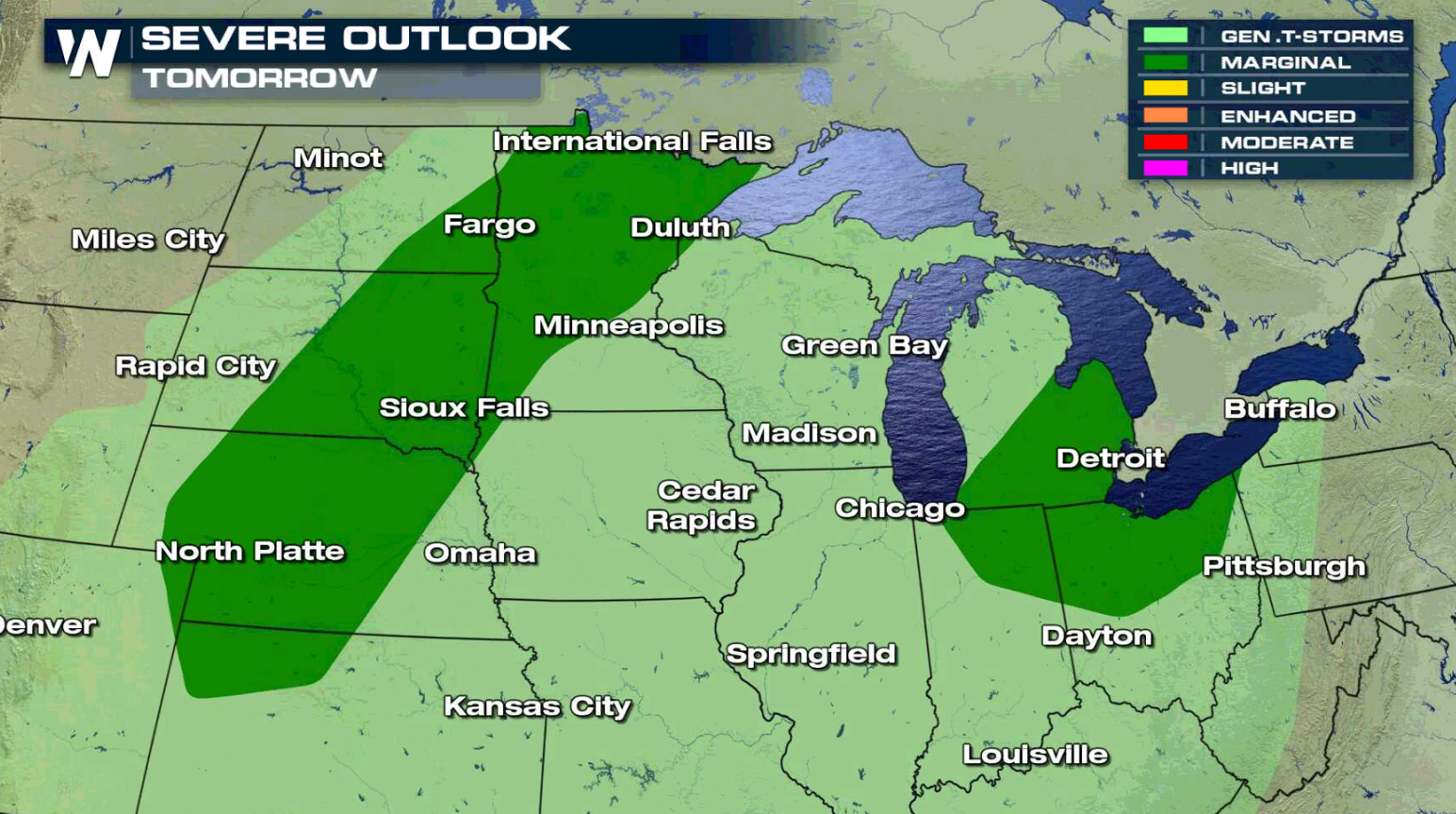
A series of slow moving storm systems will move through the Upper Midwest and Great Lakes into this weekend, bring rounds of showers and thunderstorms. Some of the storms may become severe through Sunday. For today (Friday), areas from southern Minnesota to northern Missouri have a slight risk to see severe weather. Large hail is the biggest concern, with an isolated risk for strong wind gusts and tornadoes.
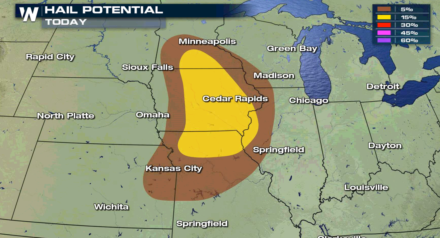
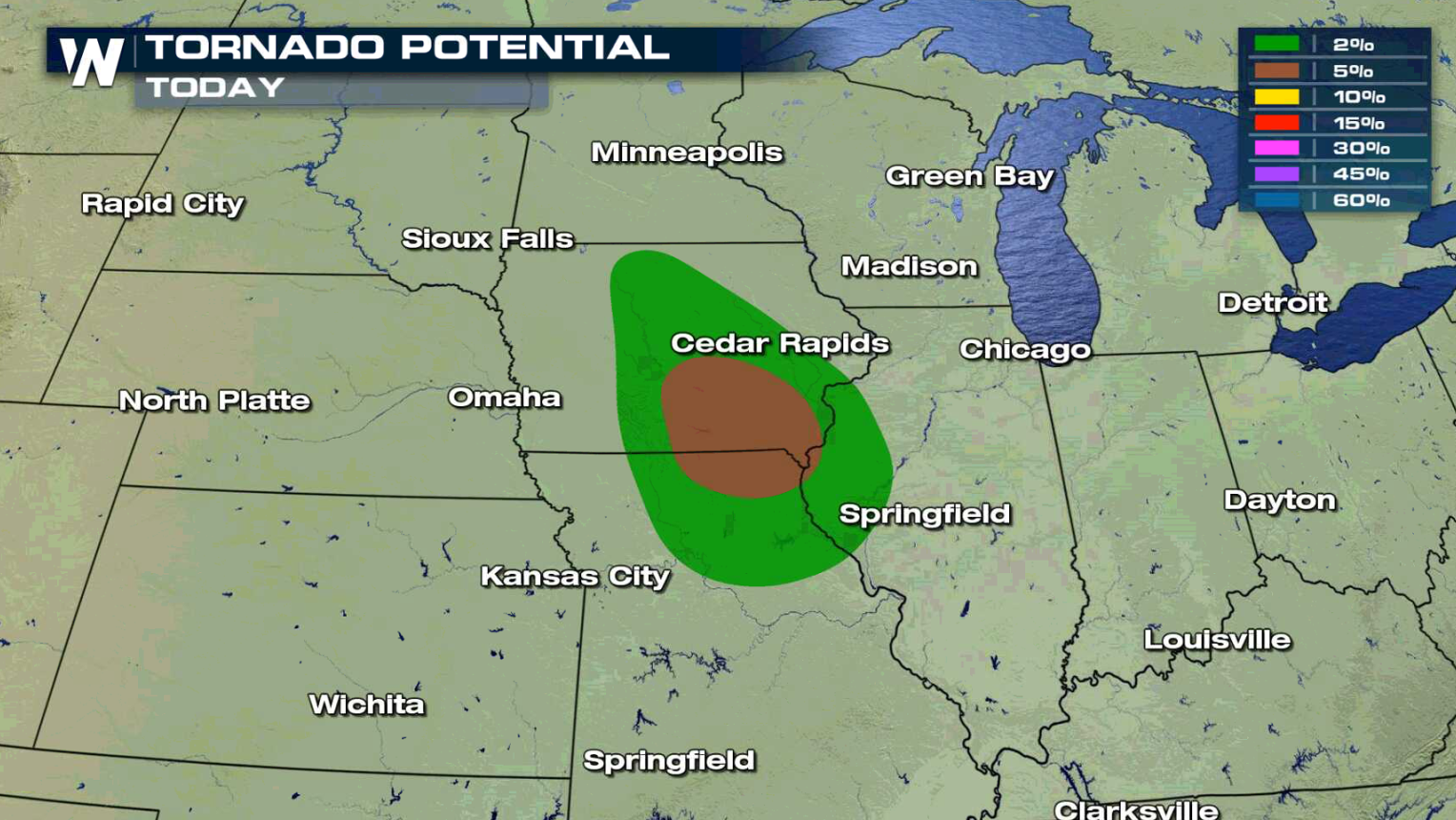
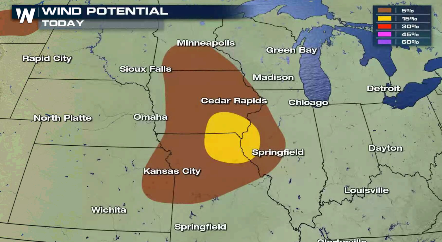 A low pressure center will push a couple of fronts across the northern Plains. Storms are not expected to be widespread, but could become severe in the late afternoon and evening. Areas near a warm front and ahead of the low are the most likely to see a few severe storms.
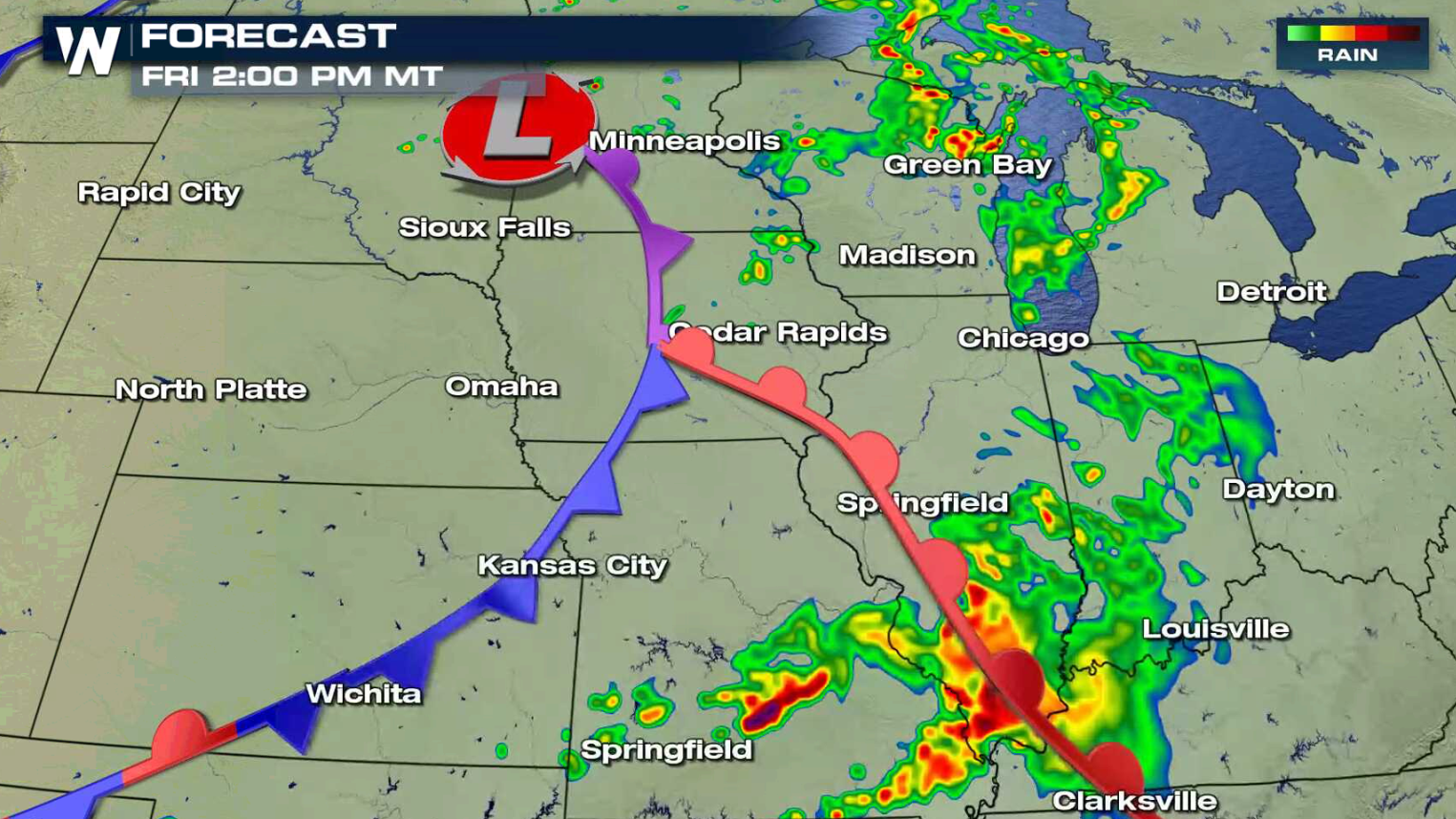
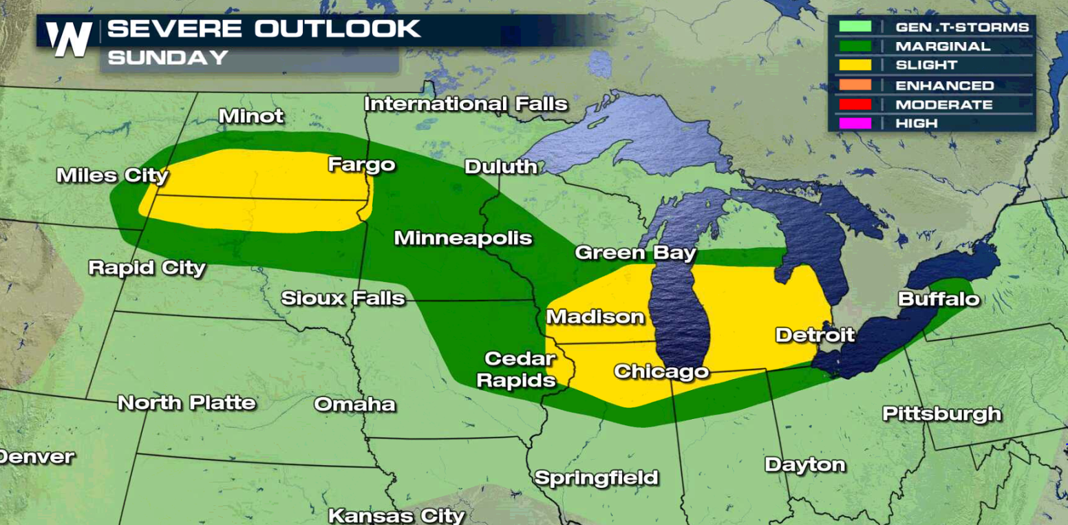
 This weekend, the threat for severe thunderstorms continues. The system now in the Upper Midwest will push through the Great Lakes. Another low will drop southward from Canada into the northern Plains. Both will produce thunderstorms and some could become severe.
 Make sure to stay with WeatherNation throughout the weekend for the very latest on the severe storm possibilities in the Plains and Great Lakes.
For WeatherNation: Meteorologist Mace Michaels


 A low pressure center will push a couple of fronts across the northern Plains. Storms are not expected to be widespread, but could become severe in the late afternoon and evening. Areas near a warm front and ahead of the low are the most likely to see a few severe storms.


 This weekend, the threat for severe thunderstorms continues. The system now in the Upper Midwest will push through the Great Lakes. Another low will drop southward from Canada into the northern Plains. Both will produce thunderstorms and some could become severe.

 Make sure to stay with WeatherNation throughout the weekend for the very latest on the severe storm possibilities in the Plains and Great Lakes.
For WeatherNation: Meteorologist Mace Michaels
Make sure to stay with WeatherNation throughout the weekend for the very latest on the severe storm possibilities in the Plains and Great Lakes.
For WeatherNation: Meteorologist Mace MichaelsAll Weather News
More