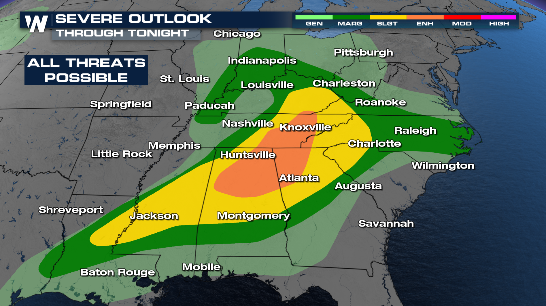
Severe Storms Move East Overnight

A strong area of low pressure and an associated cold front brought strong and severe storms as it swept from west to east. Damaging winds, tornadoes, and large hail were all reported. Hailstones up to 3.00" were reported in Franklin, TN. The severe threat will remain overnight.
OVERNIGHT
Overnight, an ENHANCED (Level 3 out of 5) risk for severe weather remains in effect for parts of Tennessee, Alabama, and Georgia. Damaging winds, large hail, and even a few tornadoes will be possible with this system into the morning hours.
Timing
Storms will follow along the front through the overnight hours. Have multiple ways to get alerts as the storms move through. Things will be much calmer for a lot of folks tomorrow morning as the front moves further south. Along the frontal boundary, a severe threat remains for Wednesday.
Wednesday
The cold front continues to track eastward, impacting areas from the Mid-Atlantic to the Florida-Georgia line. A MARGINAL (Level 1 out of 5) risk is in place along the coast as the front exits on Wednesday.
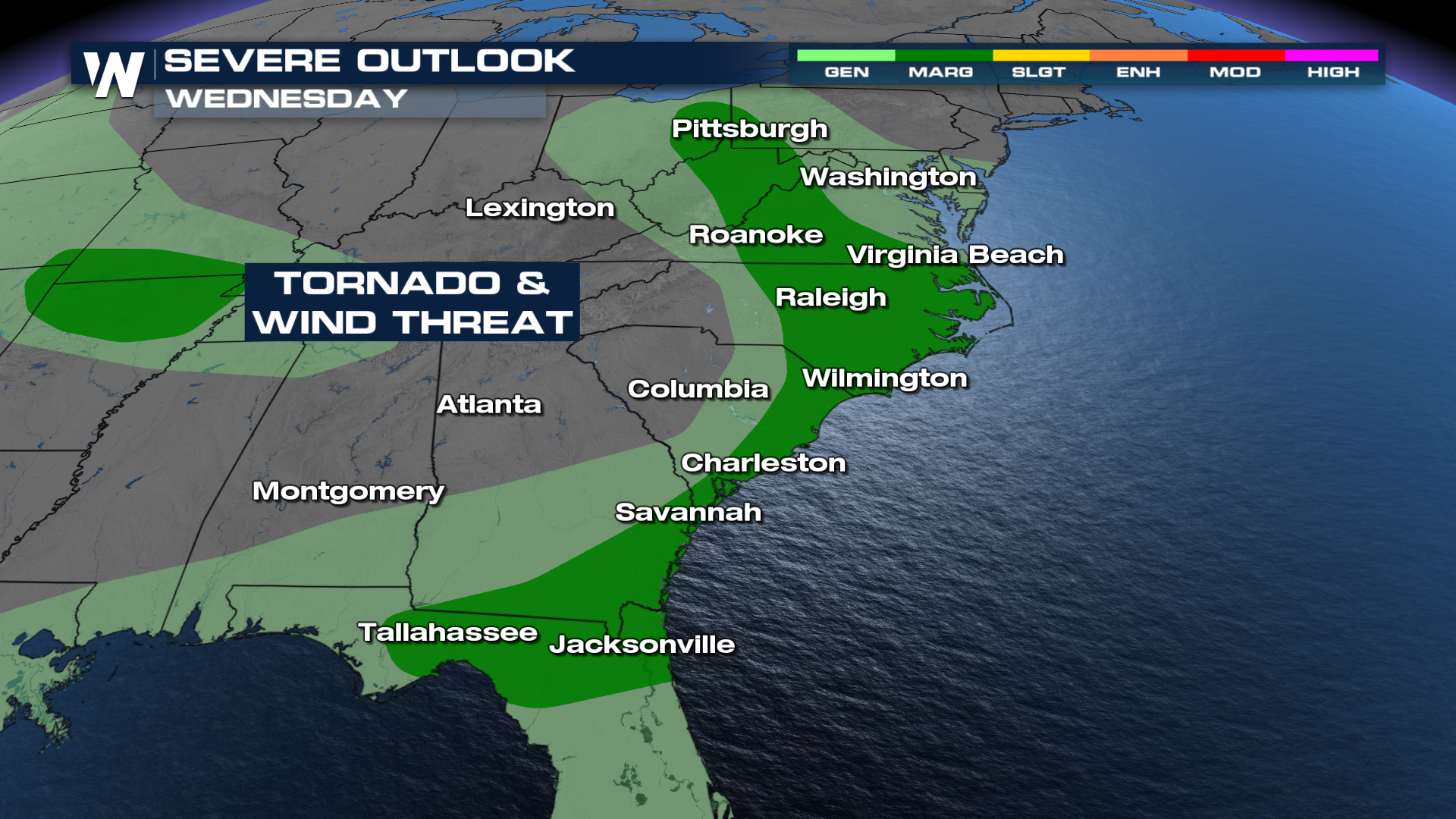 Forecast models do show storms developing along the boundary, but the severe threat appears to be more isolated and less widespread than on Tuesday.
Please continue to monitor the forecast and stay with WeatherNation as we track this system and provide updates.


