Severe Weather, Flooding for Upper Midwest

Special Stories
20 Sep 2018 8:13 AM
Thursday's most active weather will be found across the Upper Midwest. The region will likely see numerous severe storms through the day with the threat for tornadoes, hail and damaging winds. Have a severe weather plan in place and make sure you have a way to stay up to date on the latest weather information if you live in the areas within the severe weather outline:
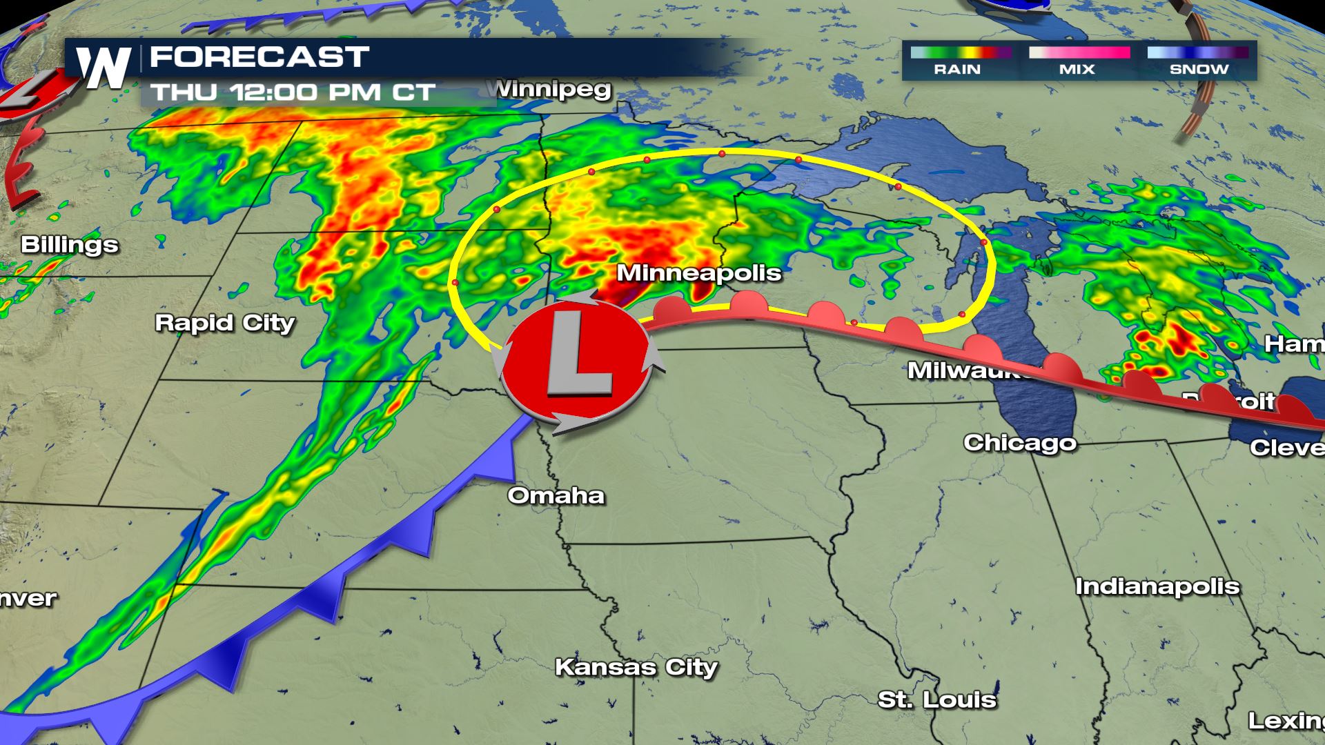
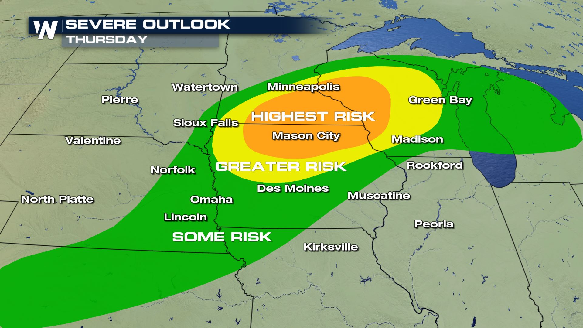 Storms will fire along a warm front which lifts north through the day. Behind the front expect quieter, but warm, conditions. Cooler, drier air sweeps in Friday into the start of the weekend.
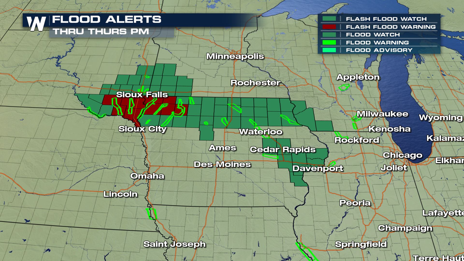
 Heavy rain comes with these storms, totals could reach above 3" in some areas. Flood alerts are out into Thursday evening, river and stream flooding concerns continue into next week.
 The severe weather threat shifts east Friday along with the same frontal system. Be on the look out for severe storms across the Northeast for the end of the work week.
For Weather Nation: Meteorologist Emily Roehler
The severe weather threat shifts east Friday along with the same frontal system. Be on the look out for severe storms across the Northeast for the end of the work week.
For Weather Nation: Meteorologist Emily Roehler
Storms will fire along a warm front which lifts north through the day. Behind the front expect quieter, but warm, conditions. Cooler, drier air sweeps in Friday into the start of the weekend.
Heavy rain comes with these storms, totals could reach above 3" in some areas. Flood alerts are out into Thursday evening, river and stream flooding concerns continue into next week.
The severe weather threat shifts east Friday along with the same frontal system. Be on the look out for severe storms across the Northeast for the end of the work week.
For Weather Nation: Meteorologist Emily RoehlerAll Weather News
More
Severe Storms Target the Midwest This Weekend
Extreme heat will be a big story this week ac
26 Jul 2026 2:15 AM

Heat Wave Grips Central, Western U.S.
Are you over the summer heat yet? The heat al
26 Jul 2026 2:05 AM

Tropics: Fausto Heads to Hawaii; Genevieve Will Become a Major Hurricane
Atlantic BasinBertha has dissipated after mov
26 Jul 2026 2:00 AM


Southeast Flood Risk Lingers Near Stalled Front
A stalled boundary over the Southeast will ke
25 Jul 2026 10:55 AM

Another Round of Storms Targets the Northeast
Tuesday brought severe weather again across p
23 Jul 2026 1:15 AM

Another Round of Severe Weather for the Upper Midwest and Great Lakes
The upper-level low train continues to keep t
21 Jul 2026 1:45 AM