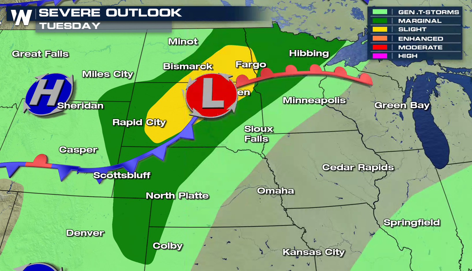
Severe Weather Forecast Through Midweek - Active in the Northern Plains
Special Stories
2 Jul 2018 11:35 AM
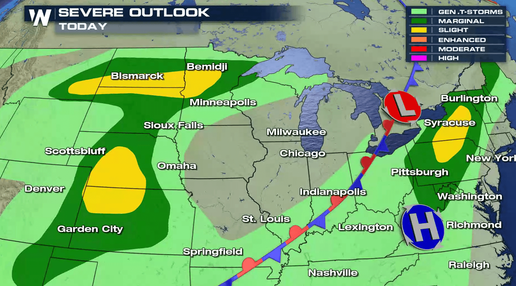
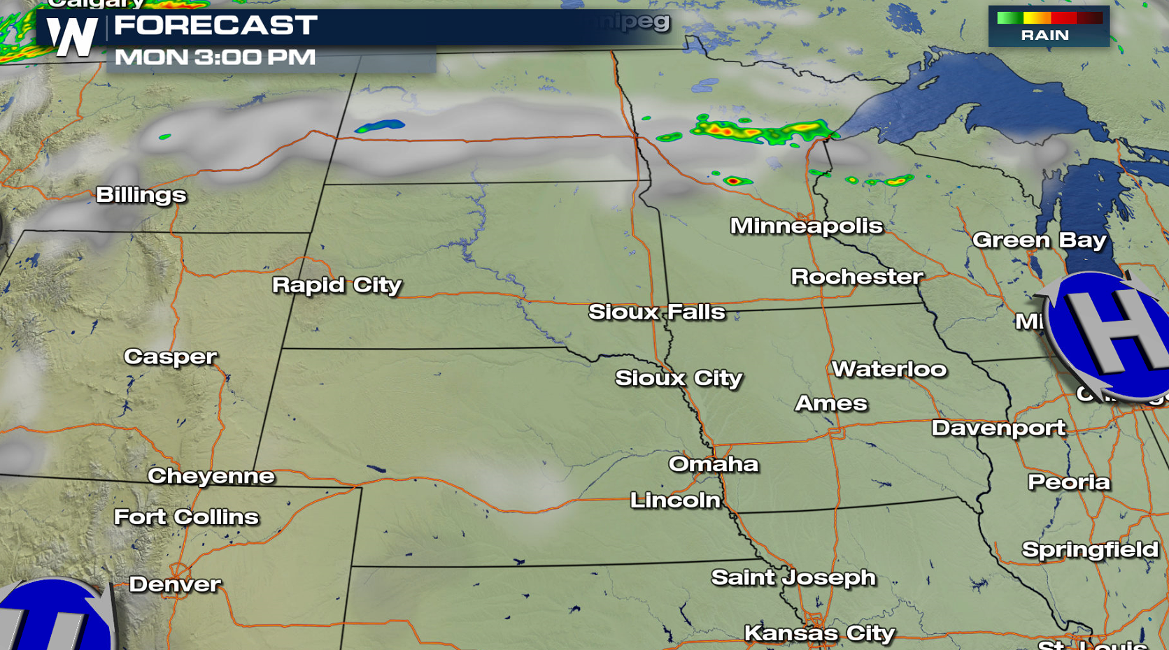
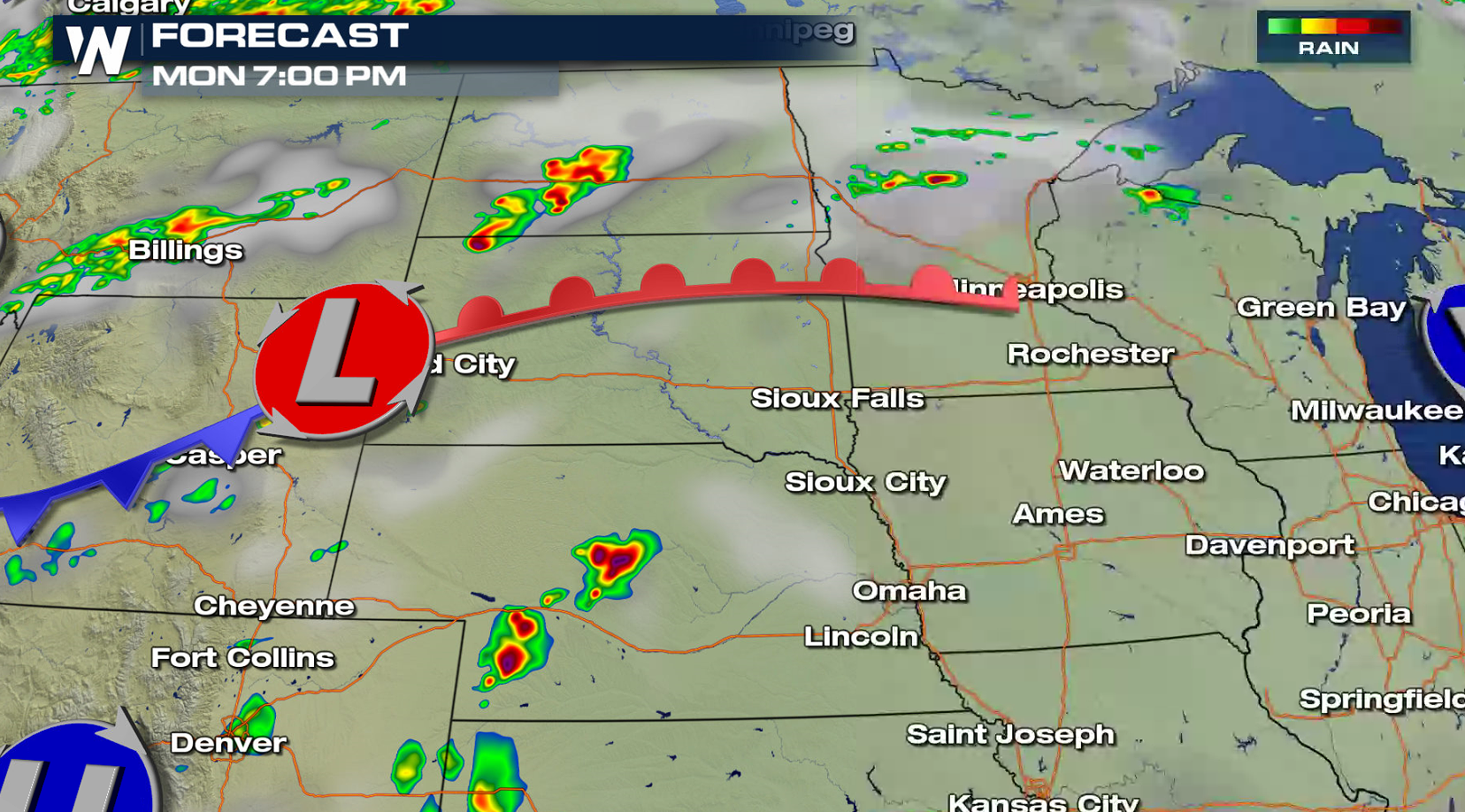
Pockets of severe weather are possible today (Monday) in the Plains and Northeast, with active weather expected to continue through Independence Day in the Upper Midwest. Hail greater than 1" in diameter and wind gusts above 60 mph are the main threats, but an isolated tornado may occur later this evening (Monday).
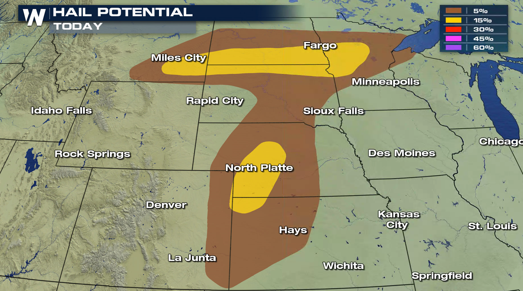
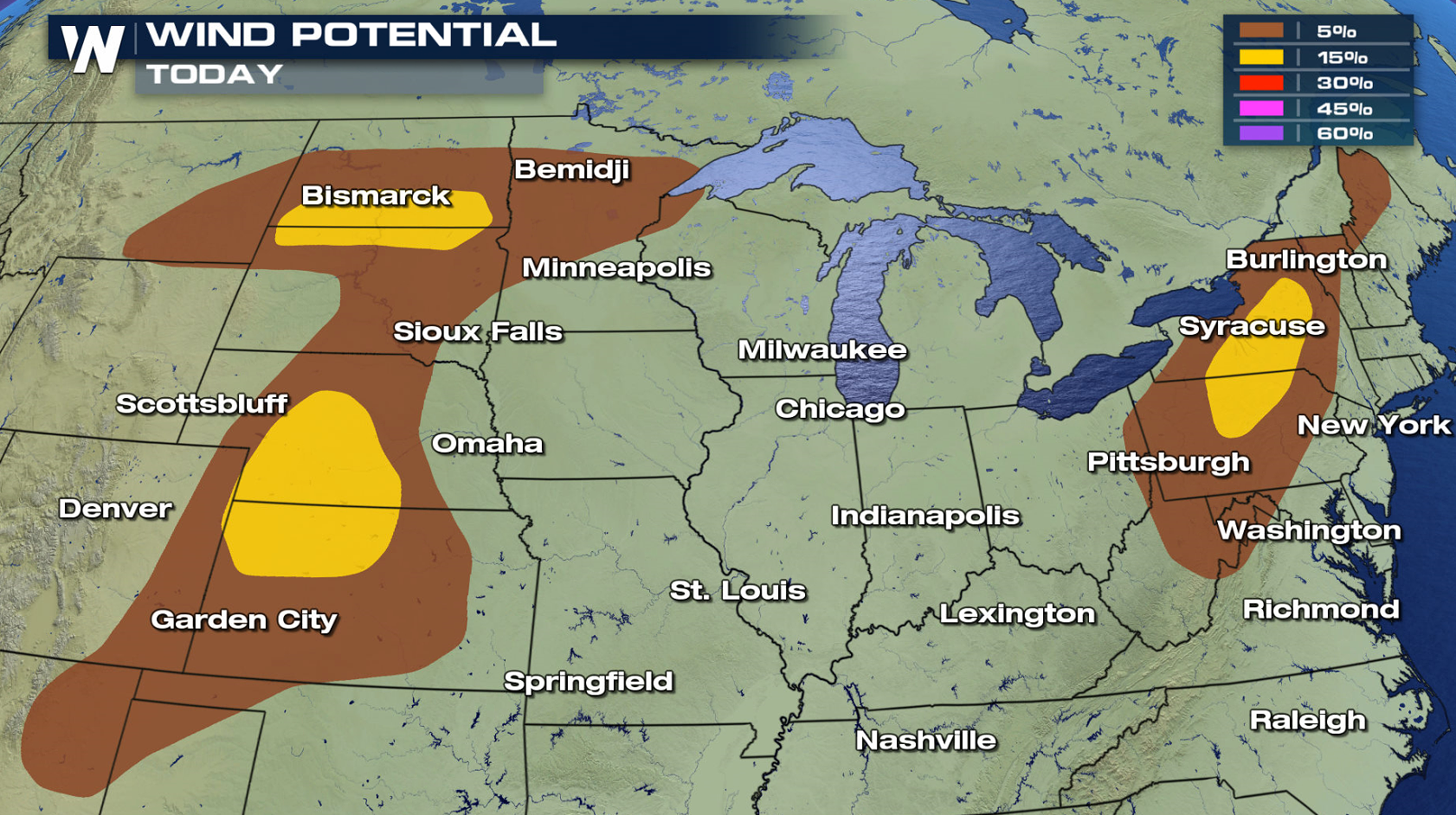
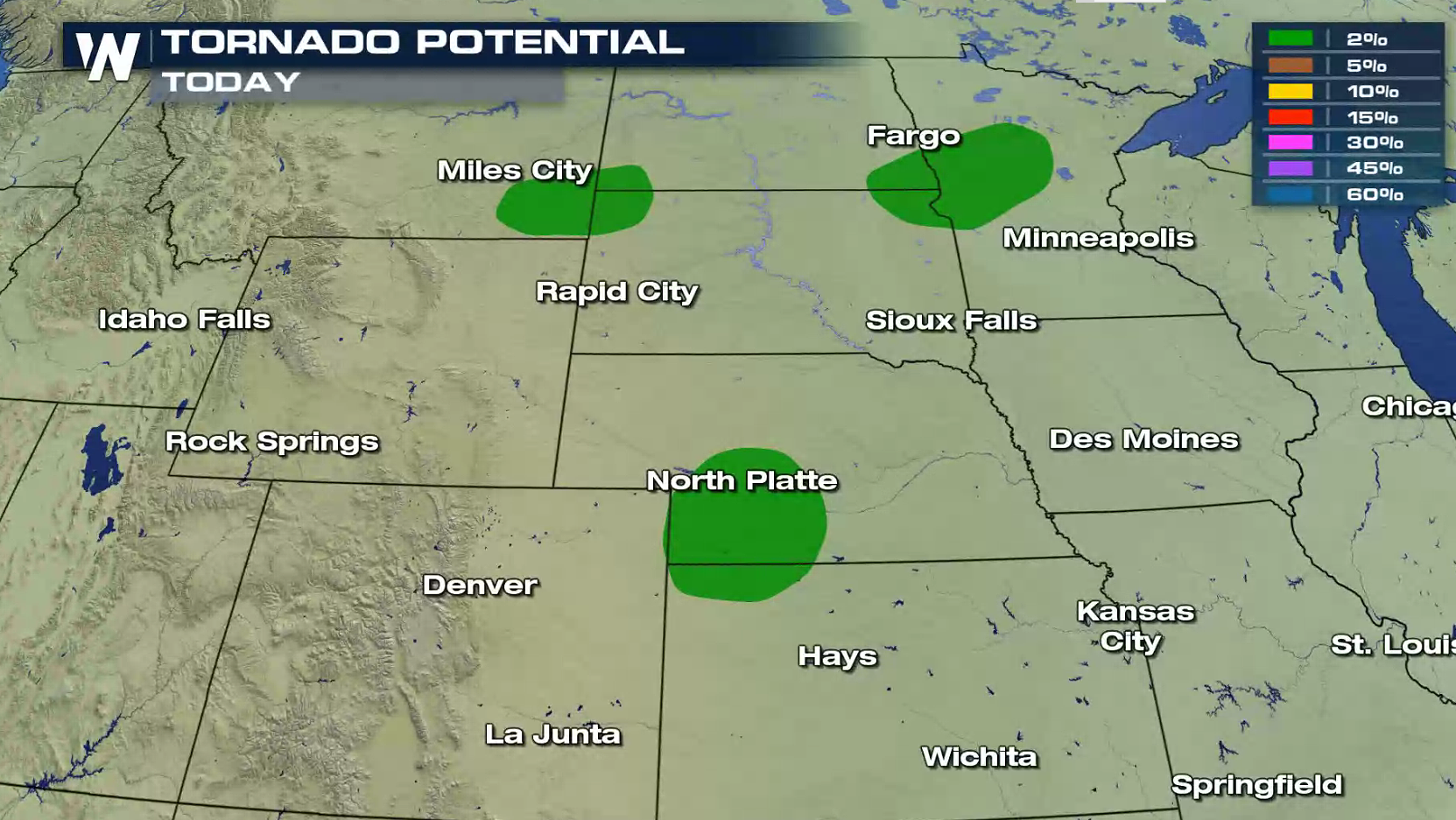 A warm front and low pressure center moving into the northern Plains will be the focus for thunderstorm development in the early evening. Storms are expected to blossom throughout the evening, taking advantage of heat, humidity, and low level wind shear.
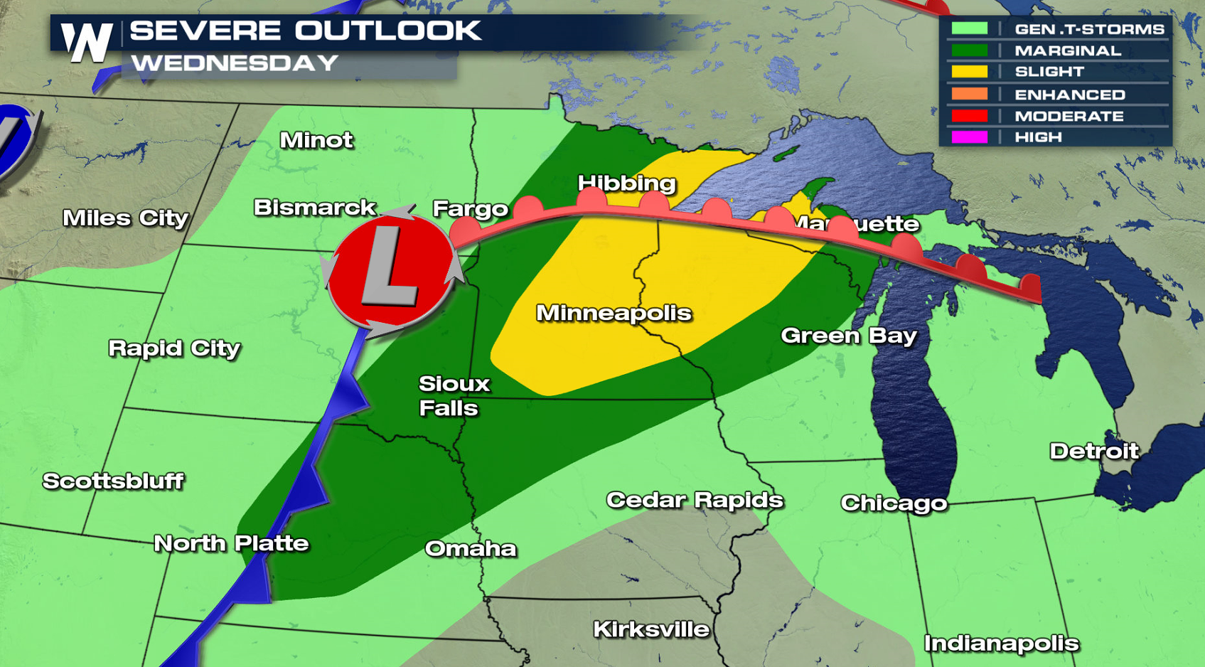
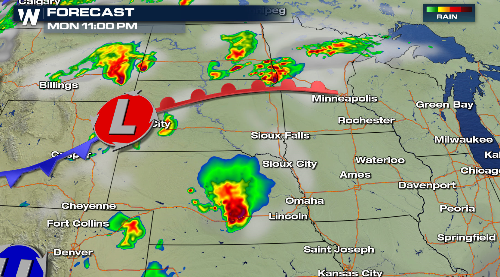 The system moves slowly through the Upper Midwest on Tuesday and Wednesday, keeping severe weather in the forecast through Independence Day.
 For WeatherNation: Meteorologist Mace Michaels
A warm front and low pressure center moving into the northern Plains will be the focus for thunderstorm development in the early evening. Storms are expected to blossom throughout the evening, taking advantage of heat, humidity, and low level wind shear.
The system moves slowly through the Upper Midwest on Tuesday and Wednesday, keeping severe weather in the forecast through Independence Day.
For WeatherNation: Meteorologist Mace MichaelsAll Weather News
More
East Gears Up for Stormy, Wet Weekend
A low pressure system crashing through the Mi
1 Aug 2026 11:35 AM


Flooding, Severe Storms Target the Midwest Again
After an active week of storms across the nor
1 Aug 2026 1:40 AM


After Reaching Category 5, Genevieve Weakens in the Pacific
PacificFausto is now a post-tropical cyclone.
31 Jul 2026 1:30 AM

Flooding Risk Increases as Heavy Rain Targets the Tri-State Area
Tuesday, heavy rainfall moved across the Nort
30 Jul 2026 12:25 AM

Severe Weather: Energy From the Midwest Now in the Southeast
UPPER MIDWEST - Through Monday, dangerous tor
29 Jul 2026 10:30 PM