Severe Weather Looms Again Across The Nation
Special Stories
8 Aug 2018 10:43 AM
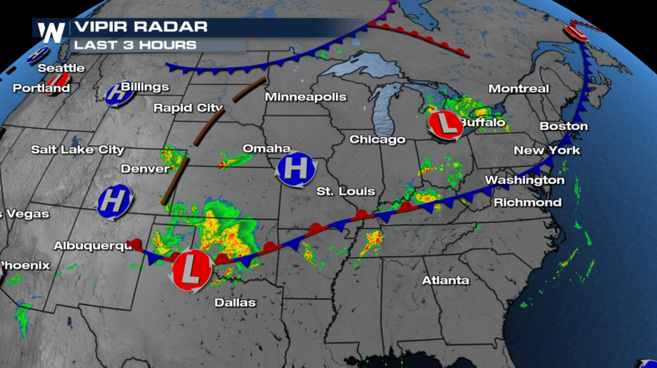
Severe weather will once again be a possibility on Wednesday in several different areas. There are two frontal zones, which will interact with unstable air masses. You can see the two frontal systems in the graphic below. The first front extends from Boston all the way into northern Texas. Showers and storms will be possible all along the front. However, there will be a Marginal Risk for severe storms along the eastern and western sections of the front.
The second front is draped across North Dakota and Minnesota. As this front moves southward, it will produce showers and thunderstorms in the upper Midwest. Severe storms will be possible in the arrowhead of Minnesota, northern Wisconsin, and the upper peninsula of Michigan.
 You can see the where the Marginal Risks are in the image below. The most likely time for severe storms will be during the afternoon and early evening hours.
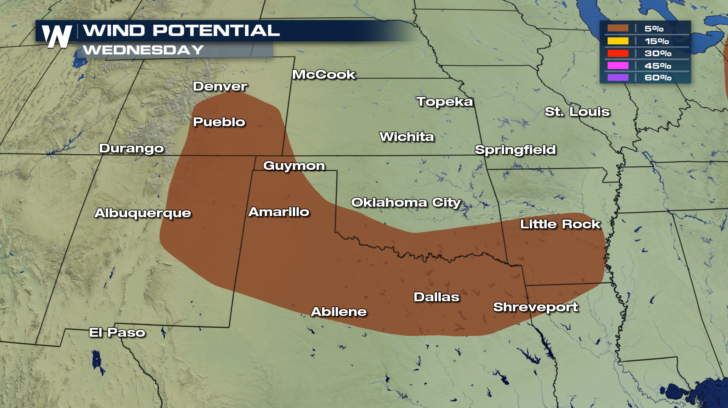
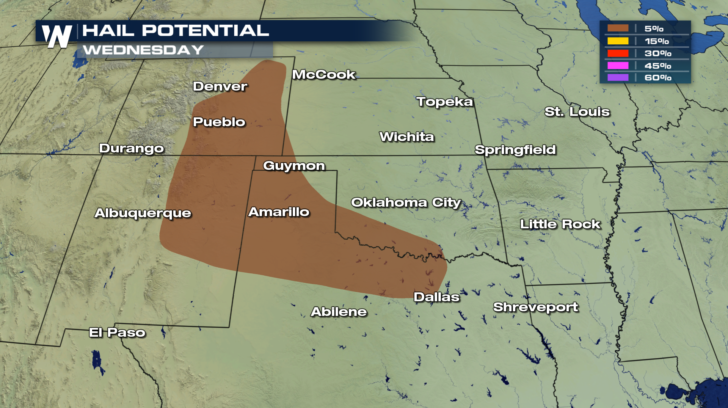
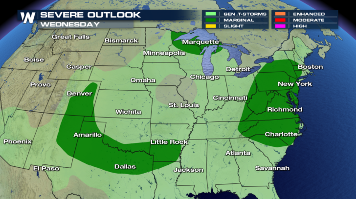 The southern risk area includes Colorado Springs, Dallas, and Little Rock. The primary threats will be damaging winds in excess of 58 mph. Damaging hail, one inch in diameter or larger, will also be possible with any storms that develop.
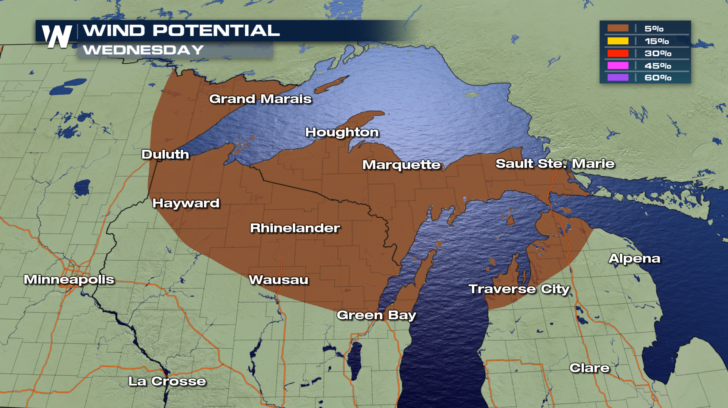
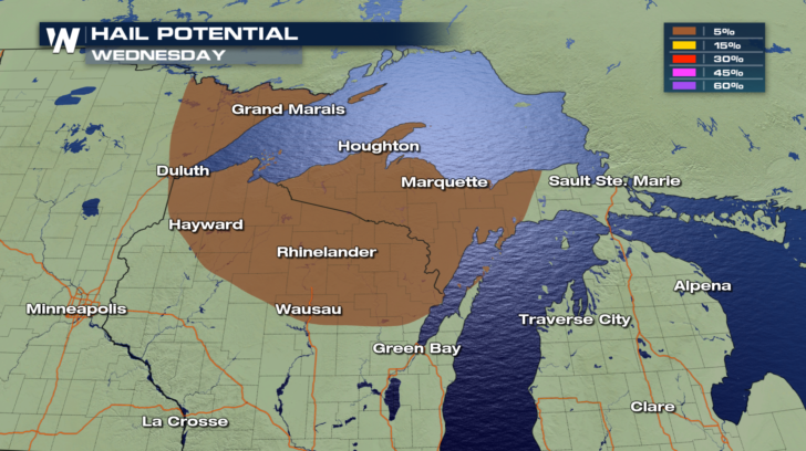
 The Upper Midwest risk area includes Duluth, Wausau, Marquette, and Traverse City. The primary threats will be damaging winds in excess of 58 mph. Damaging hail, one inch in diameter or larger, will also be possible with any storms that develop.
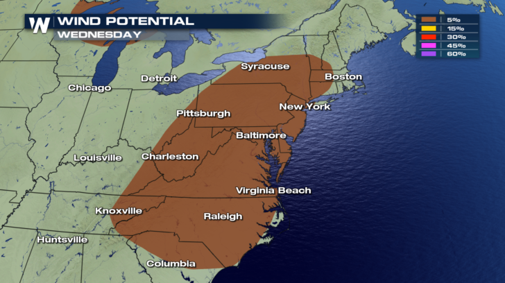
 The eastern risk area includes some major metropolitan areas. Hartford, New York, Philadelphia, Pittsburgh, Baltimore, Washington D.C., Richmond, Raleigh, Charlotte, and Knoxville are all included in the risk area. The primary threat will be damaging winds in excess of 58 mph. Damaging hail is not expected.
 There are two pieces of good news. First, tornadoes are not expected to form in any of the risk areas today. And second, a Marginal Risk is the lowest threat level out of five possible levels. That doesn't mean the risk should be taken lightly. Damaging storms are still very possible with a Marginal Risk. However, the storms are usually more powerful and more widespread when associated with higher risk levels.
For WeatherNation: Meteorologist Matt Monroe
 You can see the where the Marginal Risks are in the image below. The most likely time for severe storms will be during the afternoon and early evening hours.
 The southern risk area includes Colorado Springs, Dallas, and Little Rock. The primary threats will be damaging winds in excess of 58 mph. Damaging hail, one inch in diameter or larger, will also be possible with any storms that develop.

 The Upper Midwest risk area includes Duluth, Wausau, Marquette, and Traverse City. The primary threats will be damaging winds in excess of 58 mph. Damaging hail, one inch in diameter or larger, will also be possible with any storms that develop.

 The eastern risk area includes some major metropolitan areas. Hartford, New York, Philadelphia, Pittsburgh, Baltimore, Washington D.C., Richmond, Raleigh, Charlotte, and Knoxville are all included in the risk area. The primary threat will be damaging winds in excess of 58 mph. Damaging hail is not expected.
 There are two pieces of good news. First, tornadoes are not expected to form in any of the risk areas today. And second, a Marginal Risk is the lowest threat level out of five possible levels. That doesn't mean the risk should be taken lightly. Damaging storms are still very possible with a Marginal Risk. However, the storms are usually more powerful and more widespread when associated with higher risk levels.
For WeatherNation: Meteorologist Matt Monroe
All Weather News
More