Severe Weather Outlook for Friday
Special Stories
31 Jul 2020 9:00 AM
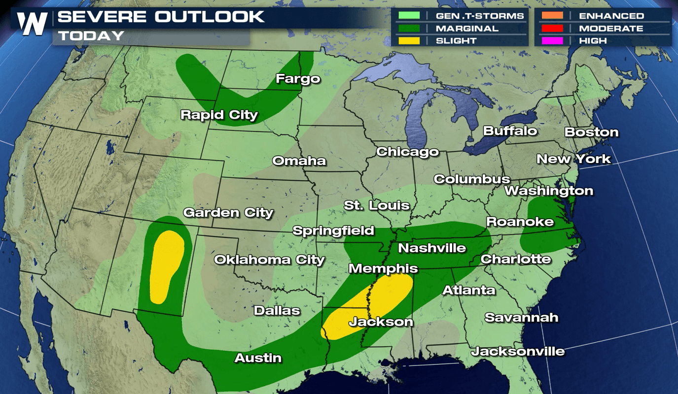
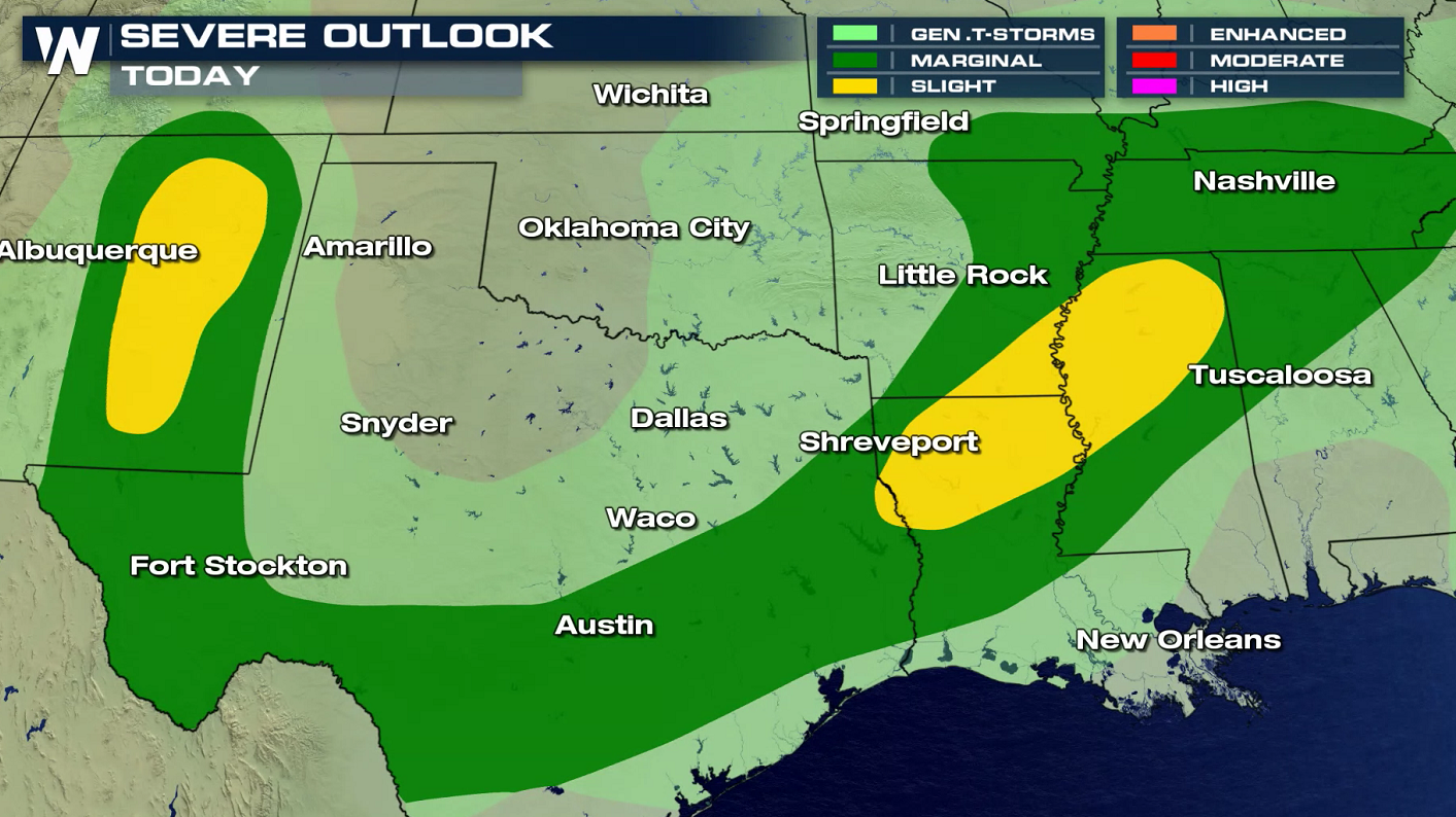
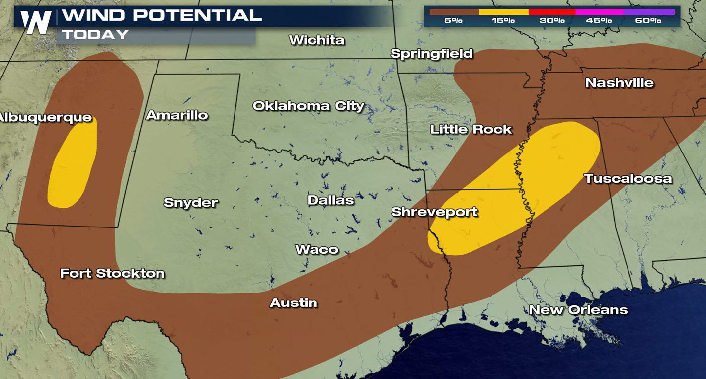
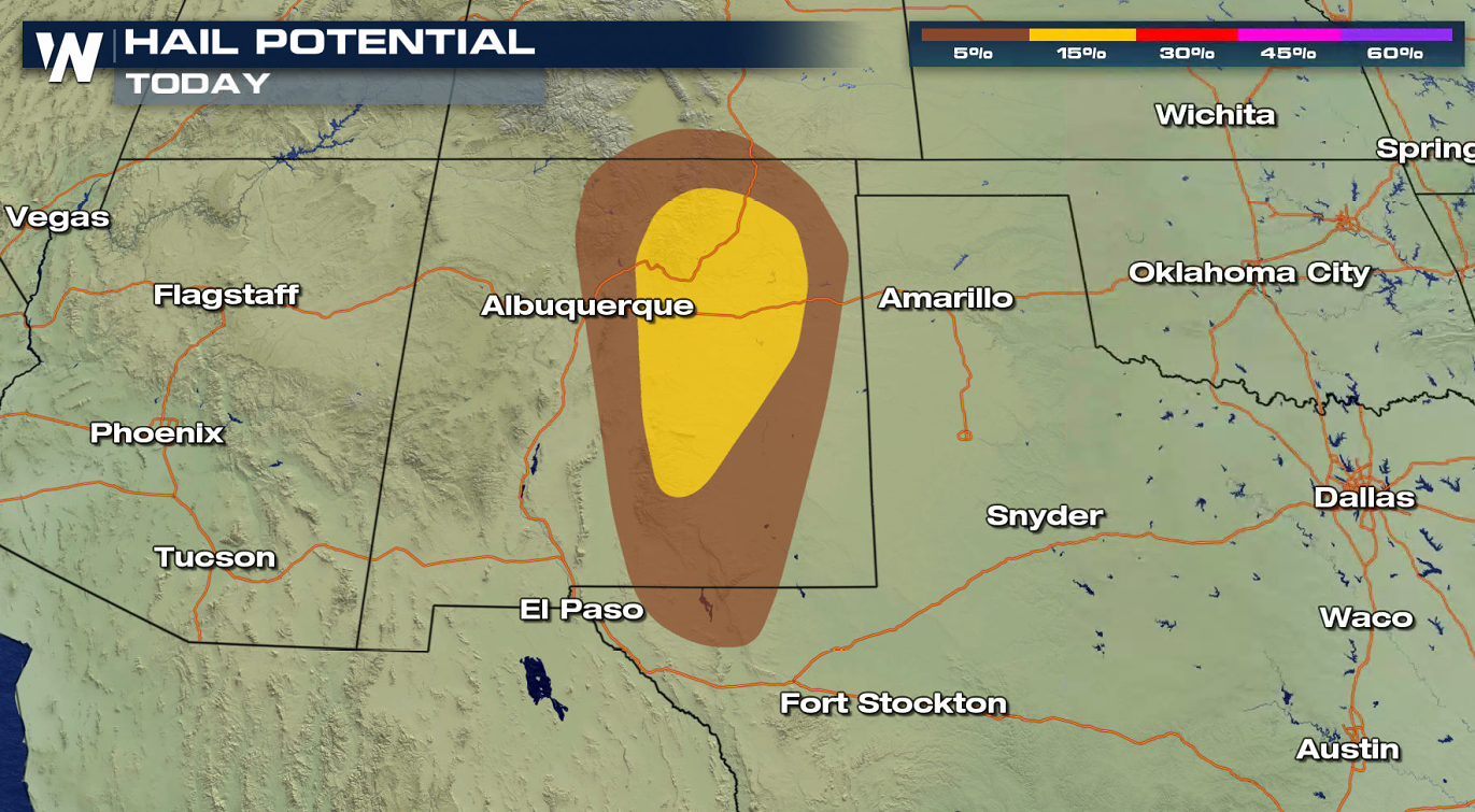
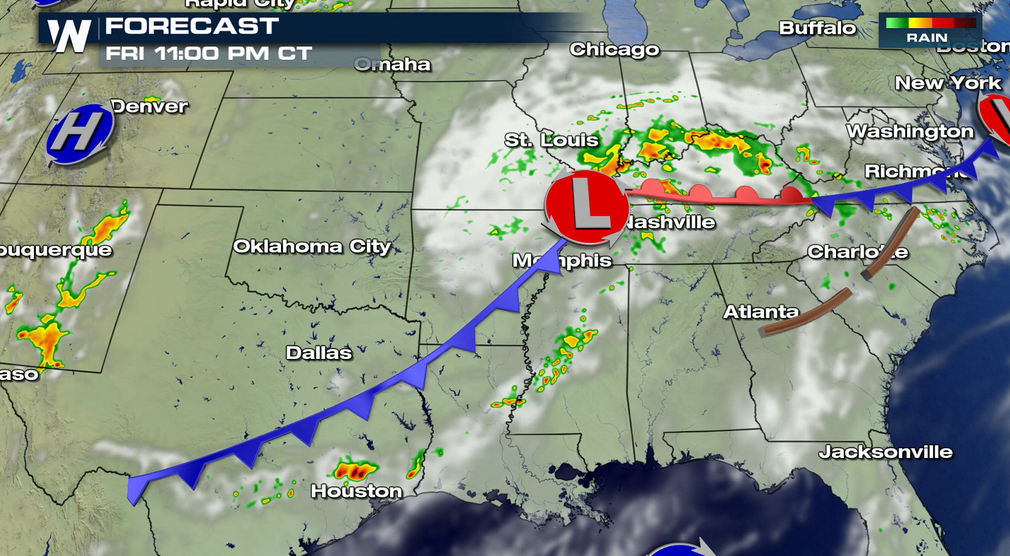
Several areas have the potential to see severe thunderstorms today (Friday), stretching from the northern Plains to the Lower Mississippi Valley and into the Middle Atlantic. A slight risk (level 1 on a scale of 1 to 5) includes parts of the Mississippi Delta and eastern New Mexico. Strong wind gusts are the biggest concern, with large hail a risk in New Mexico.
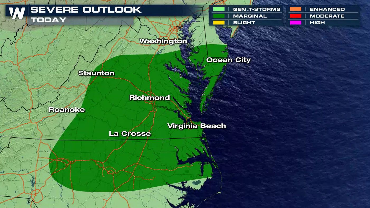
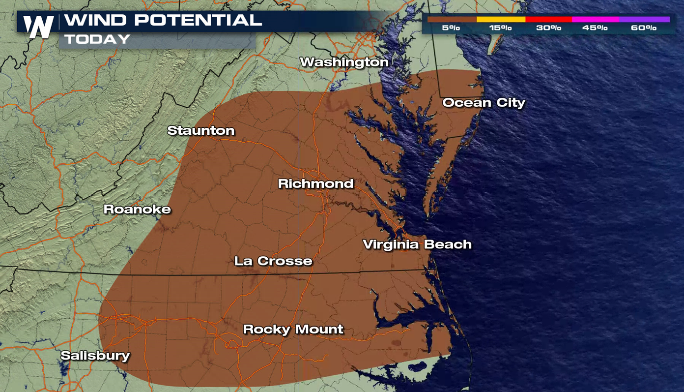
 Strong wind gusts are the main threat in the Middle Atlantic ahead of a low pressure center. A marginal risk has been posted by the Storm Prediction Center in portions of North Carolina, Virginia Maryland and Delaware.
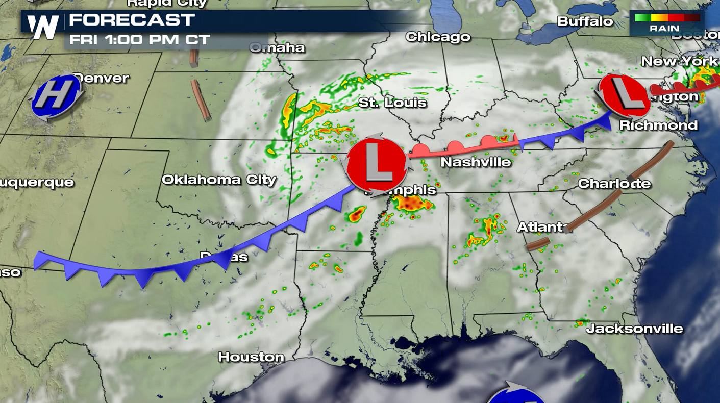
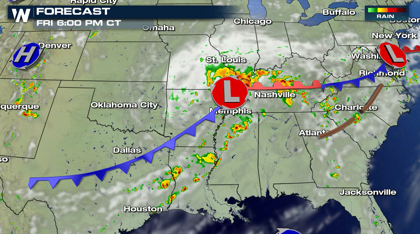
 Storms will develop in the late afternoon and continue through the evening. The thunderstorms will be focused along the cold front and near low pressure centers along near the Mississippi River and Chesapeake Bay.
 WeatherNation will continue to monitor the severe weather situation. Check back on-air and online for the latest forecast updates and alerts.
Strong wind gusts are the main threat in the Middle Atlantic ahead of a low pressure center. A marginal risk has been posted by the Storm Prediction Center in portions of North Carolina, Virginia Maryland and Delaware.
Storms will develop in the late afternoon and continue through the evening. The thunderstorms will be focused along the cold front and near low pressure centers along near the Mississippi River and Chesapeake Bay.
WeatherNation will continue to monitor the severe weather situation. Check back on-air and online for the latest forecast updates and alerts.All Weather News
More
East Gears Up for Stormy, Wet Weekend
A low pressure system crashing through the Mi
1 Aug 2026 6:15 PM


Flooding, Severe Storms Target the Midwest Again
After an active week of storms across the nor
1 Aug 2026 1:40 AM

After Reaching Category 5, Genevieve Weakens in the Pacific
PacificFausto is now a post-tropical cyclone.
31 Jul 2026 1:30 AM

Flooding Risk Increases as Heavy Rain Targets the Tri-State Area
Tuesday, heavy rainfall moved across the Nort
30 Jul 2026 12:25 AM

Severe Weather: Energy From the Midwest Now in the Southeast
UPPER MIDWEST - Through Monday, dangerous tor
29 Jul 2026 10:30 PM